Real-Time Snowplow Monitoring Proves Successful, Opening Doors for Additional Implementations
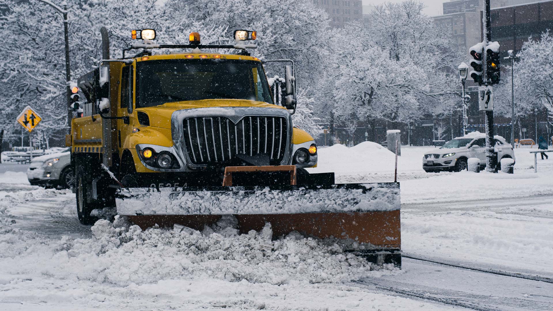
Syracuse, New York, typically receives about 124 inches of snow per year, according to the National Weather Service. This means that from late fall to early spring, frequent snowstorms make it difficult for residents of the midsize city to drive to work or school, go to the grocery store, and get to their health-care appointments, among other needs.
“During heavy snowstorms, we have people call in to ask when the city is going to plow their street,” said Conor Muldoon, deputy chief innovation and data officer for the City of Syracuse’s Office of Accountability, Performance, and Innovation (API). “We need to be able to tell them that we plowed their street three hours ago instead of not at all, which is sometimes what it might look like.”
")
With help from a team at Esri, Syracuse implemented the new Winter Weather Operations and Winter Weather Outreach solutions, along with ArcGIS Velocity, to track and report—in real time—which roads have been serviced recently by snowplows during snow events. The Department of Public Works (DPW) now uses this system to manage plowing operations, and community members can see which streets have been cleared and when.
Syracuse was the first city to put these winter weather solutions into action, and although the project is still in a pilot phase, everyone from the snowplow crew leader to Mayor Ben Walsh is impressed with how they work.
“Dashboards help the crew leader tell plows where to go next, and the mayor can see the percentage of roads that have been done,” said Joanna Bailey, a data analyst on the API team.
“We can communicate to residents how well we’re doing and then leverage the data that’s being collected to continue to improve our performance—and that’s invaluable,” added Muldoon.
Taking a Big Leap Forward in Technology
A few years ago, the City of Syracuse cobbled together a public-facing snowplow tracking app that was popular with residents and the administration. But the solution was fragile, and it depended on old sensor technology.
“One person wrote it in Python, and when that person left, it completely broke down. Our team…didn’t have the Python experience to keep it going,” said Bailey. “So we didn’t really have the snow map last winter, and the administration very much wanted us to have one.”
In the spring of 2021, the City of Syracuse procured new automatic vehicle location (AVL) sensors from Samsara to track a range of public works vehicles. The API team thought it would be a great opportunity to revisit the snowplow app—and perhaps take a big leap forward in terms of technology.
Muldoon and Bailey reached out to the city’s Esri account manager, Gerry Aiken, and told him what they wanted to do.
“They were looking to replace a legacy system with ArcGIS GeoEvent Server and ArcGIS Enterprise, but fiscally and technically, that was going to be a huge effort for them,” said Aiken. “We proposed ArcGIS Velocity—a scalable, cloud-based product that deploys in hours, not weeks—and they took to the idea right away. Now, they don’t have to manage the infrastructure, so they can concentrate on configuring the solution and, ultimately, the actual data.”
As part of Esri’s new Winter Weather Operations solution, Velocity takes live sensor data, feeds it into ArcGIS Online, and serves up map-based analytics that can aid with decision-making. This data can also be shared with the public via simple maps and apps that make it easy to monitor progress and see results.
“We were able to add Velocity to our existing ArcGIS technology without going through a massive overhaul of building out ArcGIS Enterprise from the ground up,” said Muldoon. “Being able to take Velocity pretty much out of the box and go from having our backs against the wall to having a gold-standard, cutting-edge solution was really amazing.”
Presenting the Most Accurate Picture Possible
The solution was ready to go by early December, so when Syracuse experienced its first big (and relatively late) snowstorm in early January, the API team, DPW, and the mayor were all ready to put it to use.

Within the Winter Weather Operations solution, Bailey scheduled a snow event to start when the first snowfall was expected. This essentially tells ArcGIS Online to get ready to take in and process sensor feeds from Velocity.
Once there is enough snow for the snowplows to get rolling, Velocity takes the precise GPS locations being pinged out by each vehicle’s sensor and snaps those locations to Syracuse’s street segment file in real time.
“What that does is, it shows the last time that part of the street was touched by a vehicle,” explained Bailey.
Using a scheduled big data analytic to process the most recent vehicle location data, updates are made to the street segment layer to show which streets have been plowed in the last 10 minutes, the last half hour, the last hour, and so on.
“That feeds into an ArcGIS Experience Builder application that has multiple tabs and allows the operational team within the Department of Public Works to manage the event and direct the vehicles where to go next,” explained Alexander Brown, lead solutions engineer for state and local government at Esri. “Live dashboards built with ArcGIS Dashboards can then show everything that’s happening with the current winter event, along with an entire season’s worth of information, in maps, charts, and metrics.”
The data also feeds into a public-facing web app that was built with the Minimalist template in ArcGIS Instant Apps, available through the Winter Weather Outreach solution. This simple map, posted on the city’s website, shows a live view of when all the streets in Syracuse were last plowed. Yellow indicates streets that have been plowed within the last hour; green and teal show streets that have been cleared within the last 3 or 6 hours, respectively; blue indicates streets that have been plowed within 24 hours; and gray shows streets that haven’t been plowed in over a day.
“Every storm is different, and plow operations change based on conditions on the ground,” said Muldoon. “Plows first have to take care of emergency routes and priority routes, so areas around hospitals, commercial thoroughfares, primary commuting routes, schools, and things like that. And then they tackle neighborhood streets. They also have to take into account the terrain throughout different neighborhoods. Just having this information available helps us justify and communicate what’s getting plowed when and why.”
Bailey has also incorporated a form into the solution that makes it easy for plow operators and members of the community to report double-parked cars.
“This allows residents to see that their street didn’t get plowed because an illegally parked car was in the way, so the snowplow has to come back later,” Bailey said. “So we’re taking in information from the public and from dispatch and joining it all together to try and present the most accurate picture we can for the public.”
During the first storm that the public-facing snowplow app was available, the City of Syracuse recorded 12,000 hits on the map in three days. For the next major snow event, the map received 6,000 hits in two days.
“We are getting good engagement on the map,” said Bailey.
“Yeah, it’s been really well received,” Muldoon added.
Exceeding Expectations and Trying New Things
ArcGIS Velocity and the winter weather solutions from Esri have exceeded expectations at the City of Syracuse.

“We figured out pretty quickly that this provided much more functionality than what we currently had in terms of fleet management and performance monitoring. It was also much more robust and accurate,” said Muldoon. “Now, we’re looking to continue to iterate off this tool and have it fit the unique needs of our community.”
For one thing, Bailey is working with Esri product engineer Ryan Nosek to build a custom app that will allow leaders from DPW and the mayor’s office to evaluate plow performance after storms. The two are also incorporating live sensor data from Syracuse’s sidewalk plows into the solution.
“It’s great to plow your roads, but you also need to make sure residents can walk around their neighborhoods and downtown,” she said.
In addition, the API team is exploring how Velocity could help ingest and analyze live data from other sensor technology the City of Syracuse has in place.
“It would not be a heavy lift to take this existing platform and make a public communications portal and internal performance dashboard for other DPW activities, like trash pickup or street sweeping,” said Muldoon.
Another project on the horizon is the use of Velocity for blight monitoring.
“We’re working with the Greater Syracuse Land Bank to improve the way we monitor vacant properties,” Muldoon explained. “We have smoke detectors and occupancy sensors in abandoned buildings, so Velocity could be used to make sure that when those sensors get tripped, the right people get notified so the police or the fire department can go check out the situation.”
In essence, this is what makes the City of Syracuse such a GIS success story, according to Brown and Aiken.
“They want to push technology to make better government decisions,” said Brown.
“They’re forward-thinking and eager to try new things, and it’s just a real pleasure to work with them,” echoed Aiken.
Muldoon expressed similar views about his colleagues and the administration at the City of Syracuse.
“This is a very conducive environment for being able to use new technology and leverage data to make decisions,” he said. “We are really excited to take this solution, our partnership with Esri, and the knowledge that we’ve gained to think through how we can use GIS more strategically as an organization.”