The October update of ArcGIS Online provides users with more ways to share interactive maps, new functions for transforming data in ArcGIS Arcade, and a convenient means for updating hosted vector tile layers in place.
Improved and New ArcGIS Configurable Apps
Configurable apps help users easily share their interactive maps. In this latest update, ArcGIS Online got a new configurable app, and two other apps gained significant new features.
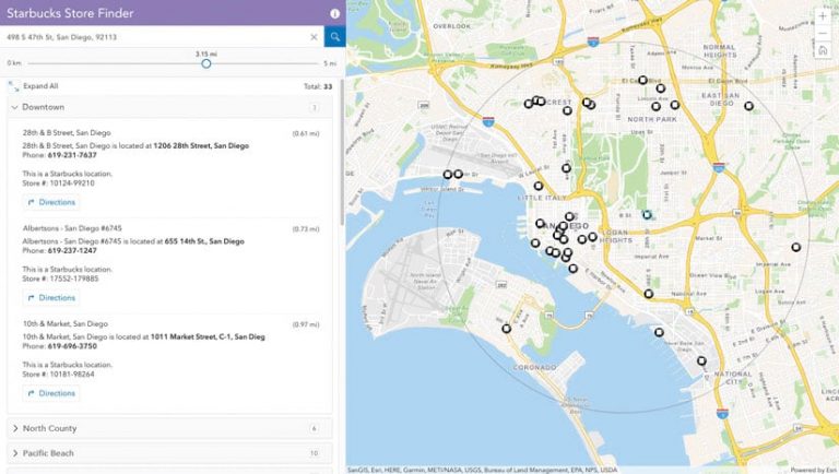
The new configurable app, called Nearby, enables users to enter an address and a search radius to find nearby locations. After selecting a location, the app can provide directions to that location. By grouping the results together by layer, app authors can configure the app to answer detailed questions. For example, a user could search for nearby schools and see them grouped by school type: middle schools, elementary schools, and universities. The Nearby app can also be configured to answer questions such as, Where is the nearest pediatrician, How many violent crimes happened near my school, or Where is the nearest dog park?
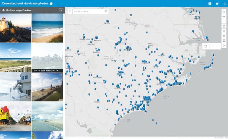
Attachment Viewer, the configurable app that provides an immersive experience for users to view features and their attachments, has a couple noteworthy new updates. App authors can now choose between the existing photocentric layout and the new mapcentric layout. In the mapcentric layout, users see a gallery of attachments based on the features within the map extent. Additional configuration options include the ability to display more than one layer, support PDFs as an attachment type, and hide features that do not have attachments. Users can also get more details about the photos they view by zooming and panning.
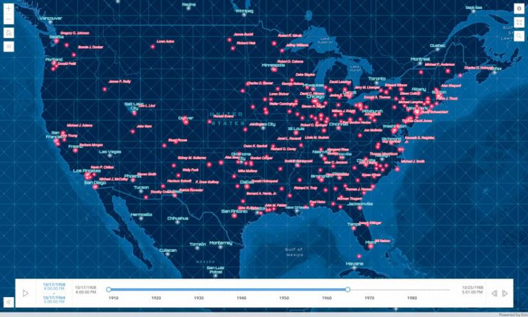
Media Map, the configurable app that delivers a crisp and simple way to share maps, now includes an interactive time slider that animates data as it appears over time, giving users the ability to showcase data that is time enabled. For example, users could spotlight weather patterns, crime incidents, or competitors’ locations during a race.
More ArcGIS Arcade Functions
Arcade, a scripting language supported in ArcGIS, transforms data on the fly, without leaving the map. With the October release of ArcGIS Online, there are four new functions available.
The groupBy function enables users to group features within a feature set by a field and then return statistics for each group. For example, if a city wants to know the type and number of trees within each of its ZIP codes, after collecting each tree as a data point, the city can use the groupBy function to query the points, group the trees by species, and calculate how many are in each ZIP code. The city can then share this information with its constituents through pop-ups in interactive web maps.
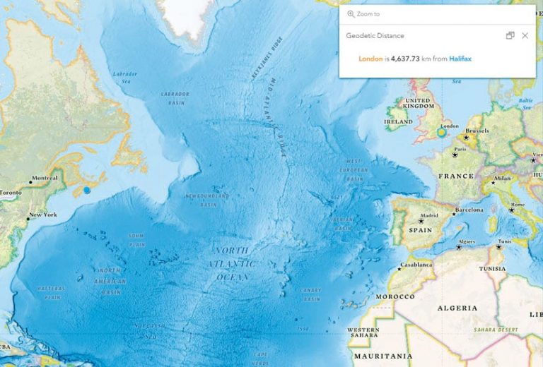
Users can now also calculate the shortest distance between two points along a great circle—say, between London, England, and Halifax, Canada—using the distanceGeodetic function. This results in a more accurate calculation than using Cartesian coordinates.
The new featureSetByRelationship function makes it easier to access features from layers that have relationships. For example, if a potential home buyer wanted a list of all the house’s previous owners, the user could employ the featureSetByRelationship function to gather this information. The function queries each of the related layers (one record per owner), collects the owner’s name, and compiles this information.
Users can now also build pop-ups rich with data from any layer within ArcGIS Online and ArcGIS Living Atlas of the World without adding the layer to their map. The featureSetByPortalItem function uses the layer’s item ID to access the data without visualizing the layer. For example, say a user wants to map all the libraries within a state. Each library’s pop-up could include the population numbers for the ZIP code in which the library resides. Rather than geoenriching and getting another layer, the author could bring in the population data from ArcGIS Living Atlas of the World using the function and the population layer’s item ID.
Update Hosted Vector Tile Layers in Place
Users managing hosted vector tile layers can update layers in place using the new Replace Layer option. Replace Layer updates the tiles in the target hosted vector tile layer by swapping the entire tile cache with the layer selected as a replacement. As a result, existing apps and styles that reference the hosted vector tile layer continue to work without having to update them. Previous workflows that required publishing new layers and updating web maps and apps that reference the layers are no longer necessary.
Updating hosted vector tile layers with Replace Layer requires minimal downtime. Users can build, do quality assurance (QA) on, and preview their vector tiles before updating the live layer. This helps ensure a quality update ahead of time. And when replacing the layer, users have the option to archive the old vector tiles. The archive can then be used for reference or to roll back the update.

