App Allows Satellite Tasking through ArcGIS Online
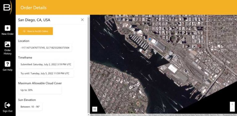
A new cloud-based app, called BlackSky Tasking, allows Esri users to task a BlackSky satellite and have dynamic, on-demand, ready-to-use imagery delivered directly to their ArcGIS Online organizational account. Available in the Esri ArcGIS Marketplace, the app allows imagery to be leveraged using ArcGIS Image for ArcGIS Online to perform analytic workflows. BlackSky’s high-revisit constellation and its underlying Spectra AI platform make it possible for users to seamlessly incorporate near real-time imagery into projects without additional processing or manipulation. The process is fully automated. Once images arrive in a user’s ArcGIS Online organization, they can immediately be used in other Esri apps. BlackSky Technology Inc. is a partner in the Esri Partner Network.
New Broadband Solution Aims to Close Digital Divide
The Federal Communications Commission (FCC) estimates that 35 percent of Americans lack access to reliable internet service, which can impact their job and educational opportunities and health-care options. To help state and local governments better understand broadband coverage in their communities, Esri released a new ArcGIS Solution called Broadband Outreach. It delivers a set of capabilities that enable government staff to inventory broadband resources and take action to close this digital divide. Find out more at go.esri.com/new-broadband-solutions.
Esri Expands Partnership with the Sustainable Development Solutions Network
The Sustainable Development Solutions Network (SDSN) and Esri will work to provide better and more timely data and improve engagement with public and private sector decision-makers to accelerate progress on the Sustainable Development Goals (SDGs).
The partnership is set within the framework of the new SDG Transformation Center, which will be launched by SDSN ahead of the United Nations’ SDG Summit 2023. The SDG Transformation Center will become a first-of-its-kind platform for learning and exchange on SDG data, policies, and financial instruments to help restore and accelerate SDG progress globally. The center will build on SDSN’s global network, thematic expertise, and instruments.
The goals for the new multiyear partnership between SDSN and Esri are to
- Enable the discovery, use, and reuse of openly available SDG data.
- Develop new indicators and datasets to fill critical information gaps that build on georeferenced information.
- Create a hub for sharing information and knowledge for the SDG Transformation Center.
- Advance a geographic approach to the SDGs through community engagement, training, and events with international institutions, governments, and other partners.
Most Current ACS Data Is Ready to Use
The latest American Community Survey (ACS) data from the US Census Bureau is available in ArcGIS Living Atlas of the World. It contains five-year estimates for 2016–2020 on income, housing, internet access, education, disability, and health insurance. Federal agencies, local governments, businesses, and nonprofits typically use the data for planning and resource allocation. It can be accessed from ArcGIS Pro and ArcGIS Online and incorporated into Esri’s configurable mobile apps and dashboards.

Esri Chief Scientist Now a Member of the National Academy of Sciences
Dr. Dawn Wright, Esri’s chief scientist, was inducted into the National Academy of Sciences (NAS). NAS is a private, nonprofit organization of the leading researchers in the United States. Membership in NAS is one of the highest honors a scientist can receive.
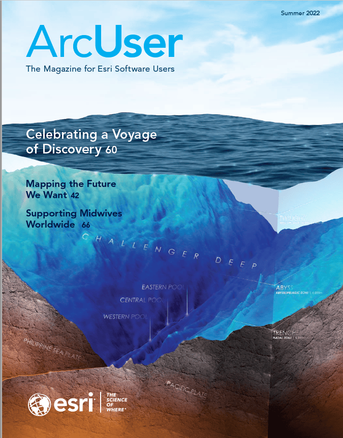
Wright is a respected leader in the science community and has led Esri’s science initiatives for more than a decade. As a graduate student at the University of California, Santa Barbara, she became aware of the challenges of applying GIS to deep marine environments. Throughout a varied career, she was a seagoing marine technician for the international ocean drilling program and a postdoctoral research associate at the National Oceanic and Atmospheric Administration (NOAA). She has been a professor of geography and oceanography at Oregon State University since 1995.
Under Wright’s direction, Esri created the ecological marine units (EMUs), a 3D digital ocean. She also contributed to the development of the ecological land units and World Terrestrial Ecosystems map. She has worked on enhancing GIS geomorphology analyses and workflows for the ocean floor. Wright has also edited and coedited many GIS books and has strongly supported science, technology, engineering, and mathematics (STEM) education.