Esri Named a Leader in Location Intelligence Platforms
The market research firm Forrester recognized Esri in The Forrester Wave: Location Intelligence Platforms, Q4 2018 Evaluation. The Forrester report notes, “Esri’s vision for location intelligence is to help organizations understand why things happen where and when they happen, with the goal of gaining business advantage through better understanding. By continuing to evolve [its] ArcGIS [platform], Esri is pushing beyond the traditional GIS markets that it has long dominated into the location intelligence market.” To learn more about Esri’s ranking in the Location Intelligence Platforms Q4 2018 Forrester Wave Evaluation, visit bit.ly/2Gak6WI.
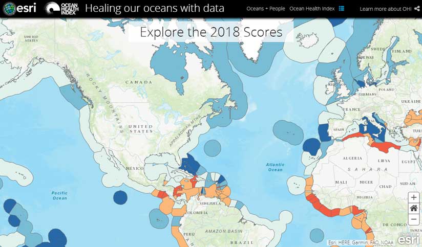
New Hubs Show Regional Ocean Health
Esri has partnered with the Ocean Health Index (OHI) team to release new ocean health data. A joint project of Conservation International and the National Center for Ecological Analysis and Synthesis, OHI looks at the social, ecological, and economic benefits that oceans provide to people. Dealing with ocean health data is complex. There are more than 100 global datasets that power OHI’s annual assessments, which will serve as the foundation for Ocean Health Hubs. While OHI’s ocean health scores are already integrated as a data layer in ArcGIS Living Atlas of the World, Esri and OHI will launch Ocean Health Hubs, powered by ArcGIS Hub, to enable ocean managers to explore data that will help them understand regional ocean health. For more details, visit ohi-science.org/ohi-global/index.
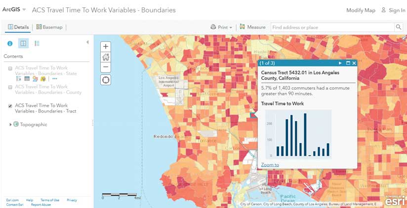
Get the Latest American Community Survey Maps and Data
Maps and data from the most current American Community Survey (ACS) five-year estimates are now available in ArcGIS Living Atlas of the World. ACS data helps determine how $675 billion in federal and state monies are spent annually, so access to the latest available data is crucial for policy makers, their staff, and GIS analysts. Anyone who uses these layers now has immediate access to the latest census data. The nationwide data (which also covers Puerto Rico) includes state, county, and tract geographies. Each year, the layers are updated in a similar pattern. This essentially eliminates the hours or days normally spent locating, downloading, processing, and doing quality assurance to have this valuable data in a GIS-ready format. Each ACS estimate comes with the associated margin of error. Each feature layer is provided as boundaries and centroids with ready-to-use cartography and pop-ups that can easily be customized or reconfigured for web maps.
2019 ArcGIS User Seminar Series
A series of free, half-day events to help Esri’s current customers become more successful in their work will be held at cities throughout the United States, ending in April 2019. These presentations share solutions, highlight new capabilities and products in the latest versions of ArcGIS, demonstrate best practices, and outline ways to engage with the Esri community. Visit go.esri.com/arcgisuserseminar for information on dates and locations.