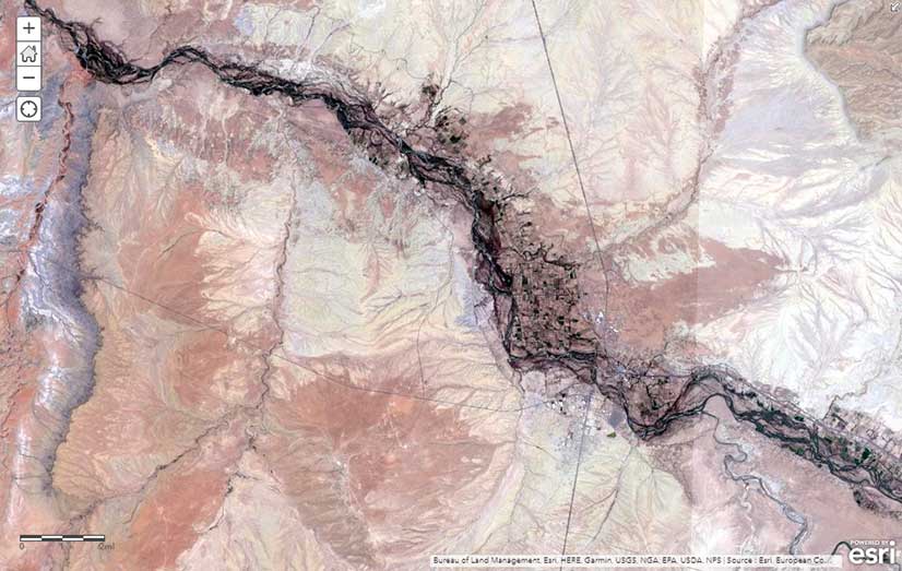
Sentinel-2 in ArcGIS Living Atlas of the World
Sentinel-2 imagery is collected and managed by the European Space Agency (ESA) and hosted in Amazon Web Services. Sentinel-2 image services, available through ArcGIS Living Atlas of the World, provide temporal, multispectral imagery of the entire globe to improve monitoring of agricultural and forest conditions and land-cover changes and assist with natural disaster management. Full service access, including a rolling 14-month archive of the Sentinel-2 data, is available to all Esri ArcGIS users. For more information on the Living Atlas, visit ArcGIS Living Atlas of the World.
Esri Achieves FedRAMP Authorization for Cross-Cloud Location Intelligence
ArcGIS Online has been granted authority by the United States Department of the Interior (US DOI) to operate as a secure platform to deliver cloud-based spatial analytics services to the US federal government. Esri’s technology has achieved Federal Risk and Authorization Management Program (FedRAMP) authorization on both Microsoft Azure and Amazon Web Services Cloud platforms. FedRAMP is a US government-wide program that provides a standardized approach to security assessment, authorization, and continuous monitoring for cloud products and services. FedRAMP authorization ensures that Esri can continue to provide its users with the benefits of security controls that are tailored to cloud services. The authorization also makes it easier for other federal agencies to obtain security documentation and authorize their own ArcGIS Online offering within days or weeks, instead of months. To learn more, visit trust.arcgis.com.
Spatial Business Initiative Fosters Location Intelligence in Business
The University of Redlands School of Business partnered with Esri to launch the Spatial Business Initiative. The project will offer innovative educational programs, groundbreaking research, and national and international advisory offerings designed to help businesses realize the value of location intelligence. The University of Redlands has been a leader in spatial education for more than a decade through its School of Business and College of Arts and Sciences. As part of the Spatial Business Initiative, the University of Redlands will offer a one-of-a-kind online MBA with a concentration in location analytics starting in September 2018, followed by the launch of a formal certificate in location analytics in January 2019, which will be offered on campus. In addition, the Spatial Business Initiative is surveying businesses to better understand how they use location intelligence to develop strategies, overcome challenges, identify trends, control costs, and mitigate risks. Other initiative projects include an annual research conference, executive training, and an Esri Press book.
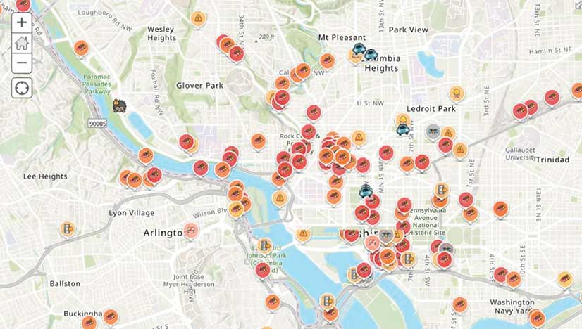
Waze Traffic and Infrastructure Live Alerts Available in ArcGIS Marketplace
Waze live alert data is available in Esri’s ArcGIS Marketplace at no cost to members of the Waze Connected Citizens Program. The Connected Citizens Program, a two-way sharing of publicly available traffic and road condition information, offers governments a stream of data—updated in real time—so staff members can make data-driven infrastructure decisions and improve incident response. Waze, the free, crowdsourced traffic and navigation app, is now fully supported by ArcGIS Online. Mapped Waze data is available in all ArcGIS apps. Governments can sign up for the free Waze Connected Citizens Program and start working with the alert data in ArcGIS to create operational dashboards that departments can use right away. Learn more about the newly available Waze live alert data in ArcGIS Marketplace.
Use Purchase Orders at the Esri Online Store
US customers can purchase term licenses and subscriptions through the Esri Store by submitting a purchase order (PO) during checkout in addition to paying with a credit card, PayPal, or wire transfer. Orders that include a PO are fulfilled after a standard credit review. If the order is below the threshold requiring a manual credit check, it will be fulfilled immediately.
Esri Official Statistics Modernization Program Launched
The Esri Official Statistics Modernization Program provides access to Esri ArcGIS Enterprise technology to support census counts that all countries will undertake during the 2020 round of population censuses. Esri will donate perpetual use licenses for ArcGIS software to eligible official statistical agencies in Least Developed Countries (LDCs) and Small Island Developing States (SIDS). By using authoritative methods of collection and cutting-edge mapping and analytics tools, developing nations can leapfrog paper-based workflows and adopt more efficient digital and mobile ones. For more information on the program and nation eligibility, visit go.esri.com/officialstatisticsprogram.
Esri on the Forbes List of Best Midsize Employers
Esri was fifteenth on the Forbes 2018 annual list of the 500 best midsize employers. Work-life balance, outstanding benefits, collaboration with colleagues around the world, and the opportunity to make a difference by providing users with constantly developing technologies are some of the reasons behind Esri’s inclusion in the list for the third consecutive year.