“What is GIS today?”
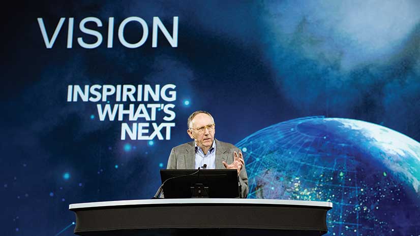
Esri president Jack Dangermond put this simple question to the Plenary Session audience at the start of this year’s Esri User Conference (Esri UC). In answering this question, he delved into the profound and exciting changes in applying GIS to the world’s problems.
More than 18,000 users of Esri technology from 130 countries met in San Diego July 9–13, 2018. The purpose of the conference has remained the same over the event’s 38-year history: learn about the latest developments in GIS from Esri and from each other, share work, celebrate achievements, and grow the community of GIS users.
In discussing the conference theme, “GIS—Inspiring What’s Next,” Dangermond noted that for many years GIS has been a system for managing and analyzing geographic information and solving problems holistically so that organizations can work more effectively.
What’s next is the new generation of GIS that is “based on sharing and collaboration and leveraging the technologies of web services to distribute knowledge and interconnect our knowledge and engage everyone.” This is Web GIS.
It extends the three conceptual components of GIS—integration, analytics, and mapping—to improve understanding. By taking advantage of faster computers utilizing distributed computing and machine learning, it more effectively harnesses the power of computational geography. Innovations in ArcGIS continually enhance mapping and communication.
“This technology [Web GIS] is literally driving major aspects of digital transformation in organizations,” because it takes sequential workflows that have been automated and interconnects them so different aspects of an organization can share information and workflows simultaneously, which will change the way organizations, as a whole, do their work.
Easy, Open, and Accessible to Everyone
This pattern is compelling because it brings together lots of other technologies—such as web maps, web apps, hubs, location analytics, and visualizations—and fuels them with sensor and other data being captured at a rate that is growing exponentially and makes it available through web services. Web maps are becoming a kind of language supporting new kinds of problem solving. Intelligence tools, like Insights for ArcGIS, bring understanding and spatial analytics to a large swath of people, not just GIS professionals.
Through Web GIS, “GIS is becoming easier and more open and more accessible to everyone.”
What’s Next for Our Planet?
Dangermond challenged the audience to think about what the future will be like. In this complex and interconnected world, “the pace of change is accelerating almost exponentially, threatening our natural world and our future as humans.”
Web GIS makes it possible to apply more widely the power of digital geography to problems and challenges such as climate change, loss of biodiversity, overpopulation, threatened water supply, and urbanization. For example, earth observations combined with GIS and artificial intelligence (AI) provide real-time global intelligence that can lead to better decisions at many scales. Web GIS plays a fundamental role in organizing content on the way to creating the pervasive geographic understanding needed to deal with these challenges. This process will “integrate geography and the work of GIS professionals into virtually everything everyone does.
Built on The Science of Where
Dangermond noted that, “The Science of Where is the foundation for GIS and the new and expanding world of mapping and location intelligence.” The GIS community needs to drive this process in an accelerated way starting with embracing a geoscience-based foundation for envisioning a better future for the planet that Dangermond calls societal GIS. After years of thought on this topic, he believes that this is not just possible, but it is essential and in some ways inevitable.
Action with Understanding
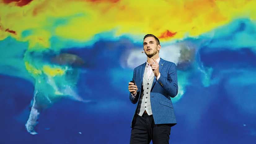
During the Plenary Session, several speakers described how their work, using GIS, is helping make a better future. One of the first speakers, Tom Crowther, a professor of global ecosystem ecology at ETH Zürich, described how the Crowther Lab is gaining a deeper understanding of how the loss of ecosystems negatively impacts the earth’s ability to regulate carbon dioxide in the atmosphere.
“Most of us now recognize the threat that climate change poses to us and to future generations, but it seems so hard to take action because it seems like such a huge and complex topic,“ said Crowther. “Our research aims to simplify this topic by generating a more spatial and holistic perspective.”
Although global ecological restoration is one of the most effective weapons in the fight against climate change and the biodiversity loss it causes, successful restoration requires intricate knowledge—down to plot-level information, but on a global scale. Trees that have been restored in the wrong ecosystems have destroyed natural biodiversity or failed to thrive.
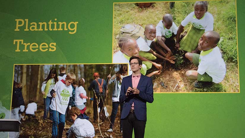
One Person Can Make a Difference
Plenary Session speaker Felix Finkbeiner encouraged attendees to participate in the Trillion Trees Campaign sponsored by the Plant-for-the-Planet organization he started in 2007 when he was just nine years old. He was inspired to plant one million trees in every country on earth by the late Nobel Peace Prize Laureate Wangari Maathai, founder of the Green Belt Movement and Esri User Conference keynote speaker in 2007.
Through the work of Plant-for-the-Planet over the past decade, children and organizations across the globe have planted more than 15 billion trees in 190 countries under the guidance of the United Nations Environment Programme (UNEP). The restoration of this tree cover will have social, economic, and environmental benefits.
This year, the now twenty-year-old Finkbeiner and his organization set their sights higher. The goal is to add a trillion trees to the world’s existing inventory to help end deforestation. Supporters can plant trees or give donations to have trees planted. The Trillion Tree Campaign based this goal on work by the Crowther Lab, which is studying the number and species distribution of trees on a global level.
To support this effort, Esri is donating 60,000 trees to offset the carbon caused by everyone who traveled to the Esri UC this year.
End-to-End Benefits
Jason Killam and Heather Morrison of J.D. Irving, Limited (JDI), explained how this 136-year-old company uses GIS to connect and optimize its vertically integrated network of 50 businesses in Canada and the United States. JDI adopted GIS in 1984, and its use of GIS underpins its resource management practices, which have garnered the company international awards for sustainability. JDI embraced digital transformation and GIS to make data-driven decisions that have benefited the supply chain for its forestry unit. From using lidar to assess the health of its forests to tracking the shipment of its forest products by truck and train, JDI uses location intelligence to automate decisions so things are done at the right time and place.
Understanding Development in Context
The Boston Planning & Development Agency (BPDA) and Esri are leading a new revolution in urban planning that promotes collaboration and engagement between real estate developers, city planners, and citizens. Using ArcGIS Urban, not only can they see what proposed projects will look like, they also have a standard process for evaluating the impacts of these projects environmentally, economically, and aesthetically. Proposed zoning code changes can be applied virtually to not only see possible problems but also opportunities.
Tools for Problem Solvers
Cobb County, located near Atlanta, Georgia, has a robust enterprise GIS. Its current mission is to extend the benefits throughout the organization, transforming its non-GIS staff into problem solvers who use location intelligence and the new analytical capabilties in ArcGIS. Felicia Alingu, a specialist with Cobb Senior Services, uses Insights for ArcGIS to probe data—nonspatial as well as spatial—to visualize interactions between the program’s clients and its centers to determine which programs are successful and anticipate the county’s future needs.
Feeding the Need for Spatial Expertise
Thousands of researchers and students have joined U-Spatial, a nationally recognized program at the University of Minnesota that builds the expertise in GIS, remote sensing, and spatial computing needed for tomorrow’s workforce. Nearly every discipline on campus uses GIS for research, teaching, and outreach. GIS is also an intregal part of campus management. Just one of the research projects highlighting the university’s innovative use of GIS was presented by Kevin Ehrman-Solberg. A founding member of the Mapping Prejudice Project, Ehrman-Solberg and others involved in the project are using GIS and other technologies to uncover how racism was embedded in the built environment through the inclusion of racial convenants in property deeds.
What’s Next Is Up to You
In closing his Keynote Address, Dangermond challenged the audience of GIS professionals to accelerate their efforts. “Keep moving, keep learning, keep understanding and leverage our best technology and science, best geographic information, and holistic design thinking to turn this around to create both a sustainable and a better world.”