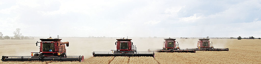
Growing up on a farm, I realized that farming is a full-time job, even if my father called it hobby farming. Farming involved the entire family working together as a team. Farming is a risky business that depends mostly on one element that cannot be controlled: the weather. Consequently, farmers leave nothing else to chance. Every move is intentional and strategic. Methodical planning and refinement enable farmers to gain the greatest yield possible. There is a time to reap and a time to sow. Perfect timing is everything.
Are you calculating every move you make in building your GIS? Are there times when lack of personnel, funding, or hardware determine your path? Do you feel like your GIS shop is affected by multiple “weather patterns” outside your control?
I will share my GIS farmer strategy for calming the storms of newly elected officials, looming budget cuts, and uninformed citizens. Let’s look at the life cycle of a GIS farm.
Crop Selection
Selecting your crop is a critical decision to make for your GIS shop. Do you want your team to be the go-to for emergency management analysis, cadastral CAD science, or mapping? These are just a few of the directions you could pursue. There is a myriad of paths your GIS troop can explore. By determining your geospatial focus, you can calm the storms before they arrive. For example, if a high-profile or mandated course is the emphasis of the division, budgeting could be less of a concern. Take the proper time and be purposeful when planning the route for your location intelligence legion.
Cultivating Relationships and Land Preparation
In farming, you need to prepare the land with a plow, a disk, or a harrow. In GIS, the concept is similar. As a GIS leader, you need to find GIS champions in your organization, town, or community. This is the time for you to get the lay of the land. Who is on the geospatial side of the fence? This is the crowd you appeal to when preparing the ground to start sowing your geospatial seeds.
At this point, the timing is perfect for you to start learning about your supporters’ interests so you can tell them how GIS can be used to harvest their dreams. Just like soil, some relationships need cultivating. Interpersonal communications play a big role in GIS farming, and that is something they don’t teach you in Intro to GIS 101.
Planting Ideas
Once you have declared your direction and know the topography, it is time to start planting seeds. If you have a squad of emergency analysts, the seed to sow could be an appreciation of the need to establish an addressing authority in your jurisdiction. This seed could be sown with the local fire chief, the chief of police, mayor, county administrator, and dispatch and emergency manager—to name a few. It takes lots of seeds to make things grow. If you are a good farmer, your seed propagates other folks’ ideas.
Irrigation and Fertilization
Choosing where to sow the seed is mission-critical to the success of your team, but the seed will need some water and fertilizer to grow. You need to apply just enough water to sustain—but not flood—it. Knowing exactly when and how much fertilizer is needed to grow the idea is truly a science. Fertilizer, in this case, may consist of statistics, maps that show irregular data, or documentation of how a workflow has gone wrong.
Growing an idea can take months—sometimes years. This means that this part of the farming life cycle will need to be repeated as needed. It could create what a programmer would call a loop. You may need to hit the Escape key to exit a loop and reevaluate the importance of the seed you planted. Perhaps you examine a new way of planting—such as the no-till method—to encourage growth. If you get caught in fertilization-and-irrigation paralysis, you can always look for a fresh perspective and new seeds to plant.
Harvesting Dreams
There is nothing better than reaping what you sowed by gathering success stories and harvesting dreams. Realizing the precise time to collect the fruits of your labor is key. The idea should be ripe to shell, shuck, or pick. Stockpile too early or too late and you could get little or no return on your crop. Harvesting at just the right time produces the highest yield. When harvesting dreams, make sure you share the victory with all the champions who supported the dream and brought it to fruition.
Climate
Several years ago, our 25-year-old GIS was under attack. Elected officials claimed that GIS was “just bells and whistles.” Even today, that attack still resonates with my team and me.
One morning I sat down with an elected county official. While sharing stories over coffee about the valuable role of GIS in emergency siren placement, handling voting precinct redistricting, and settling school district boundary disputes, it became clear that the official knew nothing about the involvement of GIS in these vital projects.
This was the turning point. This is when I became a GIS farmer and began my crusade to meet with elected officials and municipal dignitaries to relate to them GIS stories so they can understand the workhorse role that GIS plays behind the scenes. Stories of the daily uses of GIS in dispatch, school bus routing, public works, and planning have enlightened them. They now realize the indispensable part GIS plays in routine—but critical—workflows.
Here are a couple of dreams my team recently harvested. An elected city official was seeking funding to study a street intersection realignment. A city administrator from a local city asked my team to prepare a story map about that intersection. Using this story map, the city successfully lobbied the state legislature for funds to perform a study on the intersection. The city, which was awarded a quarter of a million dollars for the design of the intersection, believes the story map was “a key tool” that enabled it to receive the funding.
In our jurisdiction, there are 34 cities in two counties that manage road projects. This area is served by six utilities. Local utility partners wanted a management system that coordinated street cuts. Over the last seven years, the GIS-based right-of-way system has saved the participants more than $200,000 by synchronizing paving improvements and also easing traffic congestion. By using the farming methods that I have outlined here, these successful seeds grew into harvestable dreams with great yields and measurable return on investment (ROI).
Keep Sowing Seeds
As a GIS farmer, I find myself sowing seeds more than any other chore. You never know where a seed will take hold. Sometimes the soil is fertile where you thought nothing would grow. Sometimes seed selection will be critical because the soil is less fertile. Knowing the lay of the land will aid you the most when you are just starting GIS farming, but sometimes ignorance doesn’t hurt either.
Mostly it comes down to risk, relationships, and refinement. Farming is a risky business, so you need to be strategic and purposeful. Build relationships. Understand the needs of the community and your champions. With refinement, you will produce a bumper crop of fruitful geospatial projects. I hope my advice on how best to do these farm chores will assist you in harvesting your geospatial dreams.
About the author