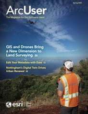
It’s almost impossible to cover all the things GIS can do. It is a crucial tool used to solve myriad problems and presents a unique way of looking at the world—through the lens of where.
For example, GIS can help people live more sustainably by investing in renewable power, as Pattern Energy is doing with its massive SunZia project in the Southwestern United States. When completed, SunZia is slated to be the largest wind energy project in the Western Hemisphere and will likely provide power to three million Americans. Geospatial technology is also instrumental in humanitarian work, even during or just after times of conflict. Tanzania-based organization Anti-Persoonsmijnen Ontmijnende Product Ontwikkeling (APOPO) demonstrates this by using GIS to track the health and locations of its mine-sniffing dogs. GIS can help plan urban renewal projects and make public utility work more effective and efficient. Some companies and organizations, like the environmental and engineering firm Dudek, are using GIS in a variety of innovative ways, from emergency response to mapping Kauai’s aging dams and reservoirs.
Equally important as asking what GIS can do is asking what GIS can do for you. How can you use GIS to expand your geospatial horizons?
Maybe this is simply about bringing efficiency to your workflows, as many of the articles in this issue address. Streamline how you edit metadata for your ArcGIS Online items. Use web components rather than widgets to build code in ArcGIS Maps SDK for JavaScript. Automate the process of sharing computer-aided drafting (CAD) and building information modeling (BIM) data within and outside of your organization. Improve the readability of your maps for viewers who are color-blind. Whether you are an experienced GIS user or new to the industry, even small improvements to efficiency or quality of life can go a long way toward helping you do big things with GIS technology.
But taking your GIS work to another level can also be about pushing the boundaries of how you use GIS on a day-to-day basis. Incorporate reality capture into your indoor GIS. Explore whether drone imagery, suitability modeling, or geospatial digital twins can improve or expand the way GIS operates in your organization.
The stories in this issue are as much about how capabilities within ArcGIS can change your work as they are about how GIS can change the world. Because solving even the most monumental issues with a geospatial approach starts with exactly that—your work.


