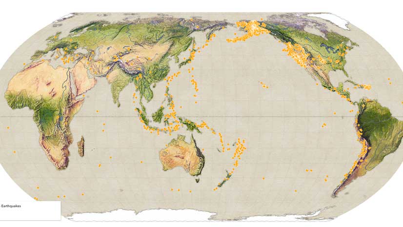
The Group on Earth Observations (GEO), an intergovernmental organization that works toward advancing open data and promoting sustainability via Earth observations, has chosen Esri as one of seven organizations to join as its first associate members. The new GEO Associates category allows commercial and nongovernmental entities to join existing member institutions in activities promoting GEO’s goals and ideals.
Esri’s associate member status acknowledges its seven years of involvement with GEO and Esri’s commitment to continue collaborating on GEO initiatives and developing interoperability between the Global Earth Observation System of Systems (GEOSS) and ArcGIS platform to promote data access between GEO collaborators and Esri users.
“We are honored to be chosen as one of the first members in GEO’s new member category,” said Jack Dangermond, Esri founder and president. “GEO is doing incredibly important work in improving critical decision-making in areas like sustainable development goals, disaster recovery, and natural resource management, as well as making Earth observation data accessible to everyone.”
The following are some of the activities associated with GEO initiatives Esri has supported.
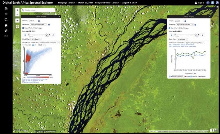
Image Data Cube Accessibility
Esri, in collaboration with NASA, Committee on Earth Observation Satellites (CEOS), and Geoscience Australia has developed an efficient software solution that enables Esri software users to easily access a variety of image data cube styles, publish web services, and use the data for visualization and analysis. As part of this effort, Esri is publishing Digital Earth Africa image services and web applications as part of the Africa GeoPortal (africageoportal.com).
Global Ecosystem Modeling
In response to GEO’s desire for foundational ecological data to enable ecosystem management, Esri partnered with project lead US Geological Survey (USGS) to devise a methodology to map ecosystems. Esri has been supporting this effort with in-kind resources for data compilation, modeling, and web app development.
This initiative to develop globally consistent, statistically based ecosystem classifications began in 2013. The global Ecological Land Units (ELU) were completed in 2014. Following this was Ecological Marine Units (EMU) in 2017. This partnership is currently developing the Ecological Coastal Units (ECU).
In addition to helping develop these valuable data resources and web services, Esri has built user friendly applications, such as the Ecological Marine Unit Explorer apps, to promote and socialize the data and make the data more easily accessible and usable.
Global Stream Flow Forecasting
Esri has been collaborating with Brigham Young University, European Centre for Medium-Range Weather Forecasts (ECMWF), and other partners as part of the GEO Global Water Sustainability initiative. The initiative is extending the value of the ECMWF gridded global runoff model by downscaling the information onto the river network. It is publishing open web services of forecasted and historic stream flow and an interactive web application for exploring modeled future and historic stream flow. These efforts are improving disaster preparedness and sustainable use.
Portal Integration and Local Training
Esri and its network of global distributors and partners have also been engaged in collaborations for improving access to the GEOSS and AmeriGEOSS portals and providing in-country training on using ArcGIS open data publishing and integration with the systems and services codeveloped through GEO initiatives
These collaborations demonstrate Esri’s commitment to making open data as web services, the importance of scalable cloud-based image data management and big data analytics, and the role of easy-to-use web applications in expanding the impact of earth observation data to inform decision-making.