Places service is a new ArcGIS Platform capability that provides developers with a ready-to-use option for incorporating richly attributed global points of interest (POI) data into their custom applications and solutions.
Places service provides regularly updated data that describes more than 1,000 types of places and has global coverage. Places service supports applications for users across industries and has flexible query capabilities and attractive pricing. Clear documentation and samples will help you get started quickly.
Places Data and Its Applications
POI are a type of places data that describes specific point-based locations on a map. Places data can be a valuable source of location-based context for users in applications that support mapping, analysis, and decision-making.
For mapping and local searches, Places service can help your users locate and understand what’s nearby. For example, users of consumer travel apps may want information on restaurants, parks, and other amenities near lodging options.
In apps using market analytics, Places service can describe potential customers, competitors, suppliers, and distributors for retail site selection solutions.
In data science apps, Places data can provide context for modeling and analysis workflows. Places data can be used in analytic modeling and artificial intelligence (AI) applications along with other context to describe, explain, predict, or even make recommendations based on the models/inferences. For example, in property insurance underwriting, this information could be used to predict future claims based on previous claims history and proximity to certain types of places.
ArcGIS Platform Places service supports coverage for more than 170 countries and regions, so you can create applications for areas of interest around the world. The service currently supports more than 1,000 categories of places. While other POI offerings may focus only on commercial or retail places, Places also supports public places such as courthouses and transportation hubs, and places in the natural landscape such as mountains and lakes.
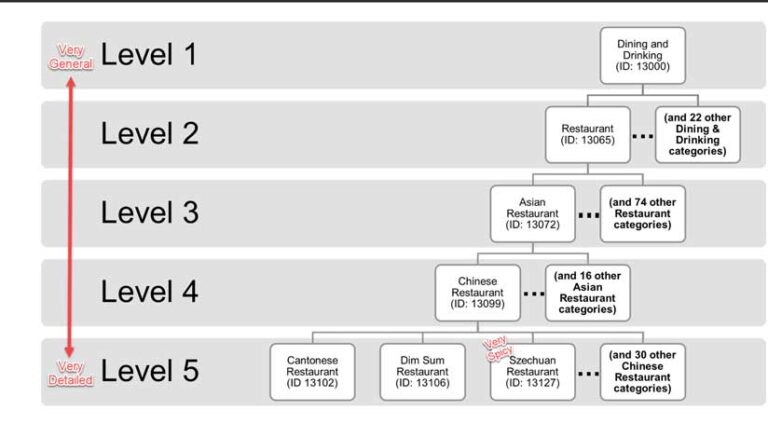
With a hierarchical category system, you have flexibility on how you target your searches—from general categories (e.g., all “Dining and Drinking” places) to detailed and specific categories (e.g., “Szechuan Restaurants”). Each place can be associated with more than one category, which can be very useful when working with collocated businesses, such as coffee shops within supermarkets or public restaurants in hotels.
These valuable characteristics represent additional business value because they contribute to the flexibility of the service to address a wider variety of your customers’ needs and opportunities. To see what categories are supported, check out the online Places category finder.
Data Sources
ArcGIS Platform Places is a service primarily based on supplier data from Esri partner Foursquare. This data is derived from various sources including more than 14 billion monthly check-ins from Foursquare’s consumer-facing apps, SDK partners, feedback from businesses, web crawls, and other third-party data sources.
Dedicated Esri data engineering and testing teams handle data intake, quality assurance (QA), production, and releases so you can focus more of your valuable time and resources on creating impactful applications rather than worrying about sourcing, licensing, processing, and hosting data. Esri currently supports quarterly global data updates and is ramping up to support more frequent releases.
Querying Places Service
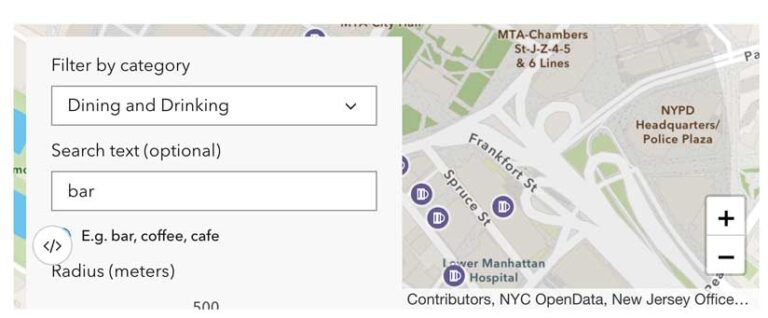
Places service supports simple and flexible query options for searching for and getting details about places. The first search option, near-point endpoint, queries places within a ring-based search area around a point location on a map. You can also include a ring radius, a list of place categories, and search text as optional filtering criteria.
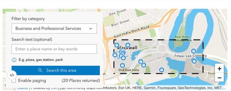
The second search option, within-extent endpoint, queries places within a rectangular search extent. For this search option, you can include a list of place categories and search text as optional filtering criteria.
Any records matching your query criteria—using either search option and up to 20 records and their standard fields—can be returned with each request. You will be metered for a single search transaction.
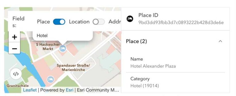
Your users can easily obtain additional information about a place, beyond the information provided by search responses using the Esri Place ID (PlaceId). Each returned record includes a persistent identifier—PlaceId—that can be submitted, along with the list of desired fields (requestedFields), to the places endpoint to obtain additional place details, if they are available. Additional information can include:
- Map coordinates for drop-off location
- Detailed address information
- Description, opening hours, and contact info
Pricing
You will be metered once for each of parent groups containing your requested fields. [Note: You will only be metered once for each group whether you request 1 or more than 10 fields from that group.] Due to the many characteristics of places data, including the plethora of underlying sources that support global coverage, not every field may be available for every place returned from your search requests.
If all your requested fields from a group are not available, you will not get metered for that group. These options give you more control and help manage costs by giving you the flexibility to request only the fields you need, when you need them.
Pricing for Places service is simple, and transaction based, with a monthly free tier. Current licensing terms prohibit storage and reuse. For additional pricing questions, contact your Esri account manager or the Esri data and location services team at data_and_location_services@esri.com.
Next Steps
Empower your users with on-demand location-based context by integrating the Places service into your custom applications and solutions today.
Getting Started
Sign up for a free ArcGIS Developer account.
Create and manage an API key and configure it with the Places location services scope.
Review the Places service topic and tutorials and REST docs and start creating valuable apps and solutions for your users.
Additional Resources
Various support resources including community support, product support, knowledge base, tech support, blogs, videos, and training and can be accessed.
About the author