Like most urban centers, the city of Nottingham, England, has a rich history and strong cultural heritage, but remnants of past retail and industrial patterns have posed challenges to its development. For years, the city’s Broadmarsh Centre shopping mall stood mostly vacant. Several former manufacturing sites needed to be cleaned up and repurposed. Train and bus transport hubs looked drab and required costly maintenance.
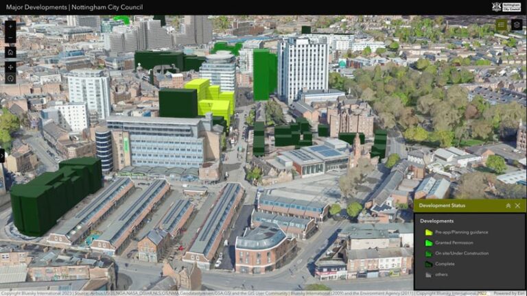
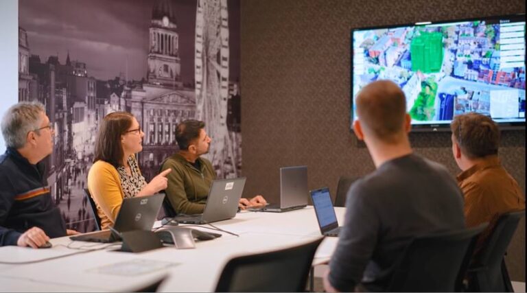
Nottingham City Council met these challenges with an ambitious revitalization plan that included new parks, office space, and housing. Using a 3D digital twin built with ArcGIS Urban and other GIS technology, Nottingham planners created and shared their vision for what the city center could become. The digital twin combines a 3D object model, real-world scans of buildings, and location-specific data to guide planning decisions. It also helped the city secure £4 billion worth of investments and redevelopment bonds for Nottingham’s transformation.
The city has already undergone numerous changes, including a renovated train station and the addition of a new bus station and parking garage that now connect pedestrians and cyclists with trains, trams, buses, and taxis. The city has a new central library and other public spaces. The Green Heart park now provides access to nature downtown with a pond, wetland plants, and a flowering meadow. The Island Quarter development includes 300 homes as well as housing for University of Nottingham students. The Queens Road development will add 380 homes near the train station.
“When other developers see that investment, they want a piece of it,” said Mick Dunn, business development specialist in geographical information services, Nottingham City Council. “That’s the beauty of pushing out the information in 3D. It’s a selling piece.”
With all this development and an influx of new residents in the center of the city, Nottingham already feels more vibrant. And with the help of its investment in digital twin technology, the city still plans to add more than 7,000 new homes, 15,000 new jobs, and two million square feet of office and commercial floor space.
Digging Beneath the Surface
Nottingham began using 3D modeling for city planning 20 years ago. The planning team also explored 3D technology to map the vast network of 850 underground caverns carved out of the sandstone beneath the city. These caves played a pivotal role in the city’s past, including helping Edward III sneak into Nottingham Castle in 1330 during a coup against his mother. Later, they provided shelter from bombing during World War II. They now serve as a tourist attraction; an interactive map created by Nottingham City Council guides exploration.
This map of the past helped planners build their skills to map the future. By mapping the caves, the planning team gained proficiency in 3D modeling and earned a reputation for app development. When the team received central government funding for city revitalization, they wanted to showcase how 3D technology could support advanced analysis.
“It’s gone from just a visualization tool to more of an analytical tool for design and metrics,” Dunn said.
Nottingham’s digital twin now covers more than 73 square kilometers and depicts thousands of historic and modern buildings, open spaces, and infrastructure. It includes data about conservation areas, floodplains, and parks, as well as live feeds for traffic and street-level video from CCTV cameras. Planners rely on the digital twin to assess site context, see how traffic behaves, and safeguard natural areas across the city.
Part of the Planning Process
Now, 3D modeling has become embedded in Nottingham’s workflows to assess the impact of development proposals. Planners drop a model of each proposed building into the digital twin to check visual impact, calculate site capacity, and negotiate height and floor space with the developer.
Paul Seddon, director of planning and transport at Nottingham City Council, noted in a press release that the digital twin has helped staff negotiate better design. “It gives confidence to both planning officers and applicants about the appropriateness of development and therefore the likelihood of planning approval being granted,” he said.
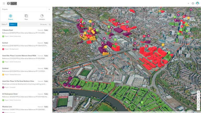
With the successful adoption of a 3D digital twin workflow, Nottingham City Council has achieved three key objectives: greater ease for people to engage in the planning process, increased transparency of decision-making, and a decrease in the amount of time it takes to move from application to formal decision.
This tech-driven, collaborative approach is making Nottingham more livable and resilient. The digital twin helps reenvision the city with input from residents, focusing on architecture and design. It prioritizes quality spaces that promote health, safety, and nature while welcoming people of all ages.
The city that once thrived on manufacturing has been fostering connections to high-growth industries, such as clean energy and life science research. The digital twin enables city leaders to better promote the city’s advantages to potential employers.
Sharing the Value of 3D Across the UK
Nottingham City Council has been sharing its expertise about the value of 3D technology with other local authorities. The city has forged strong connections with the University of Nottingham and other partners to test and understand the benefits of digital twin technology, and to discuss effective implementation.
Recently, the 3D digital twin of Nottingham City won a Geography in Government 2024 award for innovation. The Nottingham planning team hopes that the recognition and the demonstrated value of digital twins will help make 3D planning the standard across the UK.
“The move to 3D geospatial technology is inevitable,” said Laura Pullen, GIS manager at Nottingham City Council. “We are creating a blueprint to support rapid deployment of similar capabilities across other local planning authorities.”
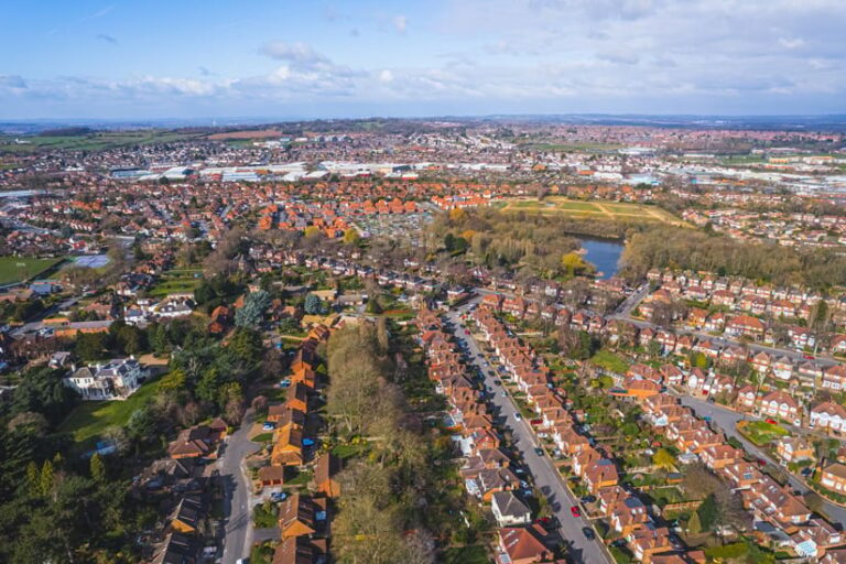
This blueprint comes at an opportune time in the UK. An ongoing national housing shortage has created a strong interest in speeding up the building approval process to address a deficit of 1.5 million homes across the country.
In March 2023, Nottingham secured a £375,000 government grant to further improve 3D technology and modernize the planning application process. Funds from the Ministry of Housing, Communities, and Local Government have enhanced the city’s 3D modeling process.
As part of the project, Nottingham planners helped the nearby city of Bradford adopt 3D planning workflows using technology like ArcGIS Urban. A cost-benefit analysis assessed the value of this digital transformation and found that for every pound invested in digital twin technology, a local planning authority can expect to get back £2 in efficiency and money saved over a 10-year period.
“The interest this has sparked across other local planning authorities has been amazing,” Dunn said. “Now we have a growing number of central government departments very interested in our approach and how this can be expanded to support operational and policy decisions relating to energy, transport, and other urban considerations.”
Balancing Nature and Development
Nottingham’s 3D digital twin, packed with environmental data, also aids planners in reaching biodiversity net-gain goals, and will provide regulatory metrics. This is especially significant as the UK now requires planners to measure nature’s value as part of the approval process, in accordance with a 2024 law. They must detail habitat improvements that will show at least a 10 percent gain in biodiversity over a 30-year period. By linking development to natural-area improvements, the country is encouraging more creative, nature-based solutions.
To that end, Nottingham’s sustainable urban drainage systems are being engineered to mimic natural wetlands. This will provide habitat for aquatic species and reduce the threat from flooding. The city also has added natural ponds and rain gardens to absorb stormwater and calm turbulent waters that could otherwise cause flooding.
Additionally, city planners have woven habitat enhancement into Nottingham’s long-term plan. The city has taken steps to protect and enhance natural areas as part of its revitalization efforts, including planting diverse species of trees and pollinator-friendly flowering plants. Residents are being encouraged to allow the growth of native plants and to give wildlife a chance to move in.
On top of this, Nottingham aims to become the first carbon-neutral city in the United Kingdom by 2028. Thanks to improved transit options, new energy-efficient buildings, and the transition to renewable energy across the city, this goal is becoming more achievable. New housing in the city center will maximize connectivity to the city’s district heating network, and enhanced green spaces will provide a cooling effect in hot weather.
The digital twin has become essential to calculating the carbon sequestration value of natural areas and comparing that value with carbon emissions to monitor the Carbon Neutral Nottingham 2028 goal. It is equally essential in transforming Nottingham into a more vibrant, sustainable city.


