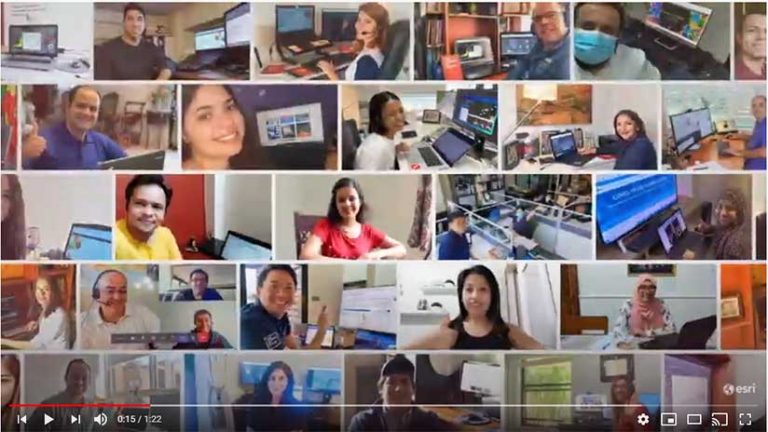
The 40th annual Esri User Conference (UC) took place July 13–16, 2020—not in San Diego in front of 18,000 users—but online with more than 88,000 registered attendees from 180 countries. The first virtual Esri UC—held in response to the coronavirus disease 2019 (COVID-19) pandemic—was an event that preserved many of the most valuable aspects of the conference and expanded its benefits to people around the world that might not have the opportunity to attend the face-to-face event.
Beginning with the first Esri UC, which was held at a Montessori school adjacent to the Esri campus and attended by just 11 users, this event has always been about connecting, inspiring, sharing, and celebrating the GIS community. The Plenary Session, livestreamed this year to more than 97,000 people in three sessions over three days, gave many more people than ever the opportunity of learning about the most recent developments in GIS.
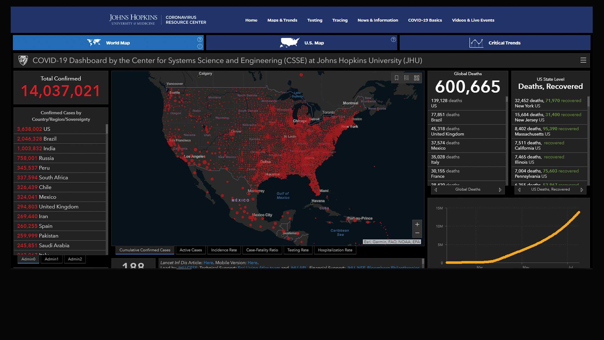
The achievements of Esri’s users were celebrated in the major awards handed out during the first day. The Making a Difference Award went to the team from the Center for Systems Science and Engineering (CSSE) at Johns Hopkins University (JHU) for its COVID-19 Dashboard built using ArcGIS Dashboards. Esri president Jack Dangermond said that they “woke up the world to seeing the context of the pandemic and helped us begin to understand it and its impact on the world.”
Ensheng Dong, a graduate student, and Lauren Gardner, professor and codirector of CSSE, were singled out for their work in developing the dashboard with technical assistance from the Johns Hopkins Applied Physics Laboratory and Esri. Learn more about the outstanding work of JHU in responding to COVID-19 by reading “Creating the Dashboard for the Pandemic,” in this issue of ArcUser.
The Enterprise Award went to two organizations this year. The Louisiana Department of Transportation & Development received it for the complete enterprise GIS it implemented for its highway department. The project, headed by Brad D. Doucet, director of Enterprise Support Services, has outfitted every fieldworker with GIS technology.
The second Enterprise Award recipient was Enel Green Power North America (EGP), recognized for its enterprise implementation led by Keith Aubin, chapter leader of Geographic Information Platform at EGP and his team. EGP was selected in part for its pioneering work in renewables, which includes wind, hydroelectric, solar, and geothermal power from plants in the United States, Canada, and Mexico.
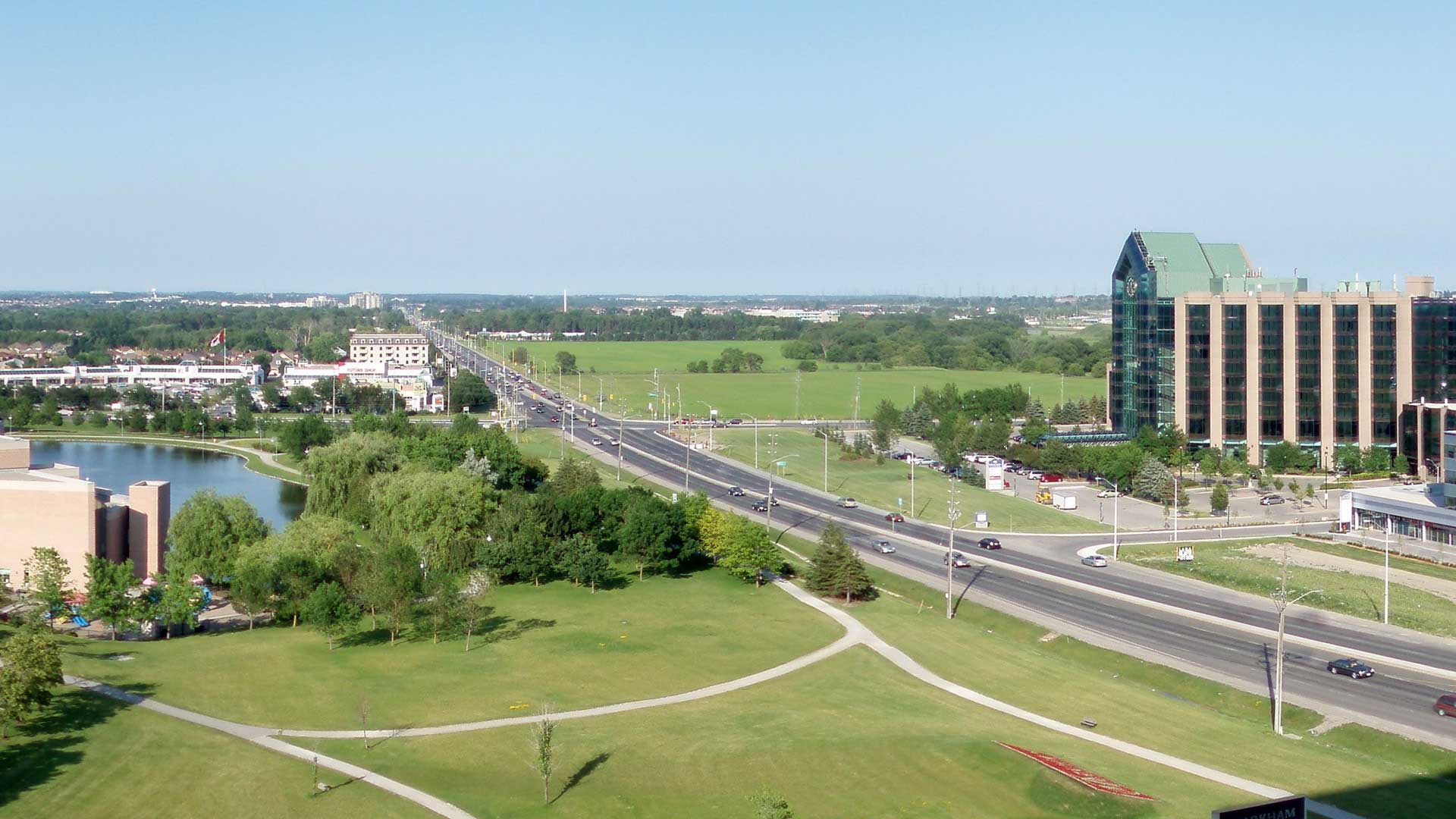
The President’s Award, which Dangermond alone selects, went to the Regional Municipality of York (York Region) in Ontario, Canada. See the accompanying article, “Geospatial Infrastructure at Its Best,” to learn more about York Region.
More than 175 organizations around the world won Special Achievement in GIS (SAG) Awards and were acknowledged during the Plenary Session. These organizations, representing less than one percent of the Esri user community, received this award in acknowledgment of their outstanding work, which exemplifies best practices in GIS.
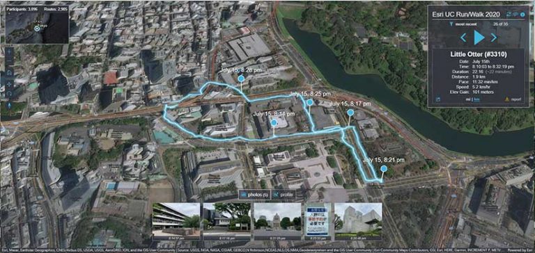
Some trademarked Esri UC events had online incarnations. The Map Gallery, a perennial favorite of attendees, became a virtual showcase of 658 maps on a wide variety of topics and interests, ranging from social justice to Star Wars. A virtual format let many more people to participate in the 5K Run/Walk. In the virtual version, participants from 82 countries used ArcGIS QuickCapture to document nearly 3,400 runs logged during the Esri UC week that added up to 16,634 kilometers. The route of each run was mapped onto a globe for online viewing.
Be proud, because we’re proud of you. GIS has never been more important than it is today. Your work on COVID-19 has been incredible. It is saving lives, transitioning economies, and making the world safer.
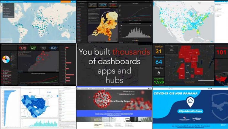
Another staple of the Esri UC Plenary Session, Dangermond’s cavalcade of user maps showing the hundreds of ways that people all over the world are using GIS to address the world’s challenges was part of the online experience. Esri received a record number of map submissions for this presentation, and a great many highlighted the outstanding work done in response to the COVID-19 pandemic.
Dangermond noted that some of this work was extraordinary. He said, “Be proud, because we’re proud of you. GIS has never been more important than it is today. Your work on COVID-19 has been incredible. It is saving lives, transitioning economies, and making the world safer. So much of the COVID work was done not as part of your job description. You stood up these sites and did the investigative work and supported people. It was heroic work, no matter how you measure it.”
After highlighting the work of users, Esri staff gave a series of presentations on the new work Esri has done since the last Esri UC. This section included presentations on the ArcGIS Pro Suitability Modeler, ArcGIS Notebooks, additional 3D capabilities, and the introduction of voxels as a data format. Demonstrations showed the continued extension of the ArcGIS platform to people who are not GIS specialists with geoenabled systems such as ArcGIS Urban, ArcGIS Indoors, and ArcGIS Mission.
Meeting Global Goals with Geographic Knowledge
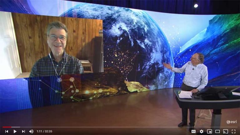
Jeffrey Sachs joined the Plenary Session live from his home to share his vision for changing “the direction of the planet.” An economist by training, Sachs is the president of the United Nations (UN) Sustainable Development Solutions Network, a UN Sustainable Development Goals (SDG) advocate, and director of the Center for Sustainable Development at Columbia University.
He noted that the Earth’s population of 8 billion needs “safe water, good food, and a healthful environment.” However climate change, pollution, and the destruction of biodiversity that blocks the achievement of these goals and are causing stresses that are pulling the world’s economy apart at an ever-increasing rate.
Sachs is committed to furthering the 17 UN SDGs as an effective way to combine economics with social justice to meet basic human rights in an environmentally sustainable way. To that end, he helped found the Sustainable Development Solutions Network, which is an organization of scientists, thought leaders, and knowledge institutions around the world. He sees the GIS community as fundamentally important to achieving the SDGs because the skills it brings are essential to devising solutions.
Sachs announced the launch of the SDGs Today site (SDGsToday.org), which provides reliable, high-quality, and timely data for informed decision-making on environmental issues.
The Need for a New Generation of Spatial Thinkers
Vicki Phillips, executive vice president and chief education officer for the National Geographic Society joined Jack Dangermond to discuss the vital role of geography and spatial thinking play in educating the next generation to meet the many challenges the world faces now and invent a sustainable future.
Esri and the National Geographic Society are partnering to develop a generation of spatial natives that Dangermond termed GeoGen. “Geography is a science well-suited to solving the problems of the 21st century,” he said. “We want to give young people a much more modern view of what geography is all about.”
Dangermond emphasized the need for a geospatially literate society that can use design thinking and spatial problem solving to better understand the world. As the COVID-19 pandemic has so emphatically demonstrated, linking science and rational thinking to real-world action is vital.
Thoughts for the Future
For Esri staff, Esri UC is always a much-anticipated opportunity to directly connect with users. This interaction is energizing and uplifting. The insights and reactions of users help inform work at Esri throughout the rest of the year. As Dirk Goter, director of product management/marketing, often observes, “Users are our greatest asset.”
Although the online platform was designed to help make those connections, staff members have said how this year they missed opportunities to share a meal or a serendipitous chat while strolling through the San Diego Convention Center on the way to a session. Dangermond echoed the thoughts of staff members in his hope that—in the near future—it will be possible to again meet face-to-face.
Despite the unrest and uncertainty of this moment, during this virtual Esri UC, the GIS community came together, as it has for the last 40 years, to share knowledge, catch up with old friends and meet new ones, validate the value of GIS work, and affirm the critical that role GIS professionals will continue playing in the future.
About the author