Location analytics is an increasingly critical component to the success of any business. In 2020, tens of thousands of companies leveraged GIS technology in planning their marketing, site selection, and business strategies. Yet students seeking business degrees are rarely exposed to GIS technology.
Carroll University in Waukesha, Wisconsin, is an exception. Although it is the oldest higher-education institution in the state, Carroll University strongly supports fresh ideas and initiatives, reflected by its School of Business’s Analytics and Business Intelligence Consortium (ABIC). The mission of the multidisciplinary consortium is to reach out to local businesses and community organizations to address their needs in workforce development, data, and analytics.
ABIC hosts monthly workshops for these groups—which include nearby chambers of commerce and other agencies around the Milwaukee area—to help them develop their analytic capabilities and make the most of decisions impacting the community. Through outreach and cooperation with local organizations, Carroll University is earning a reputation for geospatially driven collaboration.
Introducing a GIS Perspective
With fewer than 3,000 undergraduate students enrolled, Carroll University is one of the smaller institutions in the state, yet its use of location analytics in its curriculum shows greater innovation than many much larger universities in the area.
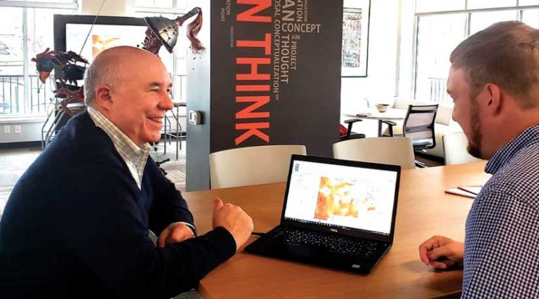
A major contributor to the university’s status as a trendsetter in GIS-informed business education is pioneering professor Dr. Julio Rivera. He is among a minority of college professors (just an estimated 10–15 percent) who currently teach location analytics in business education courses across the United States. Rivera has integrated location analytics and related technology not only in his courses but also throughout the the School of Business at Carroll University, covering topics such as market research, data visualization, and data analytics.
Originally trained in GIS, Rivera taught for years as a geography professor before moving on to teach courses in marketing and business. “One of my primary goals was to integrate my work as a geographer with business education,” said Rivera. “Much of my consulting work in geography as a GIS professor was with businesses in the community, so I thought coming to a business school with a focus on analytics was a perfect marriage.”

Rivera knew that he wanted to integrate GIS into curriculum that was focused on market research and related analysis, so he started by creating simple tutorials and assignments to acclimate the students to the technology.
“It’s really amazing to me because GIS is so intuitive,” said Rivera. “When they see it, the buy-in becomes very easy for the students.” Rivera’s approach is strongly student focused, with an emphasis on understanding what each student is trying to accomplish and which tools and training will ultimately further their career trajectory.
Rivera uses Esri Academy, an online geospatial education resource, to familiarize students with geospatial software. For most students, this is their first exposure to GIS technology. Students of Rivera’s courses then use ArcGIS StoryMaps stories to present and publish their assignments on the web. “It doesn’t matter if the course had anything to do with mapping or spatial ideas, because the interface accepts images, text, etc., and creates an attractive interactive page easily and quickly,” said Rivera. “I had students put their work here for presentations and dissemination. Last semester I had statistics students submit their semester projects in this project. The only guidance I had to give them was [in] the materials from the Esri Academy and a quick class demo.”
Tackling Real-Life Business Problems
Rivera’s market research lessons walk students through a real-life site-selection problem. Later in the semester, students complete a project in which they use GIS-enabled market analysis to plan the expansion of a hypothetical franchise into a new market. Using ArcGIS Online and ArcGIS Business Analyst Web App for demographic mapping, they analyze a given market and determine the location of the new market, complete a comparison of three different relevant markets, and perform site selection for the new store placements.
Rivera’s MBA-level courses are even more in-depth. One intensive eight-week GIS course in data analytics leads students from introductory GIS technology to advanced spatial statistics techniques. Rivera uses ArcGIS Pro to explore simple mapping processes, geocode points, construct building surfaces from point data, and perform network analysis.
One thing that makes the Carroll University School of Business stand out in its application of GIS learning is the emphasis on community outreach, partnering with local businesses to broaden the educational experience.
Rivera recalls a recent MBA student whose capstone project focused on a Milwaukee company with offices in several different cities. One office experienced a higher rate of absenteeism than the other offices. The company needed to figure out why. Rivera’s student tackled the problem geospatially, geocoding the demographic data on the office staff.
“He discovered that the employees at that office came from areas where there was more economic distress and higher levels of disease,” said Rivera. “He had the geographic [data] layers about disease, economic stress, things like that. And he was able to tell this company, ‘These people have more going on in their lives. This is probably why you have this absenteeism, and what we need is an HR [human resources] system that addresses that.’ These students are learning practical ways to apply GIS.”
Another student developed an undergraduate research project to help the Boys & Girls Club of Greater Milwaukee analyze its membership and use GIS-based site selection to plan site openings and closures. She helped support the organization by optimizing its more than 30 locations. After graduation, she became an analyst at a Fortune 500 company.
Reaching More Students with GIS
“We want to integrate GIS education and build it across other platforms,” said Rivera. He believes it can be used in other areas of the campus in useful ways because ArcGIS Online, ArcGIS Business Analyst, and ArcGIS Community Analyst are so easy to use. “When I taught marketing research this year, I used the tutorials that Esri has, and the students did great! They were able to do actual retail site selections for market research and analysis.”
Carroll University stands as a powerful and evolving example of how business educators can use geospatial techniques and GIS technology to help students think spatially, creating the next generation of business professionals who can use analytics to solve problems and make better-informed decisions.


