The Swiss Federal Institute of Technology Builds a Geospatial Legacy with an Eye toward Creating a Better Future
Students studying cartography and geoinformation at the Swiss Federal Institute of Technology, better known as ETH Zürich, are following in the footsteps of an expert mapmaker who studied and taught there: the late Eduard Imhof.
Like Imhof, the students strive for excellence. But the GIS technology that they use to make maps and conduct spatial analysis is vastly different than the tools Imhof and his contemporaries relied upon in the first half of the 20th century. Today they use GIS software from Esri for a wide range of projects, from using mobile apps to collect data in the field to working with powerful 3D city design software to build elaborate 3D models.
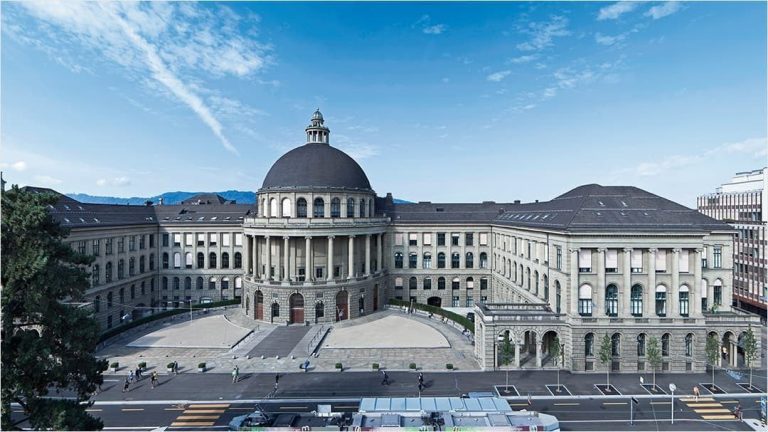
ETH Zürich is a public research university in Zürich founded by the Swiss federal government in 1854 with a steadfast mission to educate engineers and scientists. The school focuses exclusively on science, technology, engineering, and mathematics. ETH Zürich is home to 22,000 students and 540 professors from over 120 countries and consistently ranks as one of the world’s top universities, listed as 13th in 2020.
GIS software has been vital for students studying at ETH Zürich’s Institute of Cartography and Geoinformation, which specializes in cutting-edge research related to mapping, GIS technology, and spatial analytics. GIS also is used within the university’s other geoinformation-related programs, including geomatic engineering and planning, geospatial engineering, geomatics, and earth and environmental sciences.
Between the institute and the core geoinformation-related course offerings, ETH Zürich has used Esri software for more than 20 years and has produced graduates who have won awards for their work, including several Esri honors. Among students from ETH Zürich are notable winners of the Esri Innovation Program (EIP) (formerly Esri Development Center [EDC]) Student of the Year Award; some have gone on to pursue their passion and continue their research as Esri employees.
Geospatial Technology Key to Students’ Success
Monika Niederhuber, a technical assistant and lecturer for the ETH Zürich Department of Environmental Systems Science, structures her courses to foster a deep understanding of GIS technology and its applications. Students in introductory-level courses learn the theoretical basics and fundamental concepts of GIS and then practice them on small but practical projects.
For example, one of Niederhuber’s courses includes a GIS-based case study project that falls within the context of environmental problem-solving. The students collaborate with outside organizations, which propose case study topics. With guidance from Niederhuber, the students are responsible for carrying out the projects. The students plan the schedule, define the criteria for analysis, select relevant GIS data, create conceptual models and workflows, transform the models with ArcGIS, and present their results to the course plenum and the external partner. In the past, students have worked with various partners, such as Swiss Regional Parks, on projects such as modeling potential weasel or hazel grouse habitats.
Undergraduate students also take part in outdoor excursions where they use GIS. The excursions encourage students to explore aspects of data literacy through real-world experiments. For example, students use ArcGIS Collector to map large datasets on spatially relevant issues. The excursions familiarize students with GIS and provide them with interactive lessons. During these outings, students have captured data to map trees, flowers, fungi, butterflies, tiger mosquito breeding spots, and birds. They’ve also used the app to collect wind speed and direction and soil depth data.
In addition to the undergraduate course instruction, Niederhuber teaches a graduate-level GIS course focused on spatial data analysis, modeling, and optimization. In this course, students leverage ArcGIS Online, along with the powerful ArcGIS Pro for 3D modeling and data analysis.
Niederhuber’s GIS expertise goes beyond the classroom. For the last three years, she has led an established GIS user group for researchers. The group was founded 15 years ago and meets yearly to let members exchange ideas, present research, and help each other solve problems. “The goal was to bring together scientific assistants, PhD [candidates], and postdoctoral students [who work] with ArcGIS to network, collaborate, and learn from one another,” Niederhuber said.
Geospatial Research’s Impact on the Future
In the early days of the Institute of Cartography, primary research focused on topographical cartography (mapping of terrain), thematic cartography, and atlas cartography (school atlases, national atlases). In 2011, Martin Raubal joined ETH Zürich as a professor of geoinformation engineering, the institute’s name was changed to the Institute of Cartography and Geoinformation, and a new era of education and research was ushered in.
“We utilize geoinformation and location-based data in many areas of our lives, whether public transportation, sustainability, or environmental protection, Raubal said.” It would be a challenge to find an area or domain where GIS can’t be applied.”
As such, Raubal encourages his students to consistently consider where to apply geoinformation and location data. This has led Raubal’s geoinformation engineering research group to offer courses including elements of spatiotemporal machine learning and data science. Students not only learn about GIS-specific methods and applications of data science in various fields but apply them in their research projects, too.
Students study a wide range of topics such as analysis, simulation, and prediction of human mobility; mobile GIS and location-based services; cognitive engineering for geospatial services; mobile eye tracking to evaluate individual mobile decision-making; GIS for renewable energy analysis and prospecting; spatial cognition and wayfinding; and time geography. Esri technology was used for many of these studies.
“For me, I think that GIS is broad, where no matter how we use it. . .. It can be applied to many different real-world problems,” said Raubal. “But I think that GIS can be much broader, and I strongly believe the future is spatial data science, because spatial components are already so integral to everything we do.”
Students have applied this mindset while conducting research at the institute’s two core labs—the Mobility Information Engineering Lab and GeoGAZElab. For example, students leading the research on GIS for renewable energy have developed a GIS-based algorithm for the fields of biomass, solar, and wind energy to identify technical and economically exploitable potential for power generation. The students’ research also considers the regulatory and economic frameworks for Switzerland to plan for transmission lines and determine locations for biomass power plants.
A Thriving GIS Partnership
As a leader in geospatial research, the Institute of Cartography and Geoinformation applies Esri technology for various projects related to topics such as cognitive engineering, mobile GIS, renewable energy, and mobility and sustainability.
Over the years, ETH Zürich has maintained a strong partnership with Esri, with the Institute of Cartography and Geoinformation earning the EDC (now EIP) designation. The distinction places the institute into an elite group of global ArcGIS users in education whose work goes beyond typical classroom use. Several students from the programs have been named EIP Student of the Year, an award given by Esri founder and president Jack Dangermond. Winners receive cash prizes, an Esri Press book, and a certificate and are invited to participate in the Esri User Conference, which will be held virtually July 12–15, 2021. Before the COVID-19 pandemic, the conference was held in San Diego, California.
In 2017, Lisa Stähli won the Student of the Year Award for her project, Pedestrian Navigation in a Virtual Urban Environment: Evaluation of Wayfinding Directions Indicated on Public Displays. The master’s degree project investigated pedestrian navigation aids and aimed to find alternatives to the widely used map-based navigation systems. Using ArcGIS CityEngine technology, Stähli created a virtual 3D urban model that was imported into Unity, a game engine with added animations and interaction with the navigation systems. Using the created model, Stähli tested four navigation techniques with a group of 45 individuals, producing a valuable dataset and statistically proving that augmented reality was the best wayfinding tool.
A pair of students, Hasret Gümgümcü and Daniel Laumer, shared the Student of the Year Award in 2019 for the UrbanX project, a mixed-reality scenario app combining HoloLens and gesture technology with city planning apps. The UrbanX app provides several functionalities to assist urban planning initiatives, including clicking on a building to obtain information about it and adding buildings and removing old ones from the plan.
A pair of students, Hasret Gümgümcü and Daniel Laumer, shared the Student of the Year Award in 2019 for the UrbanX project, a mixed-reality scenario app combining HoloLens and gesture technology with city planning apps. The UrbanX app provides several functionalities to assist urban planning initiatives, including clicking on a building to obtain information about it and adding buildings and removing old ones from the plan.
Also, in 2020, Samuel Küng from the Environmental Systems Science Department won the Esri Young Scholar Award with his master’s thesis “Deriving forest mask according to the forest definition of the Swiss National Forest Inventory based on 3D remote sensing data.”
Students from ETH Zürich have also gone on to find successful careers in GIS and with Esri. For example, Stähli now works for the ArcGIS Urban team at Esri R&D Center, Zurich AG.
Christian Sailer, business development manager for education at Esri Schweiz AG, completed his PhD in Raubal’s geoinformation engineering group. His thesis, entitled “OMLETH,” focused on the development of a map-based learning platform for educational institutions, featuring multimedia field trips to create an authentic, location-based mobile learning experience. The OMLETH app serves to bridge the gap between GIS technologies and lesson management by assigning content lessons to spatial locations. This software is being used for augmented exercises for work in the field and is still in use at several secondary schools. OMLETH’s clients are hosted on the ETH Zürich ArcGIS Online account due to the powerful cloud capabilities and the ready-to-use user management.
“With ArcGIS Online, ETH Zürich has a tool that anyone can use quickly, doesn’t require expertise, and displays data easily,” said Sailer. “Thanks to this technology, students, researchers, and faculty can approach spatial challenges as efficiently as writing a report or calculating small statistics using MS [Microsoft] Word or MS Excel.”
For now, the robust education and research programs at ETH Zürich will continue to provide students with learning opportunities that contribute to the future of geoinformation and location-based sciences.