Esri Press Publishes a Children’s Book Series for the Next Generation of Planners, Landscape Architects, Civil Engineers, and GIS Professionals
To inspire young people to pursue careers in science, technology, engineering, arts, and mathematics (STEAM) fields and stimulate their interest in GIS, Esri just released a series of career-themed children’s books.
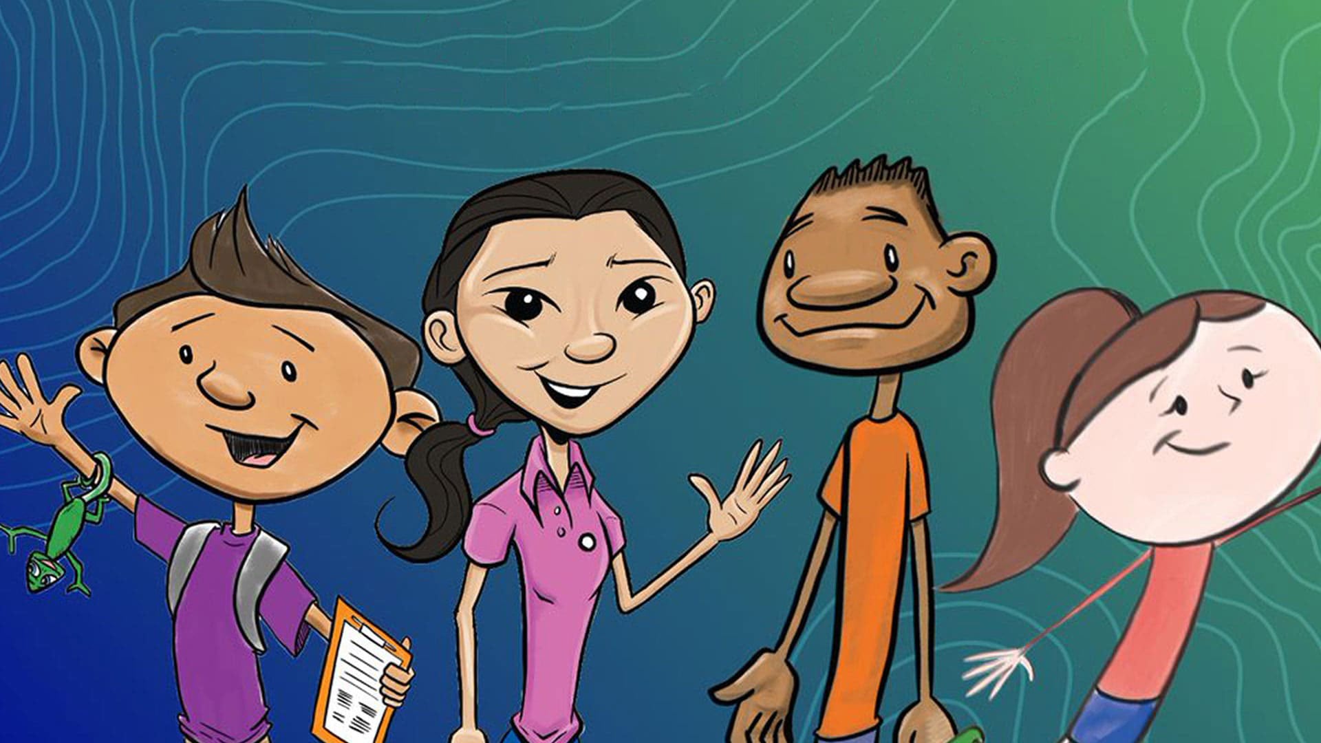
The four books focus on civil engineering, landscape architecture, urban planning, and mapping and geospatial analysis—all fields that require or benefit from the use of GIS technology.
The STEAM at Work! series, published in partnership with Bolton & Menk, Inc., an engineering and consulting firm, includes the titles Will the Civil Engineer: A City Infrastructure Story, Sam the Landscape Architect: An Environmental Design Story, Parker the Planner: An Urban Planning Story; and Lindsey the GIS Professional: A GIS Mapping Story. At least two more books in the series will be published in the future, including one about a land surveyor.
All four titles are copyrighted by Bolton & Menk, which conceived the original series and whose employees wrote them. Esri, however, licensed the series and created the online resources for the books, including teaching materials and the student activities of collecting data, making maps, solving quizzes, and drawing plans.
Publishing children’s titles is somewhat of a departure for Esri Press, which typically focuses on books about ArcGIS software, scripting, spatial analysis, data science, GIS and science, and cartography. Esri, however, wants to help ground children in thinking spatially, which is important if they want to pursue a career in a STEAM-related field and, ultimately, make the world a better place with the work they do. The books also highlight environmental and social issues that the characters go about solving such as adding green space and bike lanes and cleaning up pollution in their communities.
“It’s about how you can improve your community and think geographically, and like [Esri president] Jack [Dangermond] says, create a better world,” said Alycia Tornetta, the Esri acquisitions editor assigned to work on the series.
The children’s series by Bolton & Menk caught Esri’s attention after the publication of Lindsey the GIS Professional: A GIS Mapping Story, which was written by Tyler Danielson, a GIS specialist who works for Bolton & Menk. The story he wrote was inspired by his sister, Lindsey, who works as a GIS instructor at Esri. The books feature diverse characters and are mainly aimed at elementary school students, though a teacher in Ireland used the Lindsey book to introduce her middle school students to GIS technology for a project on the United Nations’ Sustainable Development Goals, according to Tornetta. [See the related story about the project created with ArcGIS StoryMaps.]
Tornetta said that Esri also wants to get teachers comfortable with using GIS technology. Introducing the children’s books and the accompanying fun, interactive mapping activities was one way of accomplishing that goal.
Lindsey the GIS Professional was the first book in the series that was published. Besides the English language version, the book also will be released in Spanish, German, Russian, and traditional Chinese in the future. It was sold during the virtual 2020 Esri User Conference (Esri UC) in July.
“It was super popular during the Esri UC,” Tornetta said, adding that the book generated brisk sales among parents who are GIS professionals looking for ways to keep their school age children actively learning, engaged, and entertained while quarantining due to the coronavirus disease 2019 (COVID-19). “We have a lot of excitement [surrounding the books] from teachers,” she said.
Each of the books comes with a resources website. This is where students can do everything from take quizzes, draw up plans for bridges or parks, and color maps of the world using paper printouts of PDFs. In collaboration with the ArcGIS StoryMaps team, Esri Press employee Craig Carpenter also used ArcGIS StoryMaps to create interactive maps that give children the ability to do things such as map the location of their school, add data about the current weather, measure distances on the map, make a map of a park, or map the best crosswalk locations near their school.
The teacher resources offer more in-depth Learn ArcGIS lessons, such as Map Venice in 2D and 3D, and exercises on plate tectonics, earthquakes, and volcanoes.
Read more about each of the books below.
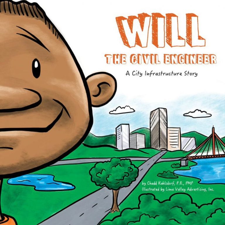
Will the Civil Engineer
Will the Civil Engineer: A City Infrastructure Story, published in September, follows the character of Will, whose father works as a civil engineer. One day, a curious Will asks his Dad what he’s talking about when he uses words like structure, utilities, and specifications.
His father explains to him what engineers have created, including great engineering feats such as the pyramids of Egypt, the Hoover Dam in Nevada, and the Golden Gate Bridge in San Francisco. He describes to Will how civil engineers design water systems, airport runways, bridges, and roads, to name just a few examples. “Civil engineers work to protect lakes, rivers, and streams so we can go fishing and swimming,” he tells his son.
The book stresses the need to study math and science to become a civil engineer and includes a helpful glossary that defines terms such as specifications, structures, and booster station. Visit the resources site.
Will the Civil Engineer was written by Chad Kahlsdorf, a principal engineer at Bolton & Menk and the father of six children. He has worked on civil engineering projects related to site development, storm and sanitary sewer design, and water distribution systems.
He said he wrote the book to teach civil engineers of the future how to improve the quality of life in their communities.
(Esri, print edition ISBN: 9781589486430, US$7.99)
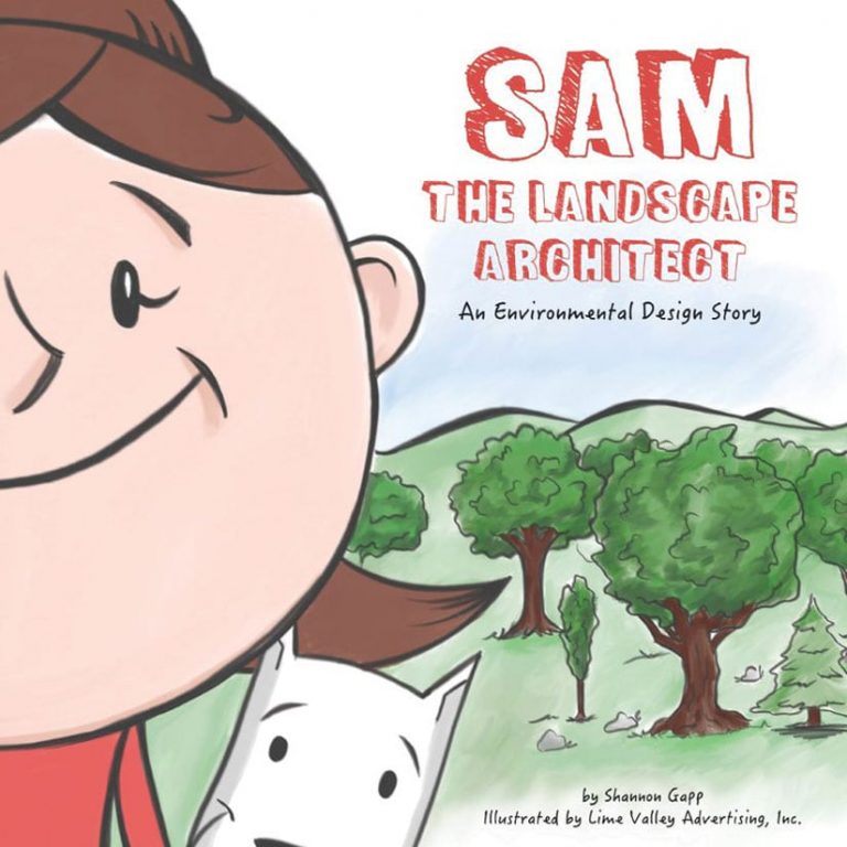
Sam the Landscape Architect
Esri’s early roots are in landscape architecture, which makes the company’s publication of Sam the Landscape Architect: An Environmental Design Story fitting.
In the book, the character of Samantha, who goes by Sam, loves to practice green living and dreams of growing up to become a landscape architect.
The beautifully illustrated picture book describes what landscape architects do for a living by showing Sam planting trees; designing parks, playgrounds, dog parks, and pollinator gardens; and creating bike paths where she can ride her trike.
The book includes many lines that rhyme. “Sam loves the water and thinks pollution is mean. So Sam designs rain gardens that keep our rivers and lakes clean.”
The book includes a glossary that defines terms such as landscape architect, plan, rain garden, and pollinator. See the resources site for Sam the Landscape Architect.
Shannon Gapp, a landscape designer for Bolton & Menk, is the book’s author. She has worked on urban and streetscape designs, comprehensive community planning projects, and plans for parks.
Sam is a reflection of Gapp, who loves the outdoors and has a sharp design eye. She said she wrote the book to inspire a new generation of landscape architects to build healthier and more sustainable communities.
(Esri, print edition ISBN: 9781589486485, US$7.99)
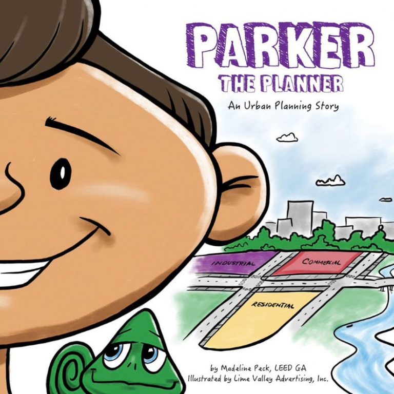
Parker the Planner
Parker the Planner: An Urban Planning Story tells the story of Parker Perez, a boy who needs to wait for a ride home from school rather than walking to his house because there are no sidewalks in his community. He’s also unable to play outside because his neighborhood playground was turned into a lot where cars are sold.
Parker brainstorms and decides to plan his own city. He shops a city plan with his neighbors—envisioning a park with an ice hockey rink, a playground, a light rail system, connected sidewalks, and a roadway system with room for cars, buses, and bikes. He also mentions the need to locate shopping areas and housing near schools to make walking to these places convenient.
The glossary for this book includes definitions for terms such as planner, land uses, and environmental benefits. Visit the resources site.
Parker the Planner was written by Madeline Peck, a landscape architect for Bolton & Menk. She works with communities to design downtowns, transportation plans, and pedestrian walkways. She said she wrote the book to show children what’s possible when they are excited about turning their communities into better places to live.
(Esri, print edition ISBN: 9781589486492, US$7.99)
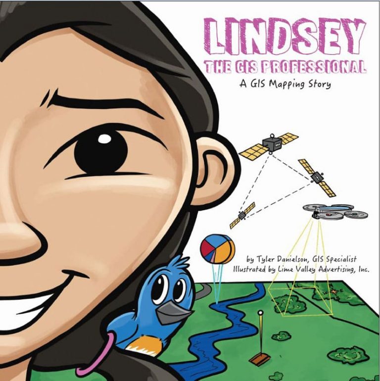
Lindsey the GIS Professional
Lindsey the GIS Professional: A GIS Mapping Story follows the character of Lindsey as she collects the data on her favorite park using a smartphone and drone. She then uses GIS technology to make a digital map of the park.
The book uses text and drawings to explain the process of data collection and defines GIS terms and concepts. Children will learn some basic terms such as spatial data and basemaps. The book also discusses vector and raster data and analysis, nonspatial data, attributes, and north arrows and scale bars.
Readers can download mapping activities and other resources from the complementary website, LindseyLovesMaps.com. On the site, educators will find information about curriculum standards and a teacher’s guide with suggestions for how this book can be applied to instruction relevant to subjects such as the arts, math, and science.
You also will find free online lessons that teach children more about GIS and how to use the technology. Downloadable activities include a maze puzzle to find Lindsey’s lost drone; data collection, analysis, and mapping exercises; and a connect the dots game.
(Esri, print edition ISBN: 9781589486126, US$7.99)
