Create Shadows for Your Symbols
Esri cartographer John Nelson shows you how import your own symbol graphics into ArcGIS Pro, tint them, and then create shadows for them.
Esri cartographer John Nelson shows you how import your own symbol graphics into ArcGIS Pro, tint them, and then create shadows for them.
ArcGIS Pro now includes new layer and feature blending modes, movement analysis tools, and 3D object feature layers.
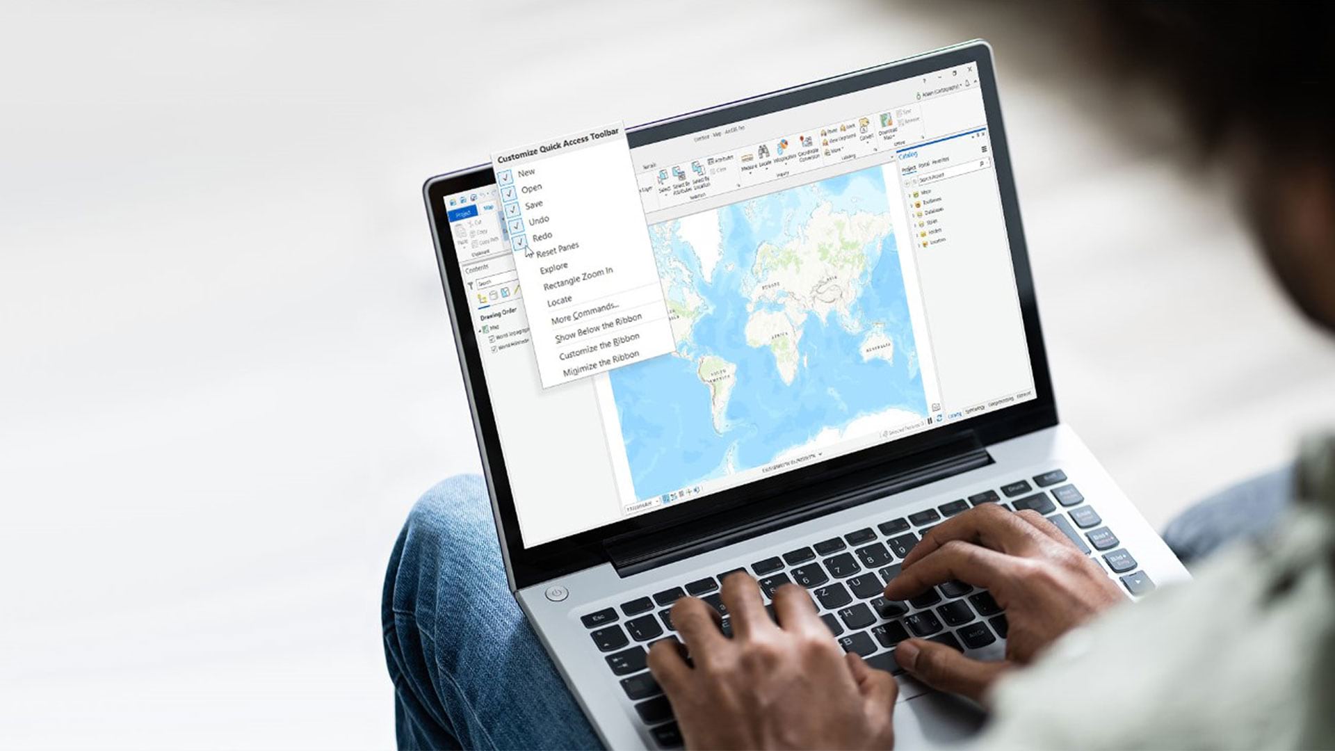
Learn to customize the Quick Access Toolbar, located above the ribbon in ArcGIS Pro. The toolbar puts commands you need most at your fingertips.
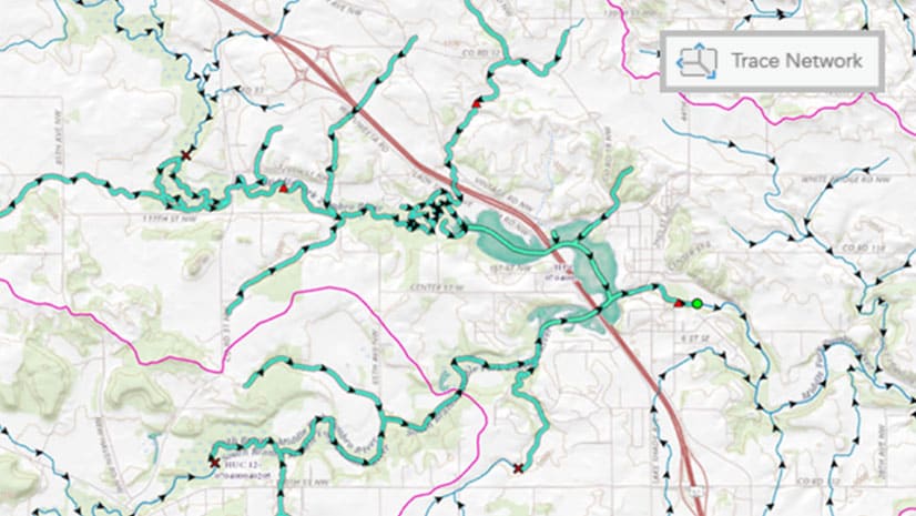
From voxel layers to trace networks and from graphic layers to link analysis, see what’s new in ArcGIS Pro 2.6.
Do you have a point, line, polygon or raster symbol just the way you like it and want to reuse it? Here's how to save it as a style.
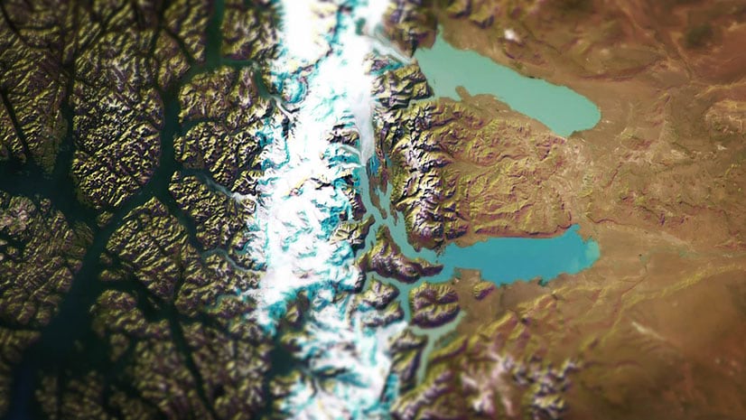
Esri cartographer John Nelson offers two color schemes for your hillshades for use in ArcGIS Pro: ice and mountains.
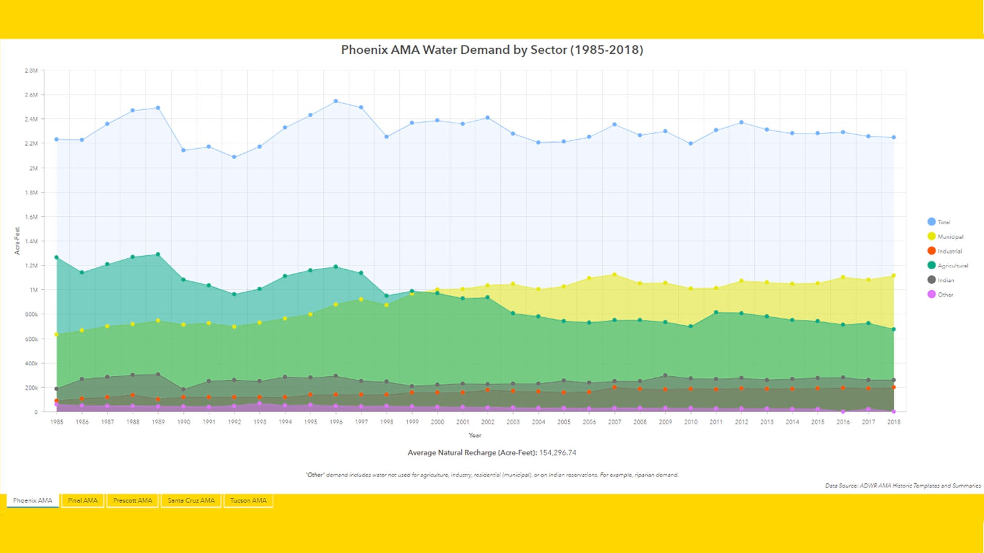
The Arizona Water Blueprint Viewer was created using ArcGIS Online and its configurable ArcGIS Web AppBuilder, along with ArcGIS Pro.
The current version of ArcMap is the last release and support for it continues until March 1, 2026.
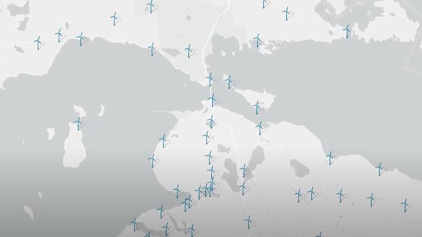
With the release of ArcGIS Pro 2.6 and Map Viewer Beta, you can now publish your own 2D symbols to ArcGIS Online using web styles.
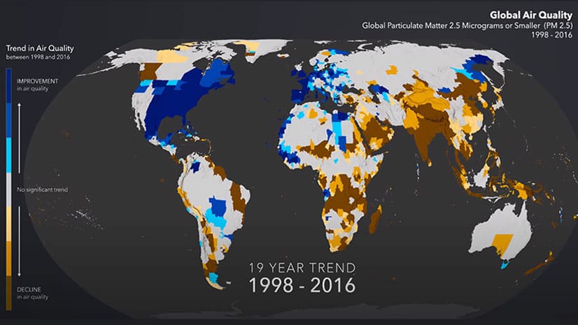
See worldwide air quality data mapped over a period from 1998 through 2016 and see where air quality improved and worsened.
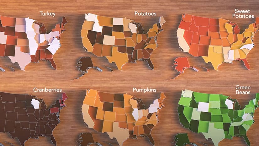
An animated map shows where the sweet potatoes; green beans; potatoes; pumpkins; and turkey that Americans eat on Thanksgiving are grown.
Enhance your GIS productivity with an ArcGIS Pro license packaged with a Dell Workstation or Rugged Tablet.