Alabama Modernizes its Public Health Department with GIS
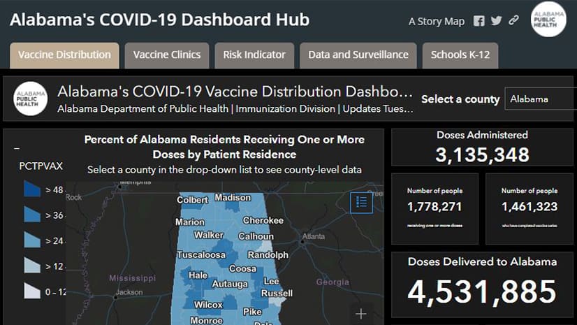
The Alabama Department of Public Health has used GIS in dealing with issues such as the Zika virus, opioid abuse, and the COVID-19 pandemic.
The Alabama Department of Public Health has used GIS in dealing with issues such as the Zika virus, opioid abuse, and the COVID-19 pandemic.
Dr. Jonathan Mayer talks about geography’s role in disease and public health with Marianna Kantor, Esri's chief marketing officer.
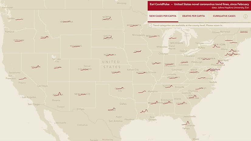
Check the new CovidPulse map from Esri to see the trend lines for reported cases of and deaths from COVID-19 in the United States.
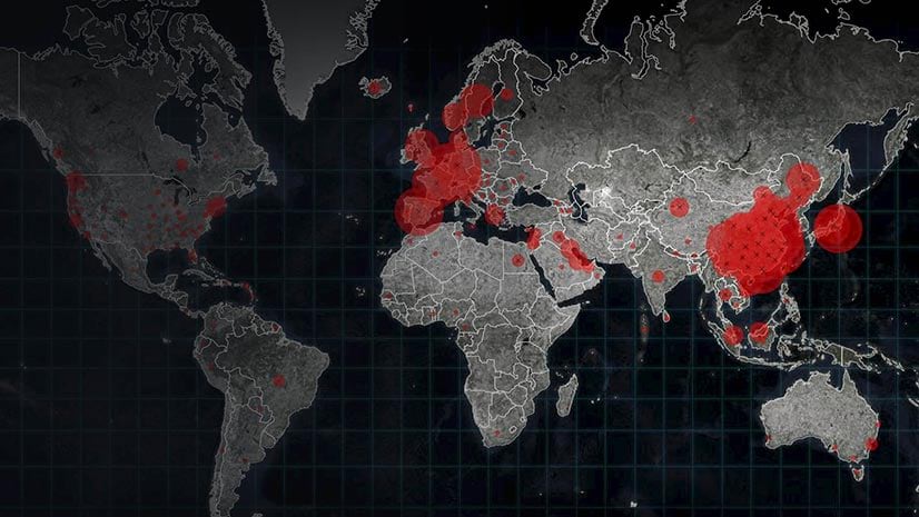
GIS departments throughout the United States can provide their organization valuable information about the spread of COVID-19 as cases rise.
Find out where cardiovascular disease is prevalent in the United States using the new Interactive Atlas of Heart Disease and Stroke mapping...
Dr. Este Geraghty is combining her passion for health and geography in her new role as the industry manager for Esri's health and human services.
Create a game-changing app that will help communities better understand and reduce the impact of climate change on health.
Honolulu, Hawaii; Yonkers, New York; and Minneapolis, Minnesota, were all on Livability's Top 10 Healthiest Cities list.
See where the measles is a major problem in the United States this year and where vaccination rates for measles, mumps, and rubella are above...
Joanne Chiedi and Tim Kropp from the United States Department of Health and Human Services demonstrate how Insights for ArcGIS can be used...