Guyana Develops ArcGIS Software-Based Forest Monitoring System for REDD+ Compliance
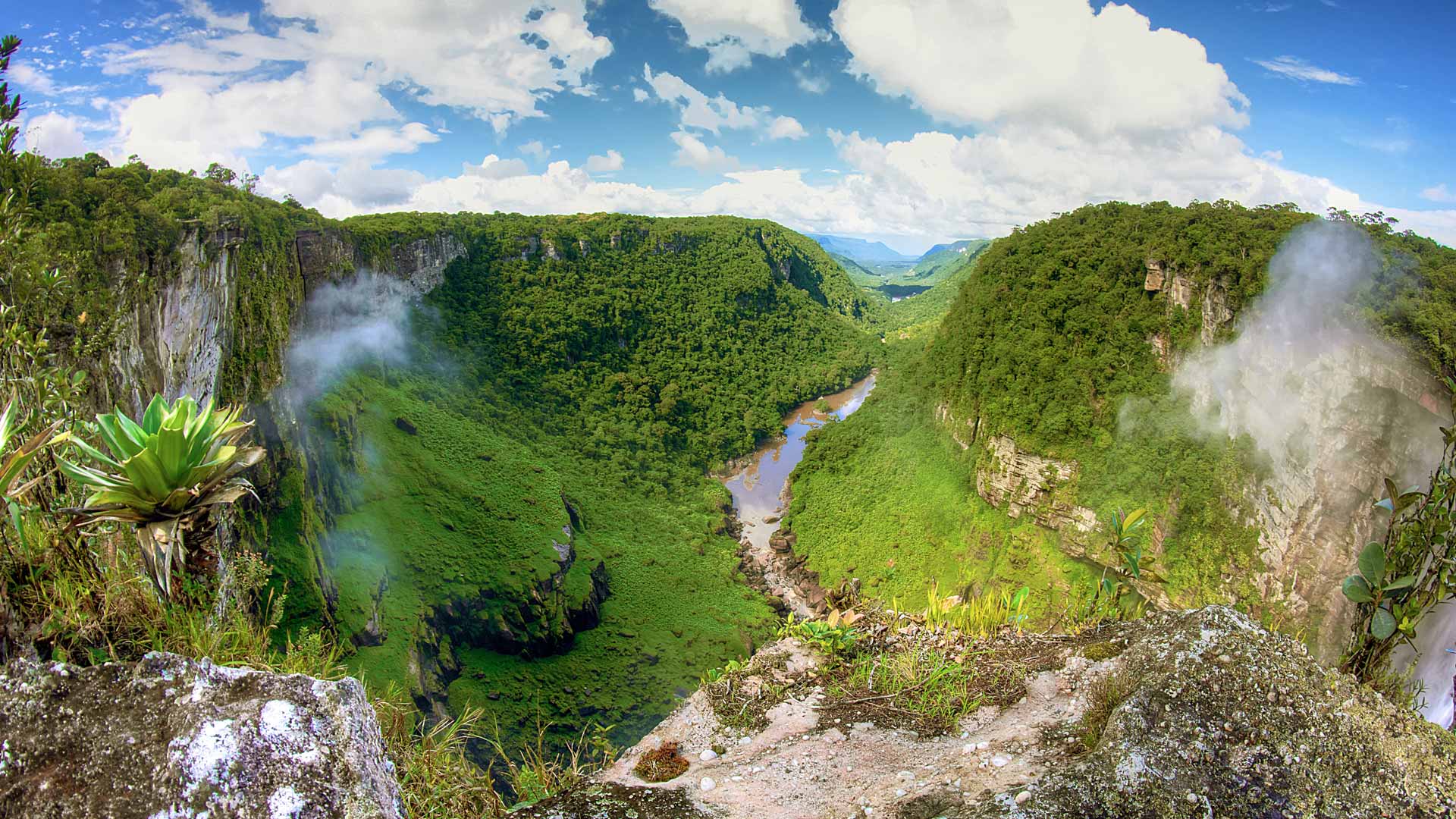
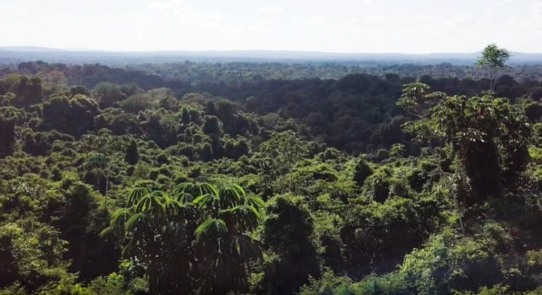
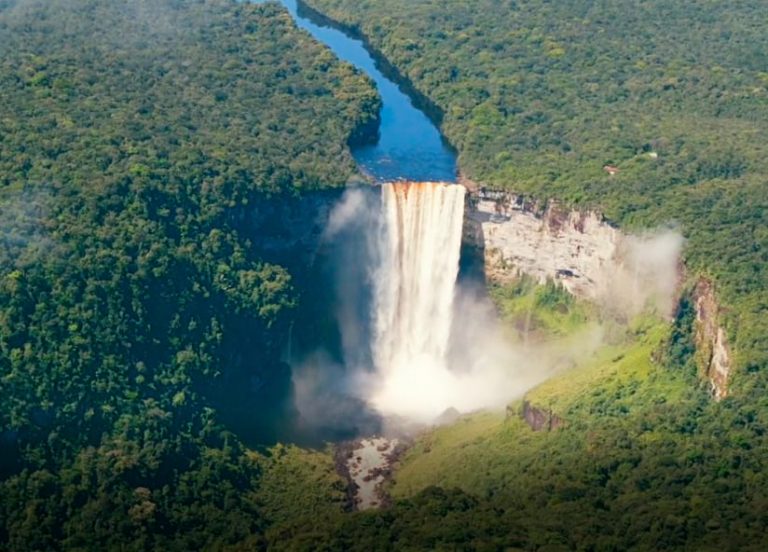
The Guyana Forestry Commission (GFC) is developing a dashboard created with ArcGIS Dashboards that will generate reports about deforestation in the South American nation, which is renowned for its lush rain forests and exotic wildlife such as jaguars, capuchin monkeys, and giant armadillos.
Esri mobile apps such as ArcGIS Field Maps and ArcGIS Survey123 also will be used by staff at GFC field stations to collect location data and other information on mining and forestry operations, wildfires, agricultural activities, and other drivers of deforestation and forest degradation. The information gathered will provide the GFC with situational awareness and a means of compliance monitoring.
“Mining operations are the main cause of deforestation in Guyana over the last decade, as shown by a monitoring system the country put into place to track such activity,” said Pete Watt, team leader of the Resource Monitoring Group at Indufor, an international consulting firm that provides services to the forestry sector. Watt works as an adviser to the GFC and is responsible for developing and maintaining the country’s national Monitoring Reporting and Verification System (MRVS), which was created to monitor its forest areas and carbon loss.
Guyana is recognized as a low deforestation country and signed the Guyana Norway Agreement in 2009 as part of the United Nations’ initiative called Reducing Emissions from Deforestation and forest Degradation, plus the sustainable management of forests, and the conservation and enhancement of forest carbon stocks (REDD+). It’s an effort to mitigate climate change. Guyana agreed to monitor, report, and verify changes in its forest cover and the related carbon loss. In return, Norway would provide performance-based payments for carbon stocks on an annual basis.
GFC began using Esri ArcGIS software many years ago to create maps of its forest cover. But in a move toward conducting more real-time data collection, analysis, and information sharing, the organization recently started to use ArcGIS Dashboards in ArcGIS Online to create dashboards and launch mobile apps to help monitor and report where forest cover losses have occurred.
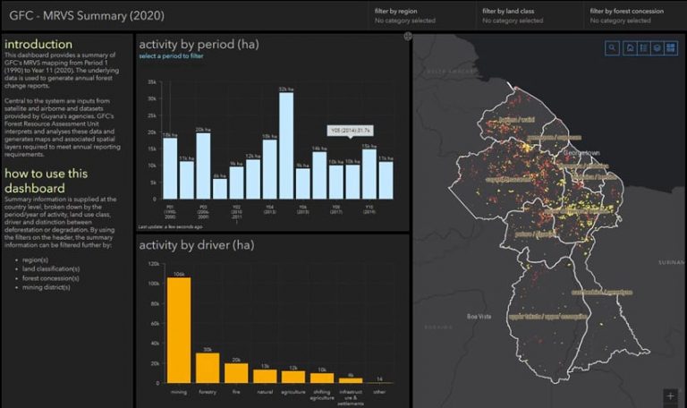
“The dashboard adds some analytics, so it’s easier to see trends—[such as] how much forest has been lost and where,” Watt said. The current map in the dashboard shows a total of 158,274 hectares of deforestation activity and 35,621 hectares of degradation activity in Guyana, a country that’s 21.4 million hectares in size. The main driver of deforestation and forest degradation is mining. Clicking on a red (deforestation) or yellow (degradation) portion of the map reveals the land-use class (e.g., degraded forest) and the driver (e.g., mining, forestry, fire).
Increases in deforestation usually occur when the price of gold spikes because of the prevalence of gold mining in Guyana, according to Watt. He added that the recent El Niño weather pattern (which has caused droughts) has led to more wildfires and deforestation in some areas.
The MRVS system is currently being expanded so that it can collect data and perform analyses in near real time, according to Towana Smartt, GIS and remote sensing manager for the Forest Area Assessment United at the GFC. “These updates include reducing the lag time from when a change occurs to when it is mapped and reported,” she said. “We are also taking advantage of cloud computing services and the availability of high-cadence satellite imagery.”
The MRVS uses Landsat satellite imagery and imagery from the Sentinel-2 satellite of Guyana’s forest cover. That imagery is processed in a cloud-based platform. GFC also is transitioning from using ArcMap to ArcGIS Pro for managing and mapping its GIS data.
All this new technology will give Guyana the ability to monitor land-cover change more frequently and with greater accuracy.
Tracking and Recording Forest Loss over the Last 30 Years
The GFC team set the baseline year for tracking deforestation in Guyana at 1990. The rate of forest loss was estimated from then until 2010 using archived satellite imagery. Since 2010, GFC has continually documented and recorded forest loss greater than one hectare. Improvements in computer processing and an increasing number of orbiting satellites have accelerated the system’s speed and capabilities. Because of frequent cloud cover in Guyana, it was necessary to develop ways to extract cloud-free imagery to allow detection of forest loss. Satellite sensors such as radar, which can penetrate cloud cover, are used to obtain clear images when necessary.
Each year, the forest cover data is summarized and run through a GIS processing model to produce the tables and figures needed to meet Guyana’s REDD+ annual reporting requirements. The data stored within the GIS is used to provide information about the location where forest loss is occurring, a summarization of the causes of forest loss, and the creation of maps and tabular summaries to support reporting and audit requirements. It is also used by Guyana government agencies for other national projects.
The GFC includes two external audits in its workflow. One of them is a map accuracy assessment. “This analysis is conducted by a team at Durham University in England,” Watt said. “The accuracy assessment is an integral part of the process because it provides an independent evaluation of the national deforestation map created annually by the GFC.”
Nasheta Dewnath, program coordinator for the REDD Secretariat at GFC, said the results to date between the national map and the accuracy assessment show close alignment. However, the feedback from this review is invaluable, as it helps identify where mapping processes may need to be improved.
In addition, once Guyana’s annual report on deforestation is released—and before it is distributed—it is subject to an international review by external auditors who evaluate and verify the methods and analytical processes used. This ensures that the processes and results meet the reporting requirements specified by REDD+.
The nation of Guyana is 21 million hectares in size, and forest cover loss, on average, has been only 12,000 hectares annually, Watt said. “That’s a good thing because the Amazon stays intact,” he said.
Unexpected Benefits Reaped from the MRVS
Several applications have been developed that allow Guyana to use the data maintained by the MRVS for national projects. These include mapping and monitoring forest cover change within protected areas; capacity building; academic research; and studies on forest change using GIS and remote sensing at the University of Guyana.
Equally, the information has improved the quality and frequency of information needed to guide national policies or report on sustainable development goals, international commitments such as the Paris Agreement, and bilateral agreements.
By implementing the dashboards, this data can be distributed to further support Guyana’s land management and other government agencies. Dashboards provide actionable data in a format that can be easily understood, quickly reviewed, and conveniently shared to support and improve the management of Guyana’s natural resources.
“A key strength of the MRVS program and its success has been a coordinated approach to the system’s in-country development and Guyana’s desire to improve the underlying monitoring processes,” said Pradeepa Bholanath, senior director, climate change, at the Ministry of Natural Resources. “Today the MRVS system provides a tool that supports the design of REDD+ activities that aim to maintain forest cover while enabling continued sustainable development and improved livelihoods for the Guyanese people.”

