The McChesney & Miller grocery store was a landmark in the Village of Glen Ellyn, Illinois, having been established in 1862. The last building the grocery store occupied was on Crescent Boulevard in the downtown area, before the owners closed the business in 2014. Now plans are under way to build a five-story, mixed-use development that includes apartments on the vacant property.
To help the Glen Ellyn Village Board of Trustees envision what the new building would look like from various locations on the ground, the urban planning and design firm Houseal Lavigne Associates got creative by developing an immersive 3D game-like environment for viewing the proposed development.
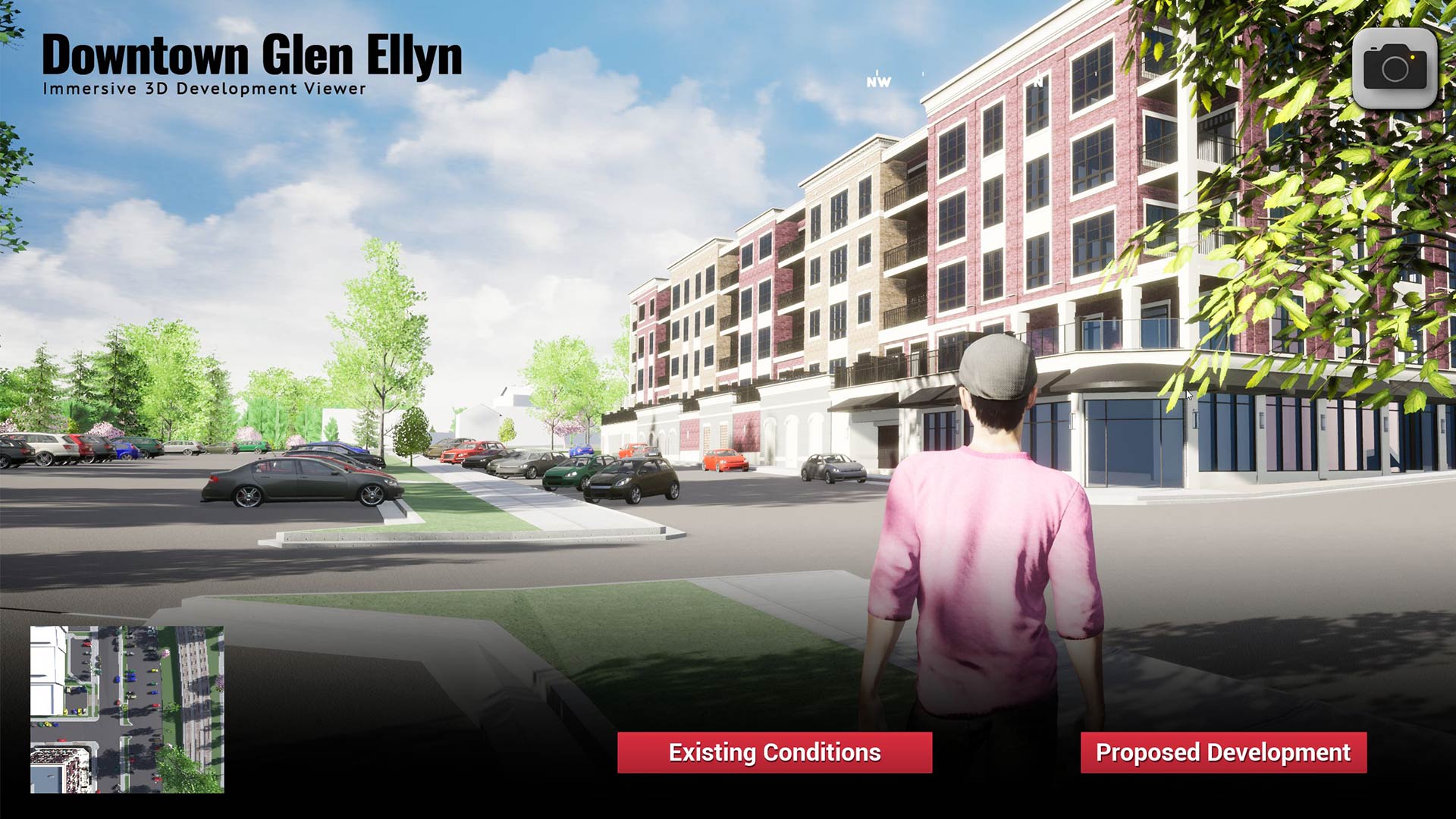
During a presentation at the recent Geodesign Summit hosted by Esri, Devin Lavigne—a principal and cofounder of Houseal Lavigne Associates—showed the audience the Immersive 3D Development Viewer, which the firm created for Glen Ellyn, a Chicago suburb. The Village of Glen Ellyn hired Houseal Lavigne Associates to work on its comprehensive plan and is using the viewer to evaluate development proposals such as Glenwood Station, the five-story mixed-use building that will include apartments, commercial space, and parking spaces.
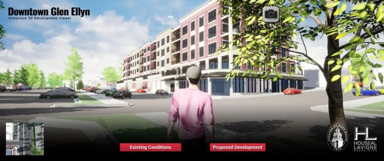
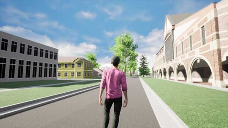
By using GIS software such as ArcGIS CityEngine and ArcGIS Pro along with the game engine software Unreal Engine, the firm was able to turn GIS information into an immersive 3D environment. This allowed users to do things such as study architectural characteristics and building heights and setbacks as well as see what the proposed development would look like from nearby properties.
The avatar in the gaming-type environment was designed to look like one of Houseal Lavigne’s employees, who also lives in Glen Ellyn. The avatar walks through downtown, looking at buildings and infrastructure from different perspectives. “Something that we say [at Houseal Lavigne] is, we love to innovate. We love to have fun. And I am particularly excited about this project,” Lavigne said.
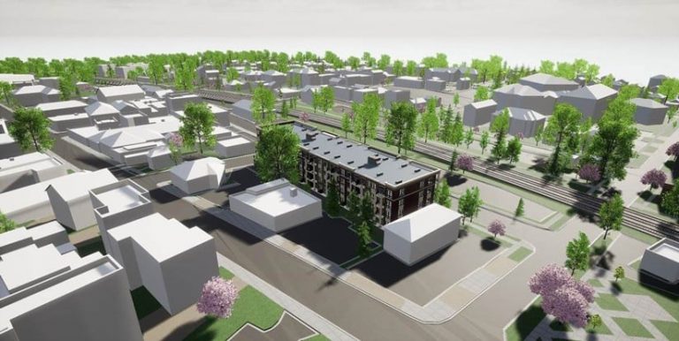
Buildings and trees in Glen Ellyn—with measurements taken using lidar—were modeled in 3D. The firm also was able to take a model of the proposed five-story structure from the developer and drop it into the environment. “We had a live [online] meeting where we streamed the video from our computer, and we showed [village officials] what was being proposed. They were thrilled,” Lavigne said, adding that the project received unanimous approval from the Glen Ellyn Village Board of Trustees.
Lavigne said that preserving the established and desirable character of the village, including the historic downtown, has been of the utmost importance to residents. But it also led to a challenge when new developments and investments were proposed that would make the downtown area financially healthier as well as more vibrant.
“With concerns and opposition to proposed height, architecture, parking location, and building materials, local developers often faced challenging approvals,” said Lavigne. “Village planners believed GIS and a 3D planning tool would allow them to better evaluate proposals, and that an immersive game-like experience could [give] elected officials and decision-makers the ability to better evaluate the appropriateness of a development within this important place in their community.”
The Immersive 3D Development Viewer has also worked well during the COVID-19 pandemic because it is a tool that village officials could use online. According to Lavigne, developers submitting proposals to the village now must send in 3D models with their applications and provide a small fee to allow for Houseal Lavigne Associates to update the model and provide the development viewer to the village.
