As the camera zoomed in from outer space toward one planet, the narrator of the short film said, “From out here, our earth doesn’t seem all that significant. But this pale blue, unique, amazing speck of light hanging in the darkness is our home.”
The narrator of the film, which opened the 2015 Esri User Conference (Esri UC), said that while humans have achieved much, problems persist, such as pollution, social conflict, overpopulation, climate change, drought, and natural disasters.
“But there is hope,” he said. “We can choose to make the right decisions for our future. We must accept responsibility as stewards of the earth. Applying geographic knowledge is key to making smarter decisions.”
Four stories told at the Esri UC Plenary Session underscored the conference theme, Applying Geography Everywhere, demonstrating how GIS technology can make a difference in solving what, at times, seems like insurmountable problems.

Getting ahead of the Fires
More than 170 people died and 2,000 homes were lost after massive fires swept through the state of Victoria, Australia, on February 7, 2009, during what came to be known as the Black Saturday bushfires. The government decided that it needed to get ready for wildfires before they happen.
“Fire is a constant companion in the Australian landscape. And Victoria’s flora, topography, and climate make it one of the most bushfire-prone areas in the world,” said Anthony Griffiths, from Victoria’s Department of Environment, Land, Water, and Planning.
So agencies across the state worked together to create eMap, a collaborative, cross-departmental emergency mapping system for fire-related information. “eMap provides collective awareness with one source and one map,” Griffiths said. “It provides our users with access to information that’s relevant, timely, and tailored.”
Using one map built on a common geodatabase and accessible on any device, the State of Victoria can now proactively respond to and manage wildfires using predictive technology. To demonstrate how the application works, the department’s solution architect, Anthony Burgon, opened up eMap to show where a fire was currently burning in Victoria, as well as where changes in weather were occurring. Using near real-time imagery and a fire modeling and prediction system called Phoenix Rapid Fire, responders and incident commanders from various agencies can predict where a fire might go next.
“In eMap, we also track everything: our people, our trucks, our planes—everything,” Burgon said.
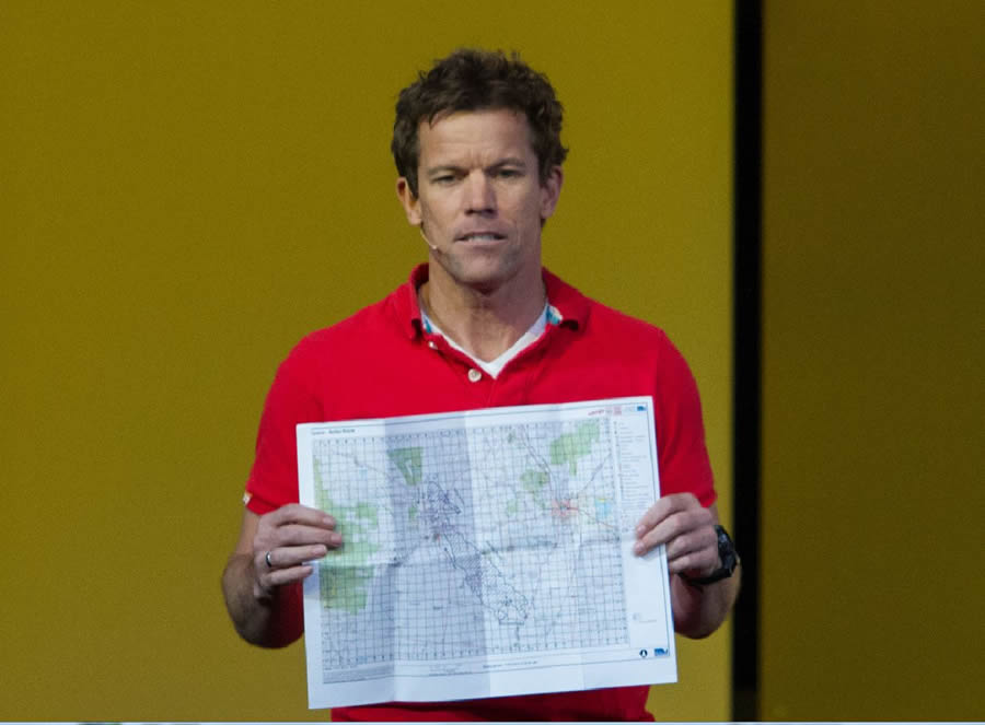
Firefighters also often need paper maps. No problem. Burgon said that anyone with access to eMap can create paper maps, even pocket-sized ones to carry with them “just in case.”
Getting ahead of the game via a GIS-enabled system like eMap improves safety and situational awareness all around. And even though the number of fires in Victoria is up this year, there hasn’t been nearly as much devastation because responders can act more quickly with predictive analysis. “More fire, less impact,” Griffiths said.

Bringing Back Seagrass in Tampa Bay
As Esri’s John Calkins said in introducing a team from Southwest Florida Water Management District, “Simply put, we cannot survive without water. How we protect and manage our most precious resource is about understanding the complex hydrologic systems, the inner connections of our world, and how we can apply GIS to the challenges around us.”
Although the district had been using GIS to balance agriculture, development, and the environment for three decades, the agency saw it needed to do more to support Florida’s water needs. Five years ago, more than 750 wells went dry and 140 sinkholes formed after too much water was pumped for strawberry crops after a big freeze, according to the district’s bureau chief, Steve Dicks.
The agency integrated GIS into all the district’s scientific and business processes and systems. “What the district was able to do was use these [GIS] analyses to develop new water-use and well construction rules that allow the farmers to protect their valuable strawberries and to ensure that homeowners have a dependable water source,” Dicks said.
The district also maps floodplains in southwest Florida and uses GIS to model surface water and subsurface infrastructure such as pipes and storm water drains. These types of analyses help in the planning of where—and where not—to build homes.
“Developers are able to use our models to go ahead and identify where to place homes so they are not in the flood zones,” said Dicks.
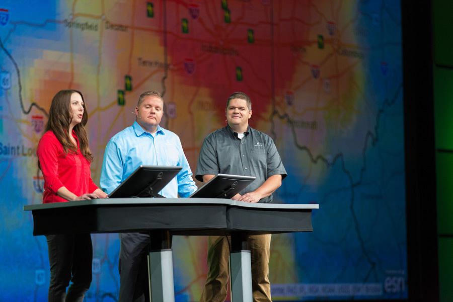
District GIS database and server analyst Leigh Vershowske then showed the audience what he called the agency’s “most important map”: an online form that makes it easy to apply for well, water-use, and construction permits. District environmental scientist Kris Kaufman demonstrated how the district used GIS in its efforts to clean up a very polluted Tampa Bay and bring back ecologically important seagrass.

Increasing Crop Yields and Being a Good Steward of the Land
Brad Fruth grew up on his family’s farm and said that he learned from his grandfather and uncle that farming is based on a simple principle: “Maximize your yield, keep your costs low, and be a good steward of the land.”
Farmers today are looking for ways to do all three, and GIS can help. Seed company Beck’s Hybrids, of Atlanta, Indiana, uses GIS to help farmers succeed by practicing precision agriculture. “At Beck’s, one of our goals is to use GIS to bring value to the farmer with the right hybrids, best practices, and modern-day farming tools,” said Fruth, the company’s information systems manager. “By bringing farming and GIS together, Beck’s provides precision ag simplified to every farm.”
As Fruth’s colleague Craig Rogers made evident, farmers do geodesign every day. He demonstrated FARMserver, a GIS-enabled web application from Beck’s Hybrids that helps farmers keep costs low and boost yields. The FARMserver dashboard includes data about the farmer’s fields, weather, and markets as well as crop health imagery. Using maps, spatial analysis, and big data from live sensors and farm equipment, software users can monitor data such as soil composition and weather information to ensure that corn and soybean seeds thrive.
“FARMserver is a complete farm management solution built on a GIS that brings precision agriculture to every farmer,” Rogers said.

Operating and Maintaining an Airport with GIS
At busy Hartsfield-Jackson Atlanta International Airport in Georgia, staff use GIS in many aspects of operations and maintenance. A robust enterprise GIS solution is in place at the airport, which handles 250,000 passengers per day and manages 200 terminal gates, five runways, 115 taxiways, 60,000 slabs of concrete, and more than 18,000 airfield lights.
The airport’s GIS manager David Wright and GIS analyst Anthony Vazquez led the audience on a tour of how the facility uses ArcGIS Online and mobile ArcGIS apps, such as Collector for ArcGIS, to inspect and maintain runways, taxiways, green space, streetlights, and other assets.
Wright and Vazquez also demonstrated how the 3D capabilities in ArcGIS Pro helped determine which trees were growing tall enough to penetrate airspace near the runways; with that information, the airport ensures that the trees stay trimmed per Federal Aviation Administration (FAA) regulations.
“Web GIS has transformed our team, from mapmakers to solution providers, allowing us to be agile and responsive—meeting the needs of a 24/7 workforce,” said Wright.
To view all the Esri UC Plenary Session presentations, visit video.esri.com.


