By Kimberly Hartley
The states that line the US Gulf Coast dominate the lists of where the deadliest or strongest hurricanes in US history occurred or where they make landfall most often. The first line of defense, though, isn’t boarding up windows or evacuating. Preceding those efforts are the alerts and warnings from the US National Weather Service.
These alerts and warnings are due in large part to the information gathered by a small nonprofit known as GCOOS, or the Gulf of America Coastal Ocean Observing System. For 20 years, GCOOS has collected on-demand, accurate, and reliable data about what’s happening in the gulf waters. Without it, according to GCOOS executive director Jorge Brenner, “You don’t have an accurate forecast and, therefore, lives will be lost.”
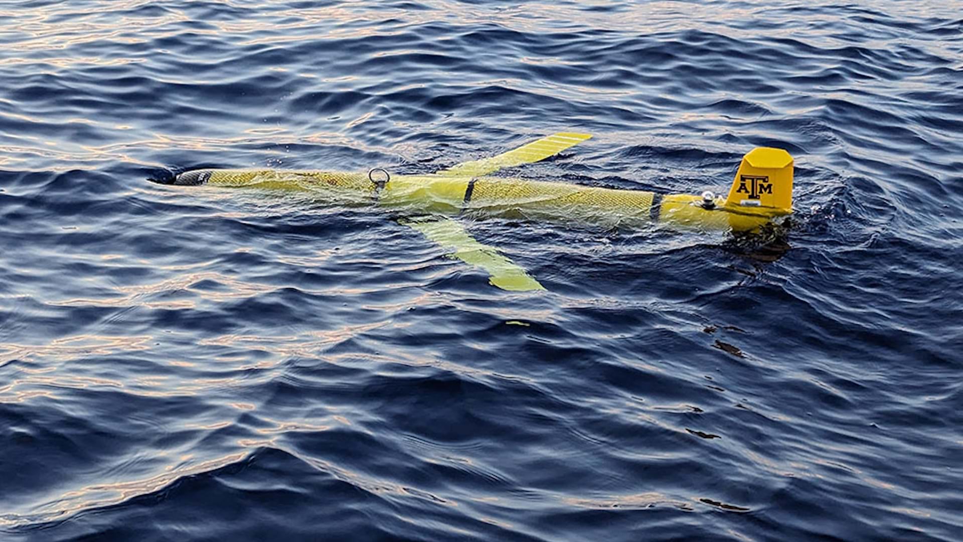
Hosted at Texas A&M University’s Department of Oceanography, GCOOS partners with universities, governments, and private industries by collecting, managing, and analyzing data. Together, they deploy innovative technology such as high-frequency radar systems, more than 1,700 ocean sensors, and a fleet of autonomous underwater gliders. The gliders collect data about water temperature and salinity that helps in determining storm intensity and where a hurricane may land on the coast.
GCOOS has long used GIS technology to manage and collect that data as well as to visualize and analyze it. Now, in a project that took less than a year, the nonprofit has also made the data it collects and manages significantly more accessible with ArcGIS Enterprise and ArcGIS Online.

Keeping a Watchful Eye
GCOOS is one of 11 regional associations that make up the Integrated Ocean Observing System, a partnership that monitors the United States’ coastal waters as well as the Great Lakes. It is funded primarily by the National Oceanic and Atmospheric Administration (NOAA), which oversees the National Weather Service.
The nonprofit’s mission expanded after the Deepwater Horizon explosion in 2010, when GCOOS helped map the resultant oil spill’s spread. Its role has grown from collecting physical oceanography data to also managing biogeochemical data about underwater species and environmental conditions.
For example, analysts observing plankton imagery can detect a red tide (caused by a harmful algal bloom) by using artificial intelligence and can send alerts to state public health officials to close beaches and warn beachgoers. GCOOS also regularly assists agencies such as the US Coast Guard with search-and-rescue efforts by providing data to help locate people who have fallen overboard. Knowing wind and water current patterns enables GCOOS to help rescue agencies pinpoint where to look for a person who may have drifted far in a short period of time.
In 2024, the US Department of Commerce and NOAA announced $101.5 million in funding to expand Integrated Ocean Observing System associations’ ability to collect wave data using buoys to identify dangerous rip currents. With that data, authorities can issue swimming advisories. GCOOS is also installing web cameras to live stream ocean activity that can be viewed in real time by the nonprofit and its partners.
“It’s very simple, but it’s very powerful,” said Brenner of the video feed.
GCOOS is also tracking dolphin and whale locations and threats to help restore populations that were reduced by the Deepwater Horizon spill. In addition, GCOOS maps the nesting and mating habitats—as well as the movements—of sea turtles as part of the Sea Turtle Atlas, which provides comprehensive sea turtle data and maps.

Taking GIS to the Next Level
Brenner joined GCOOS in 2021 after working with The Nature Conservancy, a global environmental nonprofit organization. It was there that he discovered the power of GIS technology to help make informed decisions. Once at GCOOS, Brenner realized that the association could do a better job of reaching the people and agencies that would benefit from the data. Brenner knew that GIS, with its ability to display data in an accessible way, could help GCOOS reach a wider audience.
GCOOS GIS manager Jerad King helped prove him right. King, who joined GCOOS in 2024, spun off a new ArcGIS Online organization from the larger Texas A&M account and then set GCOOS up with an ArcGIS Enterprise account, turning the nonprofit into an enterprise GIS operation in less than a year. After this, he adapted standardized, high-quality datasets compiled by NOAA so that the data could be easily accessed via ArcGIS Online.
Freeing up this data didn’t help just his organization and its partners. Now, the data is easily available online. Other Integrated Ocean Observing System associations have used the data, including one that leveraged the data to build a real-time water quality dashboard, demonstrating what could be possible.
“One of the core tenets of what we do is sharing everything,” King said.

Alongside the data, GCOOS publishes data services in dashboards and apps that take the data and make it into something more interactive for users.
“Most of the time, folks don’t know that they’re interacting with a modern cyber GIS infrastructure,” King said.
Brenner hopes that, because of the work done at GCOOS, more people will be able to better understand the ocean. Even among oceanographers, he noted, GIS hasn’t necessarily been the first choice of technology. However, his group is helping prove it can support the meaningful analysis and computational power needed.