displaying 193 results
FEMA Coordinators Cory MacVie and Josh Keller Go Above and Beyond
Though Nadika Senadheera sometimes ventures to dangerous places, her passion for GIS and feeding the hungry keeps her on the front lines...
This summit will focus on how geodesign can play a pivotal role in making European communities smarter, safer, and more resilient.
The theme of this year's Esri User Conference was GIS—Enabling a Smarter World. From Lilian P. Coral with the City of Los Angeles...
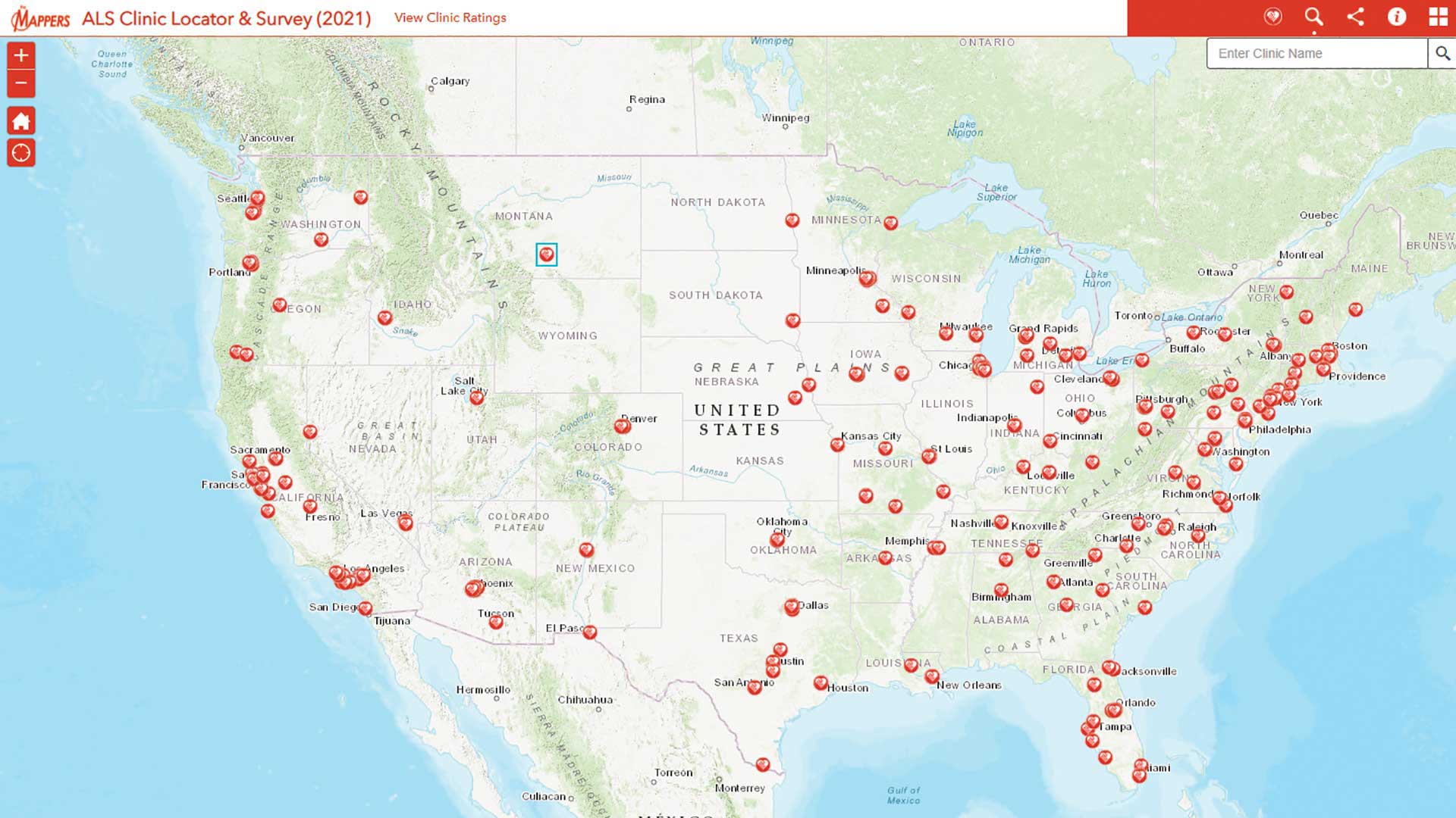
Pat Dolan used his GIS expertise to build tools to help the amyotrophic lateral sclerosis (ALS) community.

These six keys help a company build and sustain a geospatial culture:
Five years ago, the National Audubon Society, the century-old conservation group devoted to protecting bird populations and habitats, embarked on

South Carolina has gained greater awareness of COVID-19 from spatial analysts at its National Guard who have created maps, apps, and dashboards.
With GIS, Tim Prather found a powerful tool for making agriculture more sustainable, both environmentally and economically.

The Maryland Department of Information Technology Geographic Information Office deployed a COVID-19 information dashboard.
"Immersed in GIS all day, every day." That is how Jeffery S. Nighbert, senior technical specialist for GIS at BLM describes his job.