displaying 998 results

New books from Esri Press cover geospatial technology in the field, GIS and wildland fire, and GIS for geospatial collaboration.

ArcGIS products such as ArcGIS Online and ArcGIS Enterprise provide a way to comply with the European Union’s Open Data Directive.
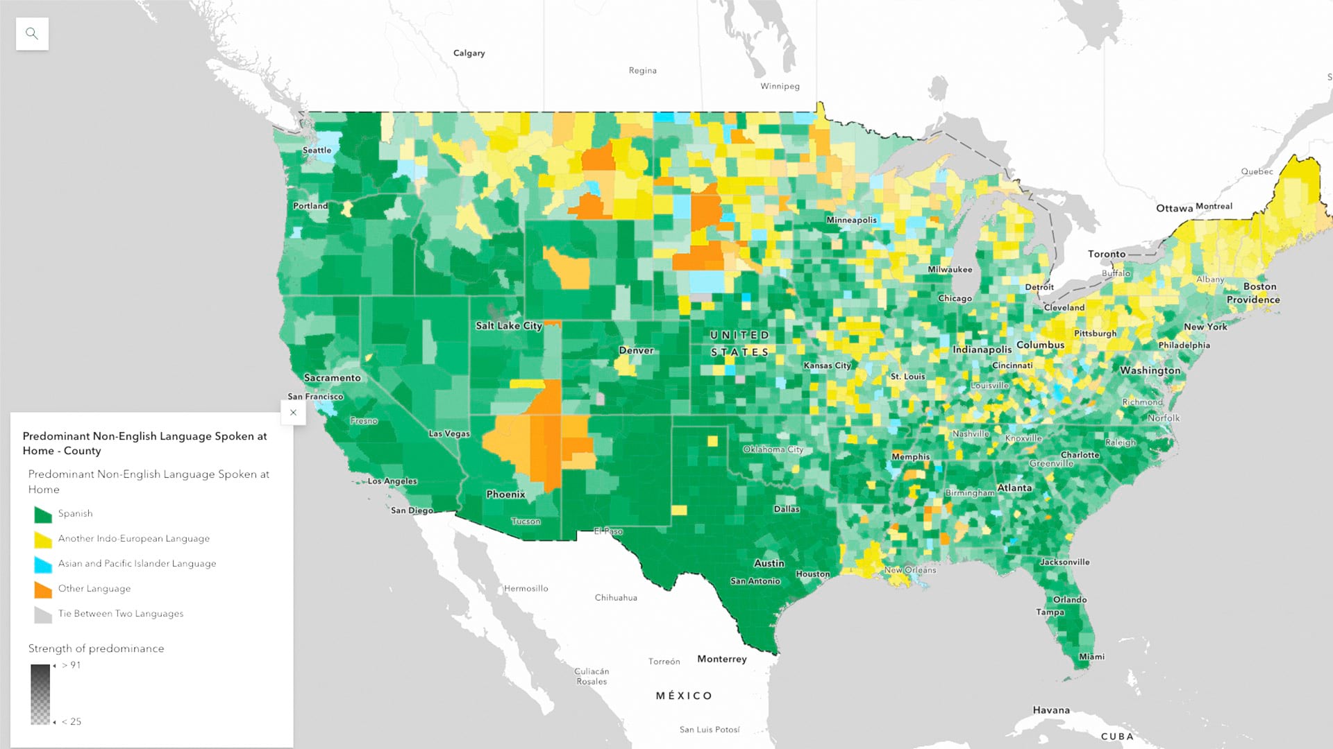
ArcGIS Living Atlas of the World now has the latest five-year estimates from the US Census Bureau’s American Community Survey

Geographers and GIS scientists can improve their research by improving their engagement with the communities they study.

In Tacoma, Washington, the city’s chief technology officer led her team to create a GIS-powered equity map that helps guide city decisions.

Esri partners facilitate and streamline workflows and management of a variety of community management projects.

Williams began using ArcGIS Monitor in 2018. But after recent updates to the software, Williams is now taking advantage of its new capabilities.
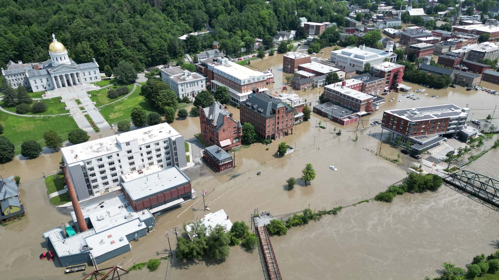
After flooding in Vermont, residents were able to get rapid relief thanks to GIS-based disaster response.

A team at the University of Vermont’s Spatial Analysis Laboratory employed GIS tools and drones for flooding disaster response in July 2023.

The Alabama Forestry Commission leverages ArcGIS StoryMaps to showcase the state’s work to protect and manage forest resources.
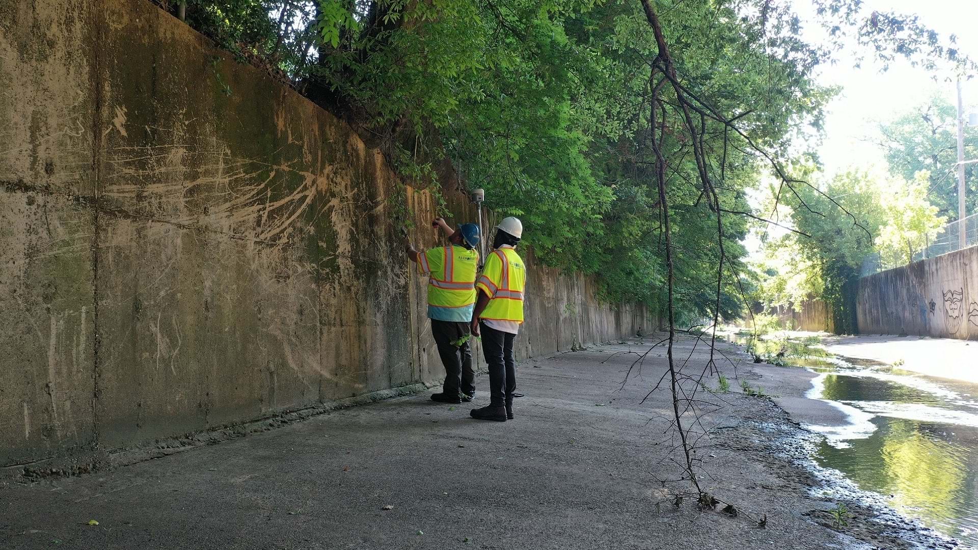
In the City of Memphis, GIS data is critical to the maintenance of vital infrastructure that prevents flooding and keeps the city flowing.