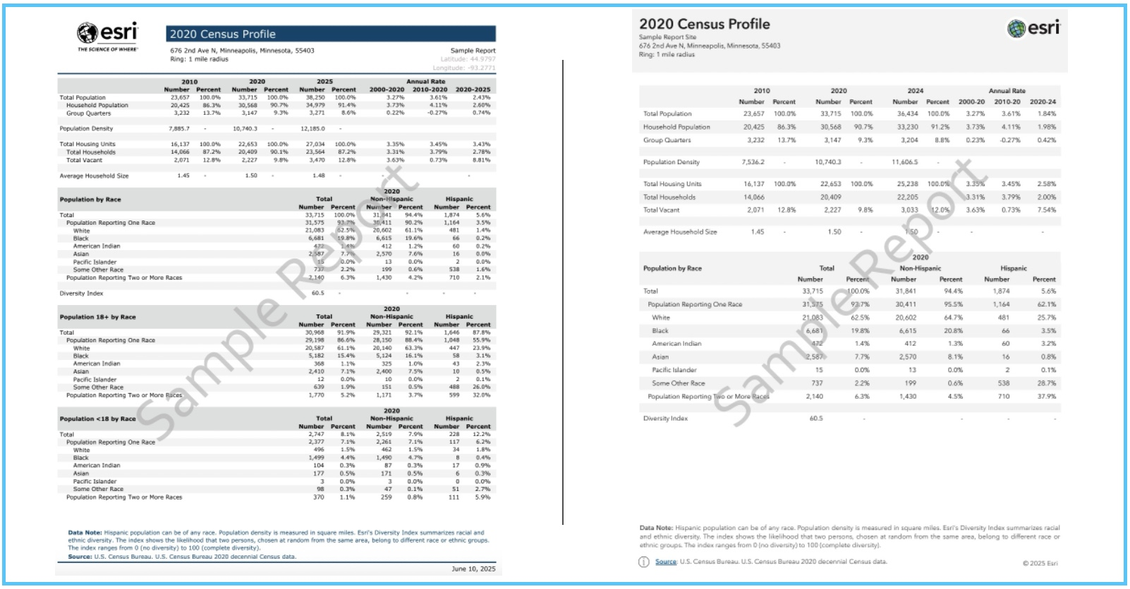
The Esri Demographics June 2025 release delivers advancements to help you analyze demographic data with greater precision. With the introduction of a segmentation system rebuild using 2020 Census data (ArcGIS Tapestry), new geographic boundaries, hundreds of new variables, and modernized demographic report templates, this update helps you make smarter decisions.
For detailed information about this release, view the June 2025 release notes.
Introduction to ArcGIS Tapestry
Esri launched an updated version of its geodemographic segmentation system, now called ArcGIS Tapestry. While block group assignments are updated annually, this refresh represents the first system rebuild in 10 years using 2020 data (system refreshes occur with each decennial census.) ArcGIS Tapestry is sourced with data from Esri Updated Demographics, the U.S. Census, Census/ACS, and the MRI-Simmons survey.
ArcGIS Tapestry users are encouraged to visit the Esri demographic documentation pages to read about ArcGIS Tapestry LifeMode groups and segment names (with detailed descriptions.) To learn more about the impact of ArcGIS Tapestry for demographic data users, read the Introducing ArcGIS Tapestry blog article.

U.S. boundary layer enhancements
The June release features updated geographic boundaries. These boundaries offer a standardized framework for analyzing, comparing, and visualizing data across consistent geographic units. The updates are currently available in ArcGIS Business Analyst, with support for other formats expected in the future.
State Legislative Boundaries (U.S. and Puerto Rico)–Districts that cover upper and lower state chamber boundaries.
- Source: U.S. Census/TIGER
Tribal Boundaries (four new layers)–Geographic delineations of land associated with a federally recognized American Indian or Alaska Native tribe.
- The boundaries included are American Indian Alaska Native Hawaiian Areas, American Indian Tribal Subdivisions, Tribal Block Groups and Tribal Census Tracts.
- Source: U.S. Census/TIGER, U.S. Bureau of Indian Affairs
Public Use Microdata Areas (PUMA) (U.S. and Puerto Rico)–A geographic unit that exists within a single state and typically contains at least 100,000 residents.
- Source: U.S. Census, Census/ACS
Updated variables for deeper analysis
The June release features hundreds of demographic and behavioral variables that have been updated to 2025 vintage.
Esri Updated Demographics (2025/2030)
- 145 new variables
- Expanded intervals in Household Income (9 to 20 intervals including a new top level for households earning $500k+), Contract Rent (12 to 24 intervals), and Home Value (13 to 26 intervals.)
U.S. Census
- 2020, 2010, and select 2000 Census variables available in updated geographies
- 71 new variables for the U.S.
- 72 new variables for Puerto Rico
- 39 variables moved from the Block Group to the Census Tract level for the U.S. and Puerto Rico (available only for mapping)
Esri Urbanicity
- This release includes two new Dominant Urbanicity (2025) attributes and 10 Urbanicity Landarea (2025) attributes
ArcGIS Tapestry
- System rebuild using 2020 Census data
- Segments updated annually in select areas
Esri Market Potential
- Changes to underlying data that has resulted in removal of select variables in Leisure & Activity, Media, Finance
Esri Consumer Spending
- Changes to underlying data that has resulted in removal of select variables that include Apparel, Personal Care, Transportation
Esri Retail Demand by Industry
- Updated to the 2025 vintage
Esri Business Summary
- Updated to the 2025 vintage
Updated data and new look for Esri Reports
Esri Reports has new 2025 data and a refreshed look and feel. The reports have been updated with the latest data across demographics, consumer spending, business, and market potential. Both classic and new demographic reports will be available for purchase in the Esri Store until June 2026. After this date, classic reports will no longer be available.
Additionally, new report templates have been introduced, featuring a cleaner and modern design, improved accessibility, and user-friendly layouts.

Where to learn more
Get started with ArcGIS Tapestry and Esri Demographics in the following places:
Esri User Conference 2025
- Visit the ArcGIS Data booth at the Expo–See the conference FAQ page for information and attendance details about this year’s conference.
- Attend our demo session. Learn more about our session on Thursday, July 17.
ArcGIS Online and ArcGIS Pro
- Use Enrich Layer to append location-based data to points, lines, or areas.
ArcGIS Business Analyst
- Identify sites and evaluate markets with ArcGIS Business Analyst demographic mapping software.
ArcGIS Location Platform
- Enhance workflows and apps with the ArcGIS GeoEnrichment Service–Enrich data with additional location-based information about people and places in a specific area.
ArcGIS Living Atlas
- Understand your community using maps and spatial analysis of Esri Demographics.
Reports and data
- If you need a demographic report or a data file, visit the Data section of the Esri Store or contact datasales@esri.com.

Hello Richard, I am working with bringing in Civil 3D data (.DWFG file format) into ArcGIS Pro but the aec_Name, aec_Description, and aec_Site fields are blank when viewing the data in ArcGIS Pro (used the CAD to Geodatabase geoprocessing tool). There is information for these fields in Civil 3D. Is there a reason this may be happening? Thank you in advance.