Sean William Morrish
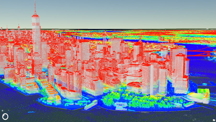
With over 15 years of experience in the AEC/GIS field Seán William a 3D Product Engineer with the 3D Analyst Group at ESRI, has been working on the next generation of 3D solutions for GIS on the desktop, mobile and on the web. He is part of the team architecting and implementing LiDAR data extraction and other 3D solutions which will form an integral part of the integration of LiDAR, BIM and GIS in city scale environments. Seán William’s recent work has focused on coordinating the use of GIS/BIM for city scale planning design and master planning.