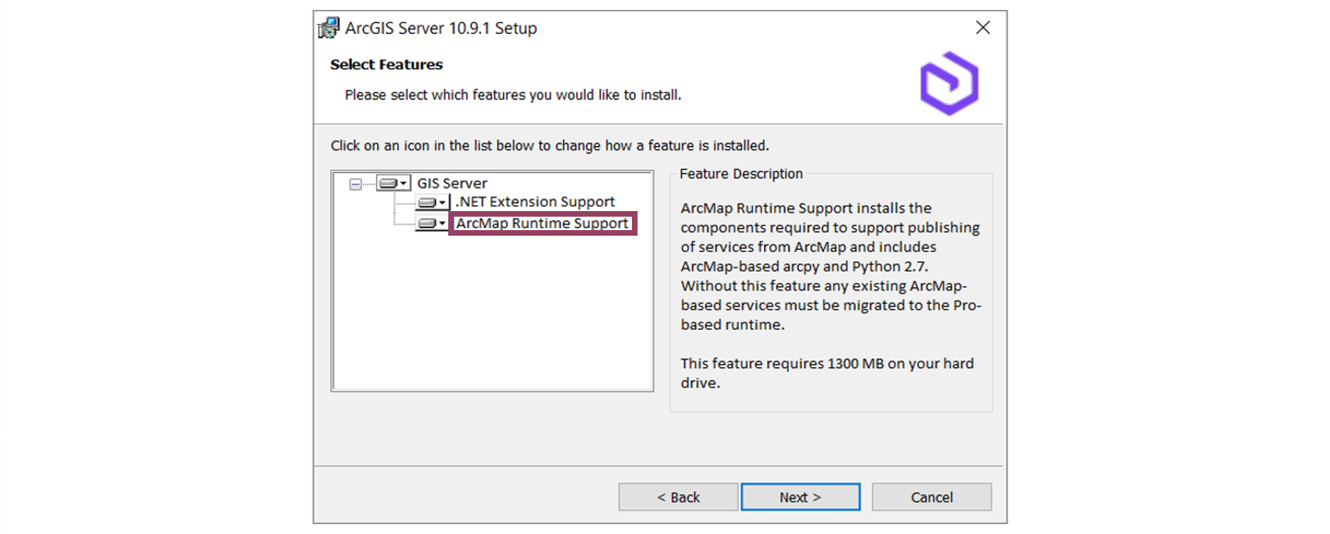
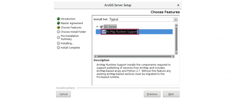
In ArcGIS Enterprise 10.9.1 the ArcMap Runtime Support feature is now optional in Windows and Linux environments. This means ArcMap Runtime Support can be enabled or disabled, depending on your organization’s needs. This blog will cover what this means exactly, why you might want to disable ArcMap Runtime Support in ArcGIS Enterprise, and how to disable this feature.
Remind me – what is a service runtime?
ArcGIS Enterprise’s ArcGIS Server component currently includes two internal runtimes: an ArcMap-based runtime for services published from ArcMap and an ArcGIS Pro-based runtime for services published from ArcGIS Pro. There are many differences between the two runtimes, including the version of Python that is installed. The ArcMap-based runtime includes an installation of Python 2.x and the ArcGIS Pro-based runtime includes an installation of Python 3.x.
These two runtimes have been present since ArcGIS Server 10.4, when the ability to publish from ArcGIS Pro was introduced. These two runtimes have been running “under the hood” and you may not have even known they were both there. And that’s okay! That’s why we’re explaining what they are now.
Disabling the ArcMap Runtime Support feature means that the ArcMap-based service will be removed from the ArcGIS Server component ArcGIS Enterprise.
Why should I disable ArcMap Runtime Support?
Now that we’re all on the same page on what the ArcMap Runtime Support feature is, let’s get into why – or why not – this runtime should be disabled. There are two main scenarios in which you might want to disable ArcMap Runtime Support.
Scenario one: need to remove Python 2.x from your system
The Python Software Foundation ended support for the Python 2.x programming language in January 2020 in order to focus their efforts on Python 3.x. Because Python 2.x is a major part of the ArcMap-based runtime, disabling this feature will ensure that Python 2.x is not installed with ArcGIS Server. If your organization has concerns about having Python 2.x on your system, consider this option.
Scenario two: you are ready to migrate fully to the ArcGIS Pro-based runtime
As mentioned earlier, ArcGIS Enterprise 10.9.1 will be the last release to contain the ArcMap-based runtime. You can take advantage of this by migrating your ArcMap-based services to use ArcGIS Pro-based runtime. Once your services are all migrated to the ArcGIS Pro-based runtime, consider disabling ArcMap Runtime Support on ArcGIS Server to ensure the runtime migration was successful. Remember, the next release of ArcGIS Enterprise will only contain the ArcGIS Pro-based runtime. Use this as an opportunity to migrate and test your services, Python scripts, geoprocessing tools, and any ArcObjects SOEs and SOIs.
Considerations before disabling
Regardless of why you decide to disable ArcMap Runtime Support, be sure to migrate all of your services to the ArcGIS Pro-based runtime. ArcMap-based services will no longer be able to run if present during after disabling ArcMap Runtime Support.
How to disable the ArcMap Runtime Support feature
When installing or upgrading ArcGIS Server, you’ll be presented an option to disable the ArcMap Runtime Support feature. It will be enabled by default. After ArcGIS Server 10.9.1 is up and running, you can disable or re-enable ArcMap Runtime Support to fully support testing in your environment.
In Windows
In Windows, you can disable or enable ArcMap Runtime Support and remove Python 2.x using the Program Maintenance dialog box or through command line.

More on this can be found in the Disable or enable ArcMap Runtime Support section of the product documentation.
In Linux
In Linux, you can disable or enable ArcMap Runtime Support and remove Python 2.x after installation using the modify_AMRS.sh script located in the ./Support folder of your ArcGIS Server 10.9.1 installation.

More on this can be found in the Disable or enable ArcMap Runtime Support section of the product documentation.
Because ArcGIS Enterprise 10.9.1 is the last release to contain both the ArcMap-based runtime and ArcGIS Pro-based runtime, the ability to disable the ArcMap Runtime Support is a feature found only in ArcGIS Enterprise 10.9.1. You won’t find this feature in previous or future releases of ArcGIS Enterprise. So, start planning for an upgrade today!
We hope to make the transition from the ArcMap-based runtime to the ArcGIS Pro-based runtime as smooth as possible for you. Let us know if you have any questions below and we hope this helps with your ArcGIS Enterprise and ArcGIS Server workflows!

Hello Jill,
We started migrating our map services to Pro, but ran into issues with two bugs and so we have had to stop. They are BUG-000144311 & BUG-000129415. Can you confirm whether these have been fixed yet or if they are planned to be fixed for the next release?
Hi Sarah – thank you for the feedback! Neither of these bugs have been fixed were fixed in our latest releases. I’ve brought them to our development team’s attention to look into further from our side.