
Finding the right data is only half the challenge. Analysts, planners, researchers, and GIS professionals often discover useful datasets in open data portals and catalogs, but then face extra steps to locate, download, connect, and add those datasets to their maps.
ArcGIS Hub helps organizations publish trusted, curated collections of content. Now ArcGIS Online makes those collections immediately actionable. Users can move directly from discovering data in a Hub catalog to using it in Map Viewer and Scene Viewer, reducing friction between data discovery and analysis.
The result is faster access to trusted information, less time spent searching and managing data, and more time spent creating maps, applications, and insights.
The challenge: finding and reusing trusted data
Organizations publish data to create value, but users often face unnecessary friction between finding data and putting it to work. The challenge becomes even greater when users encounter multiple versions, copies, or sources for similar information. Knowing which datasets are trusted can be difficult, especially when working across agencies, departments, or organizations.
Even when a catalog contains exactly the information needed, users often have to navigate between multiple systems, repeat searches, or manually locate layers before they can begin analysis. This context switching slows productivity and makes it harder for organizations to realize the full value of the data they publish.
ArcGIS Hub catalogs: connecting trusted data with the people who need it
ArcGIS Hub addresses these challenges by enabling organizations to curate trusted collections of content and make them easier to discover and use. Site managers configure catalogs using groups and can include content from their organization, partners, and other trusted sources.
These catalogs do more than make data discoverable. They help guide users toward datasets that have been intentionally curated by subject matter experts and data stewards.

Whether supporting open data initiatives, cross-agency collaboration, research, planning, or public engagement, Hub catalogs provide a trusted starting point for exploration and analysis.
What’s new: bringing curated catalogs directly into the mapping experience
Previously, users often moved between Hub catalogs and map authoring tools when assembling the datasets needed for their work.
ArcGIS Online now enables users to browse and add layers directly from ArcGIS Hub catalogs within Map Viewer and Scene Viewer. By integrating catalog access into the mapping experience, ArcGIS Online reduces the number of steps required to discover, evaluate, and use trusted content.
This creates a more seamless workflow:
- Discover trusted content in a Hub catalog
- Open the data directly in Map Viewer or Scene Viewer
- Continue browsing additional catalog content without leaving your map
- Build maps and analyses using curated community data
Instead of repeatedly searching for layers, users can stay focused on their work.
Why this matters for organizations sharing data
Organizations do not publish data simply so it can be found. They publish data so it can be used.
By making Hub catalogs accessible directly within ArcGIS Online, organizations can:
- Increase adoption of curated datasets
- Extend the reach of trusted information
- Reduce barriers to data use
- Encourage the reuse of authoritative content
- Improve return on investment in data management and sharing initiatives
When users can move seamlessly from discovery to analysis, organizations gain more value from the content they publish and maintain.
Example workflow: from discovering data to creating a map
The true value of a catalog is realized when users can quickly move from exploration to action.
Consider a researcher investigating beach access in the Pacific Northwest. After discovering relevant datasets in the Washington Geospatial Open Data Portal, they can immediately create a map and continue adding curated layers from the same catalog without interrupting their workflow. This eliminates the need to repeatedly search for content across multiple applications and helps users stay focused on analysis.
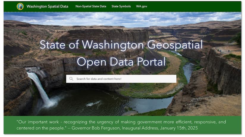
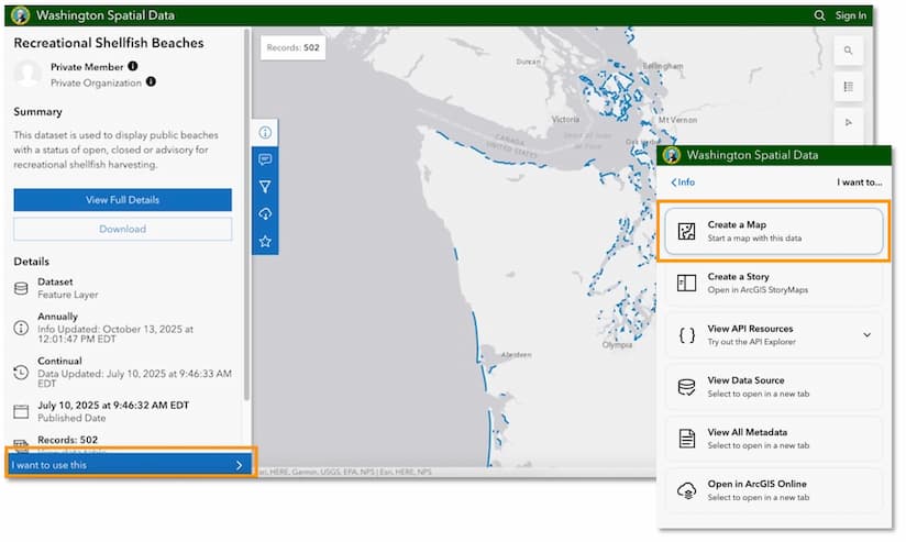
By searching for keywords like “beach,” they quickly find relevant datasets, such as Recreational Shellfish Beaches. After previewing the data, simply select I want to use this and then Create a map to open the data in Map Viewer.
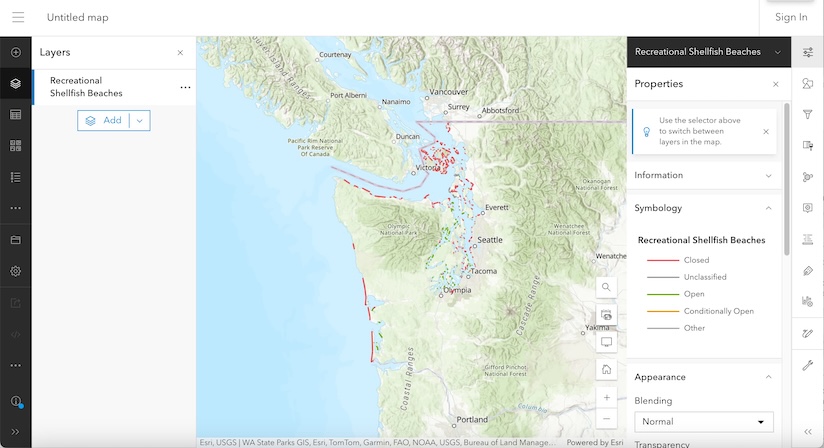
Previously, adding additional curated layers from a hub site required returning to the catalog and manually searching for each item. Now, Map Viewer and Scene Viewer integrate Hub catalogs, allowing users to browse and add layers from recently visited sites directly within the map-making environment. The browser cache keeps track of recently visited sites, and can be cleared if needed.
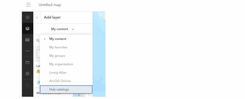

Keep trusted data within easy reach
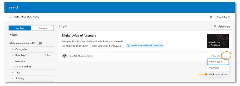
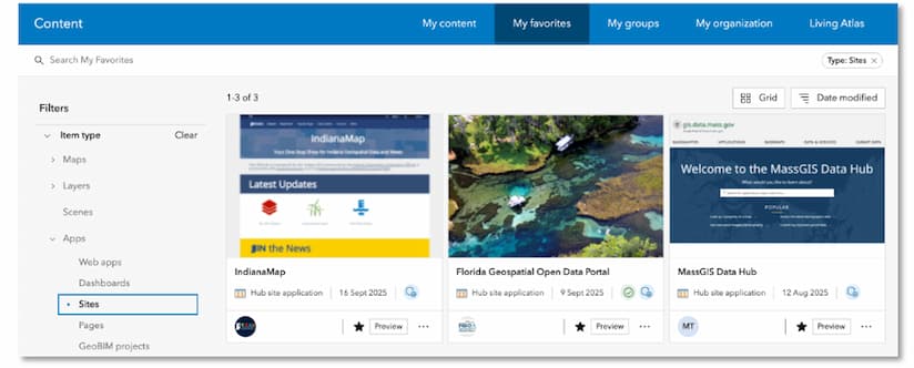
Users who frequently return to the same Hub sites can mark them as favorites, making their catalogs readily available whenever they create maps or scenes. Instead of searching for the same trusted sources repeatedly, users can quickly access curated content and continue their work without interruption.
Turning discovery into action
ArcGIS Hub has long helped users organize and share trusted collections of content. With catalog integration in ArcGIS Online, those collections become easier to access where GIS work actually happens.
By reducing the friction between discovering data and using data, organizations can increase the impact of their information while helping analysts, planners, researchers, and the public spend less time searching and more time creating insights.
Whether you’re publishing community data, supporting organizational collaboration, or building maps from trusted sources, ArcGIS Hub catalogs help bridge the gap between data discovery and data use.
Additional resources
- Get Started Building an ArcGIS Hub Site
- Find out what’s new and learn best practices on the ArcGIS Blog
- Visit the ArcGIS Hub Esri Community
- View presentations, demos, and how-to videos on our ArcGIS Hub playlists
- Sign up for the ArcGIS Hub e-newsletter
Sites featured in this story were submitted to the ArcGIS Hub gallery. Visit the gallery to explore more examples from the community.
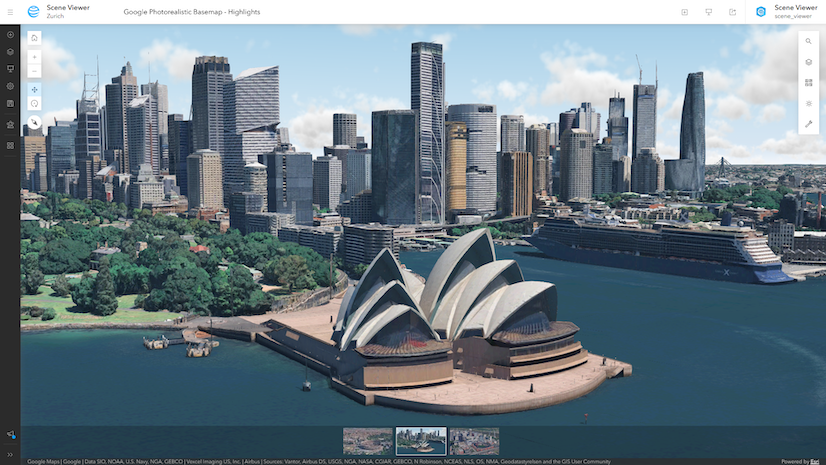
This article was originally published on October 22, 2025. It is updated to reflect that you can now access Hub Catalogs when adding layers in Scene Viewer, making it faster to find, add, and visualize the right data for your 3D workflows.




Commenting is not enabled for this article.