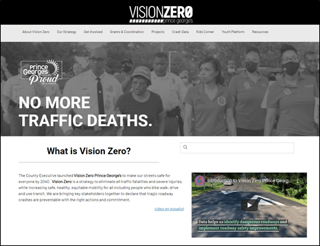
Vision Zero Prince George’s is a countywide strategy to eliminate traffic-related serious injuries and fatalities by 2040. Built on Esri’s ArcGIS Hub in late 2021, the aim of the public site is to create simpler and more transparent maps and resources to benefit and enhance partners’ and residents’ engagement with the Vision Zero Prince George’s strategy.
“The central premise of Vision Zero Prince George’s is the loss of even one life on our roadways is unacceptable and preventable. Providing publicly accessible information and progress illustrates our continued, interagency commitment to make our roads safe for everyone.
Prince George’s County launched the Vision Zero Prince George’s site based on Esri’s ArcGIS Hub; it is an easy-to-configure community engagement platform that maximizes engagement, communication, collaboration, and data sharing as part of ArcGIS Online, Esri’s web-based mapping software. The aim is to modernize and build open, responsive, and collaborative digital tools that support decisions and policy.
Vision Zero Prince George’s offers transparency to public and partner agencies to track and contribute to the progress of Vision Zero actions, including road safety improvement projects. The Vision Zero Prince George’s Project Map, a powerful GIS app built leveraging ArcGIS Web AppBuilder, shows how localized and corridor improvement projects intersect with the High Injury Network, which represent one-mile roadway segments with a high severity of crashes involving pedestrians and cyclists. The County’s continuous evaluation of investments and information-driven initiatives are only possible with Esri’s robust data platform. The Vision Zero Action Plan serves as a roadmap to achieve zero fatalities and serious injuries using the Safe System approach to improve roadway networks and to increase safe, healthy, equitable mobility for bikers, walkers, drivers, and transit users.
“Participation in Vision Zero means everyone in the community shares responsibility for the safety of people on our roads. We are able to provide resources and collaborate with the public and our partners better than ever before by having engaging resources and information on the Vision Zero Prince George’s website.”

Learn more about the Maryland Department of Transportation State Highway Administration (MDOT SHA) Context Driven efforts, built on Esri’s compelling, content-focused web experience technology ArcGIS Experience Builder. Context Driven showcases proactive and creative safety improvements and safety countermeasures.

Additionally, the Vision Zero Prince George’s site contains a library of resources that can be used by communities and Vision Zero partners, including Vision Zero Crash Data, built on ArcGIS StoryMaps, to show where crashes, serious injuries, and fatalities have occurred in Prince George’s County between 2015-2020. The story uses ArcGIS Dashboards to convey traffic occurrences using location-based analytics and data visualization to assist the County in traffic safety planning efforts. Also available are outreach opportunities from community organizations, schools, and neighborhoods to educate others on how to travel safely and respectfully. Age-specific resources and initiatives are on the site as well to help children and teens become advocates for traffic safety in their communities.
“The County’s Office of Information Technology’s technical expertise allowed us to explore the new Esri ArcGIS Hub, which we found a constructive platform for organizing data and tools to accomplish the Vision Zero actions and provide progress for the overall goals.”
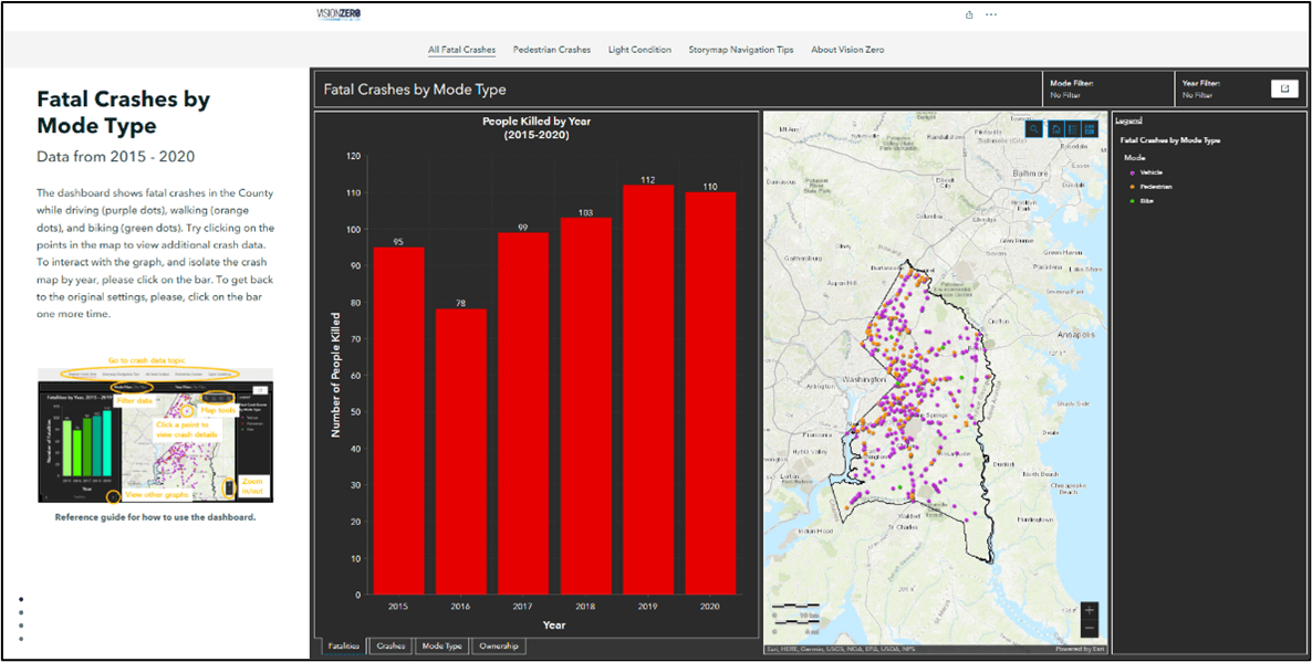
Vision Zero is a data-driven effort. Crash data and dangerous roadway analysis are put at the forefront to demonstrate how investments and resources are dedicated to engineering countermeasures and enforcement.
Acknowledgements
The Department of Public Works and Transportation collaborated with the County’s GIS manager’s team, Web support, the Vision Zero crash data task force, and the Vision Zero communications workgroup during the development process.
Contacts
Andrea Lasker, Vision Zero Coordinator 240-676-5640 alasker@co.pg.md.us
Patrick Callahan, GIS Manager, Office of Information Technology 301-883-5343 PTCallahan@co.pg.md.us


Article Discussion: