ETH Zurich, one of the top universities worldwide, is turning their university premises into a smart campus. Their goal is to implement an indoor geographic information system (Indoor GIS) that allows them to visualize, analyze, and manage all data related to their campus and facilities in one place, also known as an operational digital twin. A major driving force behind the project, which was initiated in 2021, was the need to make campus life more inclusive and barrier-free.
Challenge
ETH Zurich is looking for a holistic system to analyze and manage their university campus inside and out – literally.
While their current facilities management system supports campus data management and services delivery, it doesn’t allow for spatial data analysis to learn and optimize processes. Furthermore, it does not provide a visual representation of the interior spaces to enhance location awareness and support an effective wayfinding system across the campus. As a result, ETH Zurich often had to resort to outdated and inefficient methods, for instance to support navigation.
Indoor Navigation
One of the challenges people on campus face is finding their way around the campus spanning 58 buildings with 412 floors and a total of 400.000 square meters across two sites in the city of Zurich and external sites. Finding the correct room in the right building can turn into a Herculean task, not just for the university’s 25,000 students, but also staff and contractors moving around the campus every day.
What adds to the difficulty is that many of the historical campus buildings are under preservation order and as such cannot be architecturally changed. Therefore, these buildings are often the cause of long-winded routes one must take across the campus.
So far, the university’s wayfinding solution relied mostly on signage that could be found in entrance areas and additional signs posted during events to help visitors find the right location. The complexity of the campus in addition to old and nested buildings, however, has clearly demonstrated the limits of physical signage and static maps in the past, as they neither allow for easy updates, nor do they support barrier-free navigation.
Besides people with physical impairments, a “barrier-free” wayfinding solution must also take other impairments into account for example neurodevelopmental disorders such as ADHD (attention deficit/hyperactivity disorder) syndrome. Students or staff with such disorders may feel overwhelmed by complex static maps or the presence of too many signs. Digital solutions make it easier to cater to the specific needs of all campus visitors.

We wanted to embrace digitalization, including incorporating a state-of-the-art indoor positioning system to stay at the forefront of technological advancements.
Solution
With the goal in mind to make the ETH Zurich campus barrier-free for students, staff, and visitors, the project for a smart campus including a digital wayfinding solution was born.
A digital twin is a virtual representation of a reality, including physical objects, processes, and relationships, that allows users to better understand the facilities and optimize operations. The creation of a digital operational twin that visualizes not just the outdoor but also the indoor built environment enables ETH Zurich to better understand their indoor spaces and improve the occupant experience.

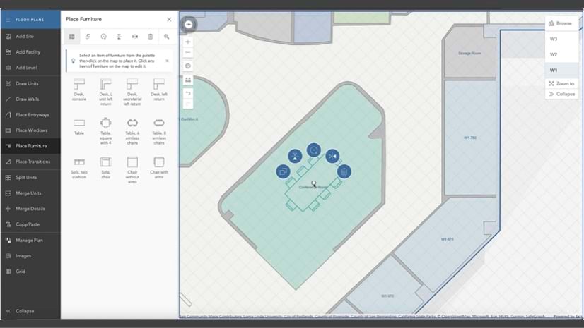
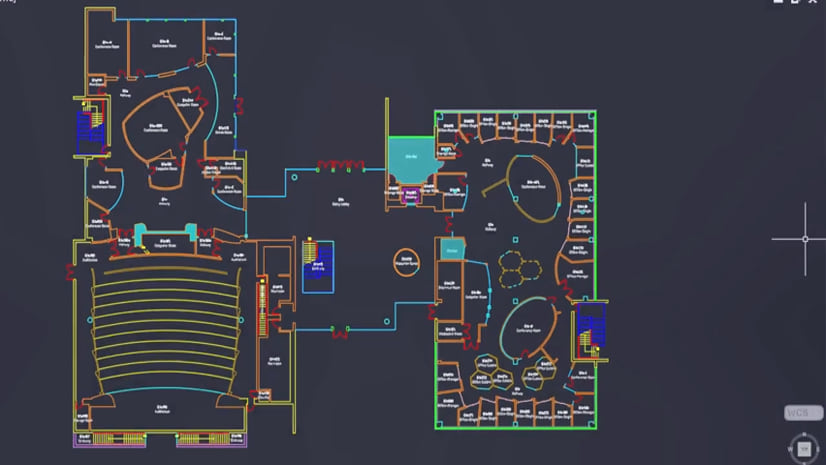
Using ArcGIS Indoors, ETH Zurich was able to accurately visualize their facilities’ interior spaces in an interactive digital format that can be easily managed and shared. Converting their CAD and BIM data into floor-aware indoor maps laid the foundation for their indoor GIS.
Combined with ArcGIS IPS, ETH Zurich enriched their indoor maps with an indoor positioning system that visualizes the user’s live position inside the facility as a blue dot on the map in the mobile app. Knowing an exact location helps users immediately understand their surroundings and where they need to go. By selecting a destination on the map, the user receives the fastest/barrier-free route with turn-by-turn directions to guide them. Monitoring the blue dot helps them stay on the right track and navigate to destinations in real-time.
The left side of this video shows the real-life view of a user navigating through an ETH Zürich campus building. The right side shows how their blue dot powered by ArcGIS IPS moves along in real time on the indoor map.
 of a building with small color palette and a blue dot")
Currently, ETH Zurich uses ArcGIS Indoors with ArcGIS IPS to map all their indoor data and enable live indoor positioning and navigation. Also, the team is working on integrating the capabilities in the official ETH Zurich mobile app, which provides school news and events, the canteen’s daily menus, and other campus related information.
The indoor positioning system powered by ArcGIS IPS uses Bluetooth Low Energy beacons, which are little radio transmitters mounted throughout the interior walls and signalize their location information to the mobile device. The mobile device, in turn, calculates its own real-time position relative to these beacons visualized as the blue dot.
Benefits and Outlook
The smart campus initiative is still ongoing. So far, several hundred users have had the opportunity to test the solution in the early adoption stage. The integration in the ETH Zurich app is planned to be fully rolled out soon to allow more stakeholders to make use of the indoor GIS.
Currently, 35 buildings on campus are equipped with an indoor positioning system. The plan is to extend the indoor GIS to 50 buildings on the main campus in Zurich and other campuses too.
ETH Zurich is already thinking about potential future uses of the indoor GIS capabilities as well; for example, enhancing safety and security. People with physical impairments may not be able to leave a building on their own in an emergency. Barrier-free evacuation would allow them to easily identify and navigate to horizontal evacuation zones where first responders can find them and bring them to safety.
Asset management is another field the university wants to improve in the long term. Pinpointing the exact location of emergency equipment and other assets and making that information readily available to internal stakeholders is critical. This level of location information allows for faster delivery of services, such as first response or maintenance management.
ArcGIS allows us to relatively easily build new apps for additional use cases to address needs that may arise. We see much potential in extending GIS to more departments and areas to maximize its value and analyze and manage our campus.
For more information on our products, please visit our web pages for ArcGIS IPS, ArcGIS Indoors and indoor GIS.


Commenting is not enabled for this article.