The Esri International Infrastructure Management and GIS (International IMGIS) conference will be held throughout April 8-10 at the Kap Europa Center in Frankfurt, Germany.
As every year, attendees can expect exciting presentations highlighting new advancements in technology and how they help create a sustainable and connected infrastructure. Renowned guest speakers will share their visions and expertise, accompanied by live demo showcases, and more. Connect with peers to learn how they are applying GIS across the infrastructure lifecycle to enhance their decision making.
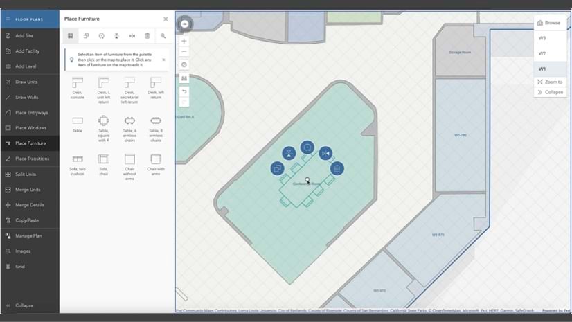
A relatively new but fast-growing field of GIS is indoor GIS, which enables GIS capabilities that we already know inside facilities. If you are interested in learning about how GIS can be applied to indoor spaces, you can explore two sessions that introduce our main indoor GIS products, ArcGIS Indoors and ArcGIS IPS, and discuss indoor asset management.
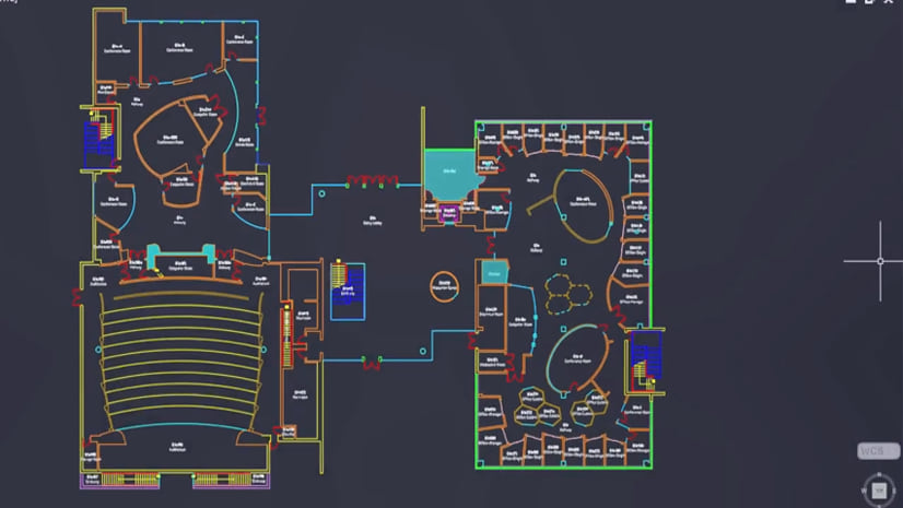
ArcGIS Indoors is an indoor system of record that allows you to create interactive indoor maps, optimize space planning and management, and provide routes to points of interest to support wayfinding. ArcGIS IPS is an indoor positioning system that visualizes your real-time position on the indoor map. Together they form the basis for an indoor GIS, which can help improve safety and security, space and asset management and the building occupant experience.
In addition, we also offer a hands-on indoor positioning and navigation demo experience at Frankfurt Main Station. You can find details on the excursion below.
Watch this sneak preview to see what you can expect from the demo:
ArcGIS IPS Demo at Frankfurt Main Station
Monday, April 8 | 2:15 p.m. – 3:00 p.m. CEST
Tuesday, April 9 | 1:30 p.m. – 2:15 p.m. CEST
Meeting point: Sign up and meet us at the info desk on Level 1
Join us for a live ArcGIS IPS demonstration at Frankfurt Main Station to experience the indoor blue dot live in action. Our indoor GIS team on site will show you how to enable indoor positioning inside the train station, locate yourself on the digital indoor map, and navigate through the station in real time.
The indoor positioning system is powered by ArcGIS IPS and, in this case, uses 100 Bluetooth LE beacons mounted on the station’s interior walls and platforms. These beacons are small radio signal transmitters that send their location information to the mobile device which in turn calculates its relative position to enable the live blue dot.
The current setup covers only part of the station between the platform on the ground floor and the city trains operating on the lower level. ArcGIS IPS is floor-aware and helps the mobile device recognize which level it is currently on, enabling seamless transitions between floors.
To participate in the demonstration, sign up and meet us at the info desk on the above-mentioned dates and times.
Taking GIS Indoors: An Introduction to ArcGIS Indoors and ArcGIS IPS
Tuesday, Apr 9 | 3:45 p.m. – 4:45 p.m. CEST
Meridian 1
This session will provide an overview of Esri’s Indoor GIS products, ArcGIS Indoors and ArcGIS IPS, showing how they can be used as a system for indoor mapping of your buildings as well as support indoor way finding, workspace reservation, indoor positioning, space management and more. Learn how you can not only map your buildings indoor spaces and assets, but also provide an experience for your visitors and building occupants to get more out of their indoor environment while enabling operations staff to manage space assignments, floor plan layouts and location-based work-order management.
Taking GIS Indoors: Establishing a Digital Twin of your Facilities for Asset Management
Wednesday, Apr 10 | 11:30 a.m. – 12:30 p.m. CEST
Plateau 1 & 2
This workshop will show you how to model your buildings’ interior spaces in a 2D and 3D GIS. We will cover a broad range of topics, from preparing and generating 3D scenes, asset inventory “inside the plant”, integrating 3D data with critical business systems, and leveraging the growing capabilities of ArcGIS Indoors.
For further information on our products, please visit our web pages for:


Commenting is not enabled for this article.