The ocean is vast, dynamic, and vital to life on Earth. Understanding what happens across its surface is crucial for sustainable management and conservation. Global Fishing Watch, an international nonprofit organization advancing ocean governance through transparency of human activity at sea, recently undertook a project increasing the level of ocean understanding for GIS users everywhere. We’re excited to share that new Global Fishing Watch layers are now available in ArcGIS Online and in the ArcGIS Living Atlas of the World. This marks a significant milestone for the GIS community, providing direct access to powerful datasets designed to inform, inspire, and support efforts to protect our oceans.
Making Global Fishing Watch Content Accessible
Global Fishing Watch’s mission is to make human activity on the ocean more transparent and sustainable by making critical data open and free. We are thrilled that our fishing and vessel activity data is now more easily accessible to the many users of the Esri community.” — Paul Woods, Co-Founder and Chief Innovation Officer, Global Fishing Watch
Overview of Core Layers
The new Global Fishing Watch Layers bring together a suite of core datasets, each designed to illuminate different aspects of human activity at sea. These layers include:
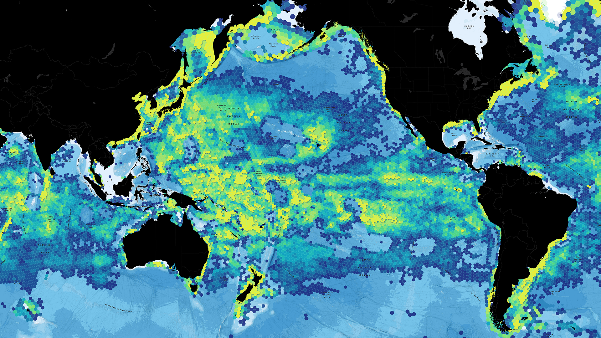
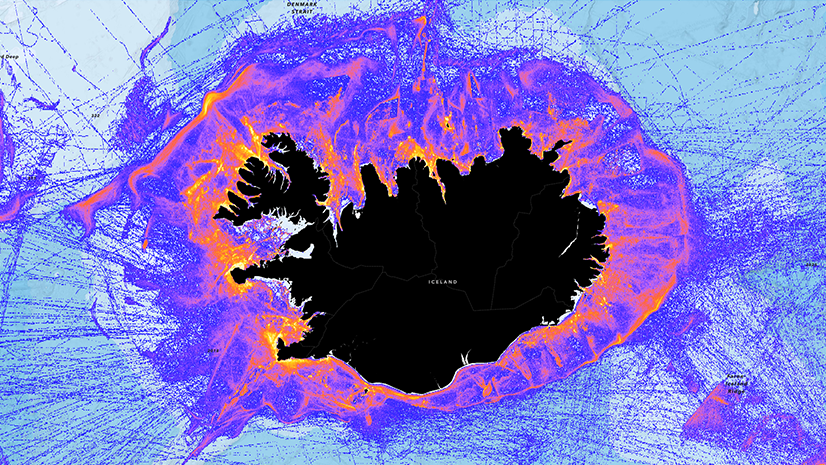
- Vessel Presence: Shows where commercial fishing vessels have been detected on the ocean, offering a clear picture of maritime traffic across time and space.
- Fishing Effort: Visualizes areas where fishing activity is likely occurring, helping users track patterns and identify hotspots.
- SAR Detection Matched & Unmatched: These layers leverage Synthetic Aperture Radar (SAR) imagery to detect vessels regardless of weather or darkness. The “Matched” layer indicates SAR detections that correspond with known vessel positions, while “Unmatched” highlights potential “dark targets” – vessels that are not appearing in public monitoring portals (they may still be reporting tracking data, but it is not public).
- SAR Fixed Infrastructure: Presents mapped offshore infrastructure detected by SAR, such as oil platforms and wind farms, enhancing situational awareness for planners and regulators and showing the expansion of offshore industry over time.
View the layers in the ArcGIS Living Atlas of the World or in the ArcGIS Online Group.

Applications for Conservation and Planning
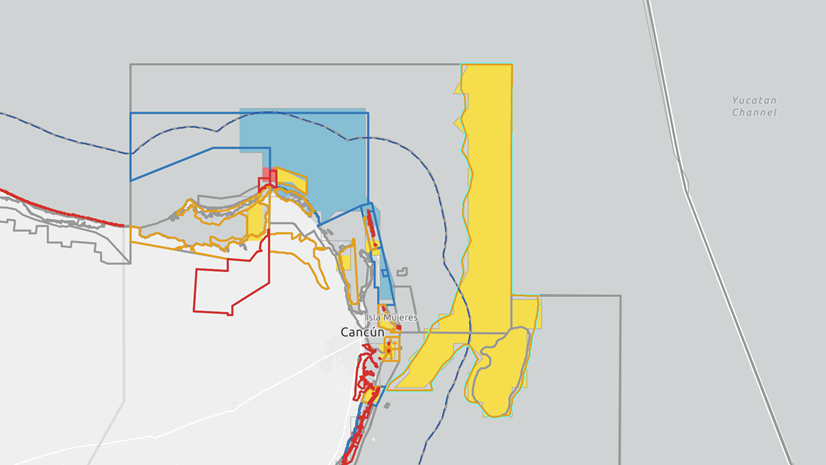
These datasets are more than just maps—they’re tools for change. Conservation organizations can use the layers to identify critical habitats, monitor protected areas, and assess the impact of human activity on marine biodiversity. Policy makers and planners can visualize how and where vessels operate, supporting evidence-based decisions for sustainable resource management. Whether you’re coordinating a marine reserve, managing fisheries, or planning offshore infrastructure, these layers provide the actionable insights needed to make informed choices.

Raising Awareness of Illegal and Unreported Fishing
Illegal, unreported, and unregulated (IUU) fishing is a persistent threat to ocean health and coastal communities. By shining a light on vessel movements—including those that don’t broadcast their location—the Global Fishing Watch Layers help expose suspicious or unauthorized activity. The SAR Detection Unmatched layer, in particular, is a valuable resource for watchdog organizations seeking to close knowledge gaps and drive accountability in remote areas and on the high seas. To learn more, see some of the Global Fishing Watch layers applied in this StoryMap.

Collaboration Spotlight: Global Fishing Watch and Esri
This initiative wouldn’t be possible without a strong partnership. Global Fishing Watch has worked closely with Esri to ensure seamless integration of API-driven datasets into ArcGIS Online. This collaboration brings together leading-edge geospatial technology and world-class ocean intelligence, amplifying our collective impact and making it easier than ever for GIS users around the world to engage with critical ocean data.
How to Get Involved: Feedback and Contact Information
We’re eager to hear from the community! Your feedback helps us improve our services and better meet the needs of GIS users everywhere. If you have questions, suggestions, or want to share how you’re using these layers, please reach out to the Global Fishing Watch Team at apis@globalfishingwatch.org, visit the Global Fishing Watch ArcGIS Online Page, or website for more information. Additionally, please see the Global Fishing Watch Platform Update Announcement.
Conclusion: Join Us on the Journey
The launch of Global Fishing Watch Layers in ArcGIS Online and the Living Atlas represents a leap forward in making ocean activity visible and actionable. We invite you to explore these new datasets, incorporate them into your work, and join a growing community dedicated to ocean stewardship and transparency. Together, we can turn data into knowledge, and knowledge into action for a healthier ocean and planet.
Article Discussion: