ArcGIS Living Atlas provides foundational elevation layers that all ArcGIS users consume in their maps, scenes, and applications. Terrain3D provides a default global elevation surface in scenes whether you are using ArcGIS Pro or ArcGIS Online Scene Viewer. Similarly, World Hillshade provides a default relief background in various basemaps (such as Topographic, Terrain with Labels) that are available across the ArcGIS system. These layers are compiled using the best available datasets from open data sources, Esri Community Maps contributors, and commercial data providers. These layers in ArcGIS Online have just been improved by integrating Maxar Intelligence’s Precision3D data, which is the most accurate 3D representation of Earth available on the commercial market.
In 2018, Esri integrated Airbus WorldDEM4Ortho 24m in elevation layers and derivatives, which brought significant quality and accuracy improvements over SRTM 30m. WorldDEM4Ortho was a hybrid DSM/DTM product where buildings were removed in urban areas, but vegetation/forest heights remain. Though urban areas were flattened in WorldDEM4Ortho to provide a better surface for overlaying 3D buildings, in some instances, small hills in the urban areas were also flattened during the building removal process and the void filling/smoothing resulted in heights which were either more elevated or depressed than actual.
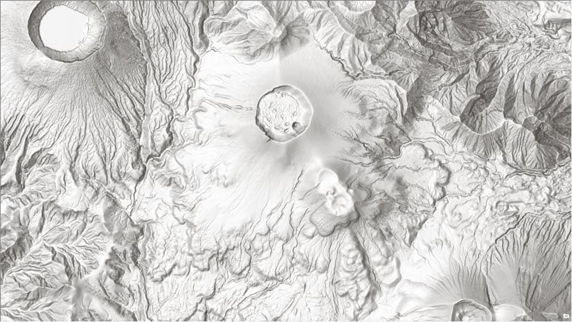
To further improve over WorldDEM4Ortho, we are excited to share that the Terrain 3D, TopoBathy 3D, World Hillshade and World Hillshade (Dark) layers are now enhanced with bare earth elevation data from Maxar’s Precision3D for parts of the globe. The Precision3D Digital Terrain Models (DTM) at 50 cm resolution are created by pairing Maxar’s extensive archive of high-resolution satellite imagery with the company’s patented 3D technology.
The first rollout of Maxar Precision3D includes large parts of Asia and Africa along with a few areas in Europe, North America, South America and Australia covering approximately 27 million sq kms area (~10.4 million sq miles) as shown below. In June 2025, ~ 6 million sq kms of new data has been added bringing the total coverage to ~ 33 million sq kms.

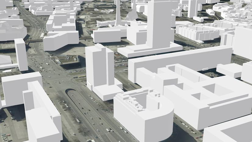
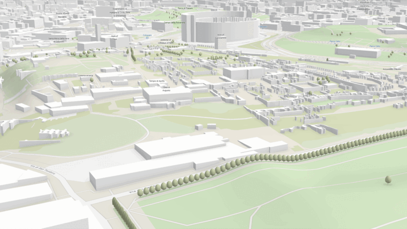
Let’s see a few enhancements in World Hillshade and Terrain3D with Maxar Precision3D in 50 cm. The 3D buildings in these examples are from Esri’s global building service, which is created from many data sources.


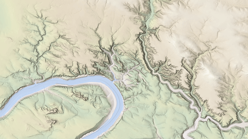
 depicted with Maxar Precision3D revealing topography and hydro features in comparison to WorldDEM4Ortho, which includes coconut vegetation heights.")
With the rollout of Maxar’s Precision3D, the elevation surface is closer to reality thus providing a better ground surface for 3D overlays and relief background.
Esri will keep improving the World Elevation Layers and derived information products with more high resolution content from Maxar, open data sources, and Community Maps contributors.
To see the coverage of various other data sources comprising the World Elevation services, check out the Elevation coverage map.
You can help in improving these services by contributing high-resolution elevation data to Living Atlas of the World. To participate and learn more, check out the Esri Community Maps for Elevation program.

Hi Rajinder – this is great news. It has really improved the DTM for large parts of the Scottish Highlands. I can see it is in the Terrain 3D layer and has also improved the “World Hillshade”. The “Terrain: Multi Directional hillshade” does not contain it though. What is the main difference between these 2 datasets? It would be good to see this in both of them. Likewise the new welsh lidar dataset is in the Terrain layer but not in this one – would be good to have parity between the 2.
Due to licensing constraints Maxar data is part of Terrain3D and World Hillshade layers only and will not be available in our dynamic Terrain image service. World Hillshade is tiled version of Terrain: Multi Directional hillshade” and contains same sources except Maxar. Generally, datasets get added to our dynamic services (Terrain) first and then flows down to tiled services in the following quarter. Wales data has been released in Terrain and will be released in World Hillshade and Terrain3D by Q3. Hope this helps!
That’s what I suspected. I guess that means we won’t be able to run viewsheds for example using the Maxar data. Either way this is a big improvement. Look forward to seeing Wales data in terrain3d.