Introducing Wayback Export, a new beta feature for the World Imagery Wayback app.
The Wayback app, in ArcGIS Living Atlas, is now delivering packages, tile packages that is. The all new Wayback Export capability is designed to support exporting small volumes of imagery basemap tiles for offline use in ArcGIS applications and other applications built with an ArcGIS Maps SDK for Native Apps.
For years, ArcGIS users have been able to export tile packages from the standard World Imagery map, leveraging World Imagery (for Export). However, ArcGIS users are no longer limited to only the most recent imagery tiles for their offline workflows and applications, they can now export tiles from any version of World Imagery available in the Wayback archive.
As before, the new tool allows exports up to 150,000 tiles in a single request. For estimation purposes, this is large enough to support the export of:
- A large city (e.g. San Francisco) down to a scale of ~1:1,000 (Level 19)
- A medium size state or province (e.g. Colorado) down to a scale of ~1:36,000 (Level 14)
Have a look below for a few tips on accessing and using the new Wayback Export functionality.
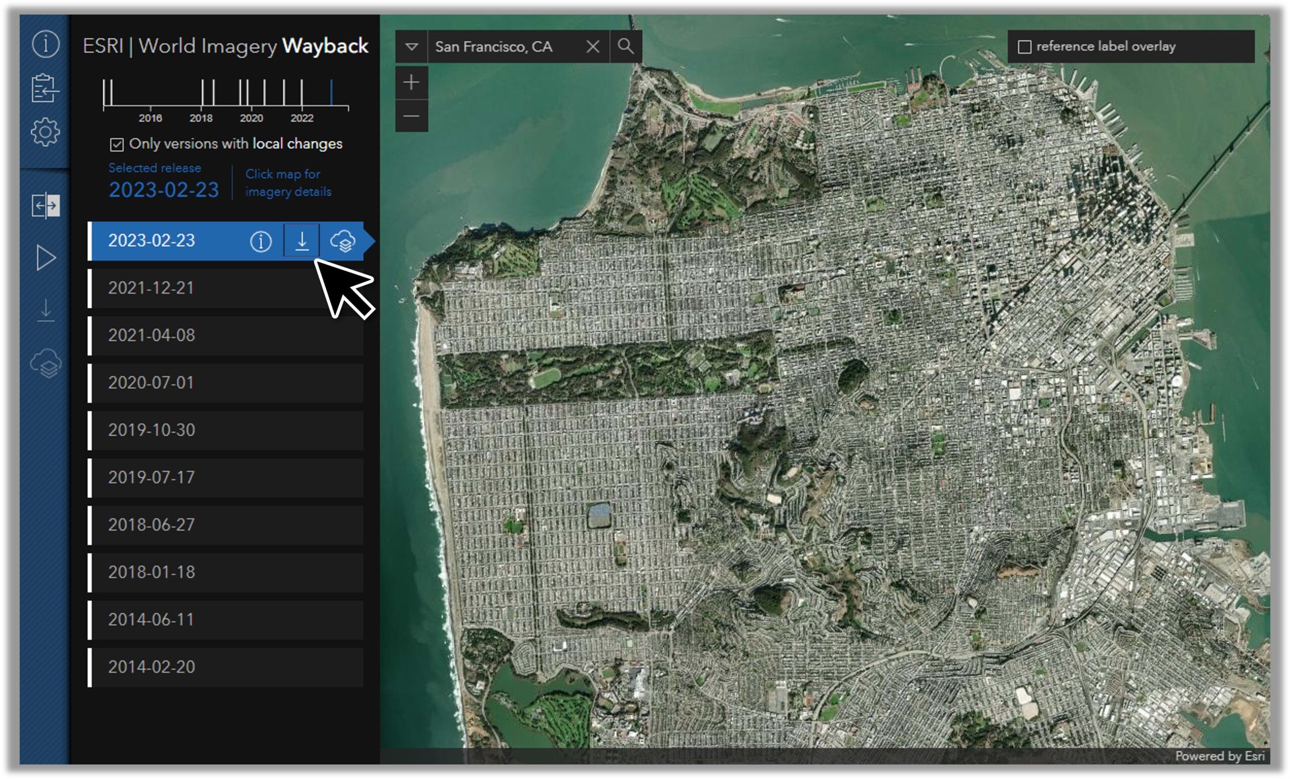
Open the Wayback app and select the desired location and version of World Imagery. On the selected layer, click the export option. Note that exports are based on map extent, with a minimum zoom level of 12.
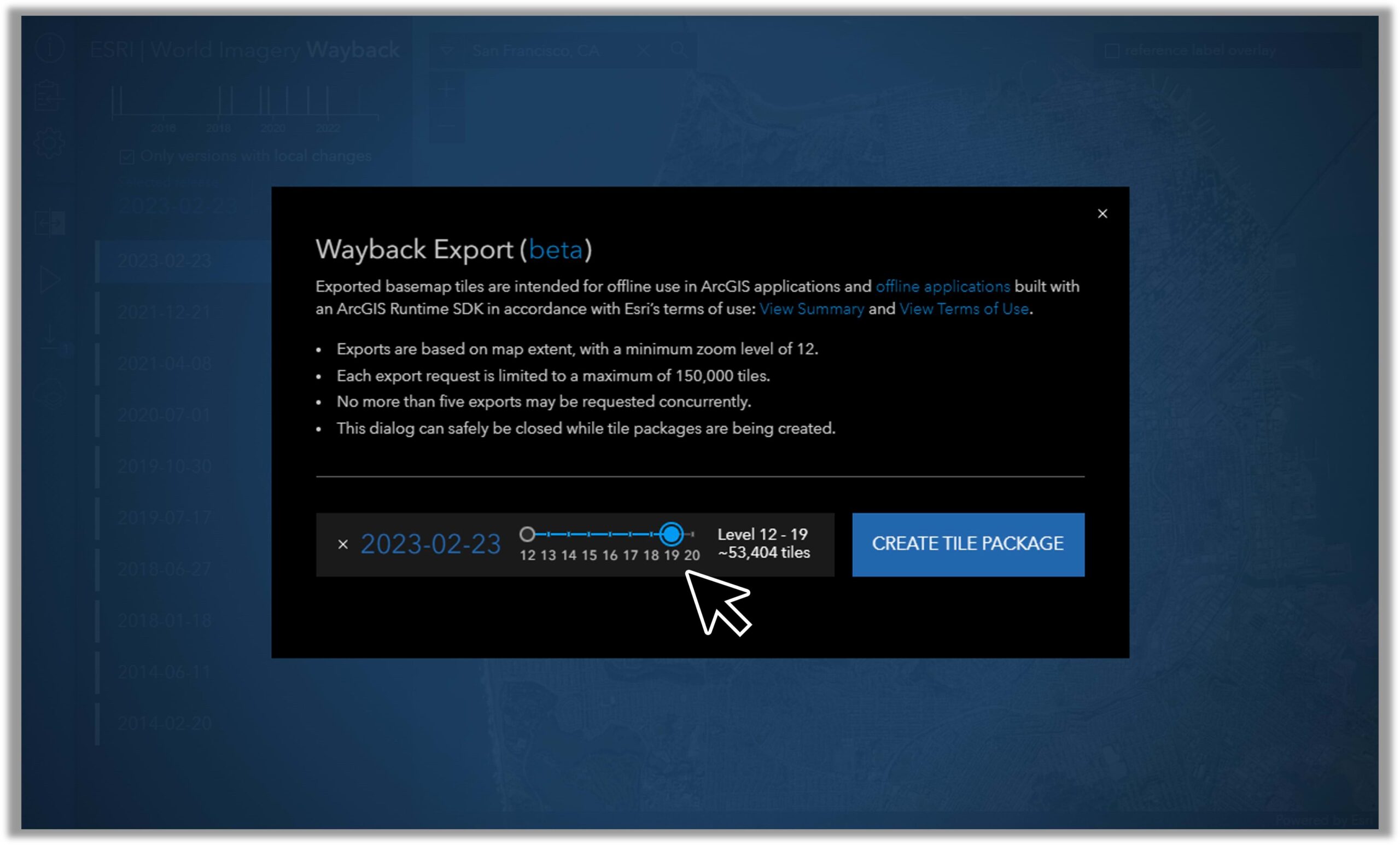
Each export request is limited to a maximum of 150,000 tiles. The level slider can be used to choose the minimum and maximum level of detail to be included in the output tile package.
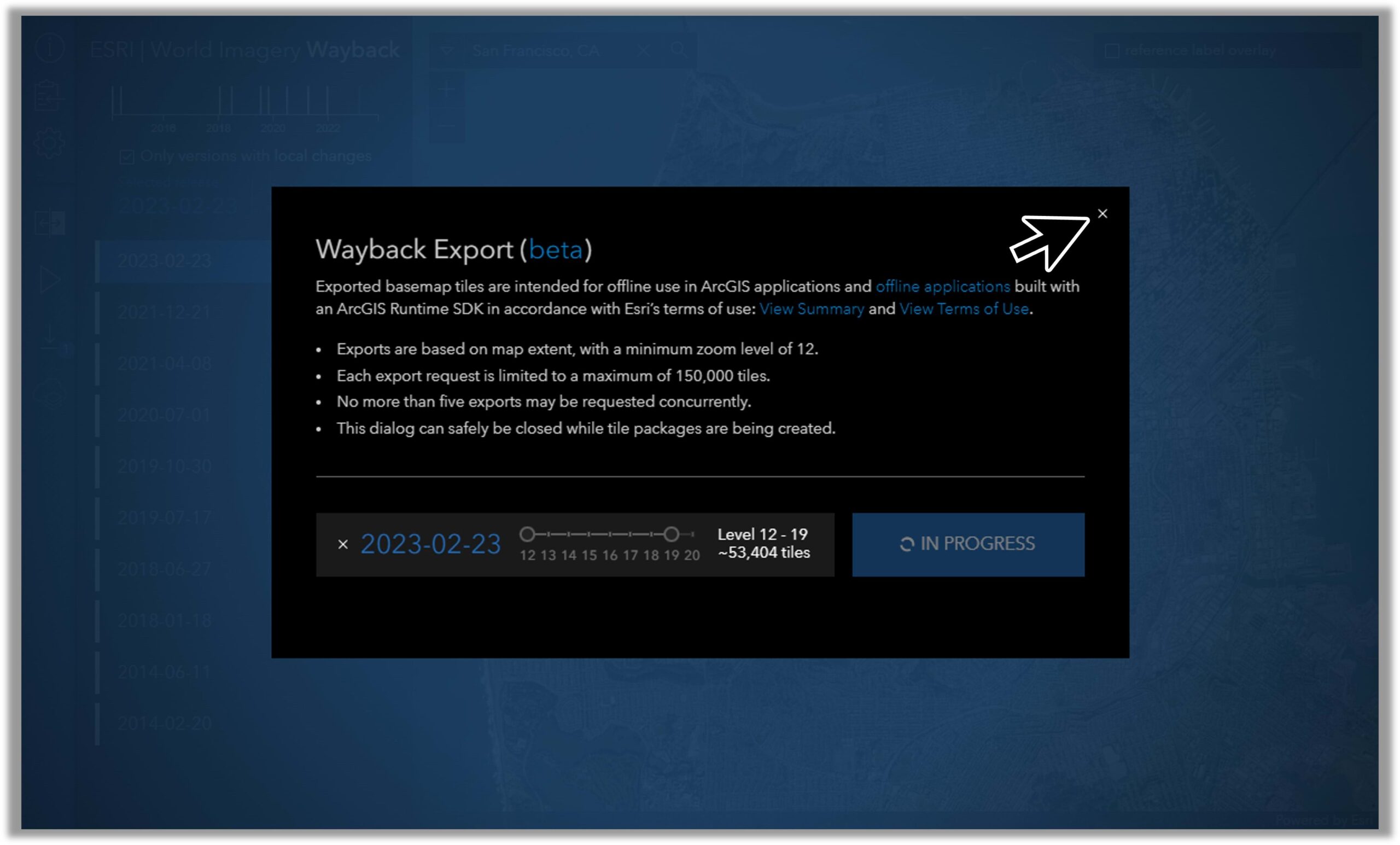
The export dialog box can safely be closed while the export jobs are in progress.
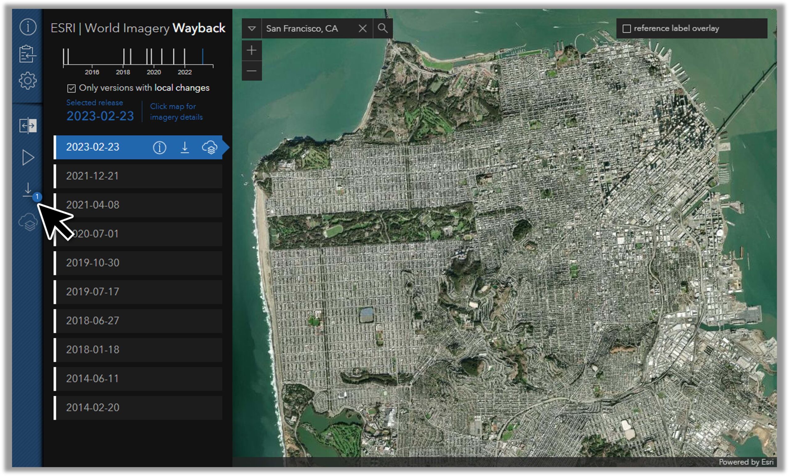
With the export dialog closed, the number of current export requests is displayed in the side panel. Click on this to reopen the export dialog.
Once the tile package is ready, choose the option to start the download.
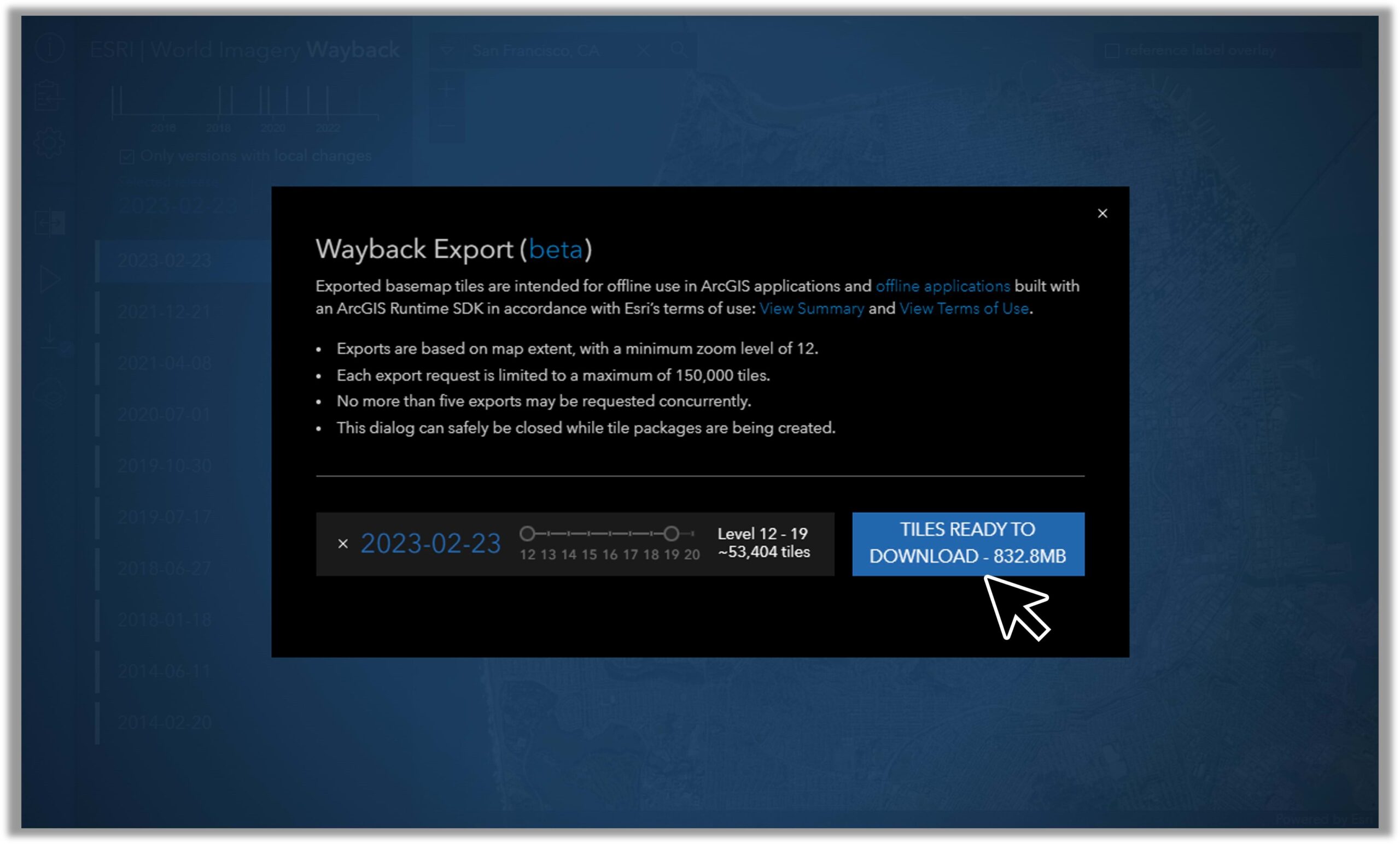
Once complete, check the browser’s download location for the ‘wayport.tpkx’ tile package file. That’s all there is to it!
Happy Mapping and Mappy Holidays!
More Resources on Wayback
Explore imagery archives using World Imagery Wayback
Additional Articles on Wayback
ArcGIS Living Atlas of the World
Credits
Wayback System Architecture: Dr. Lucian Plesea
Wayback App Development: Jinnan Zhang
Wayback App Design: John Nelson
World Imagery Curation: Jim Mason, Chris Egle, Atif Zafar, Nico Roldos, and Team

Article Discussion: