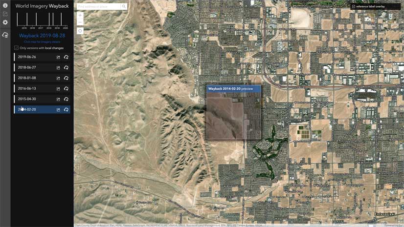
The Wayback App, in ArcGIS Living Atlas, contains every release of the World Imagery basemap archive, including the current release and dating back to the February 2014 release. The application provides discovery, visualization and utility tools that help explore the archive, demonstrate change over time, and access the archive for use across the Esri platform as individual items, layers in web maps, and as tile packages for analysis or offline use.
Esri is excited to introduce some new features and functionality. Updates Mode in the Wayback App will elevate the Esri User Community’s experience by allowing them to pinpoint where updates have been published over the past year. Plus, they can get an exciting sneak peek into the future with a view of where and when pending updates to the World Imagery basemap are scheduled to occur. Alongside this new feature, the Wayback App now supports over 40 languages with the addition of Translated Reference Labels, and a more spontaneous opening map view to encourage you to keep exploring.
Updates Mode
The Updates Mode can be accessed from the tool bar on the left-hand side of the Wayback App. This level of information is only available to the Esri Community and requires an ArcGIS organizational subscription and login to access. Below is an overview of how Updates Mode displays when you first sign in.
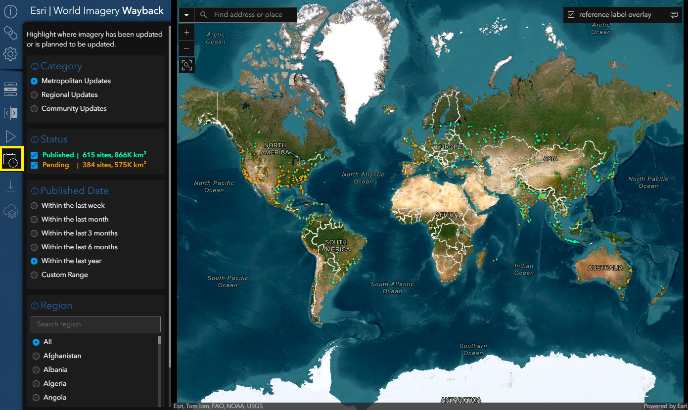
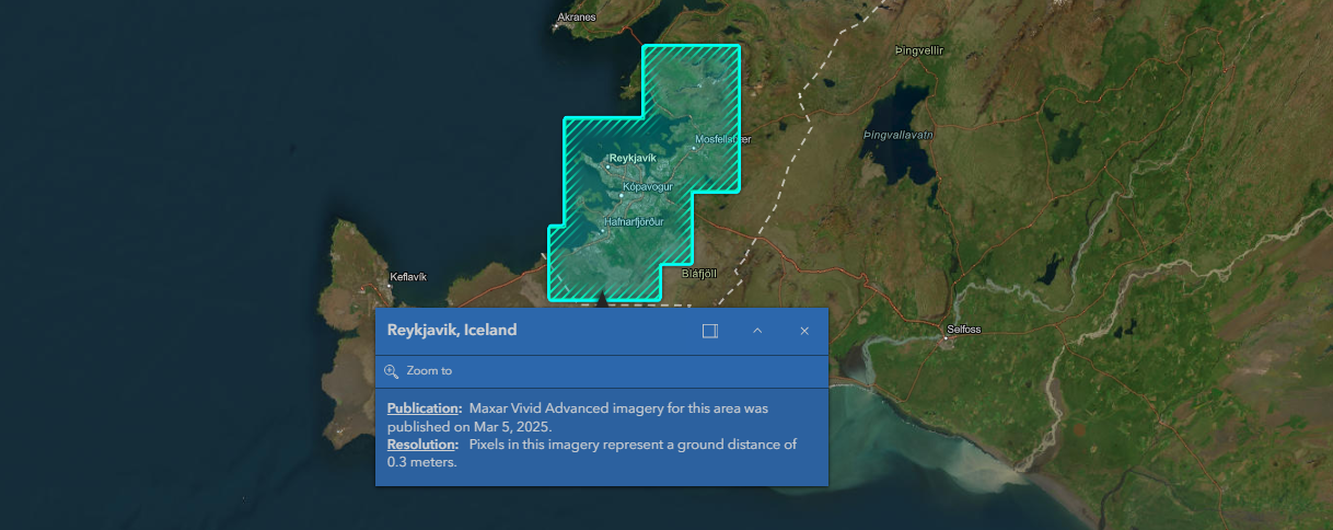
Clicking on any published or pending site within the map view will produce a pop-up that presents metadata about the publication date or pending release quarter, as well as the resolution of the imagery within the World Imagery basemap.
Updates Mode provides a number of ways to filter and refine the search for newly published and pending updates to World Imagery:
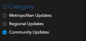
- Image Category
- Publication Status
- Published Date ranges within the last year
- Region of interest
Category
There are three sources of high-resolution imagery in the World Imagery basemap. Click on a Category to select the imagery source you want to explore updates for.
- Metropolitan updates at 30 cm. are provided by Maxar’s Vivid Advanced product for 1000+ urban areas annually, with select cities upgraded to Vivid Premium 15 cm. HD.
- Regional updates at resolutions ranging from 30 to 120 cm. are provided by Maxar’s Vivid Standard product globally.
- Community aerial imagery updates at resolutions higher than 30 cm. are provided for select sites through Esri’s Community Maps Program.
Status
The Updates Mode in the Wayback App lets you explore both pending and published updates to the World Imagery basemap from the past year. Regardless of the publication status, the number of sites and their square kilometer coverage will be summarized based on your selected filters for category, published date, and region.
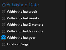
Published Date
In Updates Mode, users can filter on Published Date through pre-set options, or a custom date range, within the past year. Utilizing the custom date range, a user could search for results associated with a specific release date.
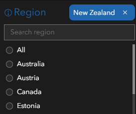
Region
The Region filter is used to focus queries on a specific geographic region. The list of regions changes based on the selections made for imagery category, publication status, and date. Selecting a region will automatically zoom the Wayback Map to your region of interest.
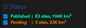
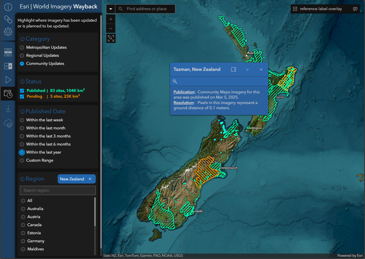
The Updates Mode filters demonstrated above, look for all published and pending sites of Community aerial imagery contributions for New Zealand within the last year. The Status results show us that 83 sites, totaling 104,000 square kilometers, have been published within the last year and that three new sites are pending publication, which will increase coverage by an additional 23,000 km2.
With Updates Mode integrated into the Wayback App, users can focus on areas of recent and pending updates and leverage existing Wayback tools to explore changes and identify releases that best meet their use case.
In the following example the Updates Mode has been used to identify all Metropolitan updates for Thailand associated with a specific release date in May of 2025.
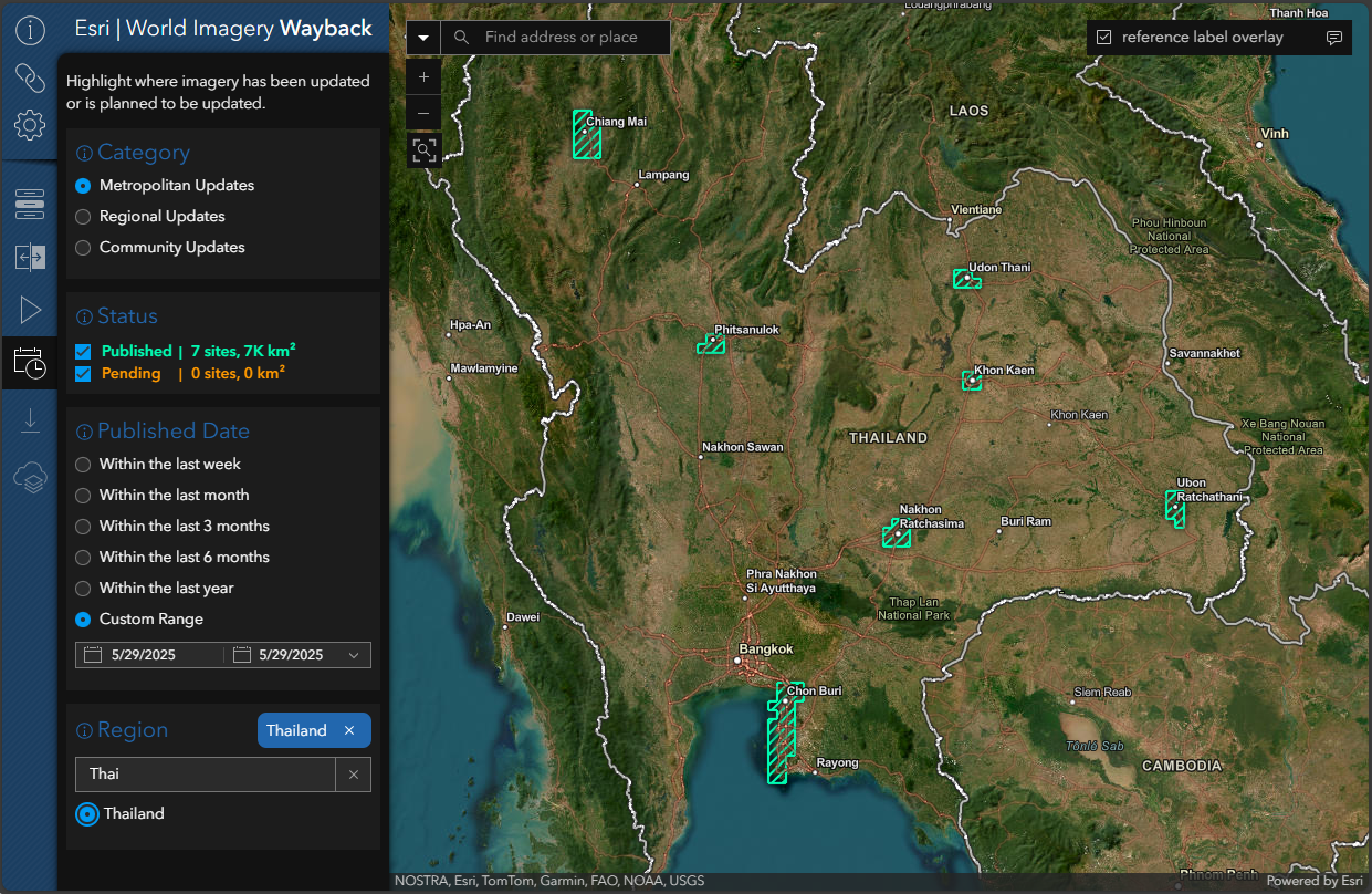
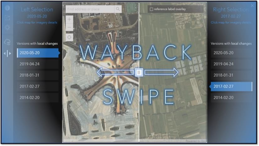
Zooming into the recently updated city of Nakhon Ratchasima in Northeastern Thailand we can leverage existing Wayback App utilities, such as the Swipe Tool, to visualize changes that have occurred on the ground between releases. It looks like the city is in the process of updating a park with new sporting venues, walking paths, and water features.
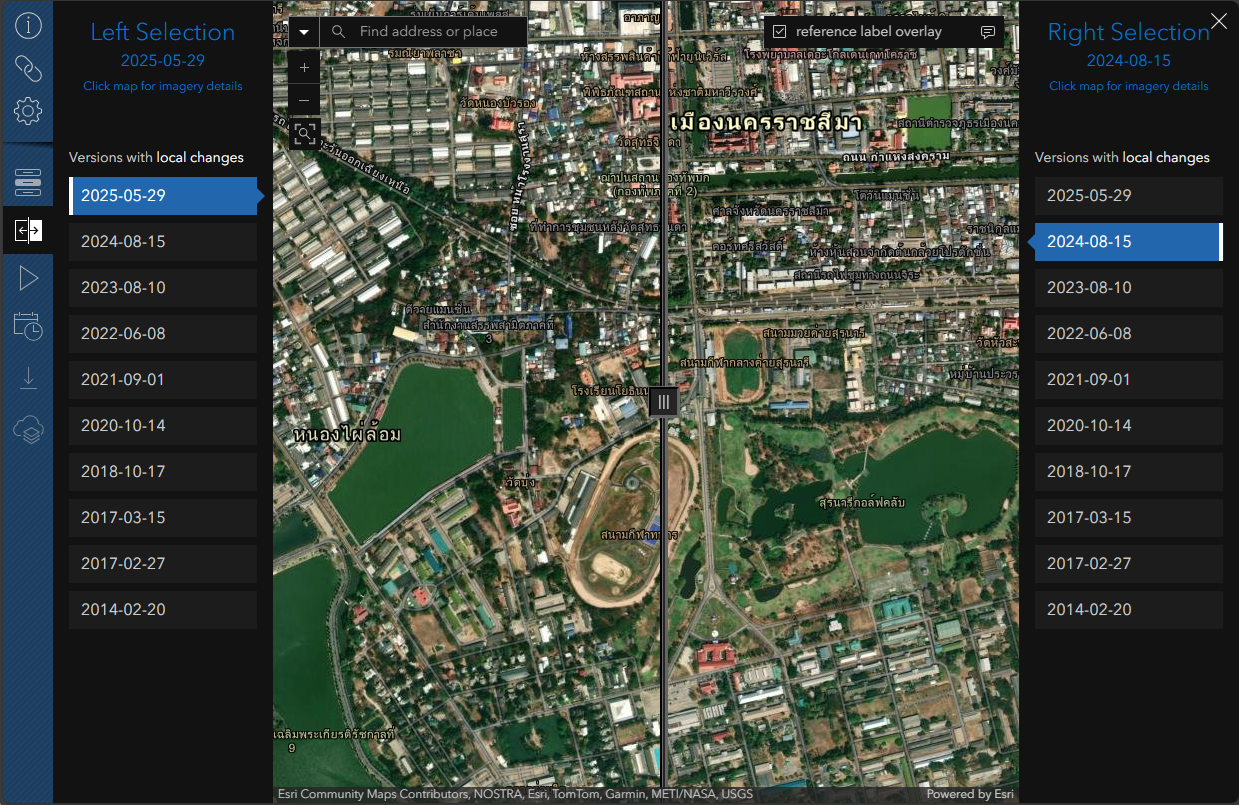
Did you notice anything unique about the reference labels in the above example of Nakhon Ratchasima, or as it is locally known นครราชสีมา? Keep reading to find out how to translate reference labels.
Localize Map Labels
The Wayback App now supports 40 languages for reference labels. To select a language, check the reference label overlay box in the top right corner of the map window, click the text bubble, and use the scroll bar to choose your preferred language.
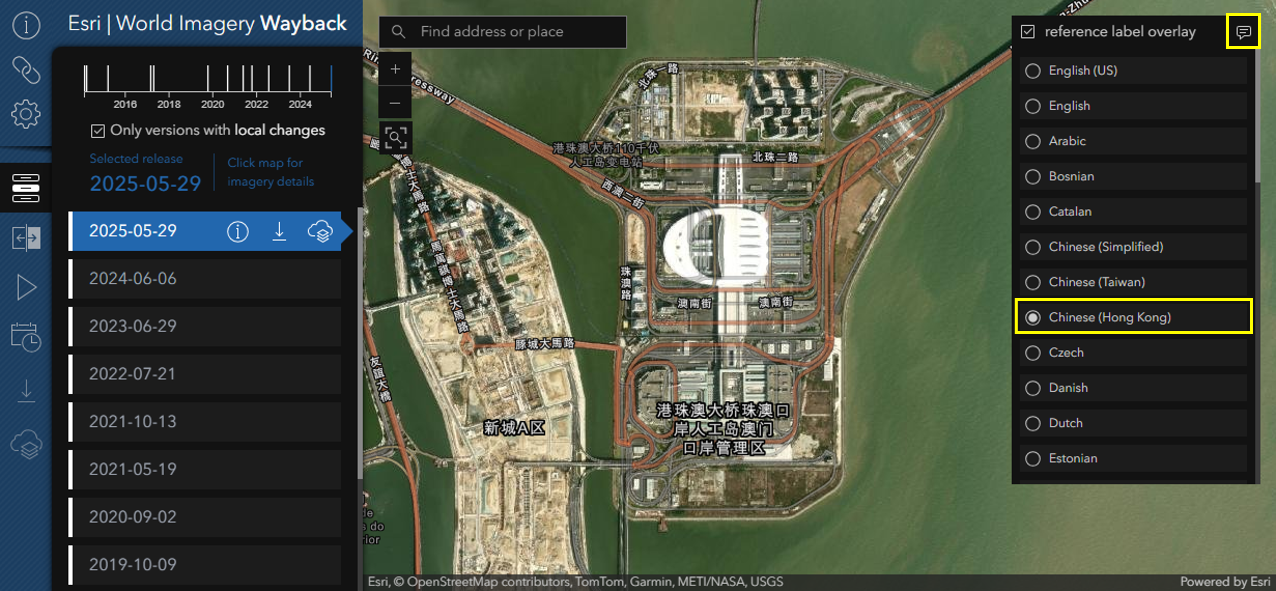
For more information on labels localization see the Localization of Esri Vector Basemaps section of the Esri Vector Basemap Reference Document.
“To learn a language is to have one more window from which to look at the world.” – Chinese Proverb
Inspired by this wisdom, each time you open the Wayback App a starting location for the map view is randomly chosen. Dive in and explore these locations, using the swipe and animation tools to witness the dramatic changes these areas have undergone since the inception of Esri’s World Imagery basemap.
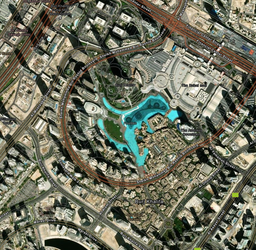
Burj Khalifa – Dubai, United Arab Emirates 30-centimeter Maxar World View 3 imagery captured on Oct 17, 2024
Explore World Imagery with the Wayback App!
Additional Resources
Explore imagery archives using World Imagery
Wayback More articles on Wayback
Credits
Wayback System Architecture: Dr. Lucian Plesea
Wayback App Development: Jinnan Zhang
Wayback App Design: John Nelson
World Imagery Curation: Jim Mason, Chris Egle, Atif Zafar and Team
Guidance on Localized Reference Labels: Andy Green and the Vector Basemaps Team

Can we get a version of this to use with our own imagery? The current Imagery Viewer is pretty inadequate.
The Wayback GitHub repo is available but there is also a backend Wayback tile server system for the imagery upon which the application is based. If your county imagery is public and you wish to see it incorporated into the World Imagery basemap you can explore how to do that through Esri’s Community Maps Program.