The September 2021 ArcGIS Online update introduces new features and key updates throughout the site. The same applies for ArcGIS Instant Apps, as we have released four new apps in total, further improved choosing and managing your apps, and addressed various bugs and enhancements to help stabilize and improve your experience across the site. See the highlights below.
Introducing the Sidebar Instant App
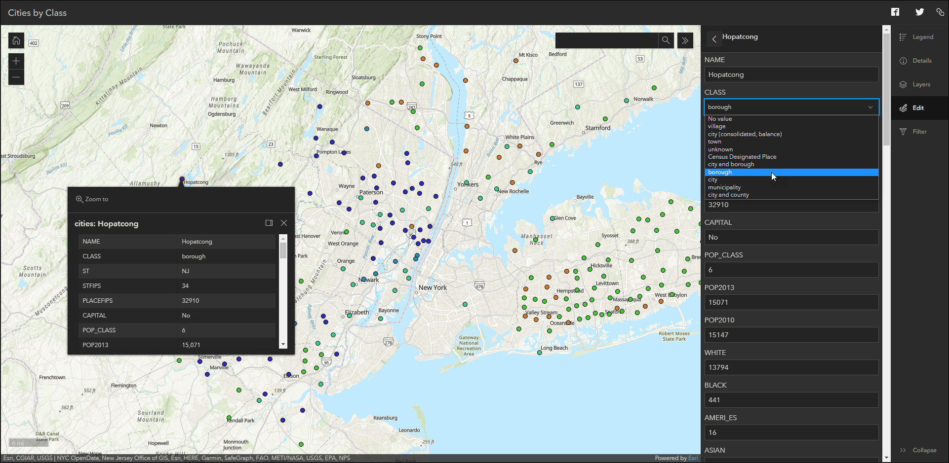
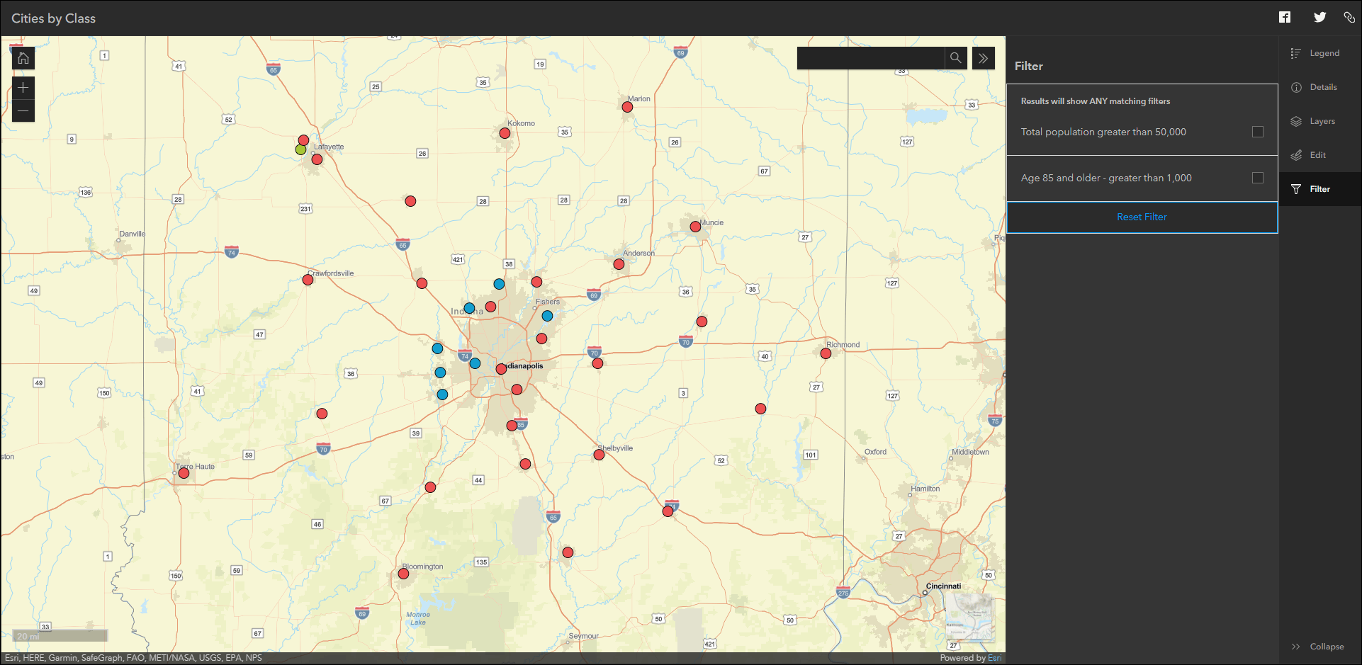
Sidebar is a new Instant App offering a range of tools for exploring, understanding, and managing data. A panel containing these tools displays alongside the map and includes data editing, feature filtering, pop-up information, bookmarks, layer list, and more. If your map contains editable feature layers, they will appear in the Edit panel with options to add a new feature or edit the geometry and attributes of a selected feature. As an app creator, preconfigure one or more filters to be utilized by the app viewer so they can further understand information in the map.
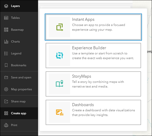
For a detailed run through, please check out our Introducing Sidebar blog. Create a Sidebar app from the map viewer, Content page, or web map item page by choosing Instant Apps from the Create App menu.
Introducing the Basic Instant App
Quickly share your map with any audience using the new Basic Instant App. Basic is a general purpose app that offers a core set of map navigation and exploration tools, and offers a clean and simple layout that lets your map be the main focus for app viewers. Like all Instant Apps, Basic is built mobile friendly and is ready to use across most browsers and devices. We also build Instant Apps with a commitment to ongoing efforts of making our apps as accessible as possible for all users. If you have suggestions on how we can improve in this ongoing effort, please leave a comment at the bottom of the app’s item page and let us know. This applies to all Instant Apps.
Please check out our Introducing Basic blog for a more detailed introduction.
Introducing the Chart Viewer (beta) Instant App
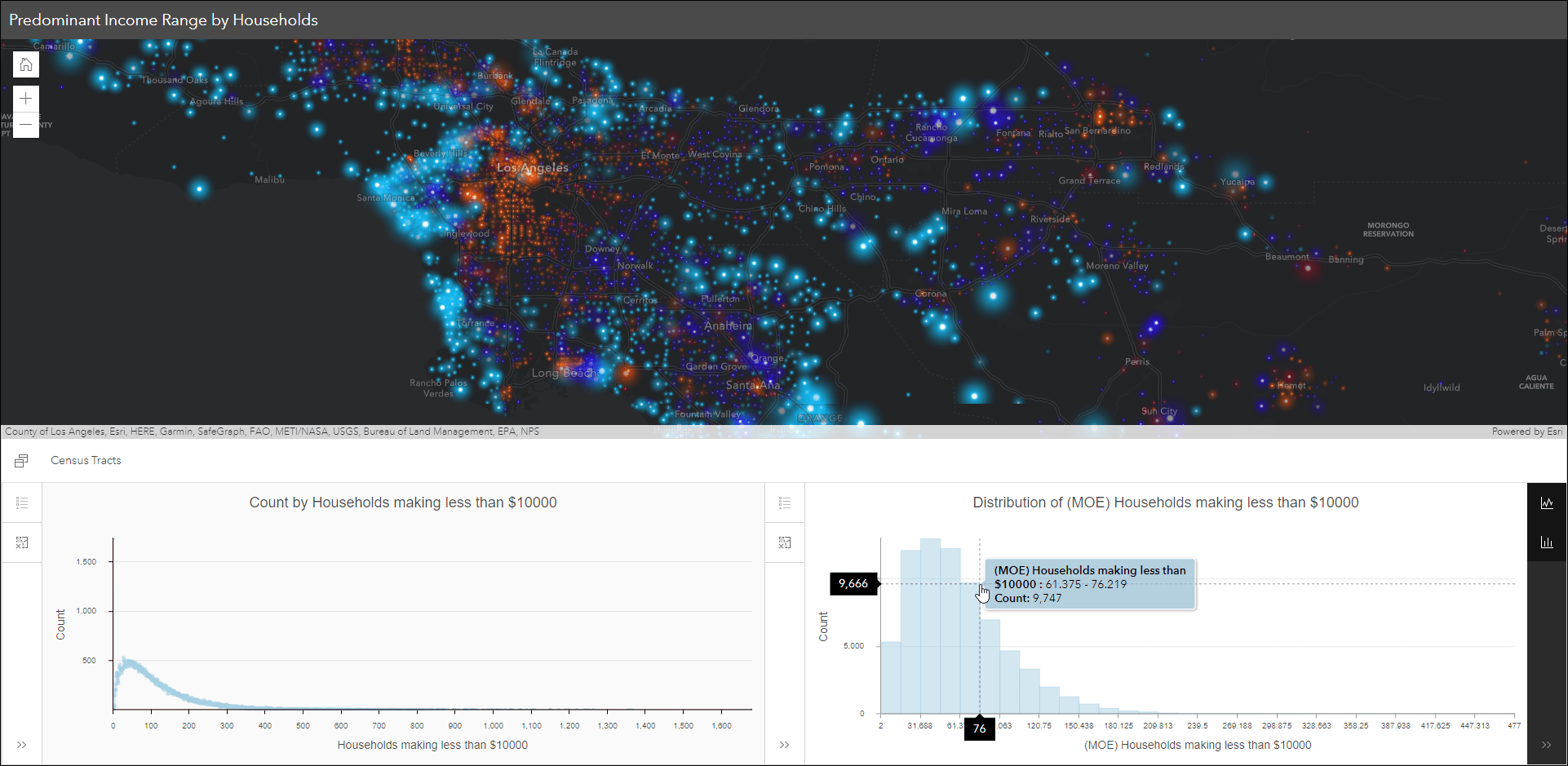
Chart Viewer (beta) leverages charts authored in Map Viewer to display data-based graphics alongside a map. This Instant App lets you include up to ten charts from the web map with configuration options for visibility, ordering, and naming of charts. Choose between two layout options, stacked or side by side, to best orient the charts panel with the map. App viewers can display up to two charts at a time in the charts panel to help understand and visualize the data. Select features in the map or data in the charts to further analyze specific segments of information.
For a more detailed introduction, please check the following blog: Chart Viewer (Beta): a new Instant App
Introducing the Slider (beta) Instant App
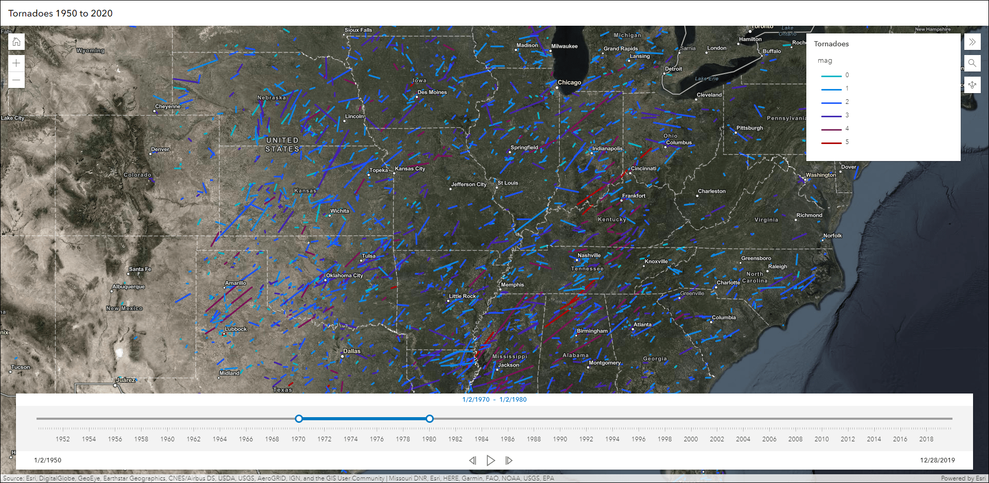
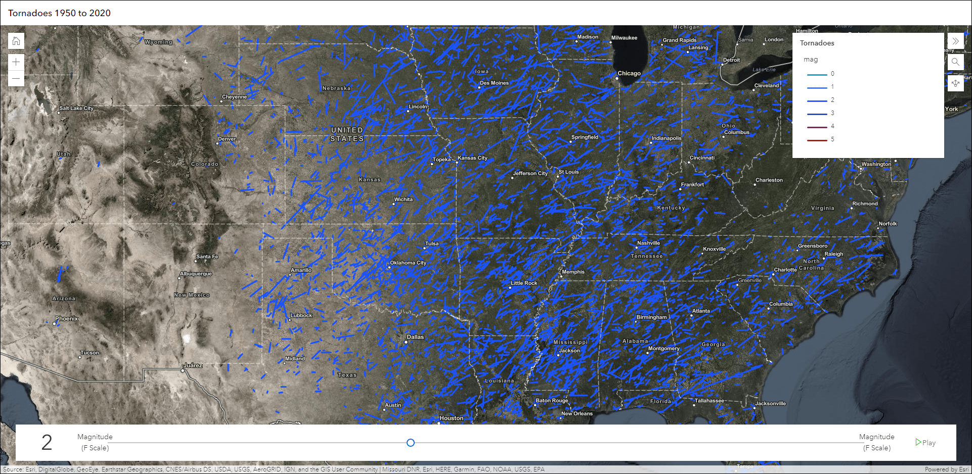
Animate through temporal or numeric data using the new Slider (beta) Instant App. Display historical, live, or future data over any interval of time, including hourly, daily, monthly, annually, and intermittent. The app configuration offers the choice of using numeric or time data, and the ability to pick the desired layer and field containing the data. For example, animate through historical tornado data by decade of occurrence, or choose to play through the data by magnitude value to see where tornadoes that are stronger occur less frequently.
For a deeper dive, check out our Animate data with the new Slider (Beta) Instant App blog.
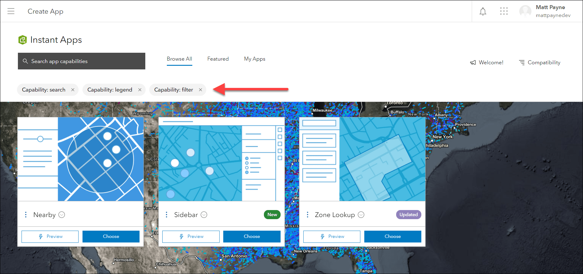
Instant Apps gallery updates
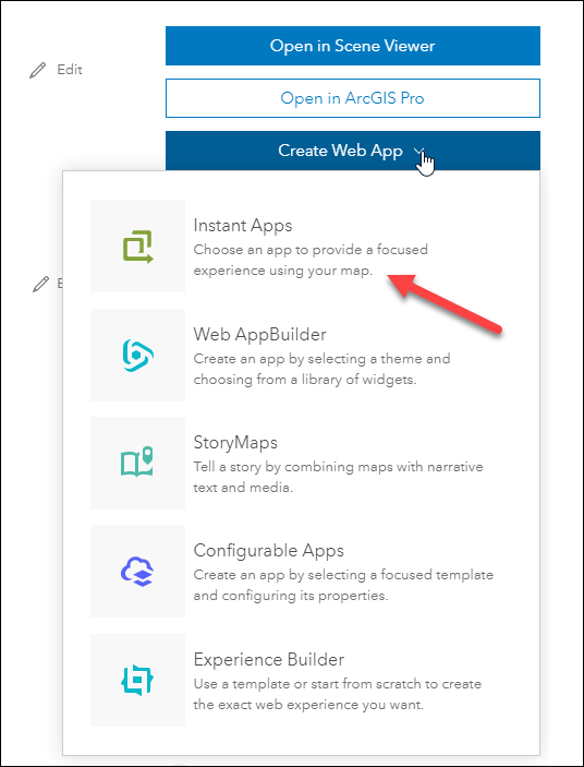
This year we introduced a new way to choose, configure, and use Instant Apps that is accessible from the new map viewer, Content page, and web map item pages. This release we have implemented the Instant Apps gallery into web scene item pages and group pages. Launch the gallery from a web scene or group using the Create Web App button to choose Instant Apps, which will display compatible Instant Apps first. Apps that are not compatible are listed in the “Additional Apps” section with the appropriate warning message explaining the non-compatibility.
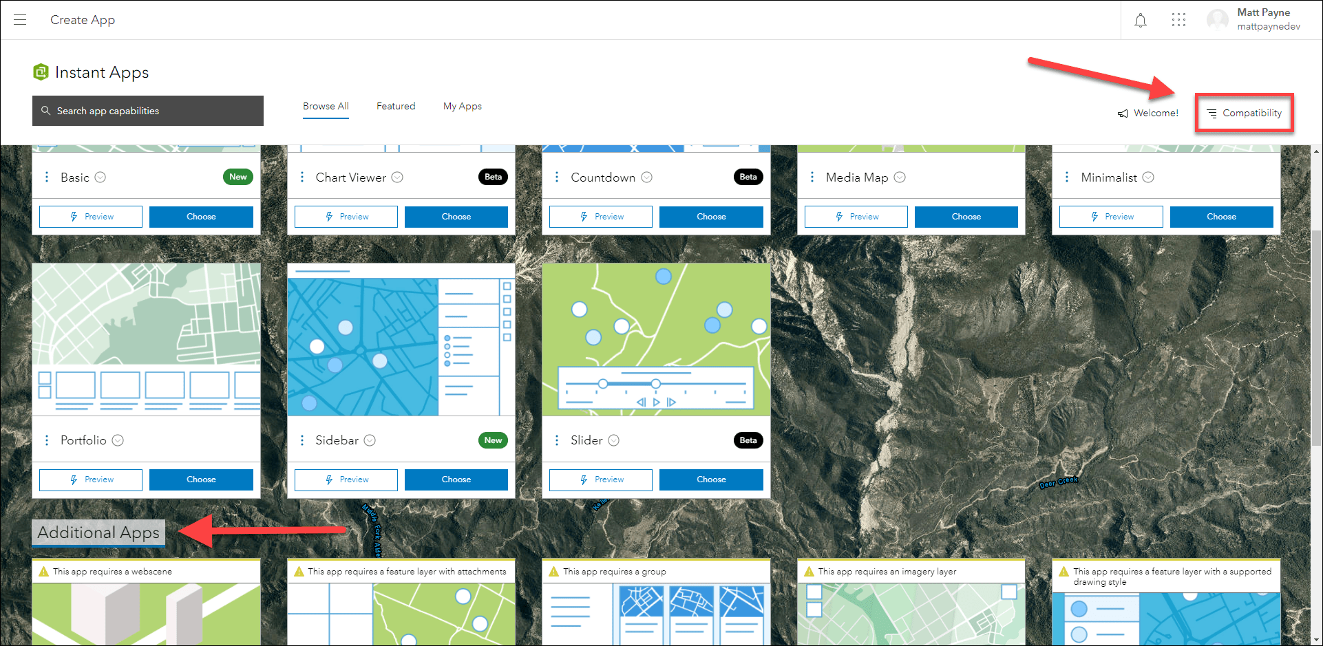
The same applies when launching the gallery from the new map viewer and web map item pages, where the compatible web map Instant Apps are listed first. Note, implementation of the Instant Apps gallery into Scene Viewer will be coming in a future release.
Furthermore, we have enhanced the app searching experience by enabling support for multiple keyword search terms. For example, find apps that have feature search, filtering, and the ability to show a legend. Multiple search terms can be chosen through the search box and are listed with the ability to add and dismiss them one at a time.
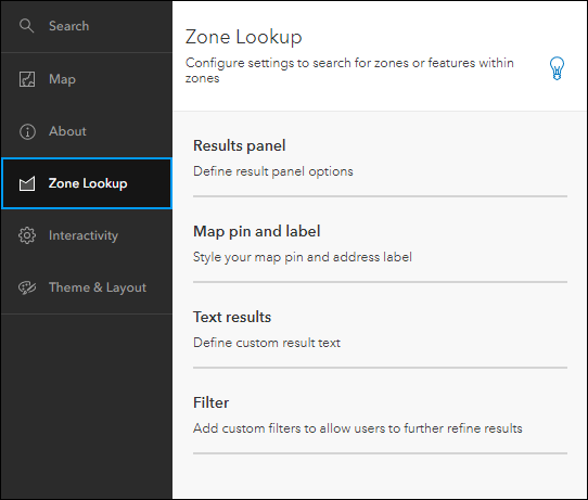
Zone Lookup updates
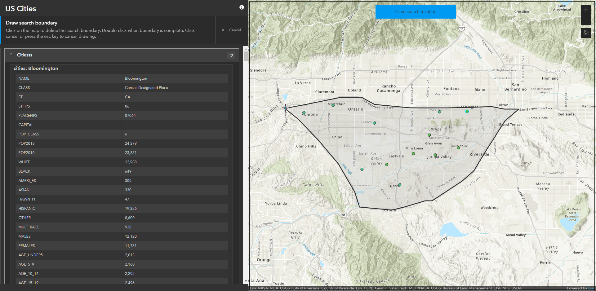
Discover locations within a zone or region to provide information using Zone Lookup. This Instant App is great for identifying school districts, store regions, emergency evacuation zones, and more based on current location or a location provided by the app user. New with this release we have added the ability to filter features in the map by attributes. Preconfigure filters in the app configuration that can be used by the app viewer to narrow down possible results. For example, find schools that are located in a specific school zone and then filter by enrollment to see schools that are smaller in size.
Also new is the ability to draw a polygon boundary to be used as the lookup zone. In the app configuration enable the “Draw a zone” option to display a draw tool for creating a custom boundary to find resulting features within.
We have also added support for viewing related records that are associated with resulting features. Enable “Include related records” on the new Zone Lookup tab in the app configuration. This release we have compartmentalized all lookup related configuration options into a single tab that makes it quicker to create the right lookup experience for your audience.
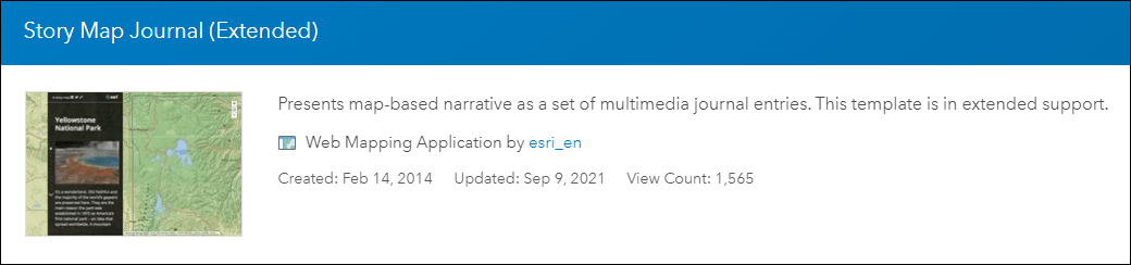
Extended Support for Classic Storymap templates
The classic Storymap templates have moved to the extended support phase of the product lifecycle. These templates will still show in the configurable apps gallery when choosing an app until the next ArcGIS Online release, and your existing apps created using these templates will continue to work as they have. Moving forward, please consider using ArcGIS StoryMaps to create stories with similar capabilities.

Article Discussion: