The Basic template is a new ArcGIS Instant Apps template with the ability to quickly share a web map or web scene. Basic comes with a standard set of tools that are used for map navigation and exploration. This app is also the perfect template to use for embedding in a website. The interface is minimal and focuses solely on highlighting the web map or scene that is being featured. For map authors getting started with web apps, the Basic template is a great place to start for showcasing and sharing their web map or web scene. Due to its limited core set of tools, the app can be quickly published and ready to share in moments.


A Basic set of tools
After choosing a web map or web scene to feature in the app, the next step is to choose the tools to include. All the tools listed below can be displayed in a light or dark theme. The tools and options that are available include the following:
- Legend: Include a legend to explain the symbols being used in the map or scene.
- Bookmarks/Slides: These are defined in the web map or web scene, and allow app viewers to quickly navigate to areas of interest in the app.
- Disable scroll: Prevent the map from zooming when app viewer scrolls using their mouse.
- Home: Zoom and pan the map or scene to return to its initial default extent.
- Zoom controls: Zoom the map or scene to view different levels of detail.
- Scalebar: Provide a visual indicator of the distances between features on the map or scene.
- Basemap toggle: Switch between two basemaps to change the look of the map or scene.
- Layer list: Display a list of layers in the map or scene with icons to turn visibility off and on.
- Social sharing: Display buttons for users to share your app using a link or social media.
- Screenshot: Take screenshots of the app, including the legend and pop-up for a selected feature.
- Search: Find locations on the map based on specified search parameters.
Due the brevity of the tools and options available in the Basic template, the app can be configured to be up and running quickly. Whether the app is showcasing a web map or a web scene, configuring the app in either express or full setup can be done within minutes.
Example
The sample apps below show some of the tools and options that have been described above. These sample apps have been created to highlight and showcase the data featured in the web map and scene.
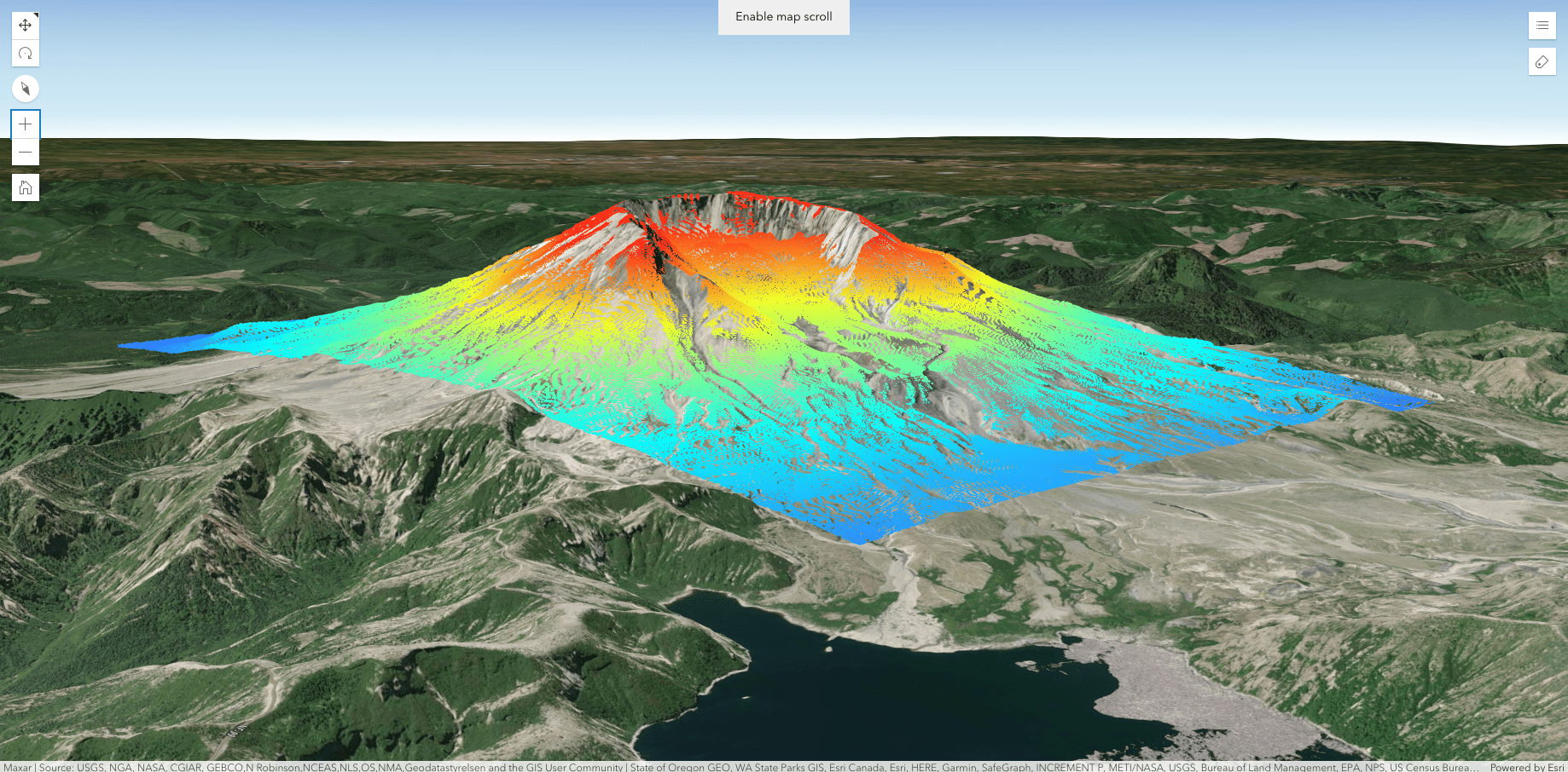
In this Basic app, a web scene of the elevation of Mt. St. Helens after its 1980 eruption is displayed. For the purpose of this app, there are minimal tools needed for data exploration so only the legend, slides, and the disable scroll option were added.
- The legend can help to decipher the symbols that show different elevation in the scene.
- The slides can be used to quickly navigate to areas of interest in the scene.
- The disable scroll tool can be helpful if this app were to be embedded in another site.
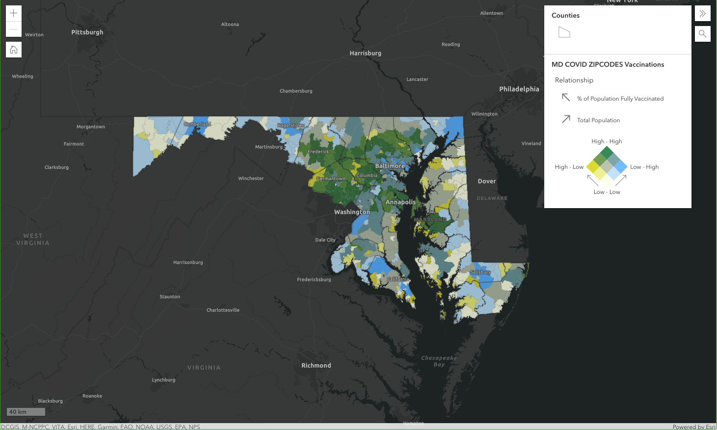
In this Basic app, a web map of Covid-19 trends in Maryland is displayed. This app also includes the legend tool, along with the search tool and the scalebar. To make sure that the app stays focused on Maryland, the navigation boundary has also been configured.
- The search tool can find locations on the map based on specified search parameters.
- The scalebar provides a visual indicator of the distances between features on the map.
- The navigation boundary is used to set an extent that cannot be panned or zoomed out of.


Article Discussion: