As we announced recently, Esri is adding 3D Basemaps to its existing collection of online, ready-to-use basemaps. Learn how ArcGIS Living Atlas Community Maps Program participating organizations are helping improve 3D features within the maps and how your organization can help further enhance these maps by contributing to the program. This new content offering will benefit the ArcGIS community by providing an easy entry-point into 3D visualization and analysis.
The 3D Basemaps include a few OpenStreetMap 3D scene layers, including buildings, trees, and labels. These scene layers are built from the OpenStreetMap Daylight Distribution, which includes buildings data from Esri Community Maps contributors.
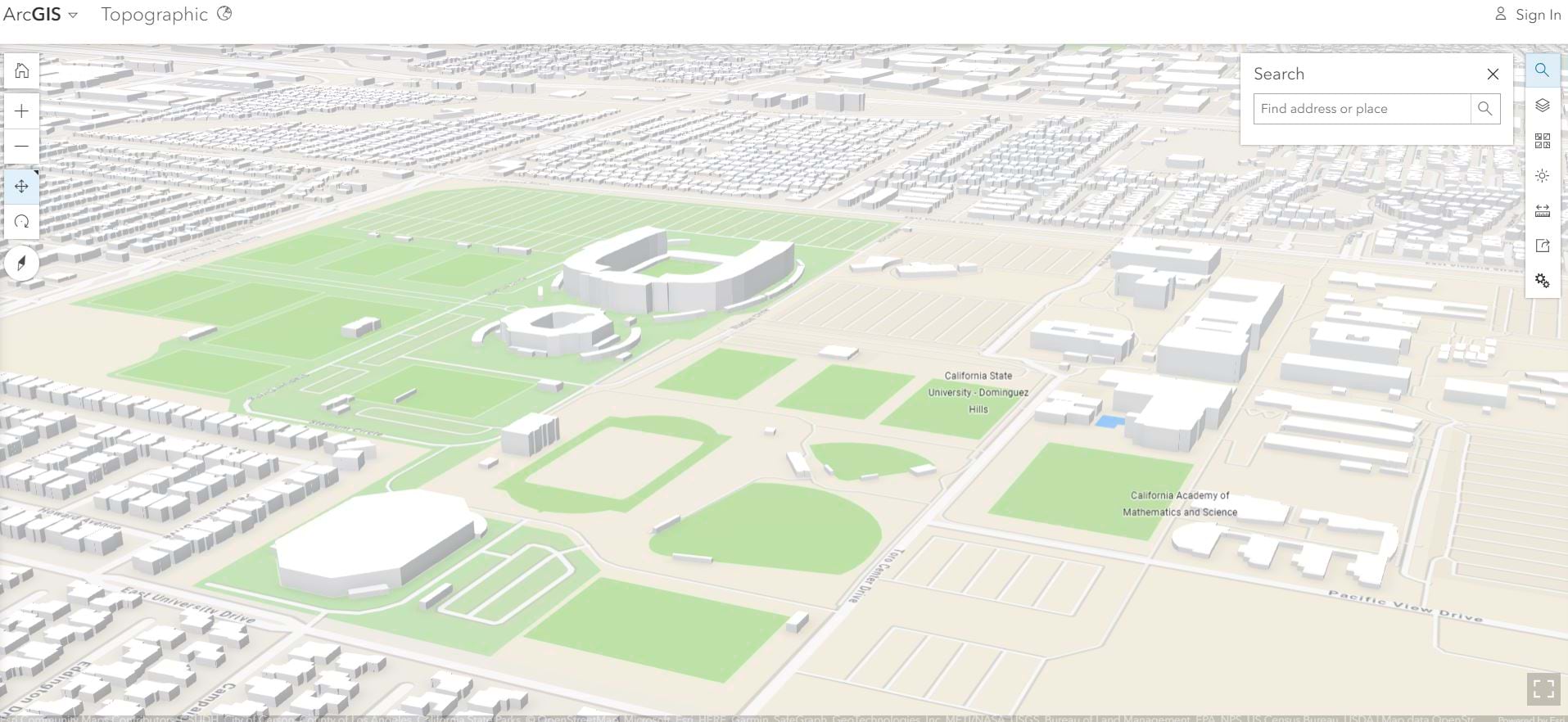
The topographic scene below, is designed to be used as a basemap in 3D, and based on the Daylight map distribution of OSM data and is hosted by Esri. The cartographic presentation is an Esri Topographic style. This 3D basemap is in beta.
Click image below to explore
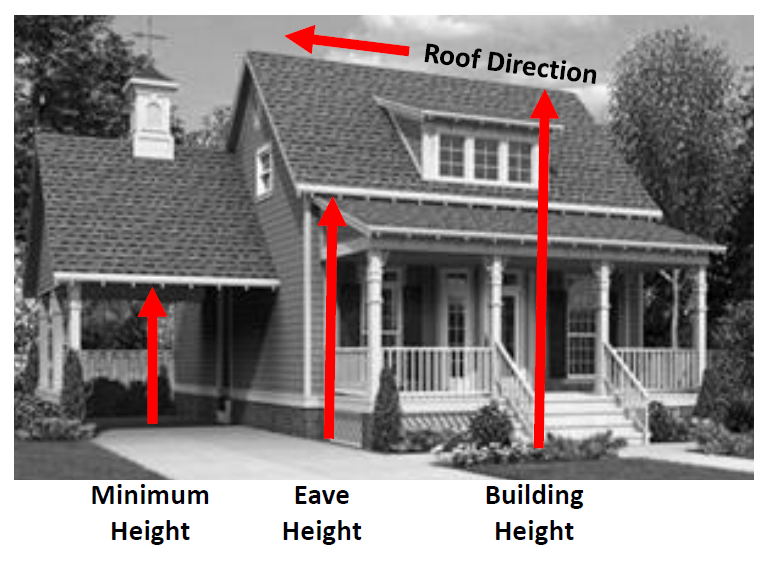
To help support this effort, the Community Maps Team has begun working with a select group of our contributing organizations. These organizations are managing enhanced attributes for their buildings, such as levels, height, eave height, and the roof form, which makes them great candidates for testing service deliveries and other tools necessary for sharing their buildings with the Community Maps Program.
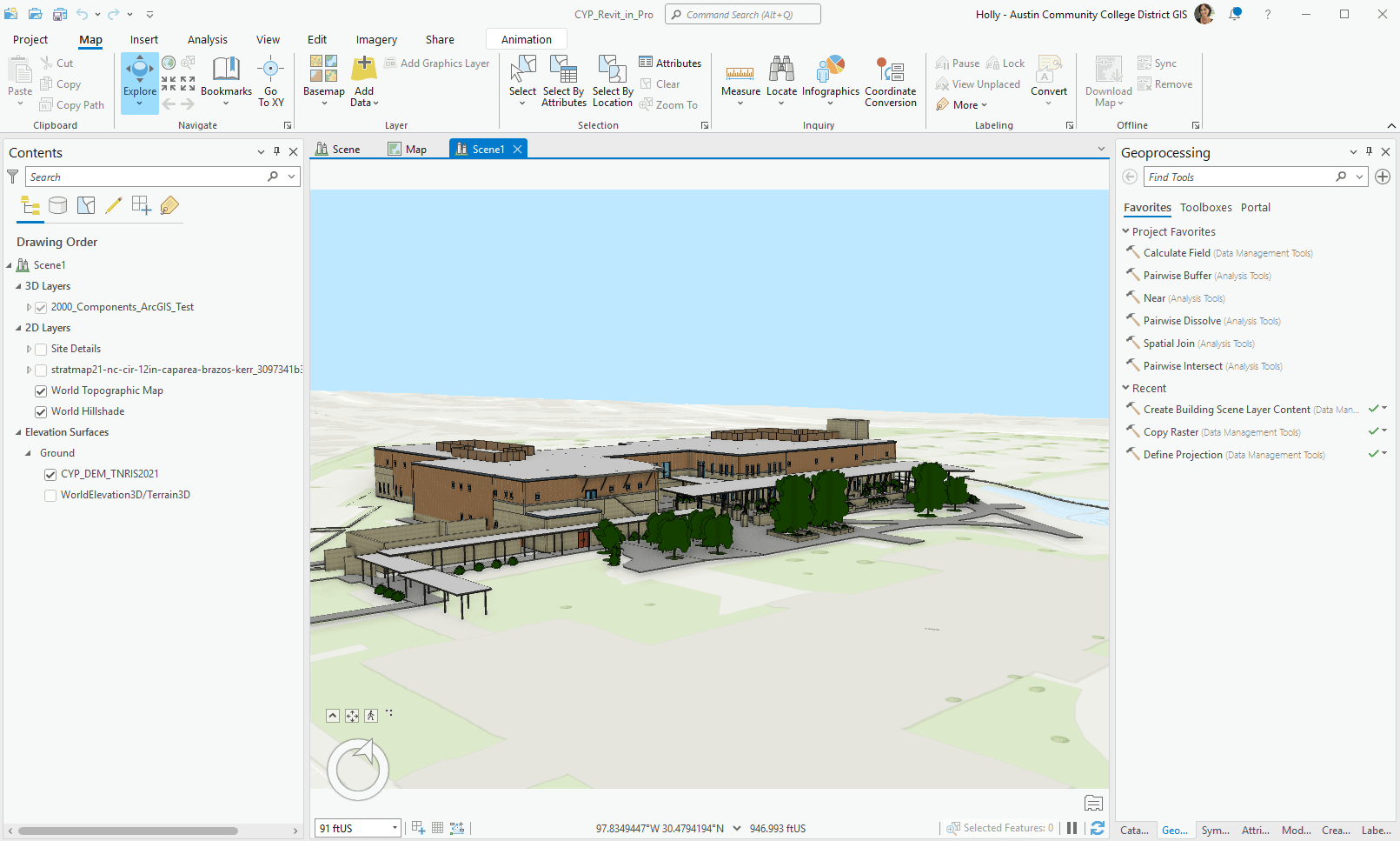
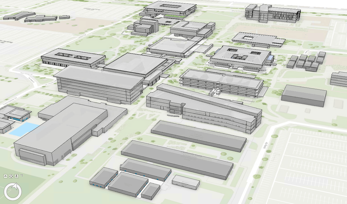
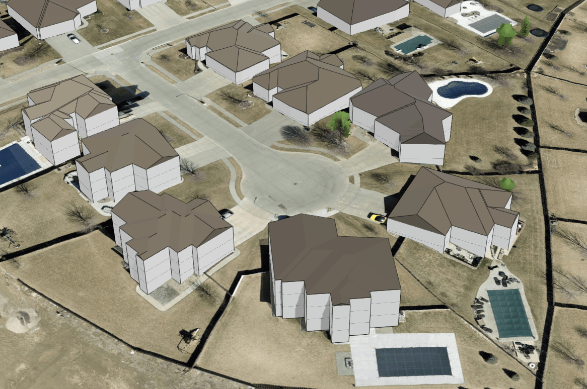
Austin Community College has been contributing to the Community Maps Program since 2013. The Facilities Information Systems team are in the beginning phase of building and using 3D in GIS for managing multiple campuses throughout the greater Austin region. They have about seventy-five buildings in their campus system and are experimenting with various 3D options, including contributing to the Community Maps Program.

I submitted building footprints by feature service subscription, which was a straightforward process. The data represents a subset of our building footprint layer with height, roof type, and roof color information added.
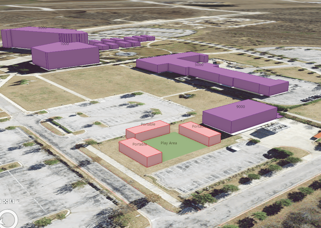
Austin Community College is already using 3D scenes to help decision-makers visualize projects. They recently created simple 3D scenes to explore how existing buildings and new portables fit into an existing campus.
The University Effectiveness, Planning, and Analytics team at California State University – Dominguez Hills (CSUDH) is maintaining 3D data for layers like buildings, but do not maintain a 3D Basemap. CSUDH is encouraged by Esri’s plans for 3D Basemaps and looking forward to enhancing them by contributing their own 3D building features.

We're hoping that Esri's 3D Basemaps will encourage our campus community to make more use of scenes for visualization of our campus, by simplifying future scene creations.
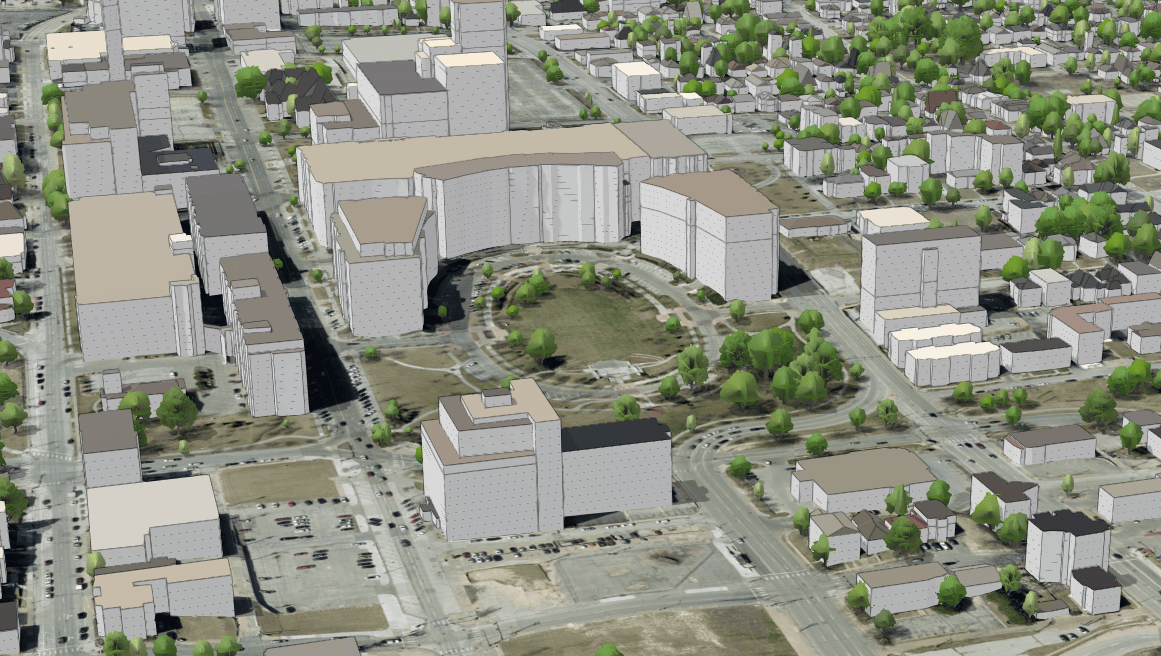
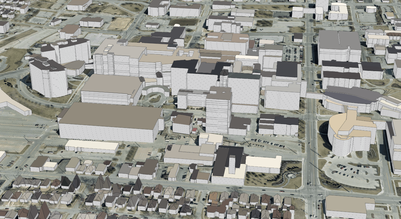
Douglas County, Nebraska, a longtime Esri Community Maps contributor, shared their 3D buildings with Esri to help test a service delivery workflow and found the process to be easy and intuitive. The County has also begun experimenting with the creation of a local 3D Basemap.
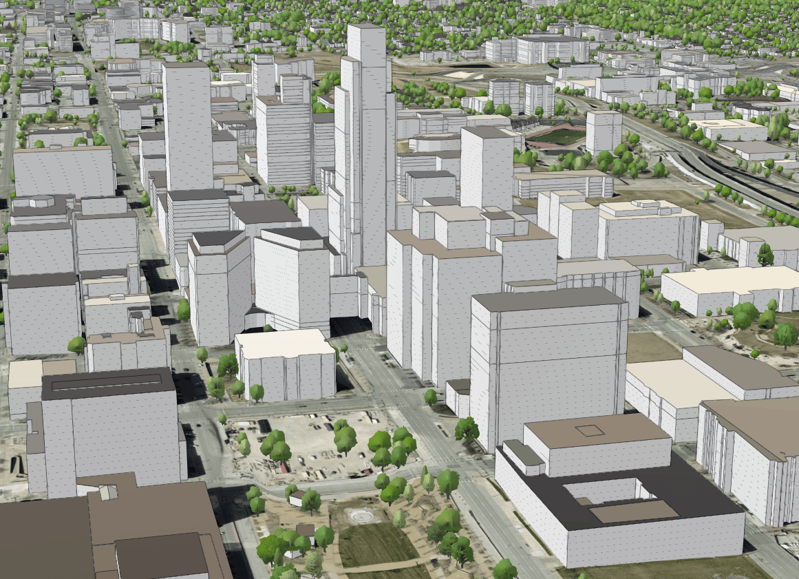

Right now, people are just having fun exploring our county buildings as 3D objects, but our planning department is starting to experiment with 'line of sight', shadowing, and using the slice tool to change the landscape. An Esri 3D Basemap will really help our planning department visualize our urban core. It's also the first step towards potentially using ArcGIS Urban. 3D Basemaps will also be used for current and future planning projects.
Click the frames below to explore select areas of Douglas County, Nebraska.
-
...

Esri’s new 3D Basemaps will be impactful to the ArcGIS community by providing a rich and immersive context for any area of interest and for any layers that are added to a scene.
These basemaps will be useful when trying to visually understand and analyze the 3D landscape of an environment. For example, the 3D Basemaps will provide useful context for urban planning, enabling planners to place 3D models of planned development in the context of a 3D scene to better visualize how it will impact the environment, while considering such things like sight lines and shadows.

The 3D Basemaps will enable quick and easy visualization of an existing environment in many ArcGIS apps that support 3D visualization, such as Scene Viewer and ArcGIS Pro, which can then be used to add other 3D layers and objects to perform analysis and enhance collaboration.
A big thanks to the organizations that have helped with testing workflows and contributing their 3D data to enrich the content in the 3D Basemaps. These organizations understand the value of managing 3D attributes for their data and sharing their data and local geographic knowledge through Esri’s Community Maps Program.
There will be additional announcements and information surrounding 3D Basemaps during this year’s Esri User Conference July 10-14. You can learn more by attending these planned sessions. Add them to your schedule now!
- ArcGIS Solutions: Building 3D Basemaps
- Living Atlas: An Introduction
- Living Atlas: An Introduction to OpenStreetMap Content
If your organization is interested in helping improve basemaps in ArcGIS Online and/or contributing your organization’s 3D data, visit the Community Maps website to learn more. Please email your questions to communitymaps@esri.com.

Article Discussion: