(Note: this article originally published in November 2020 was updated in July 2021 as the OpenStreetMap Daylight map that was previously in beta release is now part of the OpenStreetMap Vector Basemap, as described in this What’s New in July 2021 article. A few links have been updated or removed below.)
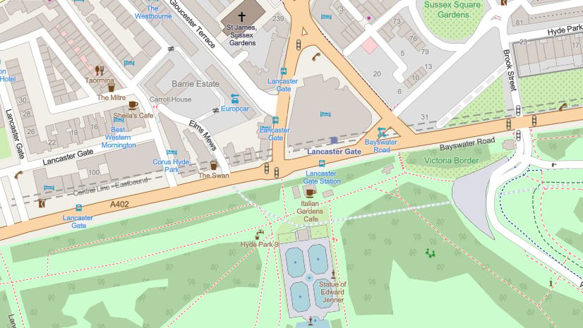
For the past few years, Esri has built and hosted an OpenStreetMap Vector Basemap that is available to ArcGIS users and developers. This vector basemap is built by Esri using OpenStreetMap (OSM) data and is updated every few weeks with the latest OSM data edits. Earlier this year, Facebook announced a new Daylight Map Distribution of OpenStreetMap data. This map distribution is intended to leverage the great work of the OSM community and enhance that with additional data validation to detect and remove map vandalism and geometry errors.
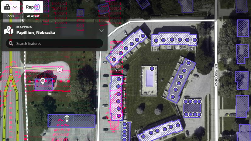
Since then, the Daylight Map Distribution has evolved to include other enhancements. Facebook has released four more updates to Daylight, building on the initial release with expanded data types and quality checks and establishing a regular monthly release cadence. In addition, Microsoft has announced the availability of the MS Building Footprint dataset as a companion to Daylight, greatly expanding the coverage of buildings in the map beyond those contributed by the OSM community (such as below).

Esri has been closely tracking progress on the Daylight Map Distribution and sees considerable value in it for the ArcGIS user and developer communities. Daylight builds on the strength of OpenStreetMap as an open editable map of the world maintained by a dedicated community of mappers with additional data validation and additional open data to help improve data quality and consistency. We feel these enhancements will add value and confidence for many organizations looking to use OpenStreetMap data in their internal and public-facing maps.
Introducing Daylight
Esri is pleased to announce the OpenStreetMap Daylight map in ArcGIS, now available in beta release. The OSM Daylight map will be built and hosted by Esri using the latest available version of the Daylight Map Distribution. The initial beta release was built using the v0.5 update of Daylight, released at the end of October. We plan to release monthly updates of the OSM Daylight map, and have already started work on the next update.
Finding Daylight
The OpenStreetMap Daylight map (as with our OpenStreetMap Vector Basemap) will be available in multiple maps styles to support different use cases. During the beta release, you will be able to find all of the available styles in this OpenStreetMap Vector Basemap group in ArcGIS Online. We will update the group as new map styles become available over the coming weeks. During the beta release, we will also be making other enhancements to the OSM Daylight map, such as addressing known issues and adding more useful open data from the ArcGIS user community.
We encourage you to explore the new OSM Daylight map during the beta release and share your feedback. You can add questions or comments below or in the comments section of the default OpenStreetMap Daylight web map item.
If you would like to contribute to OpenStreetMap and the new OSM Daylight map, we’d encourage you to explore these additional articles and join the community!
- Esri Community Maps Data Sharing: enable sharing of your authoritative GIS data with other mapping platforms, including OpenStreetMap
- ArcGIS Data Support in OSM Editors: share your buildings, addresses, roads, and other data layers to be used for editing OpenStreetMap

Article Discussion: