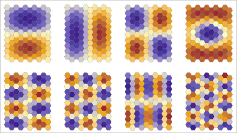
Spatial data has a fundamental characteristic that traditional statistical methods often ignore: nearby observations tend to have similar values. This spatial clustering (autocorrelation) is everywhere—from disease transmission patterns and crime hotspots to housing prices and environmental measurements. When we apply standard regression models to spatial data in the presence of spatial clustering, our models can become overconfident lead to incorrect inference. Spatial regression techniques can be used to ensure that the regression model’s performance doesn’t depend on where the model is predicting.

ArcGIS Pro 3.5 introduces the Spatial Autoregression tool, bringing modern spatial econometric methods directly into your spatial analysis workflow. This powerful new tool explicitly accounts for spatial dependence, providing three sophisticated regression models: the Spatial Lag Model (SLM), Spatial Error Model (SEM), and Spatial Autoregressive Combined Model (SAC). Best of all, the tool intelligently selects the most appropriate model for your data using established statistical diagnostics.
Solving Real-World Spatial Problems
The Spatial Autoregression tool addresses spatial dependence in two critical ways, each serving distinct analytical needs.
Analyzing Spatial Spillover Effects
The spatial lag model excels at measuring how changes in one location influence neighboring areas—what economists call spatial spillover effects. Public health researchers can now properly model disease transmission while accounting for spatial spread patterns. Criminologists can analyze how crime clusters and spreads geographically, incorporating neighborhood effects that traditional models miss. Urban planners can assess how policy interventions in one area ripple through adjacent communities.
Consider analyzing the spread of an infectious disease outbreak. Traditional regression might show how demographic factors influence infection rates, but the spatial lag model reveals the full picture: how infection rates in one area directly influence rates in neighboring communities through transmission networks. This spatial spillover information is crucial for targeting intervention strategies and understanding epidemic dynamics.
Controlling for Spatial Clustering
The spatial error model tackles a different but equally important problem: removing systematic spatial clustering from your regression estimates. When your residuals show clustering patterns—systematic over-prediction in some areas and under-prediction in others—your model’s ability to predict depends upon where those predictions occur. This is something to avoid!
Housing price analysis exemplifies this challenge. Properties in certain neighborhoods might consistently be over-valued or under-valued by traditional models due to unmeasured spatial factors like school district boundaries, environmental amenities, or infrastructure quality. The spatial error model filters out these spatial patterns, providing unbiased coefficient estimates and ensuring your model performs consistently across different locations.
Intelligent Model Selection
Choosing between spatial regression models has traditionally required extensive statistical expertise. The Spatial Autoregression tool eliminates this barrier through automated model selection using Lagrange Multiplier tests, following the established methodology from Anselin and Rey’s (2014) spatial econometrics framework.

The tool systematically tests your data, first checking whether spatial models are necessary at all. If spatial dependence is detected, it determines whether you need the spatial lag model (for spillover effects), the spatial error model (for spatially clustered residuals), or the combined model (for both issues simultaneously). This data-driven approach ensures you get the most appropriate model without requiring deep knowledge of spatial econometric theory.
Rich Diagnostics and Outputs
The tool provides comprehensive diagnostics to help you understand and validate your results. The Moran’s scatter plot visualizes residual patterns, showing whether spatial autocorrelation has been successfully removed. When residuals are evenly distributed across the plot’s four quadrants, it indicates your spatial model has effectively addressed spatial dependence.

For spatial lag models, the tool reports impact measures that decompose effects into direct impacts (changes at the location itself) and indirect impacts (spillover effects on neighboring locations). This distinction is crucial for policy analysis and resource planning.

The tool also provides spatial pseudo R-squared values specifically designed for spatial lag models, ensuring you can properly evaluate model fit without the inflated statistics that occur when spatial dependence is ignored.

Getting Started
The Spatial Autoregression tool is available now in ArcGIS Pro 3.5, bringing sophisticated spatial regression capabilities to your desktop GIS environment. Whether you’re analyzing public health patterns, conducting economic research, or studying environmental phenomena, this tool provides the robust statistical foundation needed for reliable spatial analysis.
Ready to account for spatial dependence in your regression models? Explore the Spatial Autoregression tool documentation and start building more reliable spatial models today.
Resources:


Article Discussion: