We all can sense it: a release is coming, and as part of the ArcGIS 2021 Q4 release, ArcGIS Pro and ArcGIS Enterprise are delivering on some new GIS capabilities, performance updates, and productivity improvements that will have every Esri user saying, “YES!”
To tease out what’s on the horizon with this upcoming release, Michelle and I would like to share some of the items we most look forward to in ArcGIS Pro and ArcGIS Enterprise. Let’s dive into our favorite new features and capabilities!
Knowledge Graphs
You can soon use ArcGIS Pro with ArcGIS Enterprise 10.9.1 to create a knowledge graph in the Enterprise portal that uses a new ArcGIS Data Store graph store. Knowledge graphs model real-world systems in a non-spatial manner, using entities to represent real-world objects and relationships to establish connections between them. A knowledge graph can reference documents to support the facts and relationships it establishes. You use ArcGIS Pro to load data into a knowledge graph and edit its contents.
You can visualize and analyze the knowledge graph with link charts, and use the link analysis capabilities provided by ArcGIS Knowledge to find the shortest paths between entities, or establish which entities are the most central or influential to the graph.
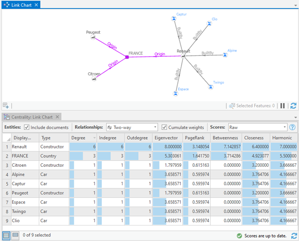
You can add a knowledge graph to a map or scene alongside traditional GIS data, and/or use geoprocessing tools to spatially analyze knowledge graph feature layers. For example, you can identify an entity’s proximity to other spatial features.
To create and interact with a knowledge graph, you must be signed in to the Enterprise portal and have an ArcGIS Knowledge user type extension.
Dynamic Feature Clustering
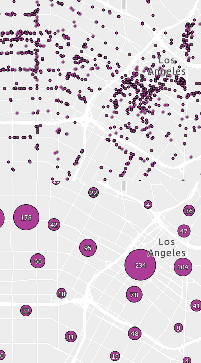
Use feature clustering to dynamically aggregate point features with changes to scale and extent. You can then control the amount of clustering by setting a scale threshold and the distance between clusters. Clusters are represented with a single symbol, unique values, proportional symbols, or unclassed colors symbology based on a summary statistic field. Clusters include a categorical or numeric text symbol representing the summary statistic field or the result of an expression. You can share a clustered feature layer as a web feature layer or map image layer to ArcGIS Online or ArcGIS Enterprise, and consume the web layer in ArcGIS Pro.
Animated Symbols
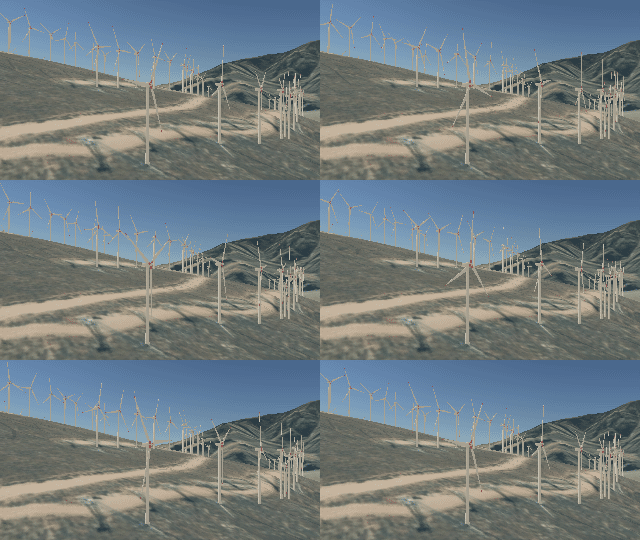
Animated marker symbol layers can be added to symbols to add movement to otherwise static data in a map or scene. The speed, direction, and synchronicity of the animation are controlled by properties of the marker symbol layer or by attribute-driven symbology. You can make your own animated symbols from animated GIF (.gif) or glTF (.glTF) files, or start with animated symbols in the system styles and modify them as necessary. Two new system styles containing animated symbols have been added to the application.
PDF To TIFF Geoprocessing Tool
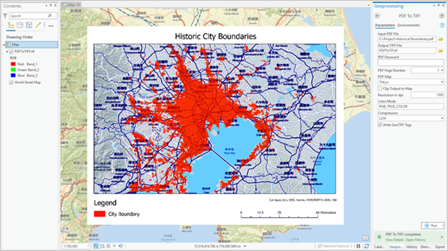
The PDF To TIFF geoprocessing tool exports a PDF file to Tagged Image File Format (TIFF). If the input PDF file includes georeferencing information, the output TIFF file can be a GeoTIFF. A GeoTIFF file can be viewed in ArcGIS Pro and used to digitize features. The tool supports both GeoPDF and ISO standards of georeferenced PDF documents.
Presence-only Prediction
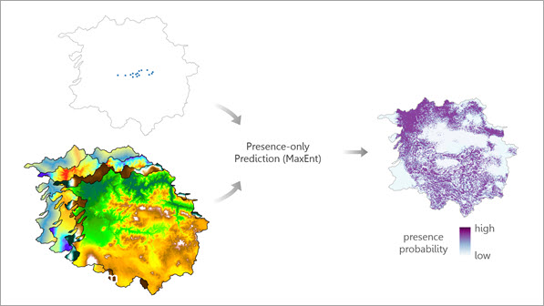
The Presence-only Prediction (MaxEnt) geoprocessing tool estimates the presence of a phenomenon in a study area using previously known presence locations and explanatory factors. The tool can be applied to problems where only presence is known, and absence is not. For example, a wildlife ecologist has collected field data of locations of a plant species, and wants to predict the locations of the plant in a larger study area. Using the known locations of the plant and underlying factors such as precipitation and solar radiation, the ecologist can create a map of locations where the plant species is most likely to be found.
Publish from cloud data warehouses
One of the most valuable updates to ArcGIS Enterprise 10.9.1 is the ability to publish from cloud data warehouses, including Google BigQuery, Snowflake, and Amazon Web Services (AWS) Redshift. This feature will leverage ArcGIS Pro 2.9’s ability to create query layers and publish corresponding map services to ArcGIS Enterprise.
New Map Viewer
The new Map Viewer, formerly known as Map Viewer Beta, was a separate beta install in previous releases of ArcGIS Enterprise. Starting at 10.9, the Map Viewer will now come installed with ArcGIS Enterprise as part of the main Portal for ArcGIS setup. Use the Map Viewer to take advantage of the intuitive look and layout, new configuration options for pop-ups, and additional options for symbology.

Enhanced support for Google Cloud features
With the 10.9.1 ArcGIS Enterprise release, you’ll get support for Google Cloud SQL for PostgreSQL and Google Cloud SQL for SQL Server. Plus, support for Google cloud storage for caching and image service workflows and support for cloud data store items that access locations in Google Cloud will also be included.
We recommend you start planning for your upgrade now. ArcGIS 2021 Q4 releases will begin to appear in the next coming weeks and will include ArcGIS Pro 2.9, ArcGIS Enterprise 10.9.1, and there will also be a maintenance release of ArcGIS Desktop (ArcMap) 10.8.2 as part of our continued support. ArcGIS Desktop 10.8.2 will be a maintenance release only. It will not contain new functionality but will have updates to several third-party components including Python 2.7, and it will be installable on the same machine as ArcGIS Enterprise 10.9.1.





Article Discussion: