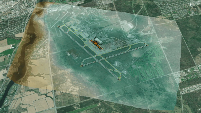
ArcGIS Pro brings together CAD, BIM, and GIS, enabling spatial analysis, visualization, and collaboration with project stakeholders. You can direct-read and georeference designs authored in Autodesk® Revit® (.rvt), Industry Foundation Classes (.ifc), Autodesk AutoCAD®, Civil 3D® (.dwg), and more. Access collections of CAD and BIM files from local project folders or connect to cloud environments like Autodesk Construction Cloud® using BIM Cloud Connection. Represent CAD and BIM datasets as feature classes. Federate them with other project information for making comprehensive insights across the ArcGIS system.
The November 2024 release of ArcGIS Pro, version 3.4, introduces updates that boost workflows for GIS teams in Architecture, Engineering, and Construction (AEC), transportation, and other industries. Check out the latest features below, including direct publishing of CAD datasets and updated support for BIM datasets, such as those authored in Revit 2025.
Release highlights
New features for CAD and BIM integrations in ArcGIS Pro 3.4 ease the pain points for some of your most common tasks. Directly share CAD layers to web maps and scenes in ArcGIS Online and ArcGIS Enterprise. Additionally, projected coordinate system information from Revit models is now automatically detected, saving you time in georeferencing.
You can also take advantage of broadened and updated integrations for Revit (through Revit 2025) and IFC elements. This includes direct-read of built components such as steel reinforcement.
Access the release notes to find detailed documentation on all new features in ArcGIS Pro, as well as other product resources to support your work.
Direct publishing of CAD to the web
ArcGIS Pro 3.4 allows direct publishing of CAD to web maps and web scenes. Now, you can add features from CAD directly to a map or scene and then share the layers. Adding CAD content as feature classes to a geodatabase prior to publishing is no longer required.
Sharing CAD content this way better preserves symbology relative to the original drawing and reduces the number of required steps in publishing workflows. This functionality adds new avenues to the sharing process, makes CAD data more readily available in a web mapping context, and further boosts collaboration.
Check out the video below, where the pre-publishing step of adding CAD content to a geodatabase is now optional.
Read-in of projected coordinate system information from Revit
ArcGIS Pro 3.4 streamlines georeferencing tasks for BIM datasets authored in Revit, with support for file formats from Revit 2020-2025. For Revit models assigned a standard coordinate system, such as those backed by an EPSG code, georeferencing tasks are improved. Coordinate system information stored in Revit files is automatically detected and carried forward when feature classes from Revit models are added to scenes.
GIS teams no longer have to create auxiliary files (.prj) for these Revit models or play detective as they try to decipher coordinate system information themselves. Rather, geospatial information stored in the Revit file is leveraged so that features display with the coordinate system intact.
By integrating upstream location details from Revit models into the workflow, you can stay focused on analysis and visualization efforts without getting bogged down in georeferencing BIM datasets.
Direct-read of reinforcement from Revit and IFC
Built components modeled in Revit and expressible in the IFC standard increasingly encompass a greater portion of the built environment. Likewise, this release of ArcGIS Pro brings broader direct-read support for BIM elements from Autodesk Revit and buildingSMART International’s open exchange BIM format.
In ArcGIS Pro 3.4, direct-read support now includes reinforcement data from Revit and IFC files. You can create scenes that represent detailed reinforcement geometry and attributes along with surrounding structural members. Including reinforcement in scenes brings new opportunities for supporting activities such as asset tracking and condition assessments. It also tightens the integration between BIM and GIS technologies by allowing for a more holistic understanding of building structures and their context.
Esri continues to innovate and redefine the possibilities of incorporating project information into spatial analysis and visualization workflows. Stay tuned for more developments on CAD and BIM integrations in ArcGIS Pro.
Ask the ArcGIS experts
Engage the ArcGIS Pro CAD and BIM product team today to make these integrations even stronger. Post questions and contribute to discussions on the Esri Community. Share your requests for new capabilities and enhancements in future releases in the product ideas space.
Attribution: Revit model, Brownsville, PA

Hi,
Looks very easy to integrate the CAD-models and drawings.
Great you use IFC also for the 3D-Model, so everybody can use and join when working with 3D models.
For the 2D drawing I only see ‘DWG’. Is it also possible to use MicroStation files (DGN)?
Hi Anne,
Thanks for sharing your insights. ArcGIS Pro also supports direct-read of DGN files.
Hi Michael, thank you for the continuing updates to CAD/BIM/GIS integrations. I thought it was a bit odd to show video example of creating file geodatabase when publishing CAD to WebScene when the new workflow avoids it. Also I believe Pro can read Revit coordinate for a while now.
Hi Bartosz,
Thanks for the kind words and for the attention to detail on the feature highlights. Additional context is below, and please don’t hesitate to reach out if I can be of further service.
– For publishing of CAD: The video on CAD publishing indeed includes the (now optional) step of calling the CAD to Geodatabase geoprocessing tool. As context, we’re currently working to make this functionality more robust. A video is planned that will highlight the further enhanced functionality and does NOT include that optional step.
– For read-in of projected coordinate systems for Revit models: Although direct-read of Revit models has been in place for several versions, this particular functionality is indeed new to ArcGIS Pro 3.4.