
A recent blog article described how attachments are an integral part of working with data in ArcGIS. For all the information they provide, there may be additional information you need to add or access. For example, most image attachments have metadata included within the image. Date taken, latitude, longitude, and orientation are examples that might be available. This additional information can add to the analysis of an associated feature.
You can view the following video and read this blog article for details about the recent updates to the existing Upgrade and Downgrade Attachments geoprocessing tools.
Watch this video created in ArcGIS Pro 3.7, or read on for more details.
Tool history
The Upgrade and Downgrade Attachments geoprocessing tools became available in ArcGIS Pro 2.7. Initially, the tools allowed you to upgrade attachments for use with apps like ArcGIS Survey123.
The original Upgrade Attachments tool added two fields to the associated attachment table: KEYWORDS and EXIFINFO. Shared as a web layer (feature service), the attach table and new fields were no longer directly accessible. The fields had limited use in ArcGIS Pro and upgraded the minimum client status to ArcGIS Pro 2.6. This means an upgraded attachment dataset attach table is inaccessible in earlier versions. Earlier versions could not delete features or records. These limitations often prevented organizations from upgrading attachments.
The Downgrade Attachments tool removes the KEYWORDS and EXIFINFO columns, resetting the minimum client version from 2.6 back to 1.0. Resetting the minimum client allowed earlier versions to again access the attachment table and delete features or records.
Changes in ArcGIS Pro 3.7
An organization recently submitted a request for additional metadata capabilities for attachments to support future 508 compliancy needs. Esri Community users have noted a need for additional metadata to enhance their data workflows and analysis.
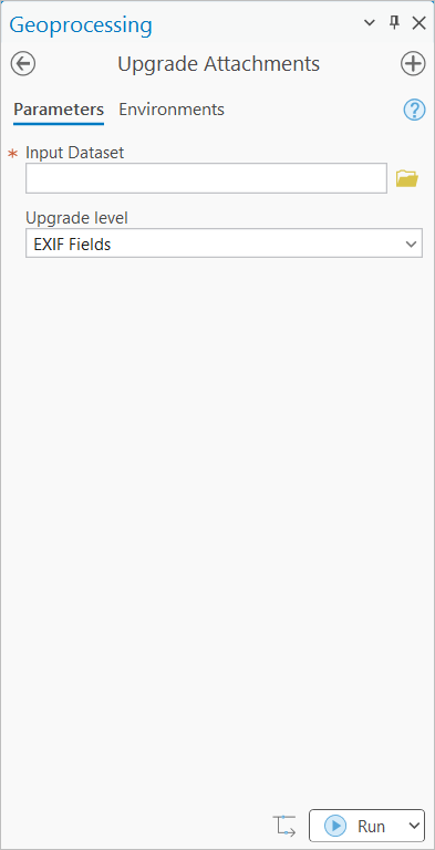
Tool Updates
This blog article will discuss these new enhancements and updates to the Upgrade and Downgrade Attachments tools.
Upgrade Attachments
Originally designed to work with shared web layers, the KEYWORDS and EXIFINFO columns in the attachment table had no functionality directly in previous versions of ArcGIS Pro. With the ArcGIS Pro 3.7 release, the EXIFINFO column populates with metadata information for applicable media files. Use the KEYWORDS column to search for keywords entered manually. Use Python scripting to update keywords programmatically.
Four additional metadata fields are available but not required: ATT_TITLE, ATT_ALT_TEXT, ATT_CAPTION, and ATT_CREDIT. To add these fields, change the Upgrade level drop-down menu to Exif and Alt Text Fields.
Upgrading attachments changes the minimum version of the attachment table to ArcGIS Pro 2.6 or 3.7 depending on the option of fields chosen for the upgrade. This change impacts how older versions of ArcGIS Pro interact with the dataset and attachment table.
Learn more about upgrading attachments
|
Upgrade level |
Min. Client version |
Attachment fields |
|
Base |
1.0 |
Default fields |
|
Exif Fields |
2.6 |
Default fields + KEYWORDS + EXIFINFO |
|
Exif and Alt Text Fields |
3.7 |
Default fields + KEYWORDS + EXIFINFO + ATT_TITLE, ALT_TEXT, ATT_CAPTION, and ATT_CREDIT. |
Downgrade Attachments
With the Downgrade Attachments tool, you can now choose a downgrade level option to remove the four alt-text fields or all upgraded fields. This, too, changes the minimum client version for the attachment table from 3.7 to 2.6, or to 1.0 depending on the downgrade level option.
Learn more about downgrading attachments
Adding metadata to the new fields
When upgrading attachments in ArcGIS Pro 3.7, we noted that you can upgrade to two or six metadata fields.
Watch this video created in ArcGIS Pro 3.7 about adding attachments with metadata.
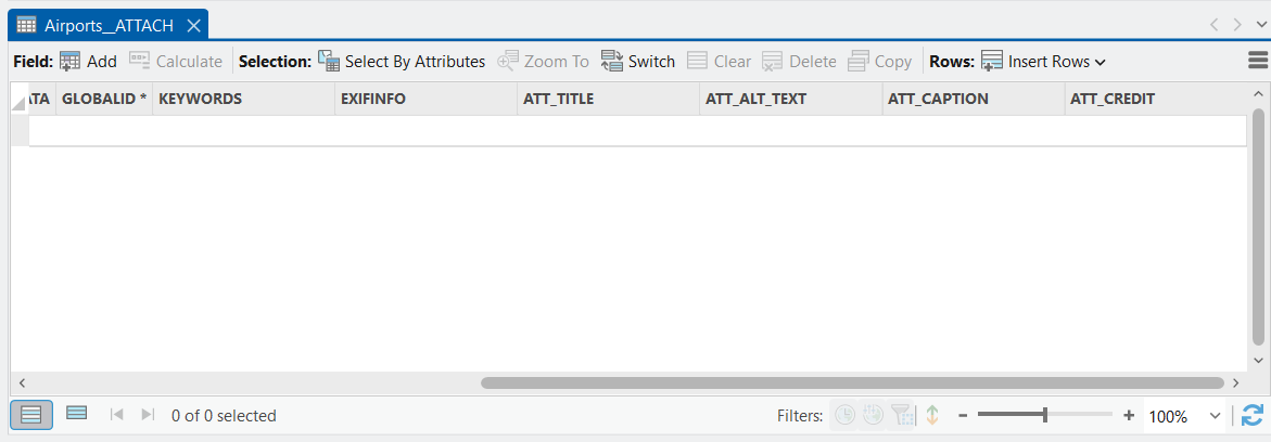
Once upgraded, the newly added metadata fields to the attachment table have no cell values. This is true, even for datasets with existing attachments.
Add metadata to the new attachment fields manually within an editing session or using the Add Attachments geoprocessing tool.
Populate metadata fields while editing
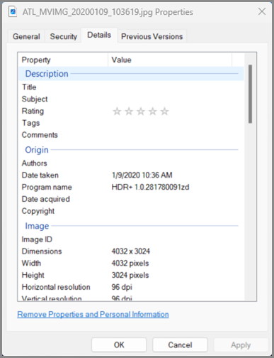
Currently, attachment metadata fields only populate when you add one or more attachments. The most common field populated will be the EXIFINFO column. This column, especially with image attachments, populates with information about the photo, stored in a JSON format. Information such as date, time, and camera information are common. Images may also contain latitude and longitude, orientation, and altitude. Other media files may not contain any EXIF information, depending on the media format.
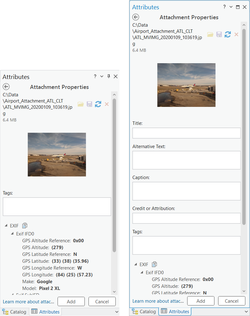
Loading this image with the properties shown (right), will only load the available EXIF information. Media types, such as Word documents and videos, along with other types will show null values.
To add an upgraded attachment during an edit session, do the following:

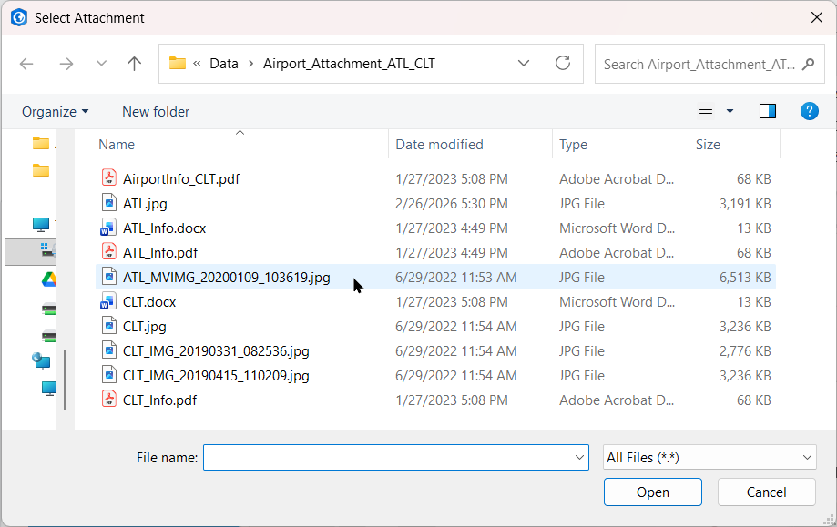
4. In the Select Attachment window, choose an image to load as an attachment. Click Open.
The Attachment Properties window display will depend on the upgrade level of the attachments. Using two examples of the Attachment Properties window, the first one on the right illustrates the EXIF Fields option. It displays an empty Tags window and EXIF information only. The Attachment Properties window on the far right shows the Exif and Alt Text Fields options. This displays all six metadata field entries including populated EXIF information.
Clicking the Add button commits this information to the new metadata fields in the upgraded attachment table.
If no metadata is available to pre-populate the entries, consider updating the information manually before adding the attachment.
5. Click Add to update the attachment table.
Populate metadata fields with media images that have additional metadata information
A similar image below shows additional metadata items edited in the Windows Properties under the Details tab. Text updates occurred for Title, Subject, Comments and Authors. This image with additional updates automatically fills in the Attachment Properties window, in addition to the EXIFINFO values.

An editing session provides an opportunity to see the metadata included when adding individual attachments.
In this example, the upgrade level chosen includes all six fields. Except for EXIF, all the other metadata values in the Attachment Properties window are editable. Make changes before or after adding them to the attachment table.
Bulk loading attachments with Add Attachments
When loading attachments in bulk with the Add Attachments geoprocessing tool, all available metadata loads automatically.
Current attachments and metadata
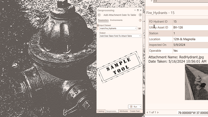
Currently, the updates to the Upgrade Attachments tool will not load metadata from existing attachments. If existing attachments included additional metadata when loaded, the metadata already exists. For example, image attachments will include EXIF data when copied to the geodatabase. However, no tool is currently available to extract the information. For now, consider using Python to access available metadata from loaded attachments. Explore the sample tool code in the blog article: A new sample tool to add attachment date to table .
Moving forward
New metadata fields and updates open new opportunities for working with attachments in the future for ArcGIS Pro. Support for additional 508 compliancy in ArcGIS Pro begins to evolve with additional metadata. Enhanced analysis and workflows result from supported media files.
This and other ideas have come from users. You can leave feedback and additional ideas in the Esri Community.
Summary
Here is a quick recap about the updated Upgrade and Downgrade Attachments tools:
- Not all media files loaded as attachments will have metadata. Images are the most common and may have one or more entries.
- For media that does not contain EXIF information, the value may be null or an empty list indicated by square brackets ([]).
- The Upgrading Attachments tool does not extract metadata from current attachments.
- Consider using Python to extract metadata from current attachments (if available).
- The Upgrading Attachments tool will add two or six metadata columns to the attachment table depending on upgrade level.
- Upgrading attachments changes the minimum version of the attachment table to ArcGIS Pro 2.6 or 3.7 depending on the option of fields chosen for the upgrade. This will limit attachment table accessibility in earlier versions of ArcGIS Pro.
- Use the Downgrade Attachments tool to remove metadata fields and reset minimum client version as needed. Downgrading will remove any existing metadata fields and values.

Commenting is not enabled for this article.