Map graphics are handy doodads for dropping in rando stuff like images, shapes, and text, that you want to be geographically referenced (but you don’t want to deal with creating layers and labels and stuff). Here’s how to make an area-of-interest callout in ArcGIS Pro using a rectangle map graphic and apply a blend mode to take it to the next level of nerdy goodness.
0:00 Absurd overly-familiar greeting.
0:44 How to add a “graphics layer” to your Pro map
1:00 Actually adding a graphic into the graphics layer
2:12 See how graphics are referenced to the map?
2:45 How do we make it look cool?
3:13 Creating a shaded ring-looking graphic thing
3:42 Making a gradient stroke with an offset effect
4:29 Using transparency in a gradient to create a shadowy feel
6:00 Digging into the gradient to get a more realistic shadow
7:14 Adding a symbol layer to create a “double stroke”
8:26 But this map graphic covers up some of my map! Well…
8:55 You can apply blend modes to map graphics! Seriously.
9:28 Soft Light blend mode to make the callout super handsome
10:30 Moving/resizing a map graphic
11:11 Geological fascination tangent
12:16 Do I have to start over if I want a different callout shape?
12:30 No way! Just save the map graphic symbol to a style
13:45 Applying the symbology to a new map graphic via the style
And that’s that my friend! I hope you have fun with map graphics to make your map extra tantalizing and luxurious. It’s so easy. In fact, this video was the first time that I’ve ever actually used a map graphic (thanks for the tip, Aubri!) so you can take that for whatever it’s worth.
Happy Map Graphic-ing! John
Oh, Wait, P.S.
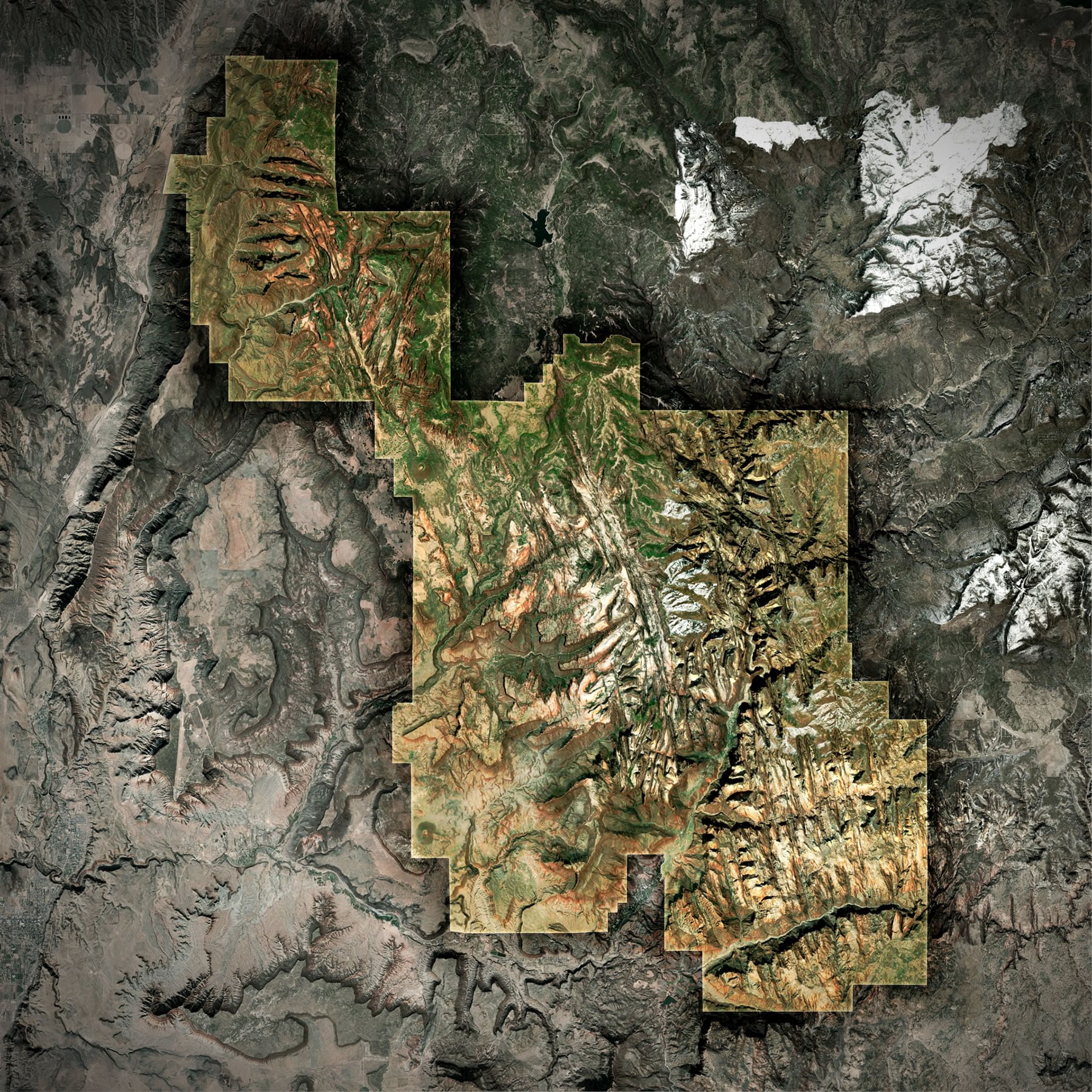
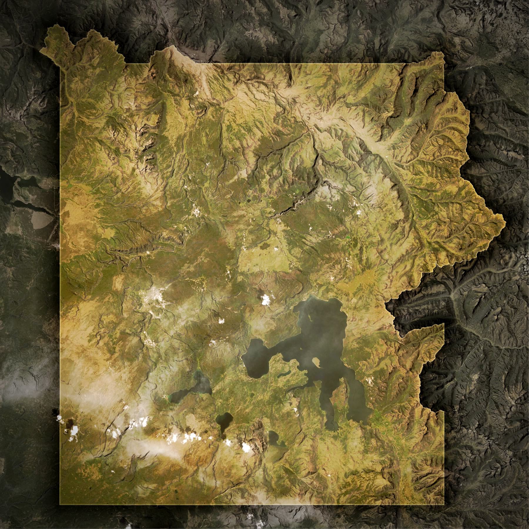
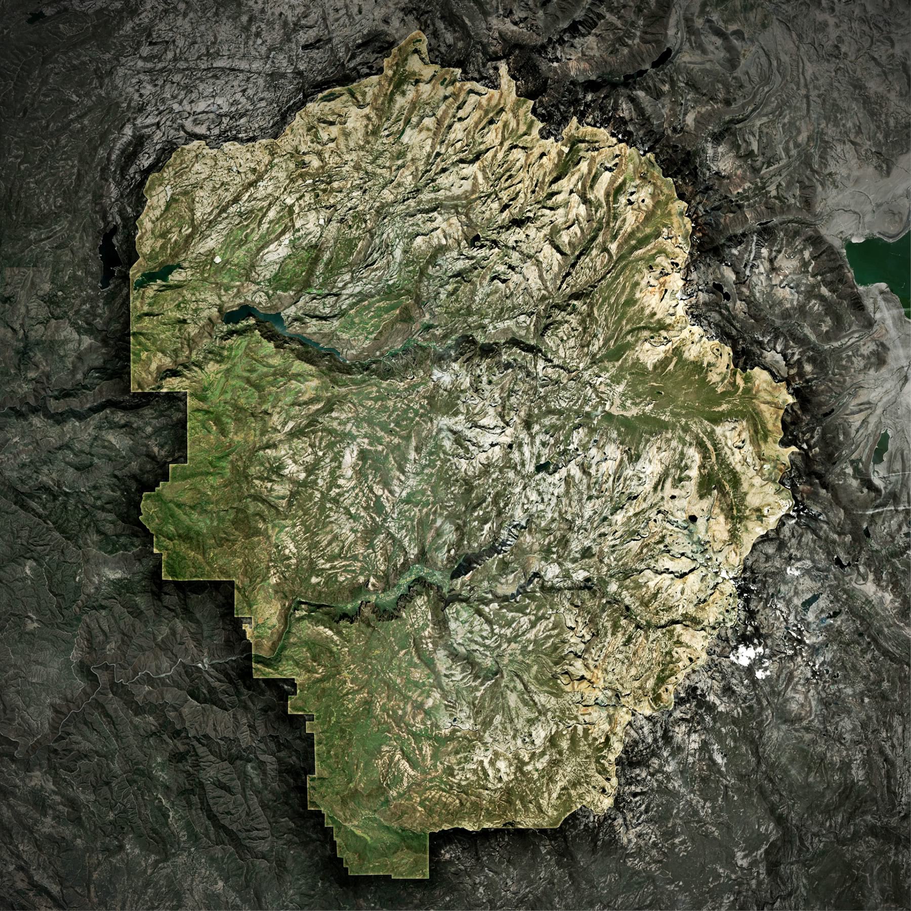
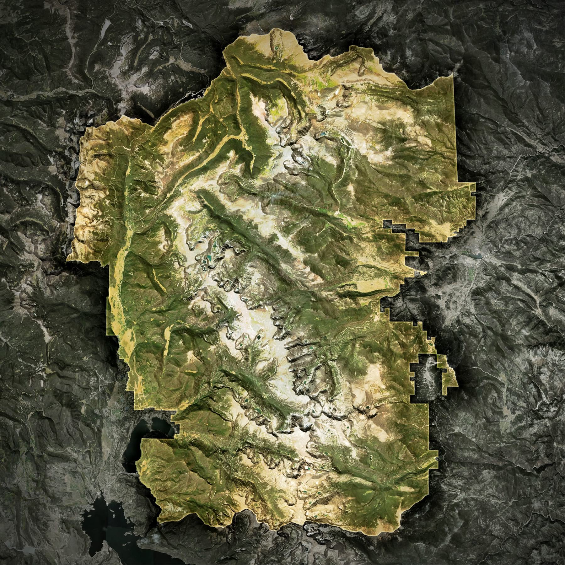
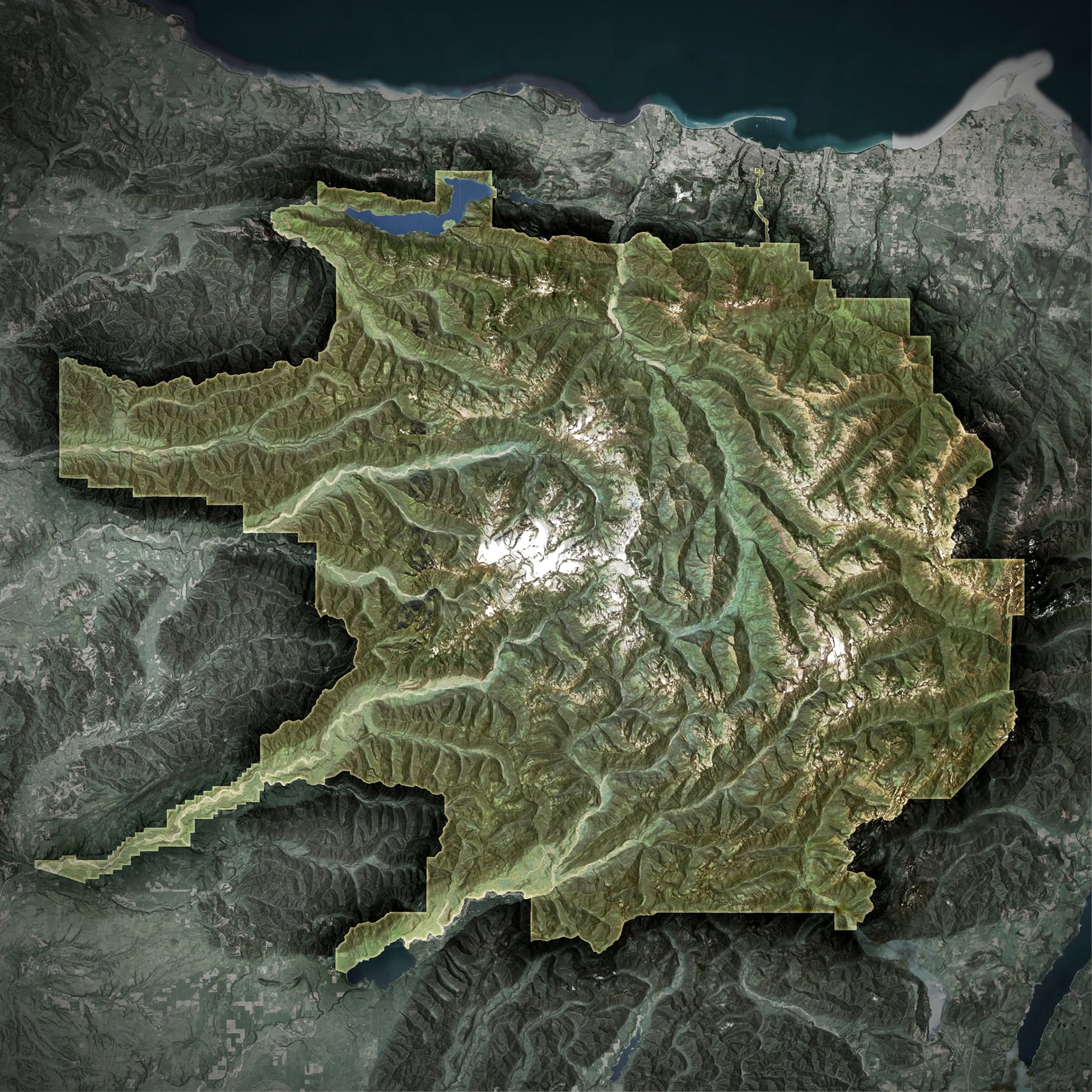
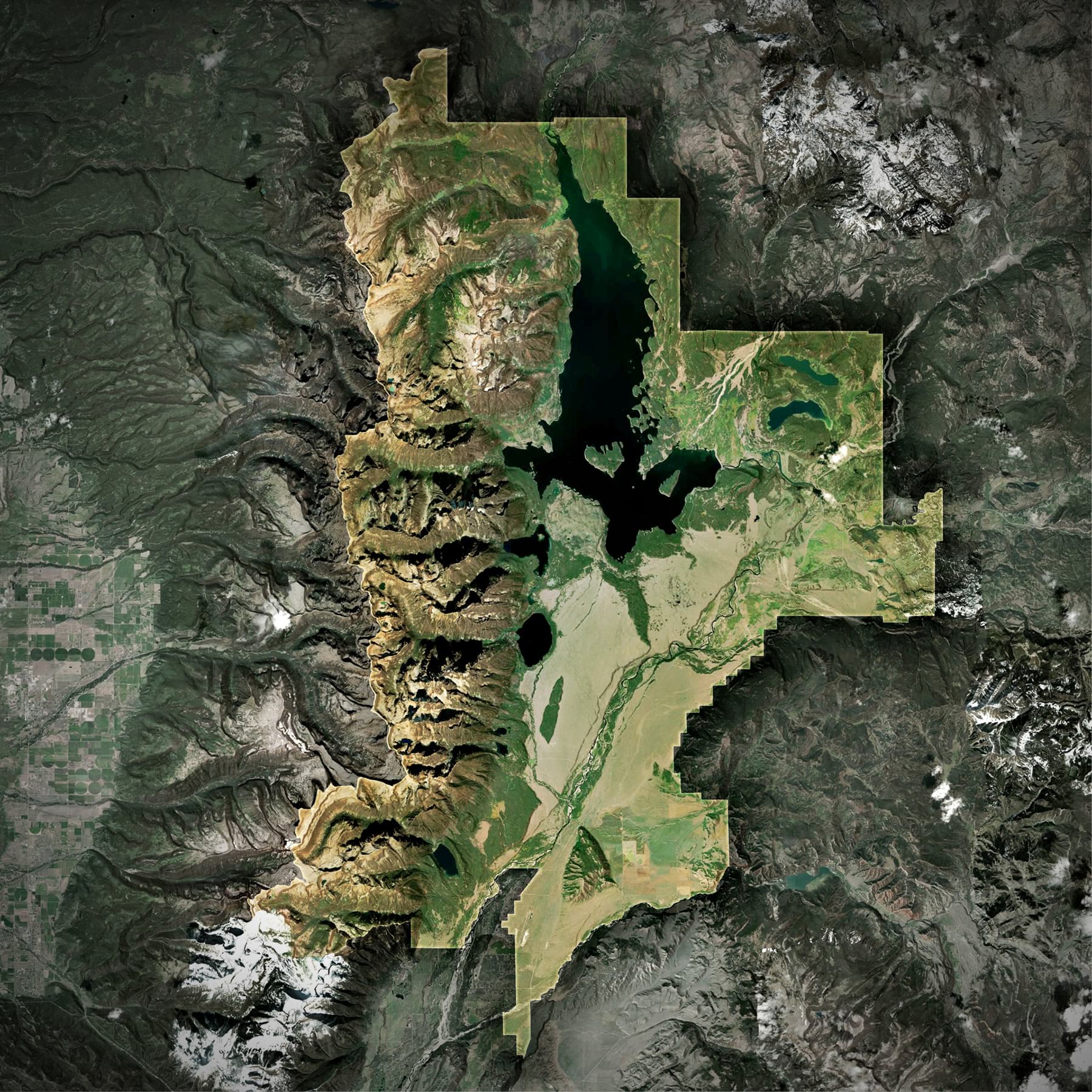
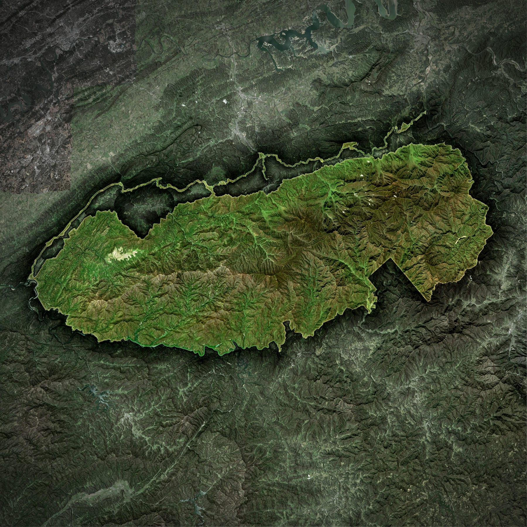
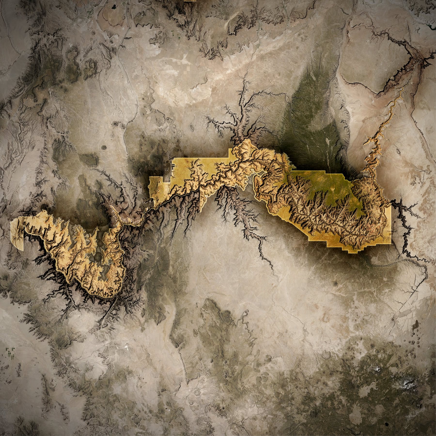
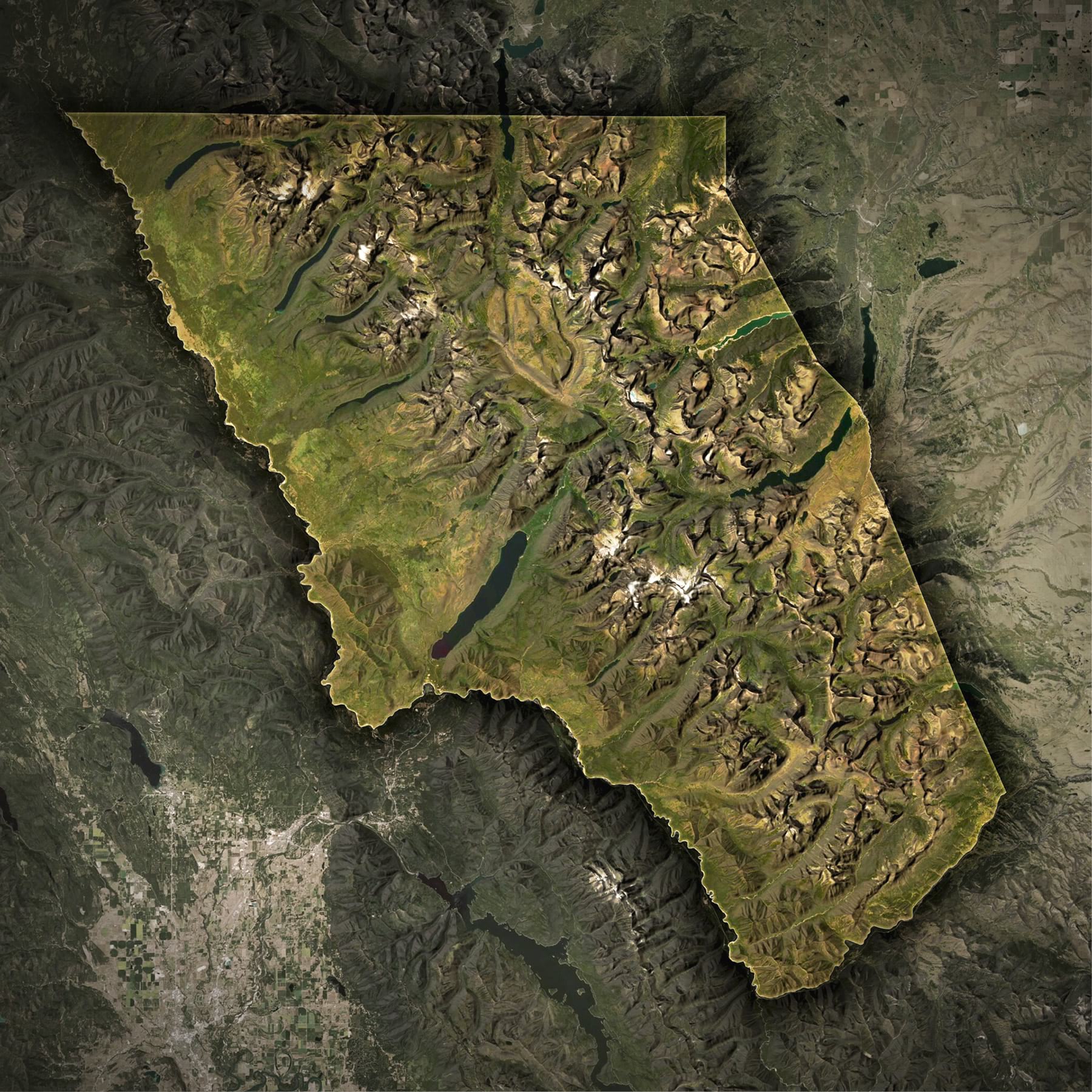
You can do cool gradient strokes and blend modes to geographic features, like these National Park polygons. They were made using the above method for the boundary polygon, en-coolified with some easy basemap blend bumpification of the delectable World Imagery basemap and hillshade tiles, plus a bit of reversed-area-of-interest making and grayscaling. Blend modes. A glorious and welcome addition to Pro (and ArcGIS Online’s map viewer beta).
Do you recognize any of these places?

Article Discussion: