Recently I wanted to georeference the stunning hand painted three-panel wall mural of Walensee, Switzerland, topography by Eduard Imhof. This isn’t really about that amazing map, though.
I found that the imagery basemap, which I would be using as a visual reference for my georeference control point hunting-and-pecking adventures, had some clouds, mosaic seams, and some variation in contrast.
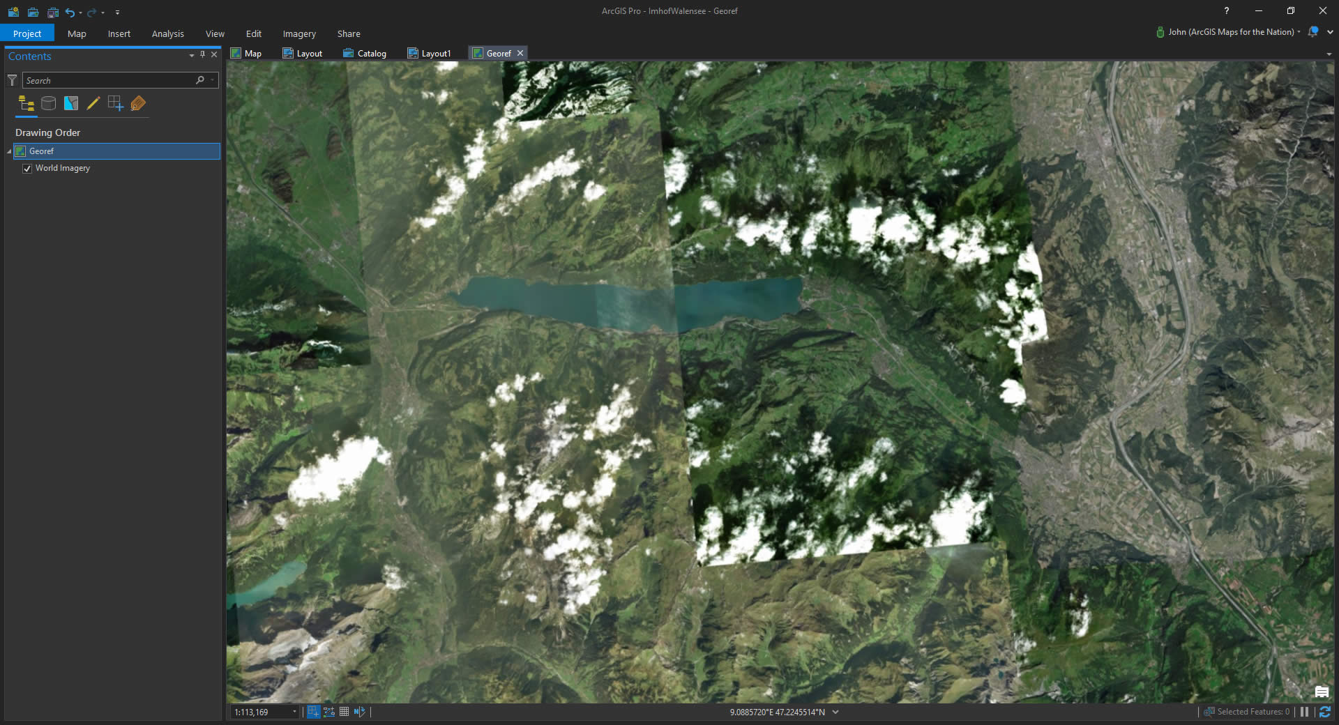
Here’s a closer look.
All understandable things since usually the most pressing consideration for satellite imagery is newness. For this task though I definitely didn’t care how new the imagery was (if I’m being pedantic, as I often am, the older the better, I suppose); I just wanted something generally cloud-free and crisp. You know, a nice reference over which to align Imhof’s brushstrokes to real world coordinates.
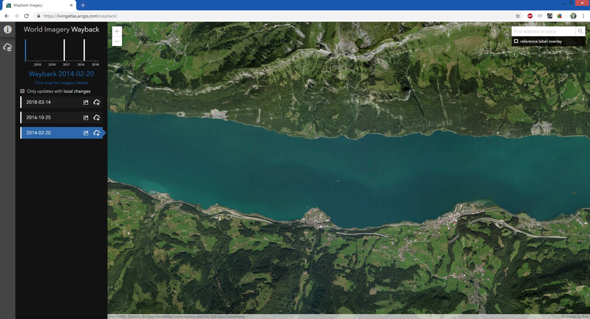
Not to worry! I fired up the World Imagery Wayback app. Wayback lets me browse all of the past releases of the imagery basemap. They are stacked up on each other and you can preview any one of them at whatever geographic area of interest.
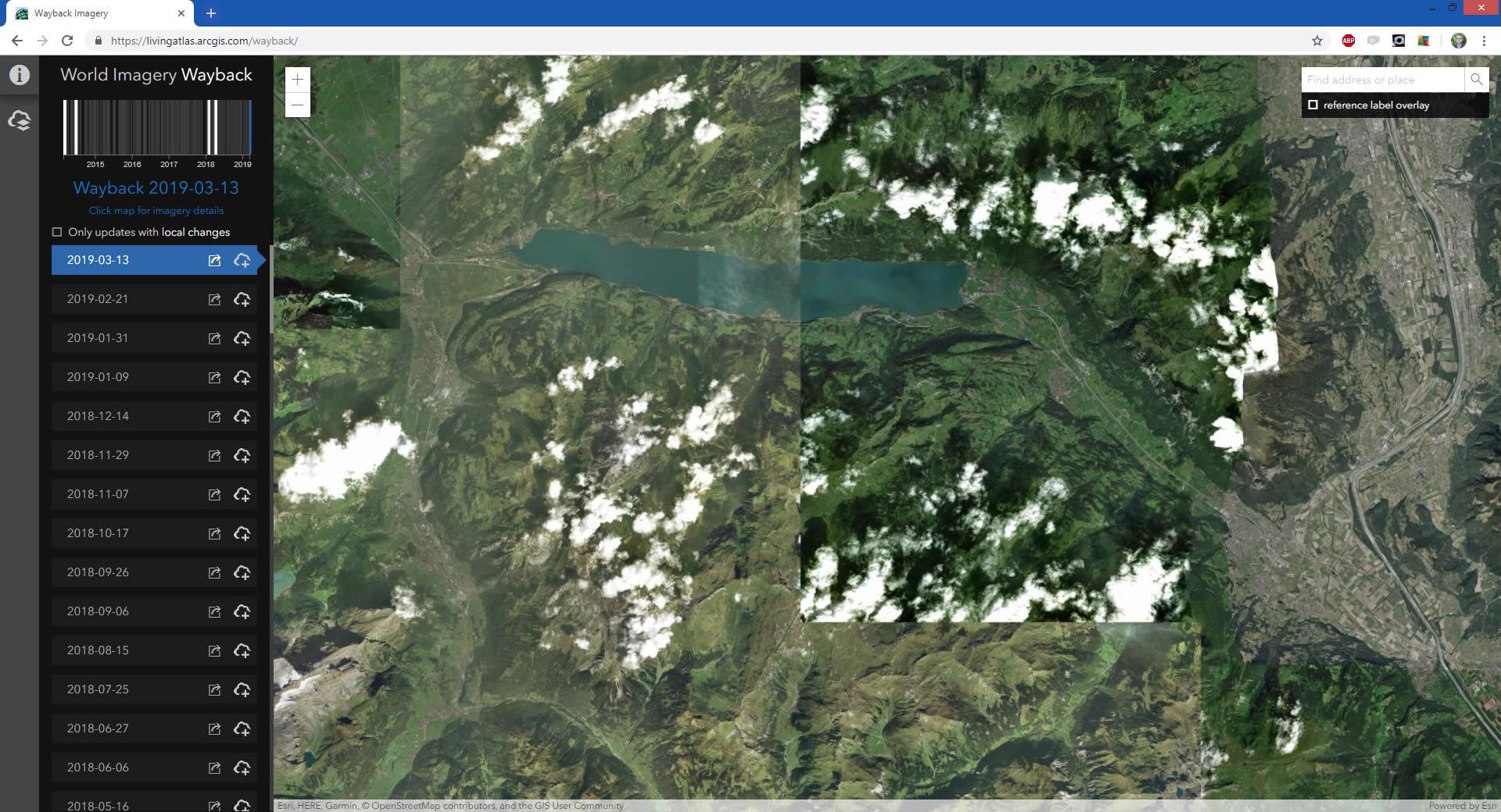
The timeline graphic shows which releases actually had changes at this local geography. I filtered by that, and explored the four versions of Walensee, Switzerland, over time. The 2014 release has the best combination of consistency, contrast, and generally the least cloudy.
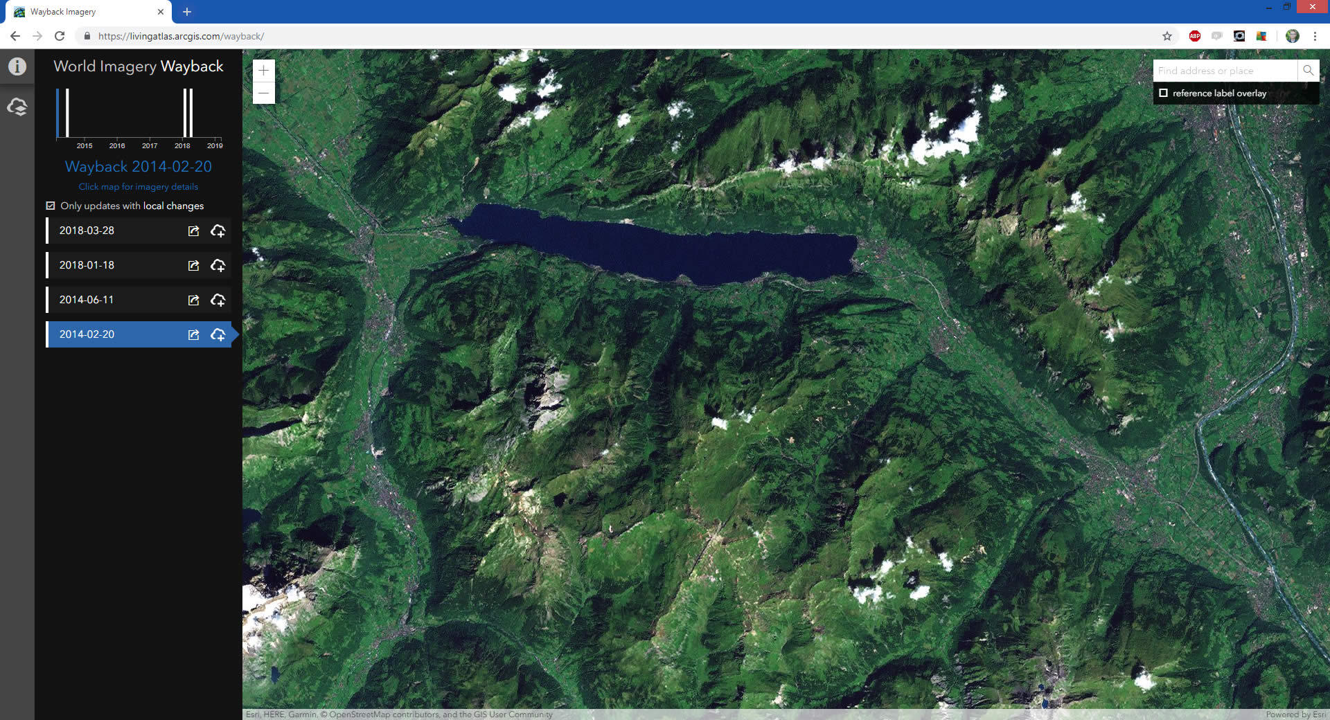
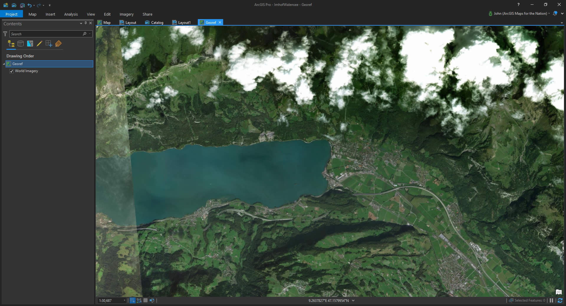
It looked good at the closer scales, too. We have a winner!
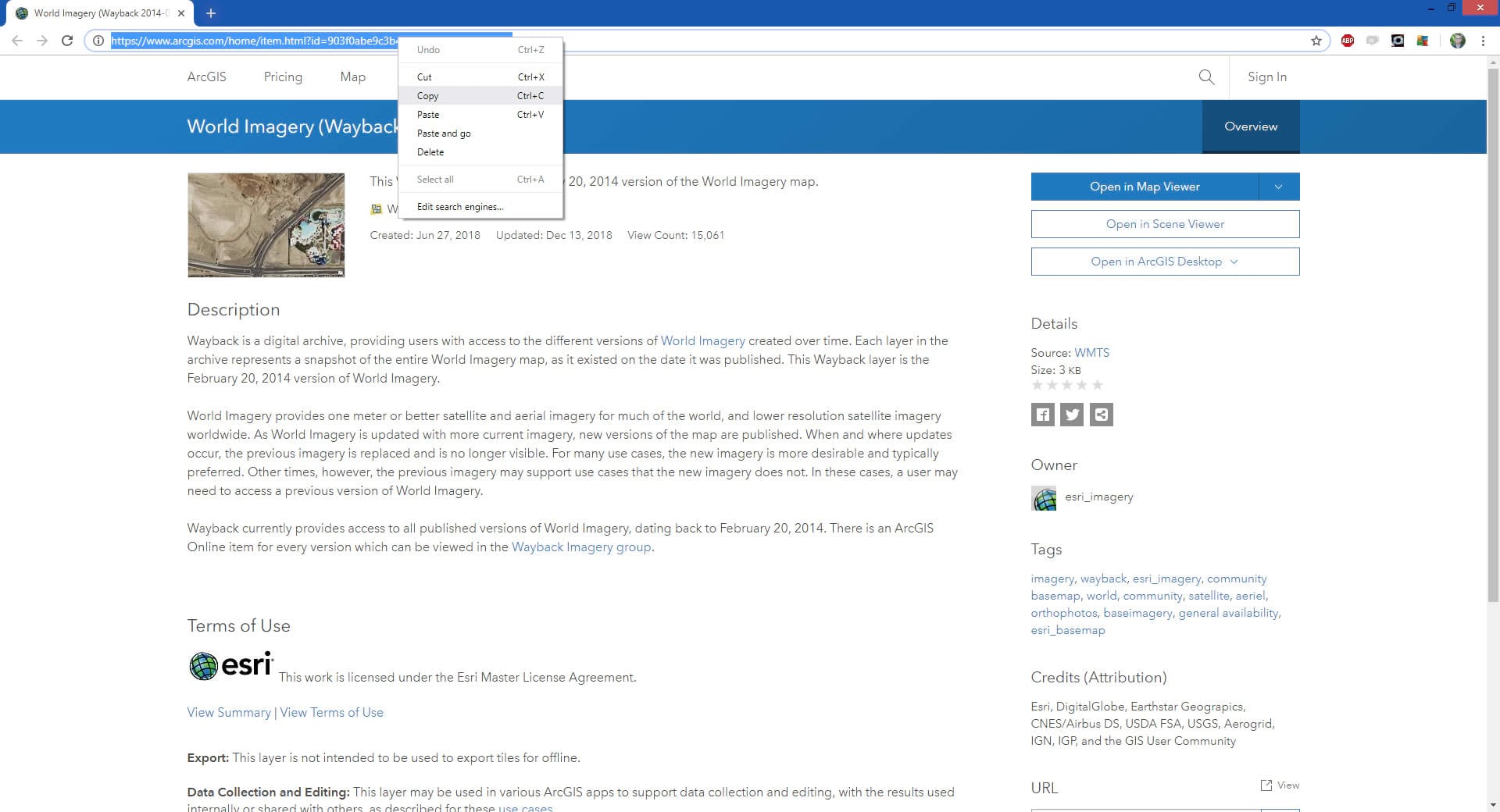
So I clicked the little “learn more about this release” pop-out button to open up its details page. I copied this URL to my clipboard.
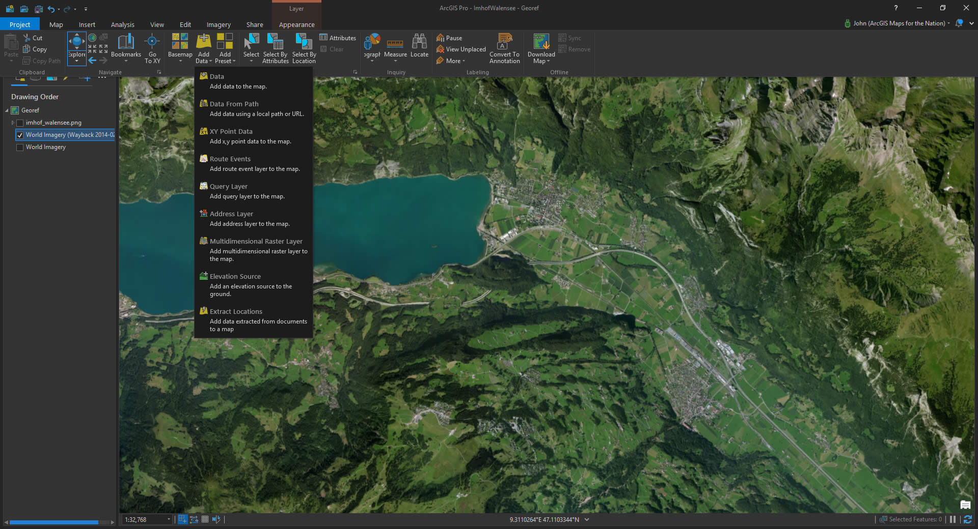
Then In Pro, I added it via the “Data from Path” option.
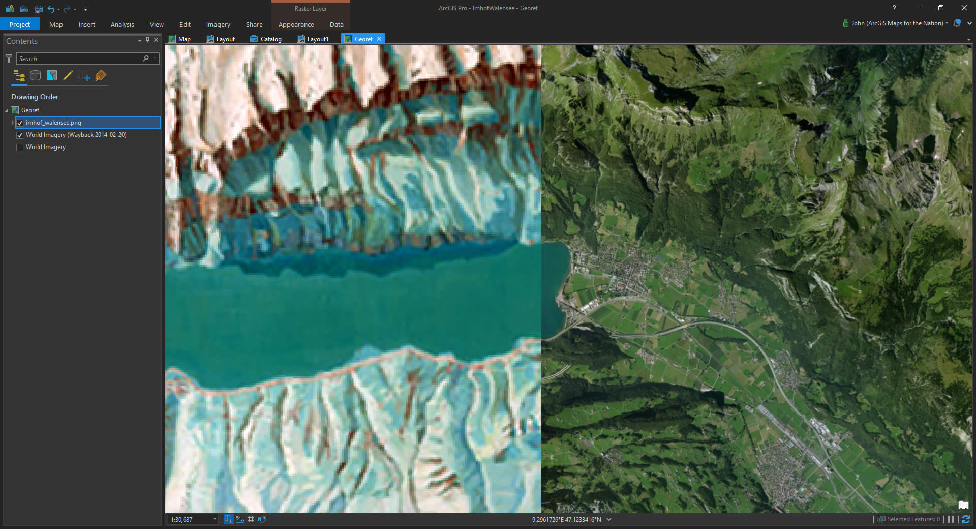
Therrrrrrrre we go. Way better on the eyes for zooming and panning while hunting up matching control point pixels. Commence georeferencing adventure!!
More Stuff
Here are some resources if your appetite for pulling Wayback imagery into Pro for who-knows-what (but maybe georeferencing) isn’t fully satisfied, and some other stuff…
- Learn more about this cleverly-named Wayback thing.
- Got some favorite Wayback vintages? Make some connections right to them in Pro.
- Wayback is an app in the Living Atlas. Check that thing out here but first get ready to live.
- Here’s more about georeferencing, that sweet sweet task of breathing spatial life into pixel dust.
- Here’s a video where you can see me actually georeferencing an image. Be gentle.
- Do yourself a favor and just learn a bit more about the topographic master, Eduard Imhof. Intrigued? Give this style for Pro a whirl.
Happy Waybacking! John

Commenting is not enabled for this article.