ArcGIS Solutions helps you make the most of your GIS by providing purpose-driven, industry-specific configurations of ArcGIS.
Utility pole owners and telecommunications companies rely on joint use programs to efficiently use pole infrastructure. In recent years, the volume of attachment requests submitted to pole owners has risen in response to increasing demand for broadband deployment. Disjointed permitting processes and inaccurate attachment inventories prevent pole owners from staying on top of incoming permit applications and understanding their existing joint use locations.
The new Electric Joint Use Permitting solution addresses these challenges by simplifying permit coordination and improving inventory accuracy.
Simplify permit coordination
The Electric Joint Use Permitting Center app provides a streamlined permitting experience for attachment owners from application through permit close-out. As an attachment owner, you can use the Electric Joint Use Permitting Center to draw your proposed service route and submit all required attachment details and documentation. You can also verify and export a list of poles included in the application for your records.
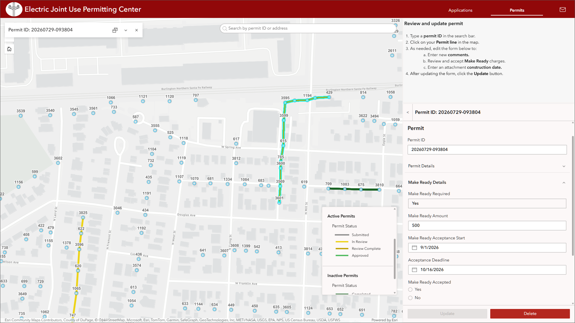
The Electric Joint Use Permitting Center also provides capabilities for attachment owners to:
- View status of active permits
- View permit history
- Leave and view comments on active permits
- Communicate with the utility about milestones such as Make Ready and the construction date when attachment construction is complete
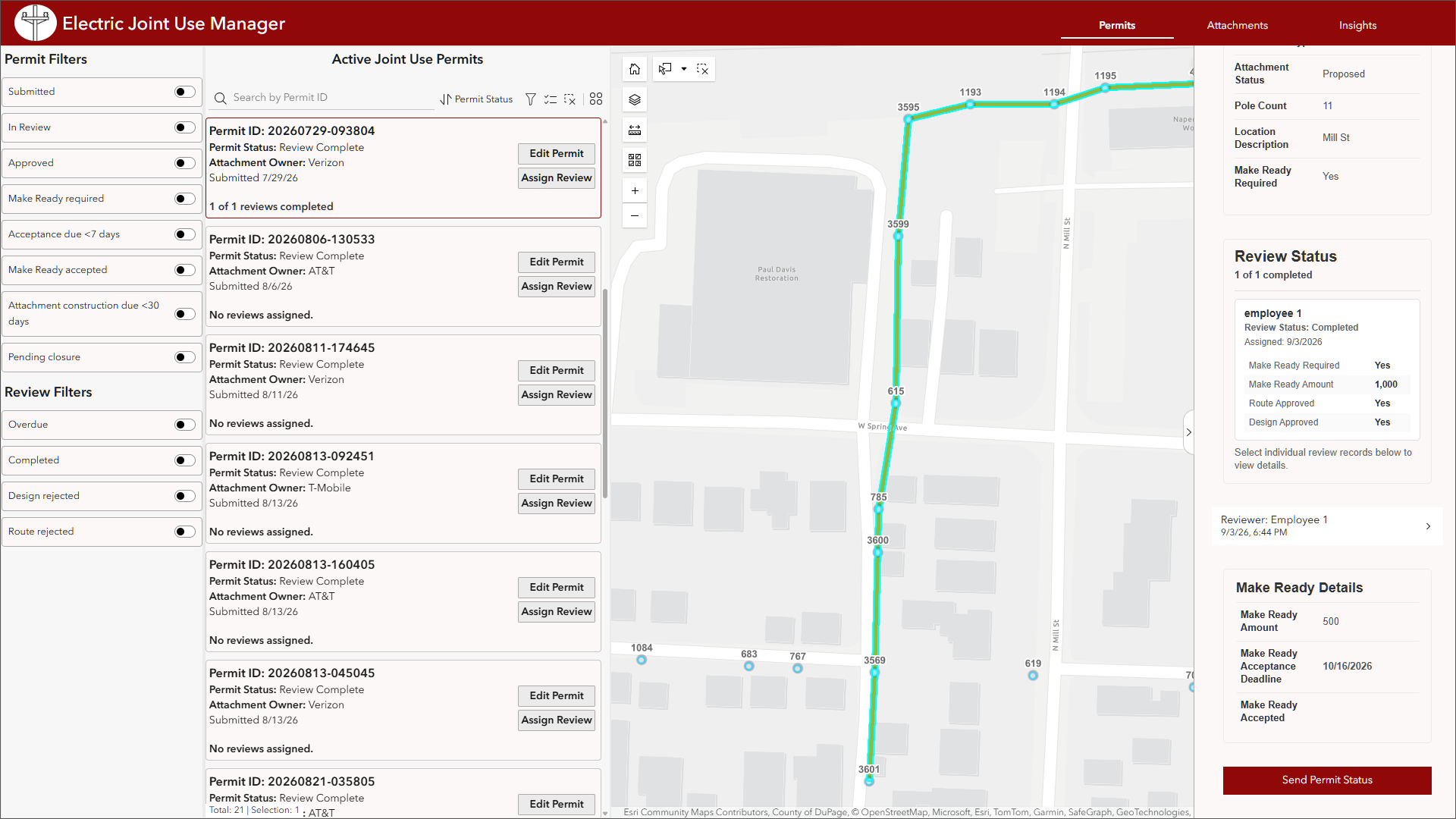
The Electric Joint Use Manager app provides Joint Use Coordinators with a streamlined experience to manage joint use permit applications and attachments. From the Permits page, Joint Use Coordinators can track a permit application through its lifecycle with easy filtering for important decision points and permit milestones.
Coordinators can also assign reviews to active permits, keep tabs on completed reviews, and send emails to attachment owners to communicate status updates or actions needed.
Improve inventory accuracy
Pole owners need accurate attachment inventories to understand their capacity at the pole-level and across the system. They also require accurate attachment counts to bill attachment owners appropriately.
With the Electric Joint Use Manager app, Joint Use Coordinators can review attachment counts system-wide, by attachment owner, and on individual poles to support a variety of operational and administrative needs from evaluating new permits to billing and annual reporting.
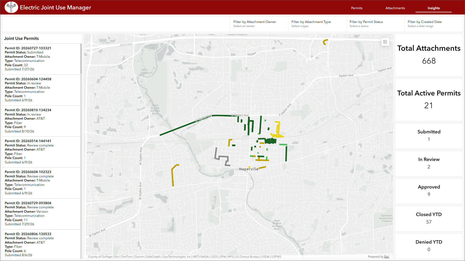
When the permit process is completed, all attachments associated with a permit can be created with an ArcGIS Data Pipeline so coordinators can skip the time-consuming process of adding attachments to poles individually. When coordinators need to update existing attachments, they have options to tackle individual or batch edits.
Enhance end-to-end visibility into joint use
With capabilities to support the joint use lifecycle from permit application through attachment creation and management, the Electric Joint Use Permitting solution helps organizations accelerate joint use approval and maintain an accurate inventory of their attachments and attachment owners.
Getting started
You can learn more about the Electric Joint Use Permitting and deploy it here.
Electric Joint Use Permitting is part of Esri’s collection of ArcGIS Solutions. It’s free for ArcGIS users to deploy and is fully supported.
Article Discussion: