Recently, ArcGIS StoryMaps team members met with colleagues from Esri Canada’s Education team to discuss using ArcGIS StoryMaps in K-12 classrooms. During our chat, our colleagues told us they enjoyed our accessible story about beavers – a popular topic in Canada. But teachers in Québec weren’t using it because it wasn’t available in French.

Our teams value accessibility and providing comparable access to information for everyone, which includes languages. We started brainstorming solutions, including using a professional translation service, but we had concerns about costs and localizing the story for a French-Canadian audience. Then we learned their team member, Arabelle Sauvé, is fluent in both French and English. So, we asked, “Can we work together to make the story accessible in French?” Now we’re sharing what we learned about doing an intricate translation involving both accessibility and localization considerations for existing stories. Hint – a collaboration partner is key for success.
The original story
We produced the original English language story to support literacy and science skills for early readers. The story design includes content that aligns with educational standards and uses StoryMaps tools to ensure the content would be accessible to learners. The accessible design features include:
- using simple words
- visuals that illustrate concepts
- alternative text
- user-controlled audio narration
- age-appropriate maps
Each of these features needed consideration during the translation process to maintain accessibility and accuracy across languages. By recruiting a collaboration partner who is familiar with the platform, content, and has dual-language fluency, they helped ensure accessibility in both languages.

Supporting visuals
While this story’s audience is early readers, authors can optimize accessibility for any audience by choosing helpful media. In this example, we used leader lines to compare similar body parts. Supportive media like this helps make connections even if the audience doesn’t fully understand the words.

Image captions also support understanding content; however, authors need to add alternative text, also called alt text, which provides written descriptions of media, to make media fully accessible. Alt text is used for assistive devices like screen readers and appears if the media fails to load. Authors can easily add alt text for media and maps within the ArcGIS StoryMaps builder. They can also upload closed captions, VTT files for videos, transcripts, or captions in the native video player to support multiple languages.
Authors need to translate alt text and transcripts just as they do their story text. It’s worth noting that we used a hybrid translation solution on this project and outsourced alt text to a professional translation service. It’s a good option when you need to balance time and translation resources.

Map data
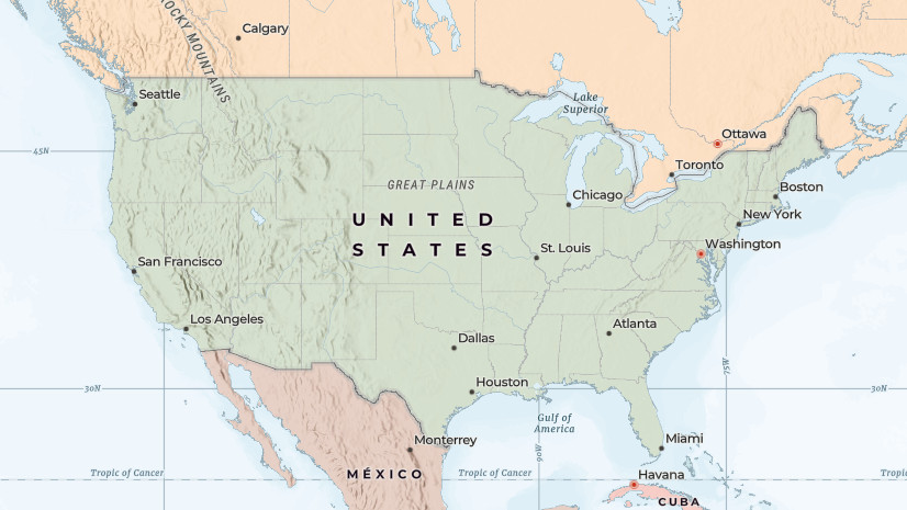
For our map visuals, we used data from a United States government agency for the original story because it didn’t require permission to use. However, the data wasn’t ideal, since it didn’t include Alaska and stopped abruptly at the United States border. We looked for other data sources and ensured we could obtain permission to use it to before translating and localizing the story. Localization can include swapping media, maps, and other elements of your story so it’s relevant to a specific audience. In this case, we needed to expand the data set to include Canada at minimum. In general, expanding the data to a wider area expands your potential audience because people are more likely to be interested in information they relate to or that affects them.

We found and received permission to use international datasets from IUCN. We added the North American beaver and also included data on the Eurasian beaver since French is also spoken in other parts of the world. While we recognize there might be slight regional language variations, it was still a worthwhile addition and expanded our audience outside of Canada.
Languages
If you haven’t translated content before, you may be wondering why we needed a partner instead of simply relying on a web browser to translate the story. The reasons are many.
First, the original English story included interactive, user-controlled audio narration that models language use. The audio support models a realistic cadence and word pronunciations that may not be done correctly with a screen reader. The audio also supports making connections between what words look like and how the words sound. Our collaboration partner was able to provide the same language modeling in French.
Local partners are also valuable for interpreting cultural differences. While an idiom may be obvious in one culture, it turns out a key phrase in the English version, “busy as a beaver” is not a common phrase among our northern neighbors.
Understanding nuances related to word meaning is vital. Our collaborator asked questions related to choosing the most accurate French word based on context; a web browser translation may have used a different, less accurate word. Moreover, since some languages use gender and class, such as formal and informal pronouns, a person with native-level language proficiency can make optimal word choices, including gender neutral words when possible.
Finally, a special perk from our collaboration was Arabelle’s schoolteacher family member who provided insight into the local educational standards related to the story content. See the item description pages for the educational standards for both stories.
Challenges
As mentioned, retrofitting translations for existing content can be challenging. Our team has adjusted our workflow, and we now assess translation potential and include accessibility considerations during the planning stages of a new story.
We also recommend choosing a basemap that supports changing language labels. Among the choices we made that, in retrospect, were not ideal, was using a custom basemap. We chose it because it’s accessible for kids, and honestly, it looks cool. However, changing the labels on that map to French is best described as an inelegant, “hacktastic” undertaking that I wouldn’t try to reproduce, even if I could.

Thank you
Finally, thank you again Esri Canada for collaborating with us on a challenging project; the French version of the story would not have been the same without your help and support. Also, the English version is now richer with the added international data set.
In summary, translating stories is an excellent opportunity to reach a wider audience and including a collaboration partner can help you localize the content to get the best results. Key tips to keep in mind while creating accessible, multilingual stories:
- Select map data that includes the applicable geography
- Choose media that supports your text
- Use plain language when possible and avoid jargon and idioms
- Consider translation and localization during initial content development
- Choose good collaborators
- Ask your ArcGIS Online administrators for basemaps in multiple supported languages
See links below to help with that last tip.


Commenting is not enabled for this article.