This new storytelling platform is the result of many months of effort by a remarkable team of product designers, engineers, developers, and content creators. It has been thoroughly researched, beautifully designed, and carefully crafted. The result, we feel, is a product that’s easier to learn, more versatile, and more fun to use than ever.
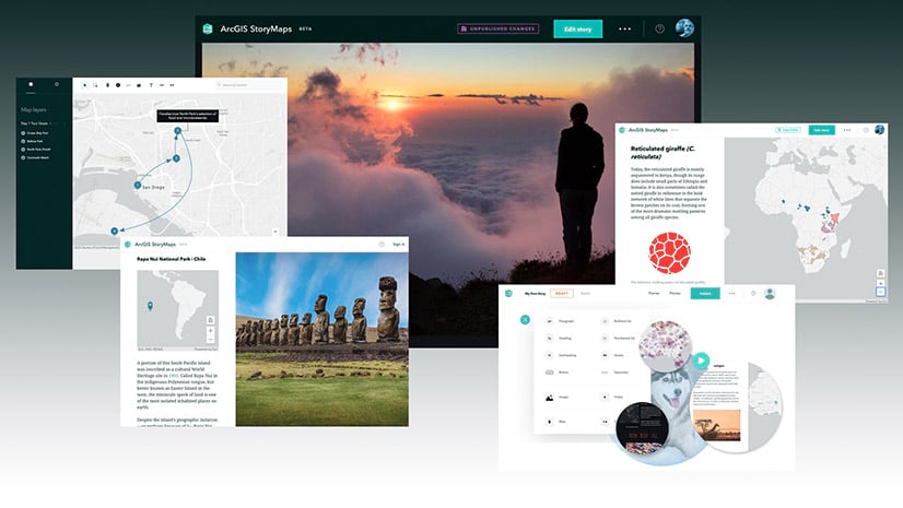
The story builder contains many capabilities from our classic storytelling templates, but there are also dozens of new features. This first official release has a long list of things that make it easy to craft stories of your own:
- A single, flexible builder that will ultimately (in a few years) replace our array of classic storytelling apps. Meanwhile, the classic apps will remain available for many months, and your previously-published stories will continue to function as they always have.
- We’re easing the process of making simple maps by introducing express maps; use these to quickly create locator maps, show an array of points, add arrows and annotations, and more.
- A design panel lets you change the look of your story with a single click. You can also choose from a variety of cover layout options, customize accent colors, and add your organization’s logo.
- Your stories will autosave as you build them, and you can make additional revisions to shared stories but only publish them when you’re ready.
- Stories have a fresh, modern look, and they load quickly, regardless of whether you’re viewing them on mobile, tablet, or desktop.
Many of you kicked the tires of ArcGIS StoryMaps during its beta period. Your comments and ideas have resulted in many improvements—thank you. We were thrilled to see that the majority of feature requests and comments received were already items on our roadmap.
As excited as we are about this release, in many ways it’s just the beginning. We have plans for lots of new functionalities, and we’ll be making frequent updates. As we incorporate new enhancements we’ll announce them on our website, describe them in our blogs, and outline their capabilities in our story map, Getting Started with ArcGIS StoryMaps.
Along with the new StoryMaps comes a brand-new website, where you’ll be able to explore albums of stories by topic and access lots of new resources, including tutorials, blogs, and instructional videos.

You, and a host of fellow storytellers, have created nearly a million story maps with our classic templates—as student projects, as instructional materials, as travelogues, and calls to action. We hope that the new ArcGIS StoryMaps will spur the creation of millions more place-based narratives—in fact you’ve already created more than 5,000 stories with the new builder during beta.
Of course, none of this would have been possible without the love and support of the story mapping community and its champions. This is an exciting new chapter in the long history of Esri’s storytelling tools, and we look forward to your continued support, suggestions, and feedback as you try out ArcGIS StoryMaps. So go ahead, dive on into the builder and let us know how it goes. We’re eager to hear what you think.


Article Discussion: