AI-enabled tools, models, and services that accelerate data creation, extraction, and analysis in ArcGIS continue to expand as organizations look to enhance their everyday GIS workflows with AI. This update highlights the latest additions and improvements, with a focus on how foundation models and embeddings are shaping the next phase of geospatial AI (GeoAI).
From task-specific to foundation: AI models in ArcGIS are evolving
ArcGIS offers more than 100 pretrained AI models to help organizations automate solutions to real-world geospatial challenges. These models can be used out-of-the box and are easy to access through ArcGIS Living Atlas. Esri continues to expand its library of task-specific models that are tailored to specific use cases and geographies, while also making foundation models—both open-source and Esri-developed—available directly within ArcGIS. To understand what this means in practice, it’s helpful to look at the role of foundation models.
Foundation models are trained on massive and diverse datasets, allowing a single model to support a range of analysis tasks. This gives GIS professionals more flexibility to solve problems without fine-tuning or building models from scratch. Depending on the data type, foundation models can be used for tasks such as object detection, feature extraction, pixel classification, prediction, forecasting, and change analysis. For instance, the Text SAM model enable users to identify and extract features from imagery through simple prompts rather than extensive model training, making it faster and easier to apply AI in everyday workflows without needing specialized expertise.
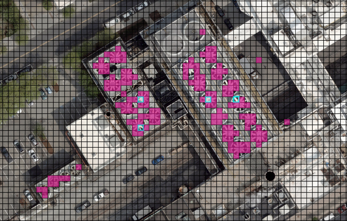
Since July 2025, the ArcGIS Living Atlas has added several open-sourced foundation models, developed by the broader community, that focus on working with geospatial data. For example, the Clay (Large) model is trained on remote sensing imagery and can capture spatial context and patterns in the data, making it easier to complete many analysis tasks, particularly for environmental monitoring and urban analysis. By bringing these foundation models into ArcGIS, Esri is helping organizations accelerate AI adoption, reduce training requirements, and unlock insights from geospatial data more efficiently.
Introducing Esri-developed foundation models
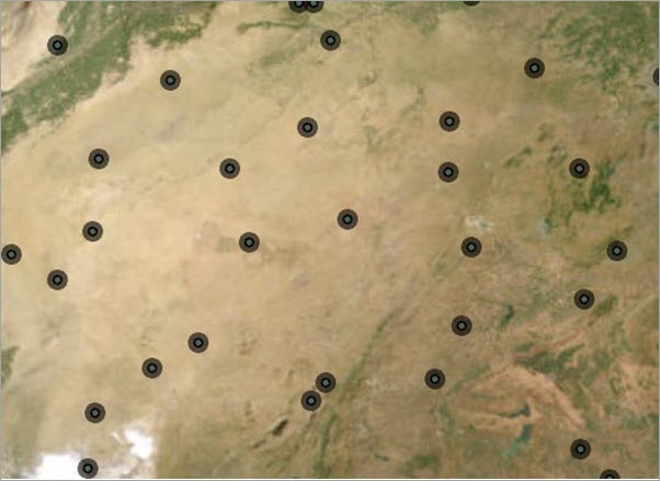
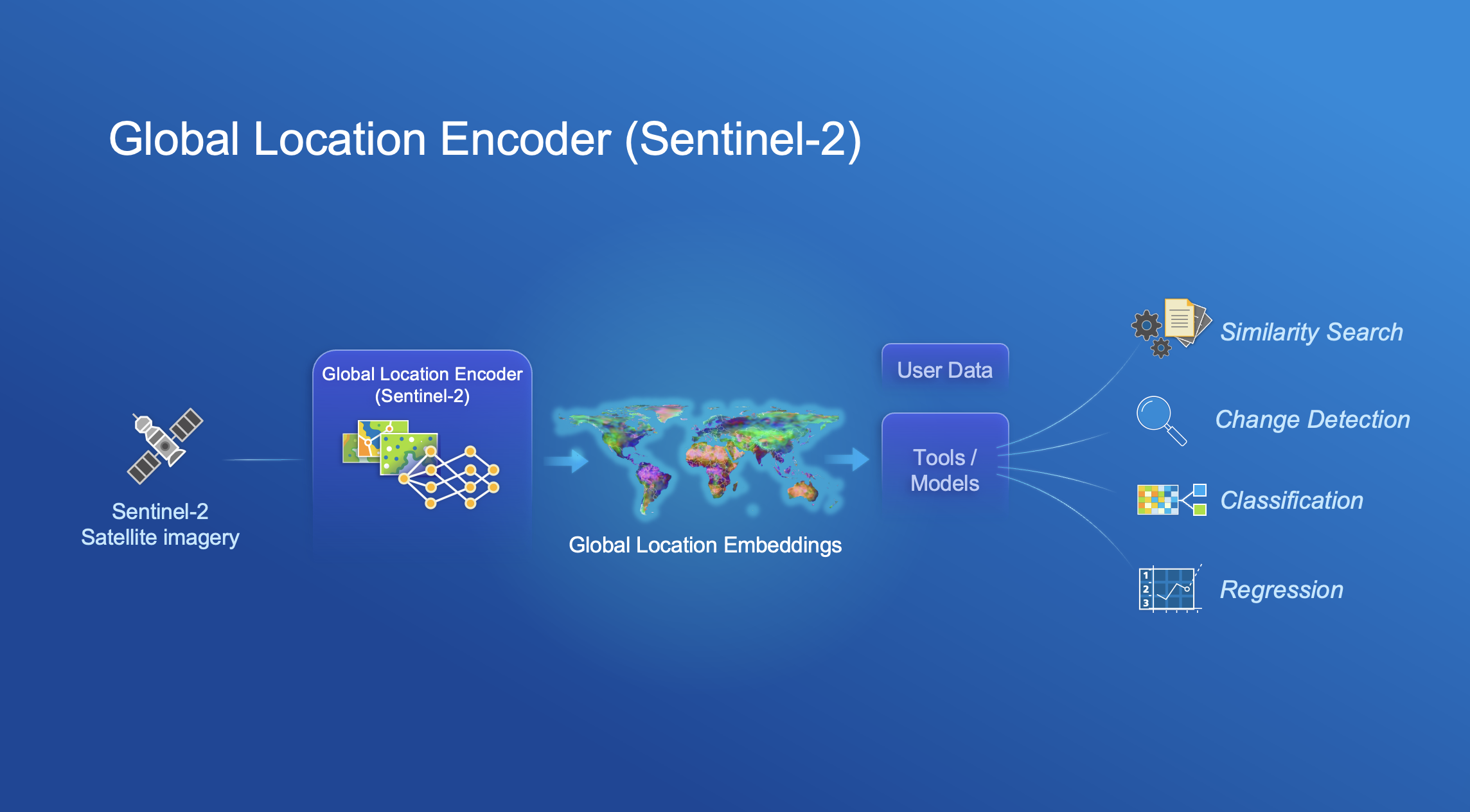
In addition to bringing foundation models from the broader community into ArcGIS, Esri is developing its own foundation models to help users extract more value from their data with less effort. One example is the Global Location Encoder (Sentinel-2), a new foundation model designed to understand the relationship between satellite imagery and geographic coordinates. Trained on globally distributed Sentinel-2 Level-2 imagery from 2024 using most available spectral bands, the model captures environmental and physical characteristics associated with locations around the world. The Global Location Encoder can accelerate a variety of analysis workflows, including classification, regression, change detection, similarity search, and location-aware image analysis.
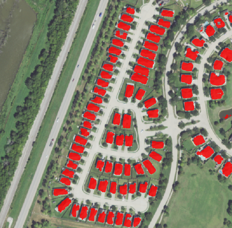
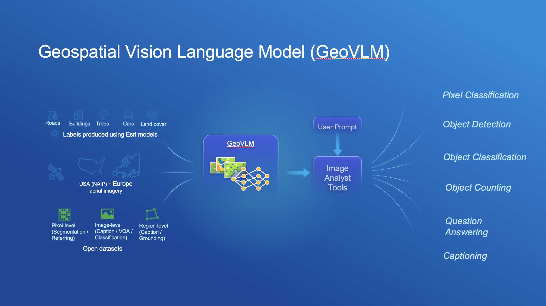
Another notable Esri-developed foundation model is the Geospatial Vision Language Model (GeoVLM). The GeoVLM takes the adaptability of foundation models further by connecting remotely sensed imagery with natural language, allowing users to extract GIS features or describe image scenes using prompts like “Segment roads” or “Describe the region”.
Unlike many vision-language models that are designed for general purpose, GeoVLM is a multi-purpose model designed for geospatial workflows that can support a variety tasks, including object detection, pixel classification, object counting, question answering, image captioning, and scene classification. Built for remote sensing, it has been trained on millions of image-caption pairs from both Esri-produced and open-source datasets spanning geographies around the world. Its open vocabulary allows it to identify a broad range of features without being explicitly trained on them. Local deployment support enables organizations to run the model within their own environments without relying on external cloud AI services. GeoVLM will have a private beta for a limited set of users. If you are interested in providing feedback, complete this form to be the first to know when the model is available for testing.
Reveal hidden patterns with geospatial embeddings
As foundation models expand what a single model can do, the next question is how are they able to represent such diverse types of geospatial data and support a wider range of tasks? The answer is by converting the raw input data into embeddings, or numbers that retain the meaning and relationship within data in a form that AI models can use.
Geospatial embeddings can be thought of as learned, hidden features that encode the essential characteristics of a location. You can then use embeddings in downstream analysis workflows such as finding similar features and making predictions. This makes it easier to identify trends, relationships, and areas of interest such as identifying ideal store locations by matching areas to the geodemographic profiles of your most successful sites.
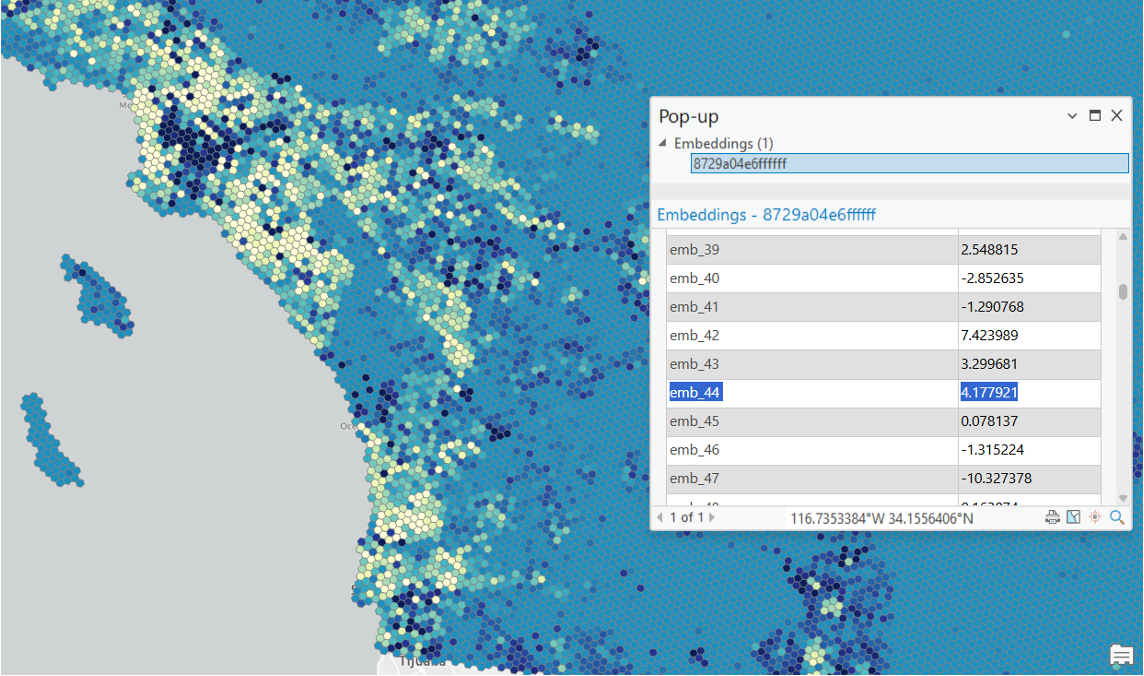
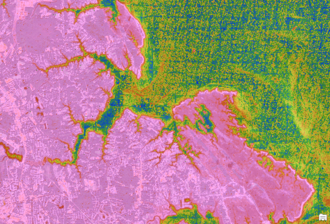
Broadly speaking, there are two types of geospatial embeddings: location embeddings and imagery embeddings. Location embeddings represent the key characteristics of places—capturing signals related to demographics, economics, the environment, and other geographic factors. Imagery embeddings capture the visual patterns and semantic meaning within imagery, such as whether an area is “forested”, “urban”, or “arid desert”. They provide a unique value because they aid in converting imagery into an analysis-ready dataset that AI models can work with at scale, making advanced image analysis more accessible to GIS professionals.
Leverage USA Geodemographic Embeddings to enhance spatial analysis tasks
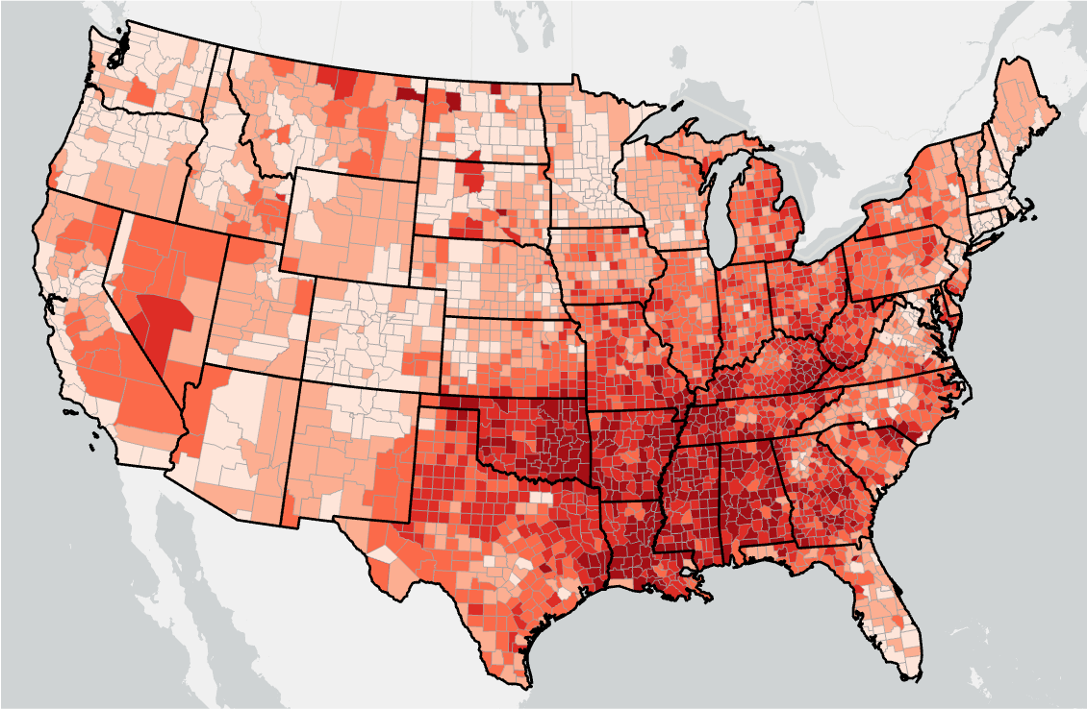
One area where geospatial embeddings are already being applied is in demographic analysis, where complex patterns can be captured and used more effectively in spatial workflows. To make demographic insights more accessible for spatial analysis, Esri is releasing a geodemographic embeddings dataset for the USA. The new USA Geodemographic Embeddings feature layer transforms more than 5,000 demographic, socioeconomic, environmental, and census-derived variables—including data from the U.S. Census Bureau and American Community Survey (ACS)—into over 250 embedding attributes that capture complex relationships and patterns across communities.
By reducing thousands of variables into a smaller set of meaningful characteristics, demographic embeddings help analysts build more efficient and effective workflows for tasks such as predictive modeling, clustering, and finding similar features. Whether estimating heart disease rates, identifying areas at risk of lead exposure, or uncovering similar locations, users can generate insights faster and with less data preparation. Compared to working directly with raw variables, geodemographic embeddings can help extract more information from analysis faster.
The embeddings-based analysis toolset:
ArcGIS Pro 3.7 introduces new tools to help you generate and work with embeddings in both imagery and vector datasets.
- Generate Embeddings Using AI Models – This tool creates embeddings using foundation models. In addition to the Global Location Encoder, there a few new open-source foundation models available to use with this tool for image analysis and similarity search, such as Prithvi EO 2.0, Clay, TerraMind, DOFA, and DINOv2. These can be accessed through the ArcGIS Living Atlas deep learning packages.
- Find Similar Features Using Embeddings – This tool helps you find similar features within geospatial data, even when those similarities are subtle or difficult to define when using raw attributes alone. It works by comparing the embeddings at different locations to identify which locations are most similar. For example, after identifying one damaged area in a post disaster image, you can then use this tool to automatically find other areas with similar damage patterns across a large imagery collection.
- Merge Embeddings – This tool aggregates embeddings from a source layer into a larger target polygon layer, allowing you to summarize complex information across broader geographic areas. For example, you can aggregate embeddings generated at the ZIP code level to the county level.
Get started with foundation models and embeddings in ArcGIS
ArcGIS is bringing the power of foundation models and embeddings into everyday GIS workflows, helping organizations analyze data faster, uncover hidden patterns, and solve complex spatial problems with less effort.
- To access open-sourced and Esri developed foundation models, visit the Deep Learning Packages in the ArcGIS Living Atlas.
- Learn more about embeddings in GIS in this article and how to generate and use embeddings with the Embeddings-Based Analysis toolset in ArcGIS Pro documentation.
- Explore the USA Geodemographic Embeddings feature layer

Article Discussion: