ArcGIS has long provided a suite of image analysis and processing capabilities that transform raw imagery into geospatial information products. With the introduction of capabilities such as deep learning, multidimensional analysis and change detection, this arsenal of tools continue to grow to help you solve a variety of problems, from predicting crop yield to identifying military targets. As you journey across ArcGIS Pro (desktop), ArcGIS Enterprise (enterprise) and ArcGIS Online (SaaS), you may wonder which deployment best fits your needs and your preferred working environment.
After reading this blog, we hope to guide you to the right deployment and ArcGIS Image extension (see table of extensions below) that empowers you to easily integrate imagery and raster data into your geospatial analysis workflows.
When is ArcGIS Pro preferred?
…When you want to leverage the entire breadth of the desktop tools.
ArcGIS Pro is a comprehensive GIS and imagery workstation that gives you access to more than 1,400 geoprocessing tools and 150 raster functions, along with a suite of interactive tools and wizards to perform advanced analysis to derive further insights.
…When you want to perform advanced image analysis not available in ArcGIS Enterprise or ArcGIS Online.
Operations such as classification accuracy assessment or random tree regression are only available in the ArcGIS Pro deployment.
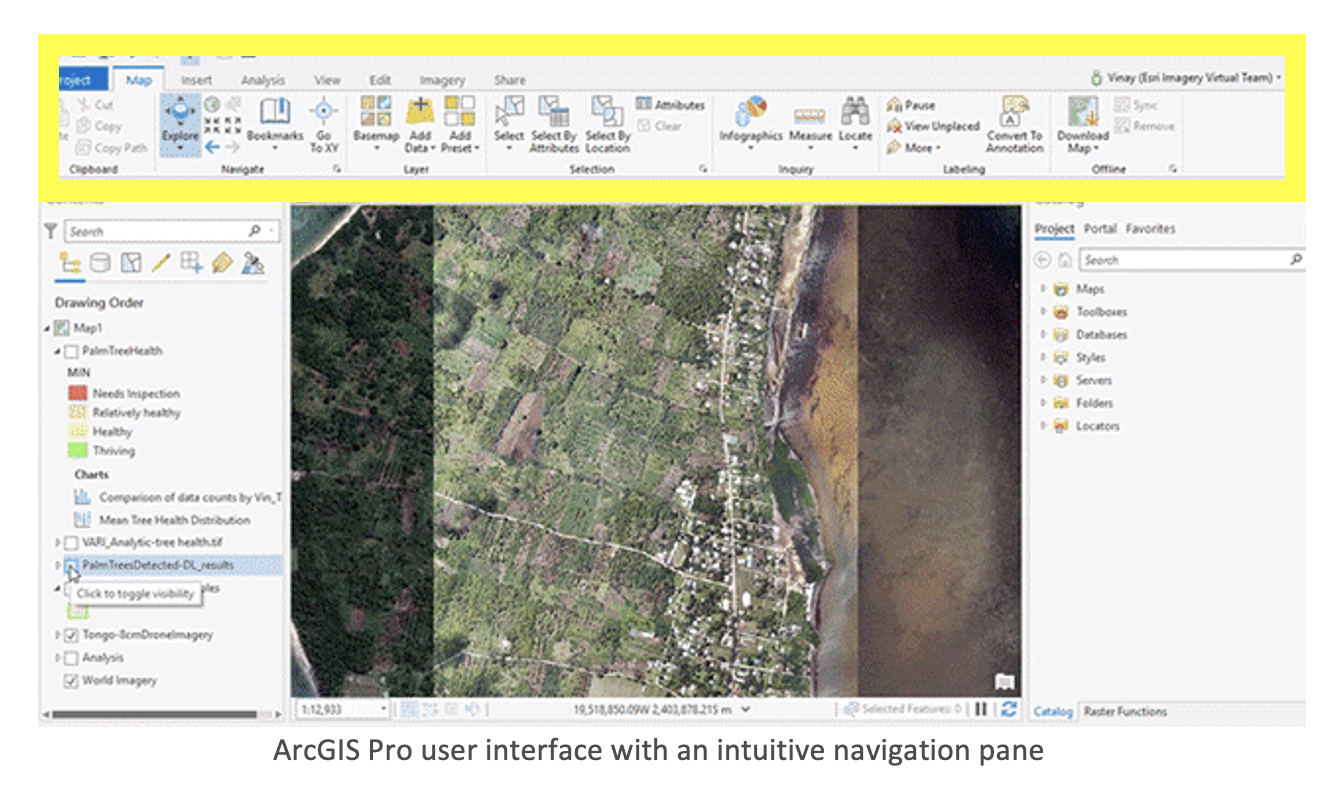
…When you prefer using your desktop GIS user interface
If you are comfortable with your desktop environment, you can take advantage of the ease of navigating a familiar ArcGIS Pro user interface (UI). With an intuitive, ribbon UI, accessing the available capabilities is made easier.
…When you have targeted geographies (cities/towns) to process.
Many organizations have relatively small geographies they monitor and from which they extract information. For instance, agricultural firms might fly drones once a week over their farms/fields and then perform deep learning to identify crops that are declining in health. Resources required to process this kind of data are minimal, so ArcGIS Pro and your local machine would provide sufficient processing power.
…When you want to preview results as you develop your workflow.
With ArcGIS Pro, you can preview your results on-the-fly as you test your processing parameters. Once you’ve finalized your parameters, smaller scale processing can be run in ArcGIS Pro, or you can run your processing and analysis at scale using ArcGIS Enterprise or ArcGIS Online.
When should you use ArcGIS Enterprise?
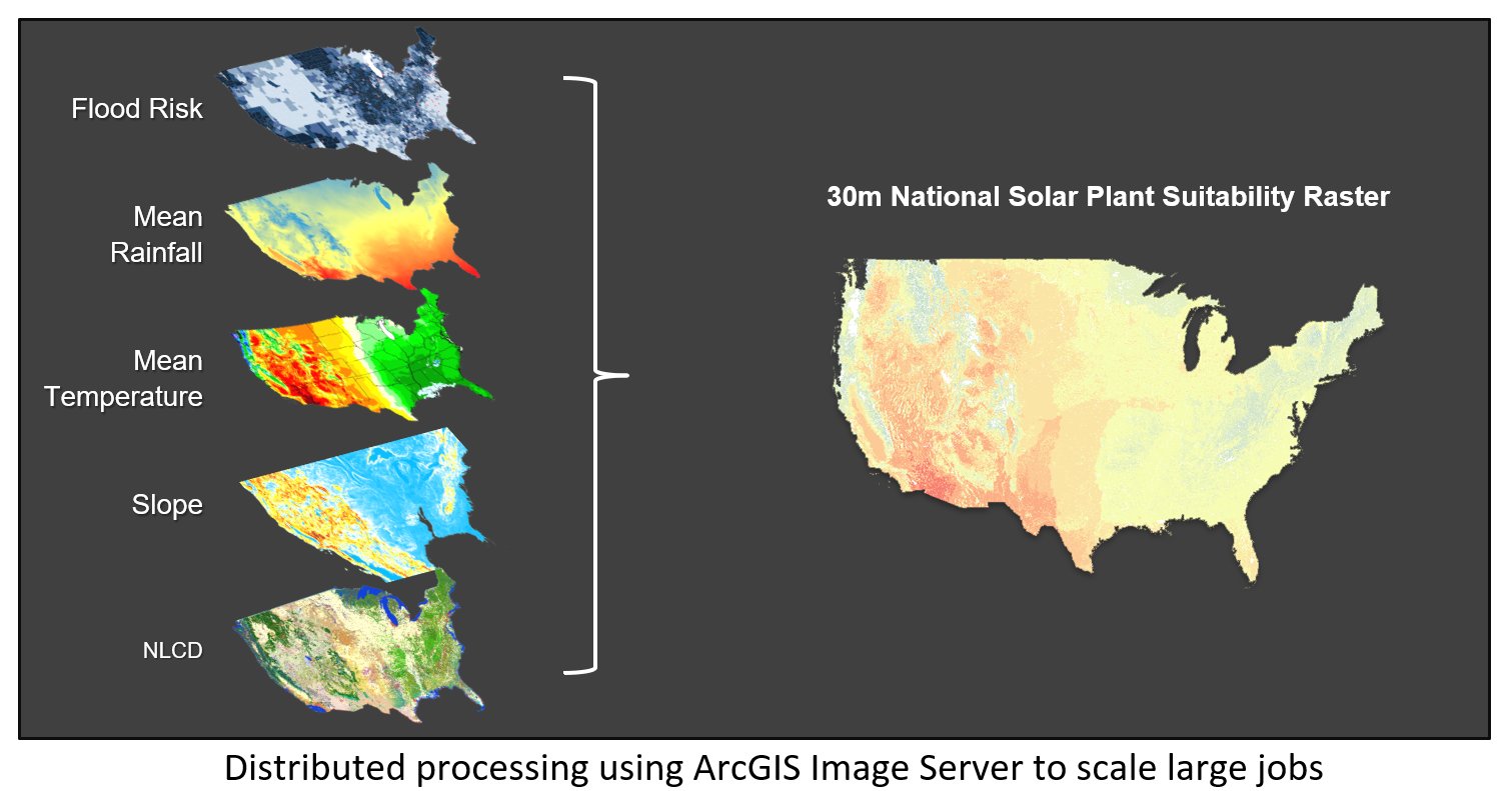
…When you want to scale your processing and analysis
Object detection (a form of image analysis) is automated, but it takes time! An ArcGIS Enterprise deployment can scale using ArcGIS Image Server, so you can run large jobs optimally. If you have the ArcGIS Image Sever extension, and a cluster of servers at your disposal, this will always be the fastest and most efficient option.
…When you need results that are easily shared through your whole organization.
Using Image Server for analysis will result in generating outputs that are accessible and shared through your own spatial data infrastructure inside and outside the organization. This is particularly valuable to organizations that manage, process, analyze and share data behind a firewall.
…When you need the flexibility of running your processing on a thin client (like a web browser)
You have access to more than 25 tools and more than 160 raster functions in the Map Viewer. With the function editor in the web Map Viewer, you can chain the functions to create custom workflows. The browser is the front-end UI used to create processing chains and gather processing parameters. The heavy lifting (processing and analysis) is then done by the server, and the results are stored as hosted imagery and feature layers.
When should you use ArcGIS Online?
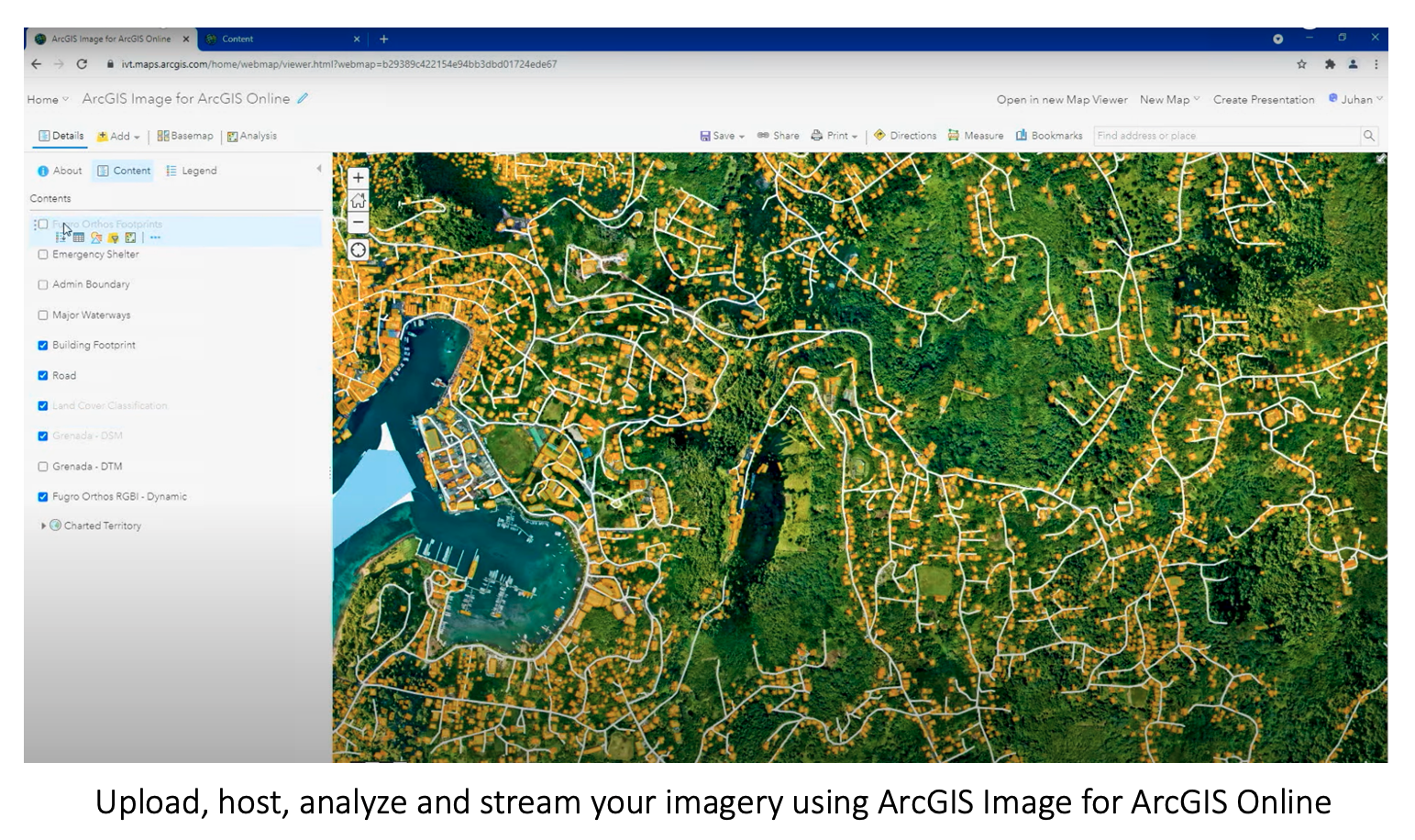
…When you don’t want to manage and maintain infrastructure.
You can save on infrastructure costs and maintenance by using a secure, scalable, and performant cloud environment managed by Esri. Deploy ArcGIS Image as a SaaS using ArcGIS Online to upload, host, analyze and stream your imagery.
…When you need results that are easily shared internally and externally to your organization.
Just as with ArcGIS Enterprise, ArcGIS Image for ArcGIS Online also results in generating outputs that are accessible to users inside and outside your organization.
…When you need the flexibility of running your processing on a thin client (like a web browser).
Similar to ArcGIS Enterprise, the map viewer enables users to author processing chains and kick off processing and analysis jobs through a browser. The heavy lifting (processing and analysis) is then done by the server, and the results are stored as hosted imagery and feature layers.
Summary
ArcGIS provides powerful imagery and raster analysis capabilities to suit a wide range of user workflows. Depending on your use case, you can perform your analysis using ArcGIS Pro, ArcGIS Enterprise or ArcGIS Online. After reviewing the different scenarios optimal for each deployment, you are now well-equipped to begin processing and analyzing your imagery.
ArcGIS Image Extensions
| Products | Extensions |
| ArcGIS Pro | ArcGIS Image Analyst |
| ArcGIS Spatial Analyst | |
| ArcGIS Enterprise | ArcGIS Image Server |
| ArcGIS Online | ArcGIS Image for ArcGIS Online |
Ready to give these new capabilities a try?
What’s new in the ArcGIS Image Analyst Extension (ArcGIS Pro 2.9)
Esri UC 2021: Raster analytics and deep learning in ArcGIS Online
Overview of Extensions in ArcGIS Pro
Get started with our learn lessons
Use deep learning to assess palm tree health
Assess hail damage in cornfields (ArcGIS Pro)


Article Discussion: