What’s New in ArcGIS Mission 11.3
ArcGIS Mission, our premier real-time command and control system, continues to evolve, providing vital operational capabilities to teams in the field and command centers. The latest 11.3 release brings significant enhancements across the board, improving functionality, accessibility, and integration. Here’s what you can expect from the new update:
Revamped Responder Application
We’ve completely overhauled the Responder application, transitioning from the ArcGIS Runtime SDK 100.15 to the more robust ArcGIS Maps SDK 200.x. This upgrade not only enhances current features but also sets the stage for future advancements, including 3D capabilities and indoor positioning system (IPS) integration. This shift underscores our commitment to meeting the growing needs of our users.
Enhanced Accessibility
Following a comprehensive review of the Web Compliance Accessibility Guidelines of Section 508 of the Rehabilitation Act, we’ve made targeted improvements to increase the software’s usability for individuals with disabilities. These enhancements make our platform more accessible and ensure a better user experience for all.
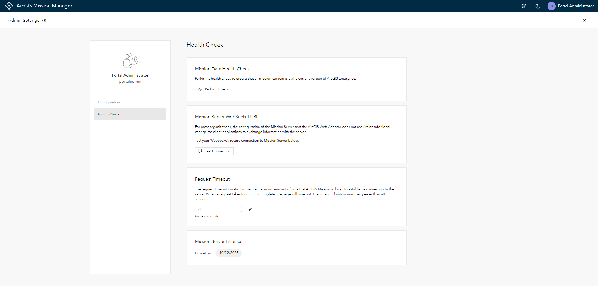
Expanded Administrative Control
The 11.3 update significantly broadens the scope of control that Mission administrators have. New features include:
- A tabbed interface in the admin settings for easier navigation and configuration
- Enhanced troubleshooting services now accessible via a user-friendly GUI
- Improved upgrade functionalities and health checks to ensure missions are always running the latest version
-
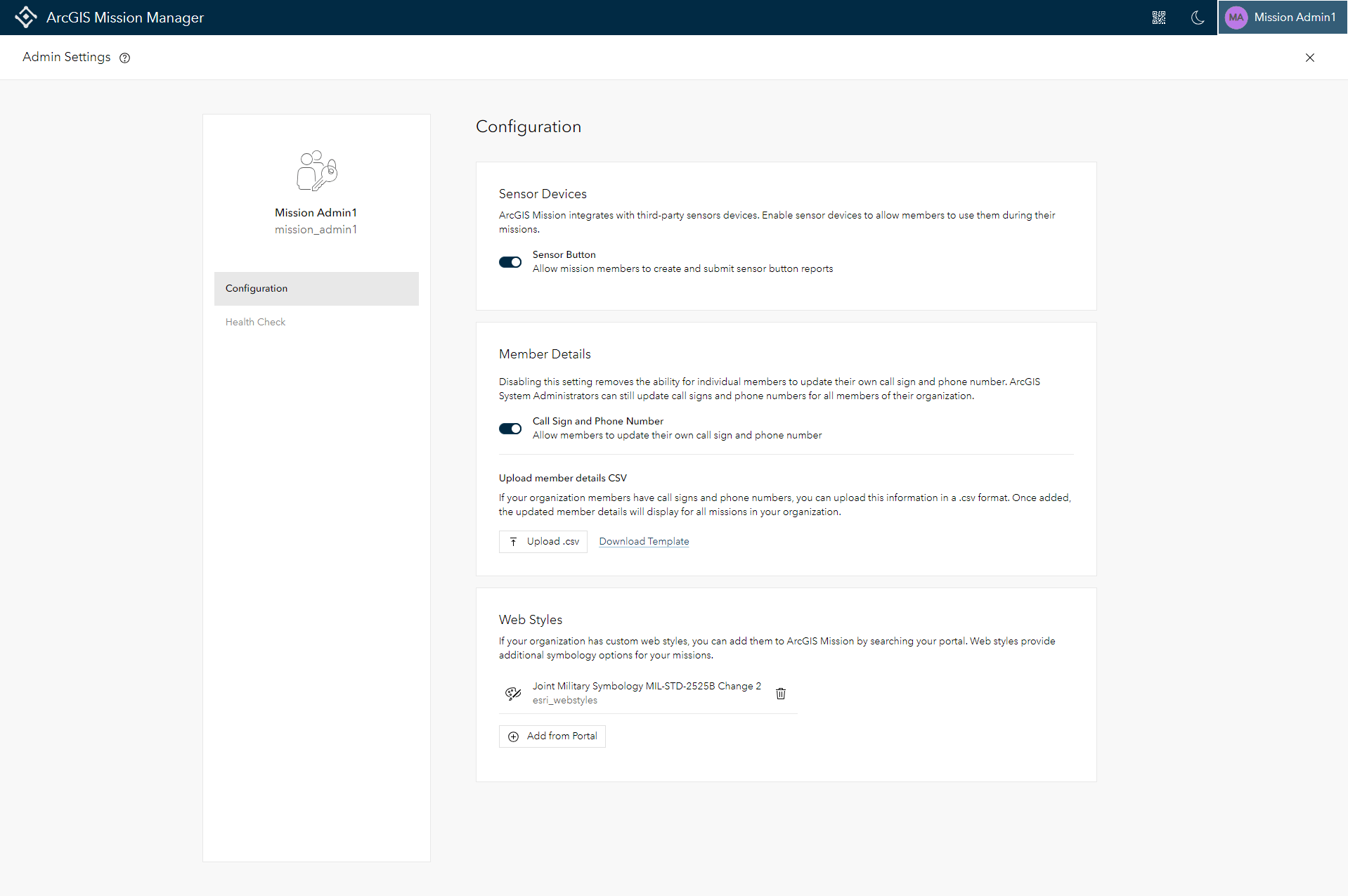
Admin Settings focusing on Mission Troubleshooting and Health Status
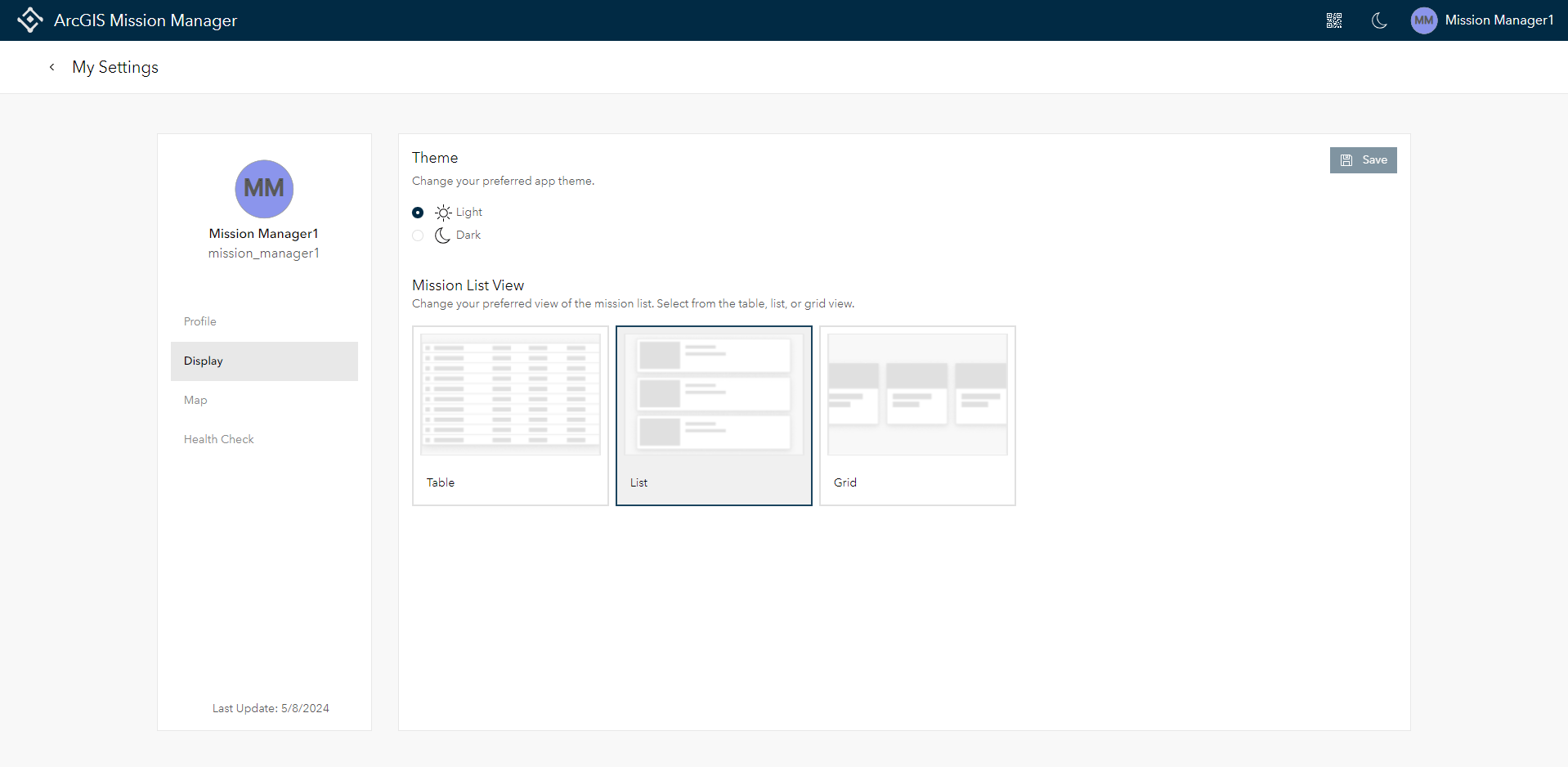
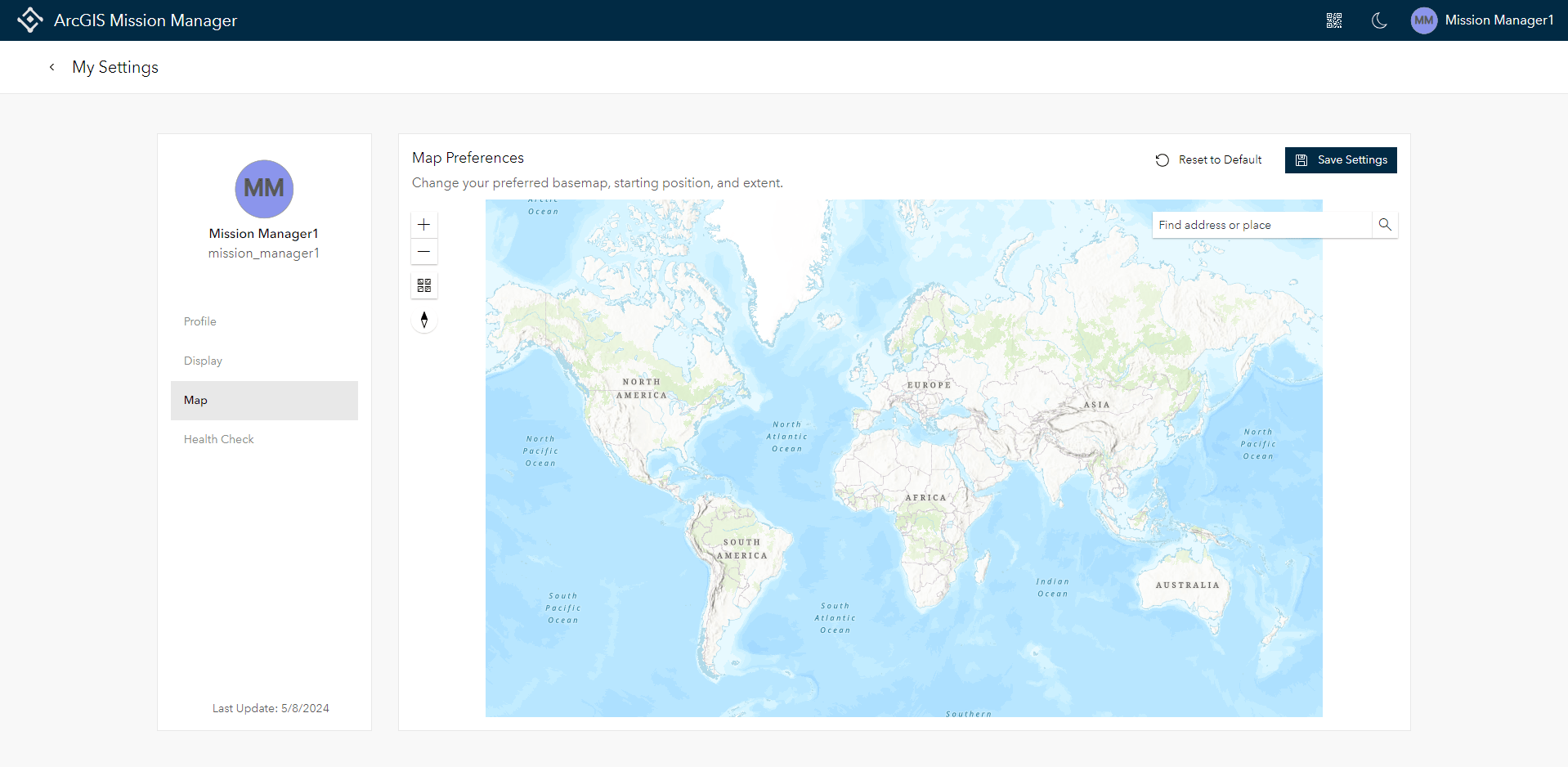
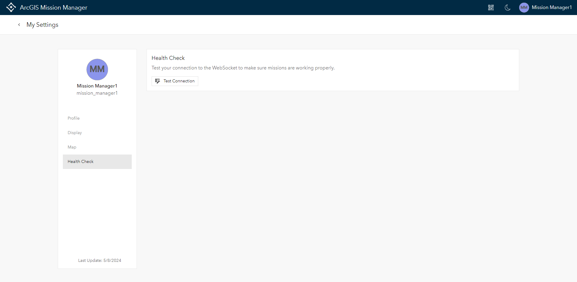
User Settings Enhancements
Admins are not the only users that have expanded control over the environment. Users now enjoy greater control over their operational environment with expanded settings:
- Direct editing of profile information within Mission settings
- Customizable display options including color schemes and default map views
- Health Check features to diagnose and report connection issues
-
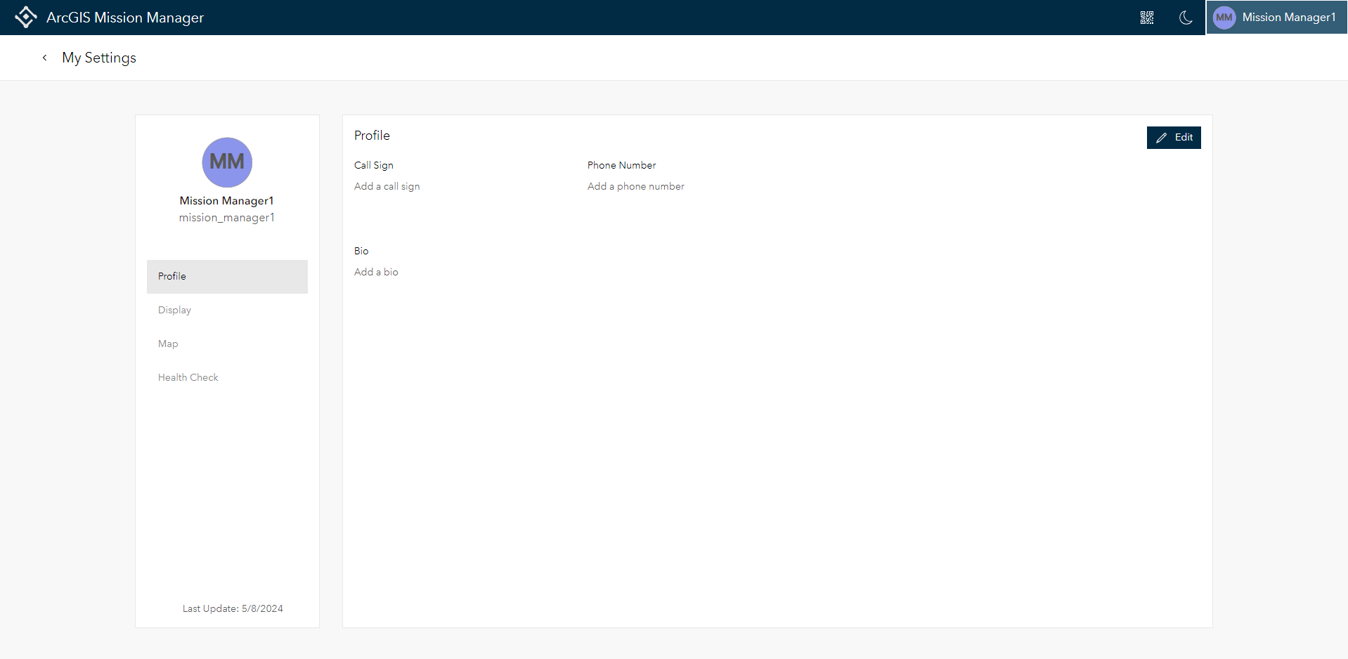
User Settings highlighting persona settings
Analyst Notes Feature
During an active mission, analysts have their attention drawn to many different areas trying to manage personnel and tasks. To prevent crucial details from slipping through during the heat of operations, we’ve introduced the Analyst Notes feature. Analysts can record observations, attach documents or pictures, and even “chip” portions of the map for enhanced contextual clarity. These notes are accessible anytime, ensuring important information is always at hand.

Bringing External Devices into Mission
Building on our existing compatibility with ATAK interoperability, the 11.3 release integrates these devices more seamlessly into the ArcGIS Mission experience. Location data from external devices now directly populates within the Mission Manager enabling analysts to view tracks or lock onto location for ATAK devices in the Mission Analyst map.

Additional Enhancements
- Improved search functionality in the Mission List view.
- Expanded mission deletion options.
- Ability to save mission reports as templates.
- New counter notifications for reports and chats.
- Enhanced task-related notes visibility and editability.
- Upcoming feature: Display tracks as tracklines, expected in late June.
These updates are designed to enhance the efficiency and effectiveness of your missions, ensuring you have the tools you need, when you need them. Explore the new features of ArcGIS Mission 11.3 and take your operational capabilities to the next level.


Article Discussion: